
CW3E AR Update: 27 January Outlook
January 27, 2018
Click here for a pdf of this information.
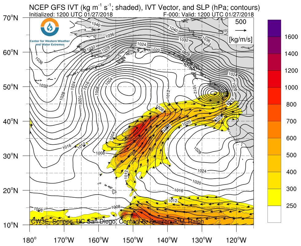
Multiple ARs Currently Impacting and Forecast to Impact the West Coast this Weekend
- An AR is currently impacting the West Coast (Referred to as AR 1)
- Two Air Force C-130s and a NOAA G-IV collected observations within this AR on 26 January
- A second (Referred to as AR 2) AR developed from a mesoscale frontal wave within the first AR and is forecast to make landfall at ~6 UTC on the 28th (10 PM PST on the 27th)
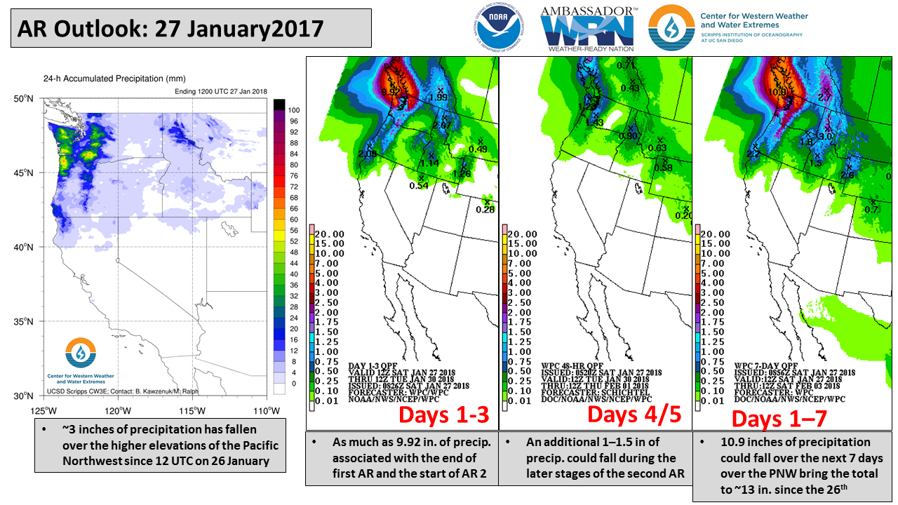
- Over 10 inches of precipitation may fall over the Higher elevations of the Olympic mountains and Vancouver Island due to the two ARs
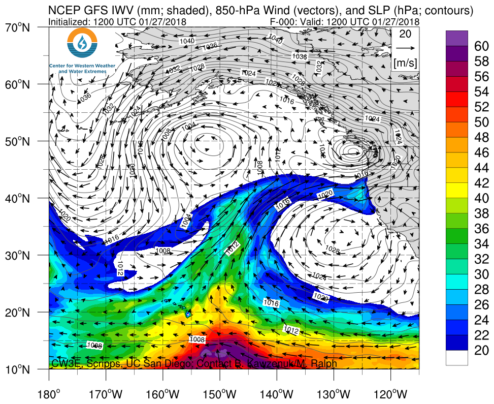
Click IVT or IWV image to see loop of 0-180 hour GFS forecast Valid 1200 UTC 27 January – 0000 UTC 04 February 2018 |
|
 |
 |


Summary provided by C. Hecht, F.M. Ralph, A. Wilson; 2 PM PT Saturday 27 January 2018
*Outlook products are considered experimental