
CW3E id: DRW
CDEC id: DRW
NWS id: DWDC1
Lat/Long: 39.197574 / -123.159850
Elevation: 280m
Team Lead: [private]
Install Date: June 29, 2017
Permit Expires: --
Watershed: Russian
Telemetry: Cell
Monument: Pole
Land Owners: USACE
Permit Type: Email
Site Type: SurfaceMet+Soil
CDEC id: DRW
NWS id: DWDC1
Lat/Long: 39.197574 / -123.159850
Elevation: 280m
Team Lead: [private]
Install Date: June 29, 2017
Permit Expires: --
Watershed: Russian
Telemetry: Cell
Monument: Pole
Land Owners: USACE
Permit Type: Email
Site Type: SurfaceMet+Soil
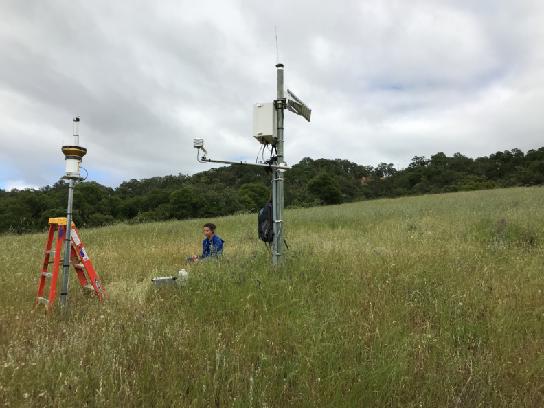
View of DRW from the northwest
DRW is on an open, grassy, northwest-facing hillside on the east side of Lake Mendocino with ~11deg slope and ~298deg aspect.
Sensors
| Type | Label | Model | SN | Installed On |
|---|---|---|---|---|
| Air Temperature/Relative Humidity | -- | CS Hygrovue10 (CS215) | E1851 | July 26, 2022 |
| Anemometer | -- | RM Young 05108 | 162137 | July 26, 2022 |
| Barometer | -- | Vaisala PTB110 | -- | June 29, 2017 |
| Soil Moisture | Soil1 | CS616 (CS107 temp) | -- | June 29, 2017 |
| Soil Moisture | Soil2 | CS616 (CS107 temp) | -- | June 29, 2017 |
| Soil Moisture | Soil3 | CS616 (CS107 temp) | -- | June 29, 2017 |
| Soil Moisture | Soil4 | CS616 (CS107 temp) | -- | June 29, 2017 |
| Soil Moisture | Soil5 | CS616 (CS107 temp) | -- | June 29, 2017 |
| Soil Moisture | Soil6 | CS616 (CS107 temp) | -- | June 29, 2017 |
| Tipping Bucket | -- | TE525MM | 86249 - 0421 | July 26, 2022 |
Other Equipment
| Type | Label | Model | SN | Installed On |
|---|---|---|---|---|
| Data Logger | None | CR1000 | None | June 29, 2017 |
| Cell Modem | None | Sierra Wireless RV50 | LT71550266011028 | June 29, 2017 |
Funding Sources
| Start | End | Source |
|---|---|---|
| June 29, 2017 | -- | USACE FIRO |