
Current Conditions Overview
Observed Conditions
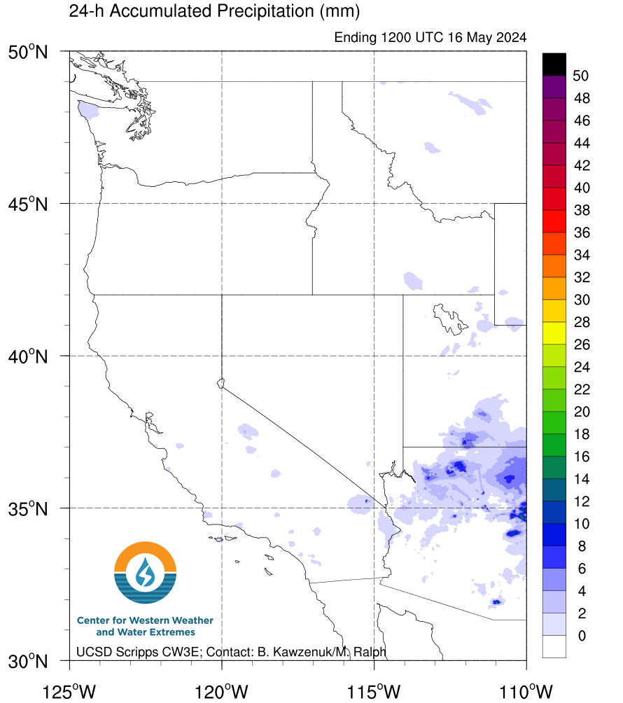
Quantitative Precipitation Estimate (QPE) from the National Stage IV QPE Product, provided by the NOAA/NCEP/EMC. See more precipitation observations here.
 |
 |
 |
 |
Current conditions over the Northeast Pacific from GOES-West satellite. More information on satellites available here and more satellite products available here. Click on image to see loop.
Forecasted Conditions
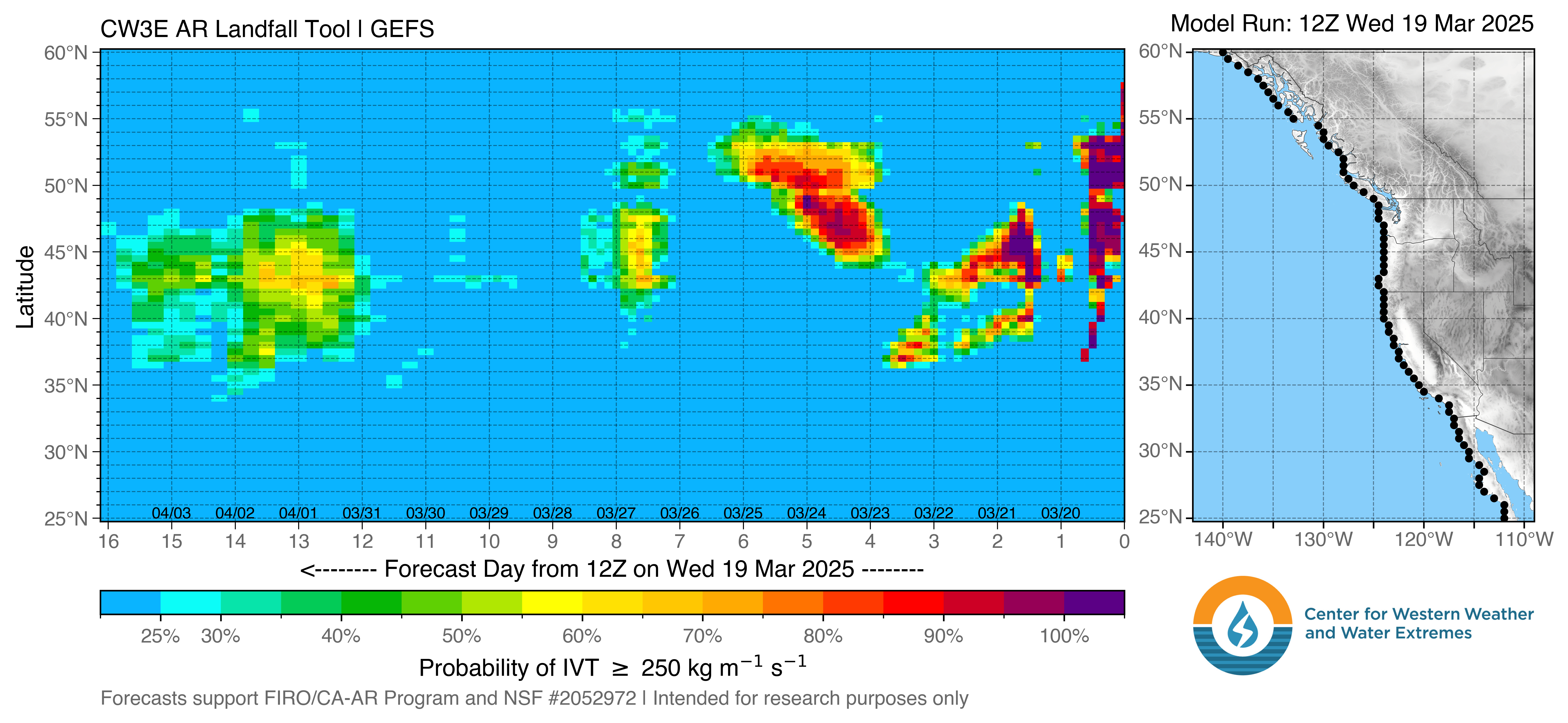
The probability CW3E AR Landfall Tool displays the likelihood and timing of AR conditions at each point on the map in a line along the U.S. West Coast or inland derived from the NCEP GEFS model over the next 16 days. The probability of AR conditions represents the number of ensemble members that predict IVT to be greater than the chosen threshold at the given location and time. See more here.
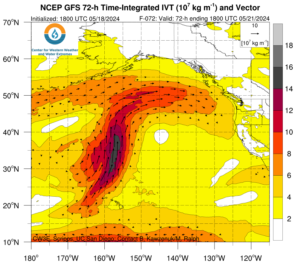
Time-integrated IVT is the temporal sum of the six-hourly IVT for the 72-hour period ending at the forecast time shown. Magnitude is shaded and direction indicated by vectors in units of kg m-1 divided by a factor of 107 from the 0.25° Global Forecast System (GFS) model. See more here.
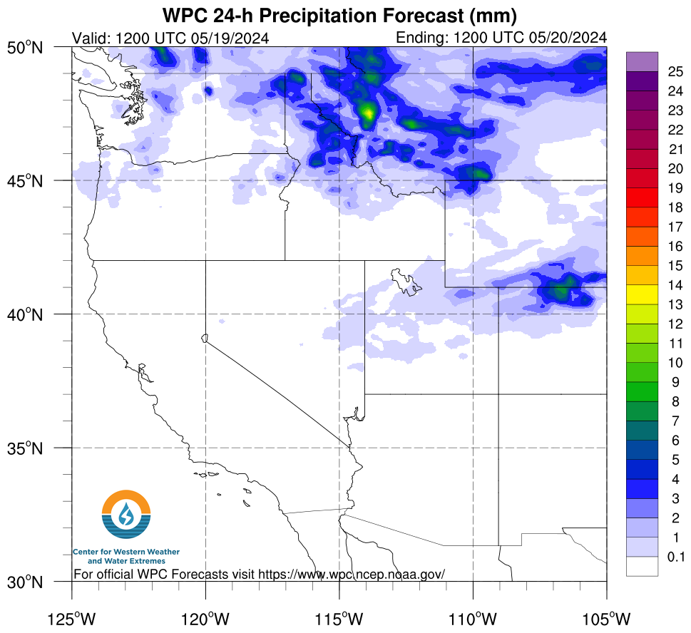
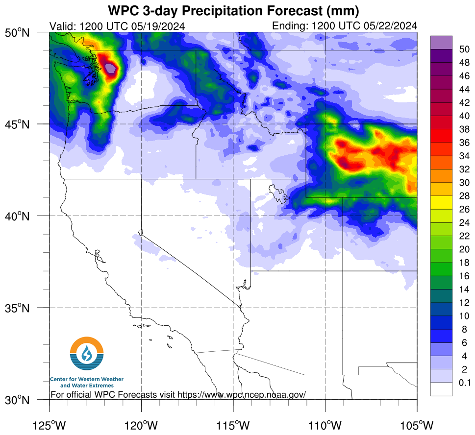
Quantitative Precipitation Forecasts (QPF) from the NCEP Weather Prediction Center (WPC) for one and three day accumulation periods. For more precipitation forecasts click here.
 |
 |