
Precipitation Observations
This page shows gridded precipitation products for the previous 1-hour, 6-hours, 24-hours, 7-days, and current water year, as well as rain gauge observations for the previous 24-hours from the Community Collaborative Rain, Hail & Snow Network (CoCoRaHS) and water-year-to-date rain gauge observations throughout California. Gridded precipitation data are the National Stage IV Quantitative Precipitation Estimate (QPE) Product, provided by the NOAA/NCEP/EMC and PRISM daily precipitation estimate from PRISM Climate Group, Oregon State University.
Gridded Products: | 1-h |6-h | 24-h | 7-day | Water-Year-to-Date |
Rain Gauge Observations: | 24-h CoCoRaHs | Water-Year-to-Date |
Gridded Precipitation Products
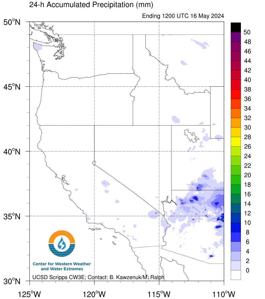
Latest 7-days: National Stage IV QPE Product
National Stage IV Quantitative Precipitation Estimate (QPE) for the previous 1-hour, 6-hours, 24-hours, and 7-days shaded according to scale. Light gray indicates missing data.
 |
 |
 |
 |
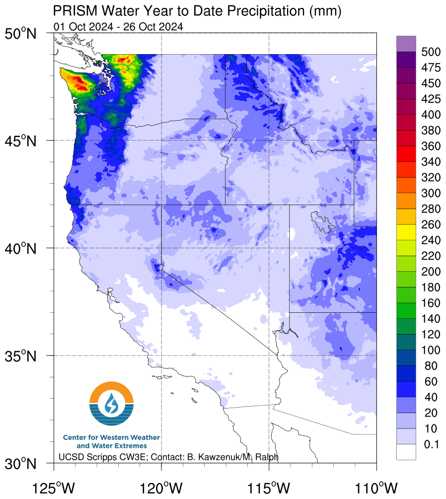
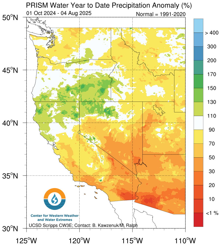
Current Water Year to Date: PRISM Climate Group
Plots below show PRISM precipitation data for the current water year to date using daily precipitation data and normal PRISM precipitation data for 1991-2020. Left plot shows current water year to date precipitation accumulation in millimeters. Use the menu to change the right plot between current water year to date precipitation anomaly (%), current water year to date departure from normal (mm), or current water year to date normal precipitation (mm). Data available from PRISM Climate Group, Oregon State University.
 |
 |
Rain Gauge Observations
Previous 24-hours: Community Collaborative Rain, Hail & Snow Network (CoCoRaHS)
Rain gauge observations from the previous 24-hours (ending 7 AM current day) from the Community Collaborative Rain, Hail & Snow Network (CoCoRaHS).
|
California |
Oregon |
|
Washington |
|
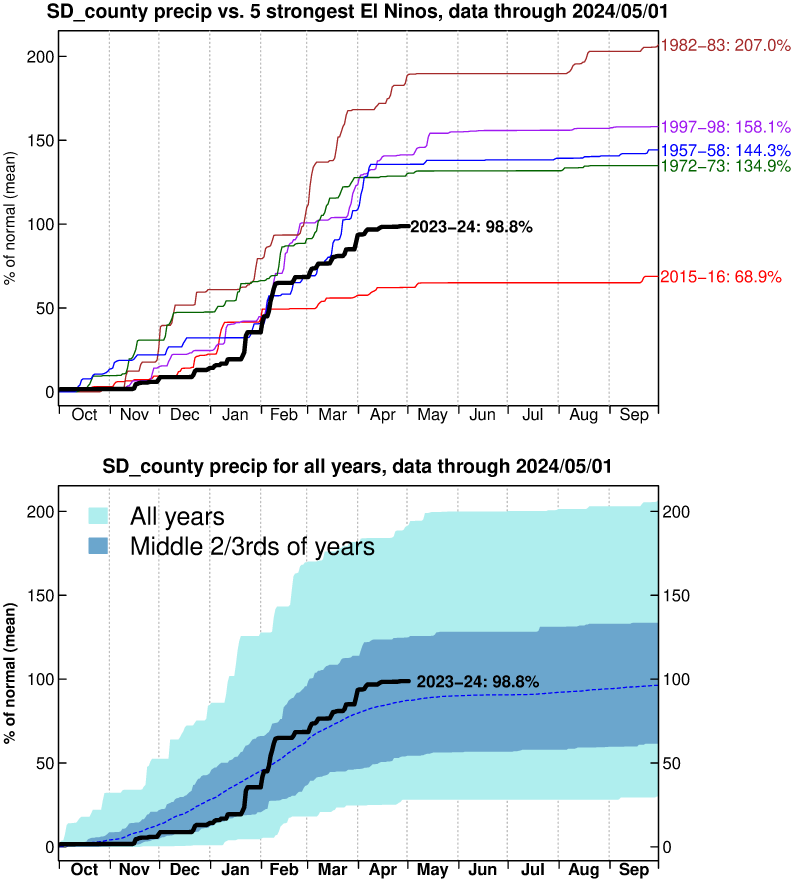
Current Water Year to Date
Click on a title or image to open a new page with rain gauge observations. Both data sets updated daily.
|
Total water-year-to-date precipitation across the western U.S. from station observations. |
Showing water-year-to-date precipitation (as a percent of normal accumulation over the water year) various regions throughout California and Nevada. |
 |
 |