
Satellite Imagery
Jump to: | GOES | MIMIC-TPW | SSMI | AR Detection |
GOES Geostationary Imagery (From NOAA/NESDIS/OSPO)
Infrared, visible, and water vapor satellite images are available from GOES-16 and GOES-17 at three different domains each. Click on the desired product and domain to view the latest image. For loops click to open in a new tab. For more information on these images and additional domains and products click here.
 |
GOES-West
GOES-East
|
Integrated Microwave Animations of Integrated Water Vapor (From CIMSS/Univ. of Wisconsin)
The following loops show total precipitable water from Morphed Integrated Microwave Imagery at CIMSS (MIMIC-TPW). For more information on this product click here. For image and animation archives click here.
Global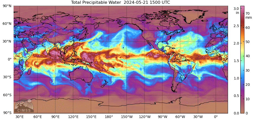 |
|
NE Pacific  |
N Atlantic  |
SSMIS Water Vapor Products(From NOAA/ESRL/PSD)
The following images show the latest SSMIS integrated water vapor, cloud liquid water, and rain rate. Place your mouse over a product to view it or click to open in a new tab. For more information and archived images click here.
Full Pacific 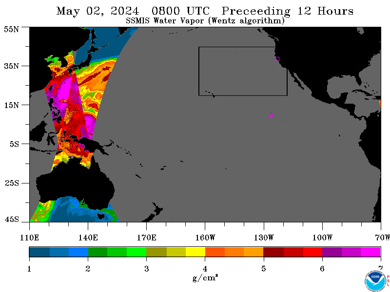 Water Vapor Cloud Liquid Water Rain Rate |
Local Domain 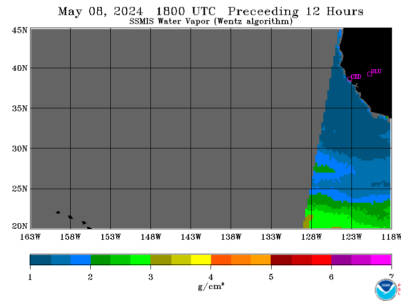 Water Vapor Cloud Liquid Water Rain Rate |
Automated Atmospheric River Detection(From NOAA/ESRL/PSD)
The following shows the Automated Atmospheric River detection technique designed and run by NOAA/ESRL/PSD applied to SSMIS water vapor imagery. For more information and archived images click here.
SSMIS IWV Imagery 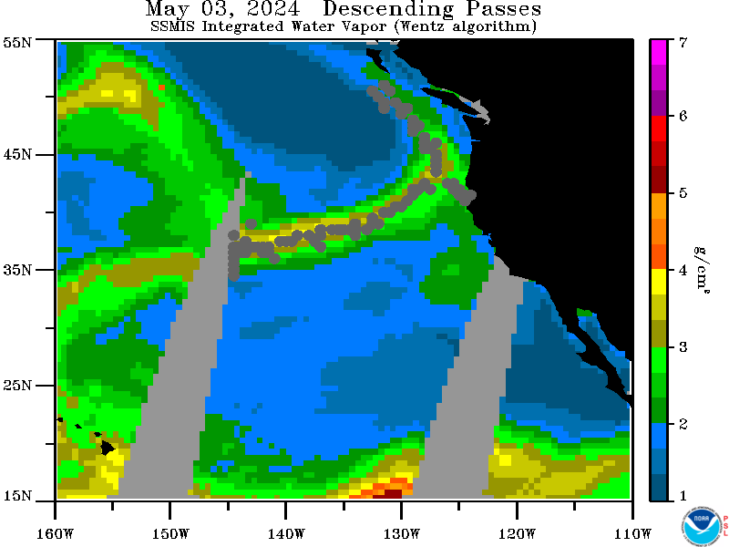 |
SSMIS Strength of IWV in core of AR 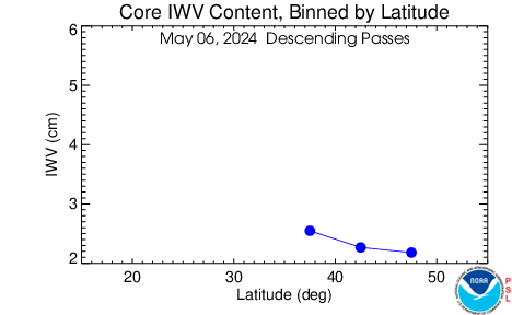 The above plots shows the strength of the AR depicted in the left image in value of IWV (cm) at each latitude along the AR corridor. The above plots shows the strength of the AR depicted in the left image in value of IWV (cm) at each latitude along the AR corridor. |