
CW3E AR Update: 25-27 February Post Event Summary
February 28, 2019
Click here for a pdf of this information.
Landfalling Atmospheric River brings record breaking precipitation and flooding to Northern California
- A long duration AR impacted Northern California between 25 and 27 February 2019
- A cut off low interacted with the AR as it was making landfall, intensifying IVT and prolonging AR conditions over the coast
- This event was classified as an AR Category 3 event over a large portion of North-Coastal California by GFS Analysis
- Numerous locations across Northern CA experienced >5 inches of rain with Venado, CA receiving the most at 21.36 inches
- Several rivers and streams throughout the region experienced flooding, such as the Russian River in Guerneville, which rose to 45.4 feet (13.4 feet above flood stage)
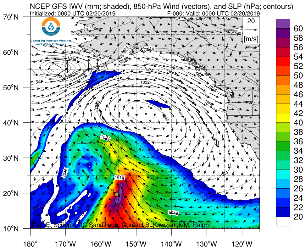
Click IVT or IWV image to see loop of 0 hour GFS analysis Valid 0000 UTC 20 February – 0000 UTC 28 February 2019 |
|
 |
 |

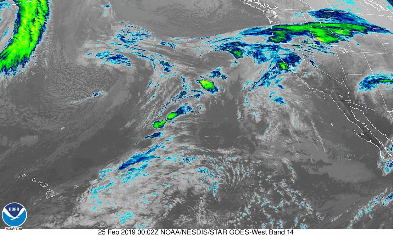
GOES 17 Longwave IR
Valid 0000 UTC 25 February – 1200 UTC 27 February 2019


Summary provided by B.Kawzenuk, C. Hecht, F. Cannon, L. Dehaan, J. Kalansky, N. Oakley, D. Reynolds, E. Sumargo, A. Wilson, F. M. Ralph; 1 PM PT 28 February 2019