
CW3E AR Update: 8 January 2024 East Coast Outlook
January 8, 2024
Click here for a pdf of this information.
Two Low Pressure Systems to Bring Heavy Precipitation to East Coast
- Two low pressure systems and associated atmospheric rivers (AR) are forecast bring heavy precipitation to much of the Eastern and Midwest US this week.
- The first strong AR (IVT > 1200 kg m-1 s-1 in the core) is forecast to form early Mon 8 Jan, progressing up the US East Coast through Wed 10 Jan before moving out to the Atlantic.
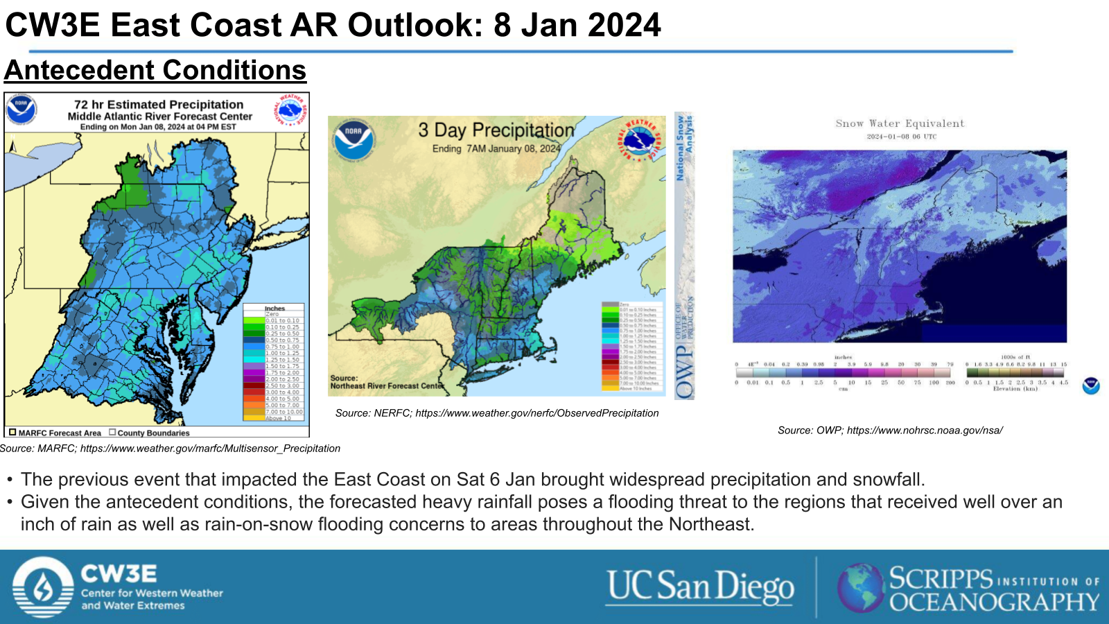
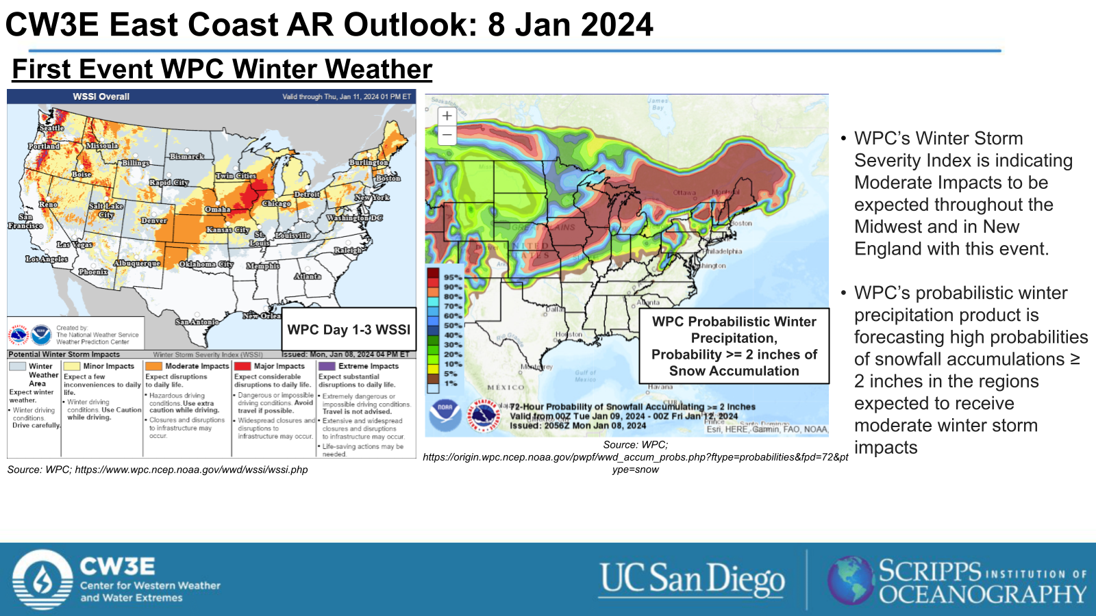
- The first system is forecast to bring heavy precipitation, a mix of rain and snow, to the Eastern US.
- Given the recent AR that impacted the eastern US, there is an increased threat of flooding throughout this event, with the Weather Prediction Center (WPC) Excessive Rainfall Outlook (ERO) forecasting a Moderate Risk (level 3 of 4, or 40% chance) for flooding for select areas through Tuesday Night.
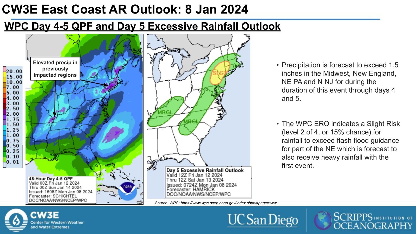
- The second AR (IVT > 1200 kg m-1 s-1 in the core) forms in the Gulf Thu 11 Jan, propagating through the East Coast out over the Atlantic by Fri 12 Jan.
- The NWS WPC is forecasting an additional 1+ inches of rainfall for the region as it progresses up the coast. This continues the threat for flooding throughout the region.
Click images to see loops of GFS IVT and IWV forecasts Valid 0000 UTC 8 January 2024 – 0000 UTC 14 January 2024 |
|
 |
 |


Summary provided by M. Steen, S.Bartlett, C.Castellano, and P. Iniguez; 8 January 2024
To sign up for email alerts when CW3E post new AR updates click here.
*Outlook products are considered experimental