
CW3E AR Update: 04 April Outlook
April 04, 2018
Click here for a pdf of this information.
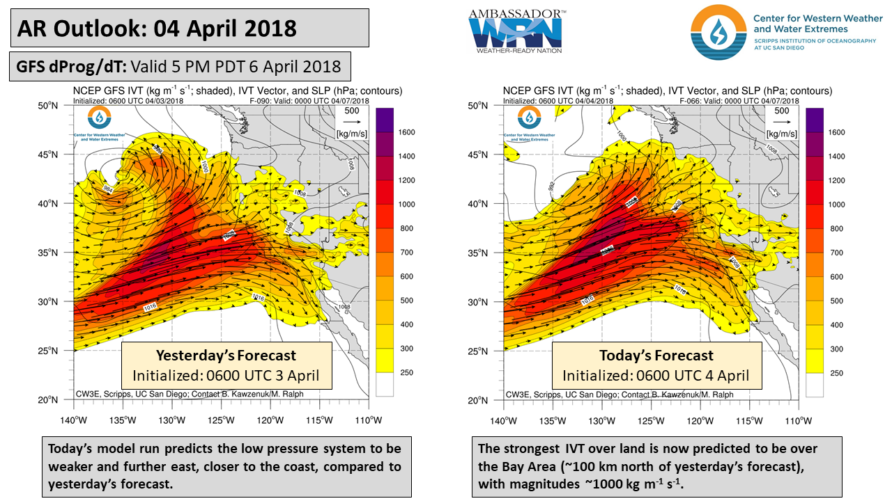
Atmospheric river forecast to impact California over the next four days
- Forecast confidence is increasing for a moderate or strong AR to strike the U.S. West Coast between this Thursday and Saturday
- This will be the strongest AR of the season for this region, with total water vapor transport greater than approximately 25 Mississippi Rivers worth of water
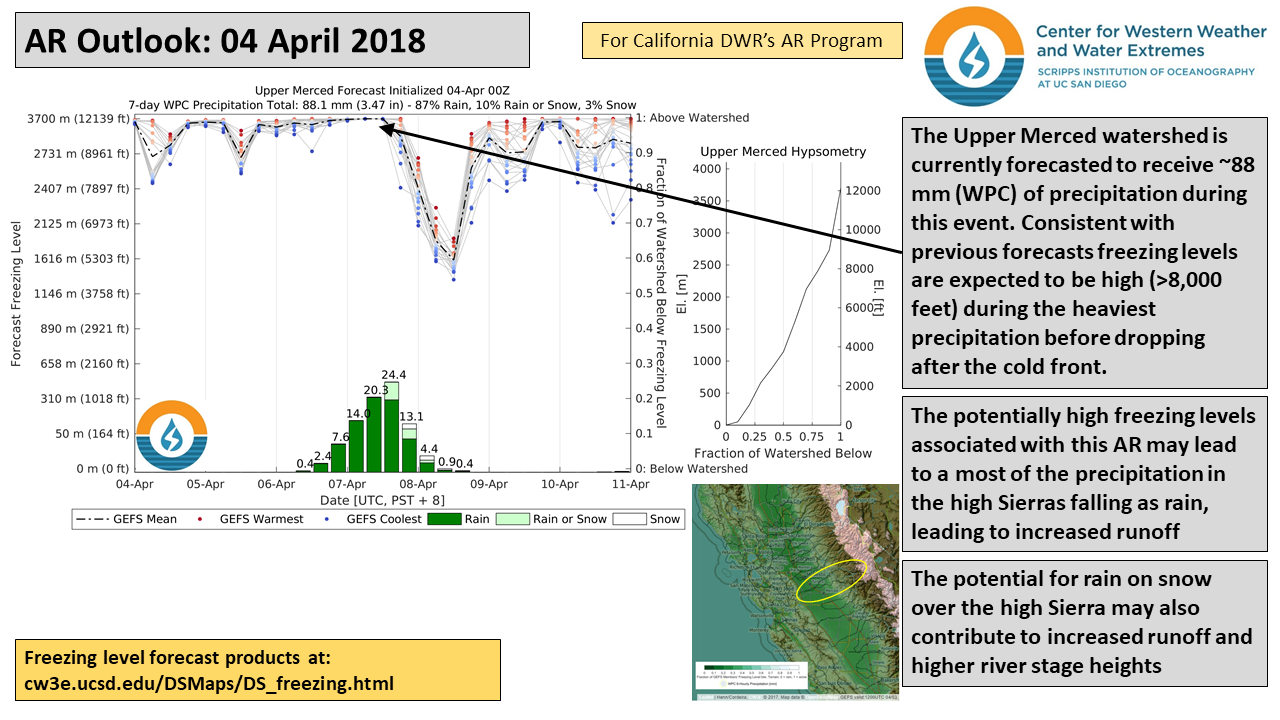
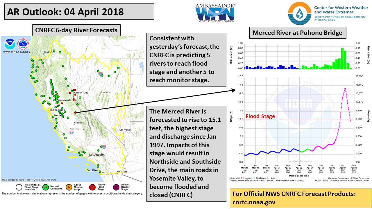
- Heavy precipitation is predicted over the CA coast and Sierra Nevada, with accumulation up to 7 inches possible
- High freezing levels during the heaviest precipitation will result in rain at high altitudes over the Sierra Nevada leading to potential flooding
Click IVT or IWV image to see loop of 0-102 hour GFS forecast Valid 0600 UTC 04 April – 1200 UTC 08 April 2018 |
|
 |
 |


Summary provided by B. Kawzenuk, F.M. Ralph, and C. Hecht; 10 AM PT Wednesday 04 April 2018
*Outlook products are considered experimental