
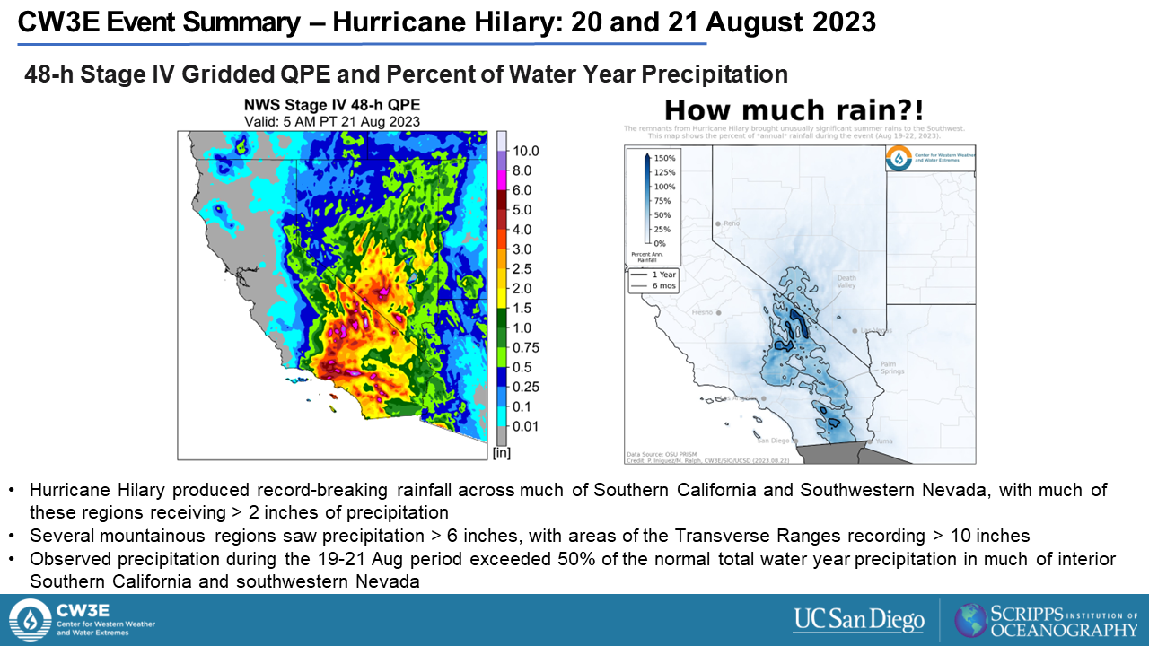
CW3E Event Summary: Hurricane Hilary 20-21 August 2023
August 24, 2023
Click here for a pdf of this information.
Hurricane Hilary Brings Heavy Rain, Flooding and High Winds to Southern California
- Hilary made landfall as a Category 1 hurricane in Baja California and weakened into a tropical storm before crossing into California
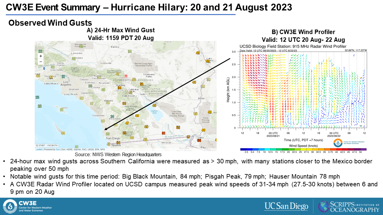
- The cyclone produced heavy rain and high winds across Southern and Central California on 20 and 21 August
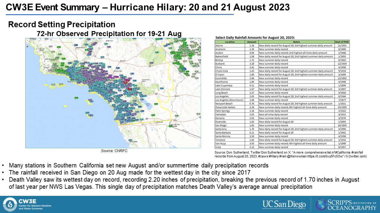
- Much of Southern California and Southwestern Nevada received > 2 inches of precipitation with stations in the Transverse Range measuring > 10 inches
- Several stations set new daily precipitation records for the month of August while Death Valley set its all-time single day precipitation total at 2.20 inches
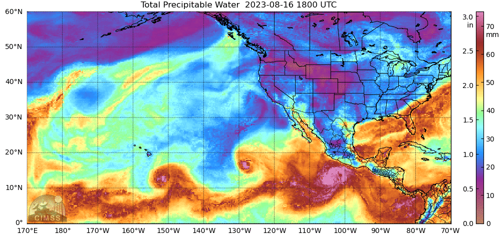
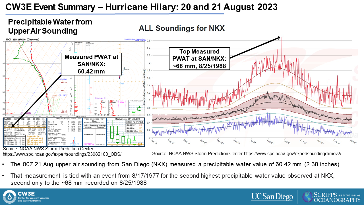
- Precipitable water observed during this event in San Diego was 2.38 inches, tying for the second highest recorded value per Storm Prediction Center records
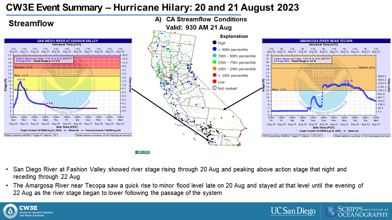
- Many streamflow stations throughout Central and Southern California saw streamflows > 90th percentile of climatology because of the record-breaking rainfalls
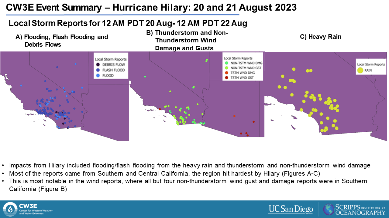
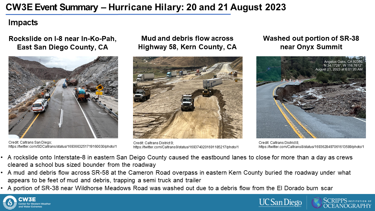
- Heavy rainfall resulted in widespread flash flooding and debris flows that damaged roadways
- High winds caused trees to fall and resulted in power outages for more than 50,000 people across Central and Southern California
- Per the National Oceanic and Atmospheric Administration Hilary was the first tropical storm to pass over California since Nora in 1997
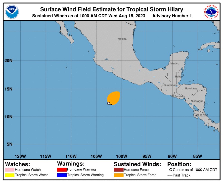
National Hurricane Center
Valid 9 AM PDT 16 August to
2 AM PDT 21 August 2023
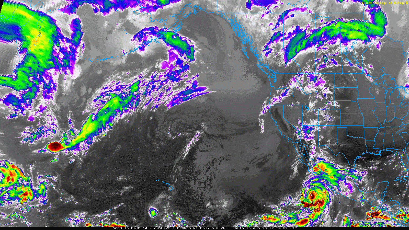
GOES-West – Longwave Infrared
Valid 512 AM PDT 18 August to
1120 AM PDT 21 August 2023
MIMIC-TPW2 Total Precipitable Water
Valid 1800 UTC 16 August – 1500 UTC 21 August 2023


Summary provided by M. Steen, C. Castellano, S. Roj, P. Iñiguez, J. Cordeira, and J. Kalansky; 24 August 2023
To sign up for email alerts when CW3E post new AR updates click here.
*Outlook products are considered experimental