CW3E AR Update: 21 November Outlook
November 21, 2018
Click here for a pdf of this information.
Update on the ARs Currently Impacting and Forecast to Impact the U.S. West Coast
- Precip. has begun in association with AR 1, where as much as 0.5 to 2 in. has fallen over North-Coastal CA
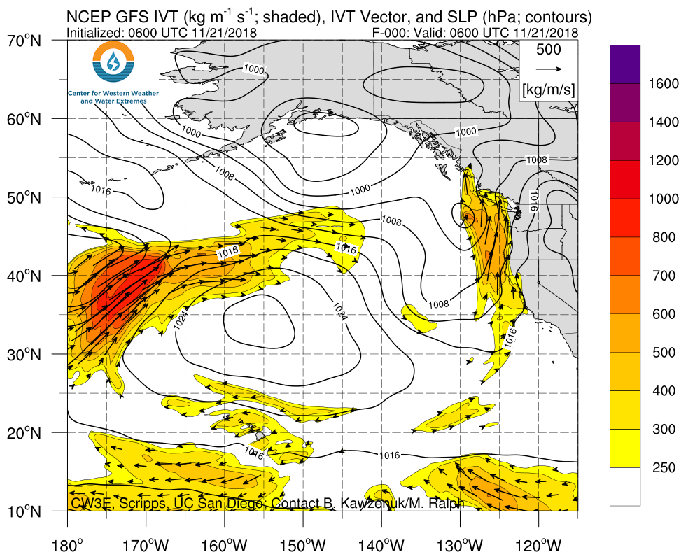
- AR 2 is forecast to bring strong AR conditions (IVT 750–1000 kg m–1 s–1) to Southern OR and moderate AR conditions to CA tomorrow
- The National Weather Service has issued numerous Flash Flood watches across the Northern CA and Southern OR
- Forecast Confidence for another period of AR activity from 26 to 28 November has increased
SSMI/SSMIS/AMSR2-derived Integrated Water Vapor (IWV)
Valid 0000 UTC 18 November – 1600 UTC 21 November 2018
Images from CIMSS/Univ. of Wisconsin
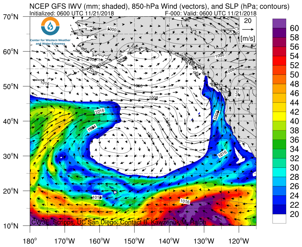
- The current AR (AR 1) is forecast to end over Southern California at ~12Z (4 AM PST) on 22 November
- AR conditions over Southern California will be weak and impacts will liekly be minimal
- AR 2 is forecast to make landfall over Coastal Oregon at ~15Z (7 AM PST) 22 November
- AR conditions associated with AR 2 are forecast to end at ~6 UTC 24 November (11 PM PST 23 November) over Central CA
- Additional ARs are forecast to make landfall in the extended forecast (5 days+) but uncertainty is currently high
Click IVT or IWV image to see loop of 0-240 hour GFS forecast Valid 1200 UTC 21 November – 1200 UTC 26 November 2018 |
|
 |
 |
Summary provided by C. Hecht, F. M. Ralph, F. Cannon, J. Kalansky; 1:30 PM PST 21 November 2018
*Outlook products are considered experimental

