CW3E Precipitation Update: 8 March 2021 Outlook
March 8, 2021
Click here for a pdf of this information.
Cutoff low forecasted to bring precipitation to most of California this week
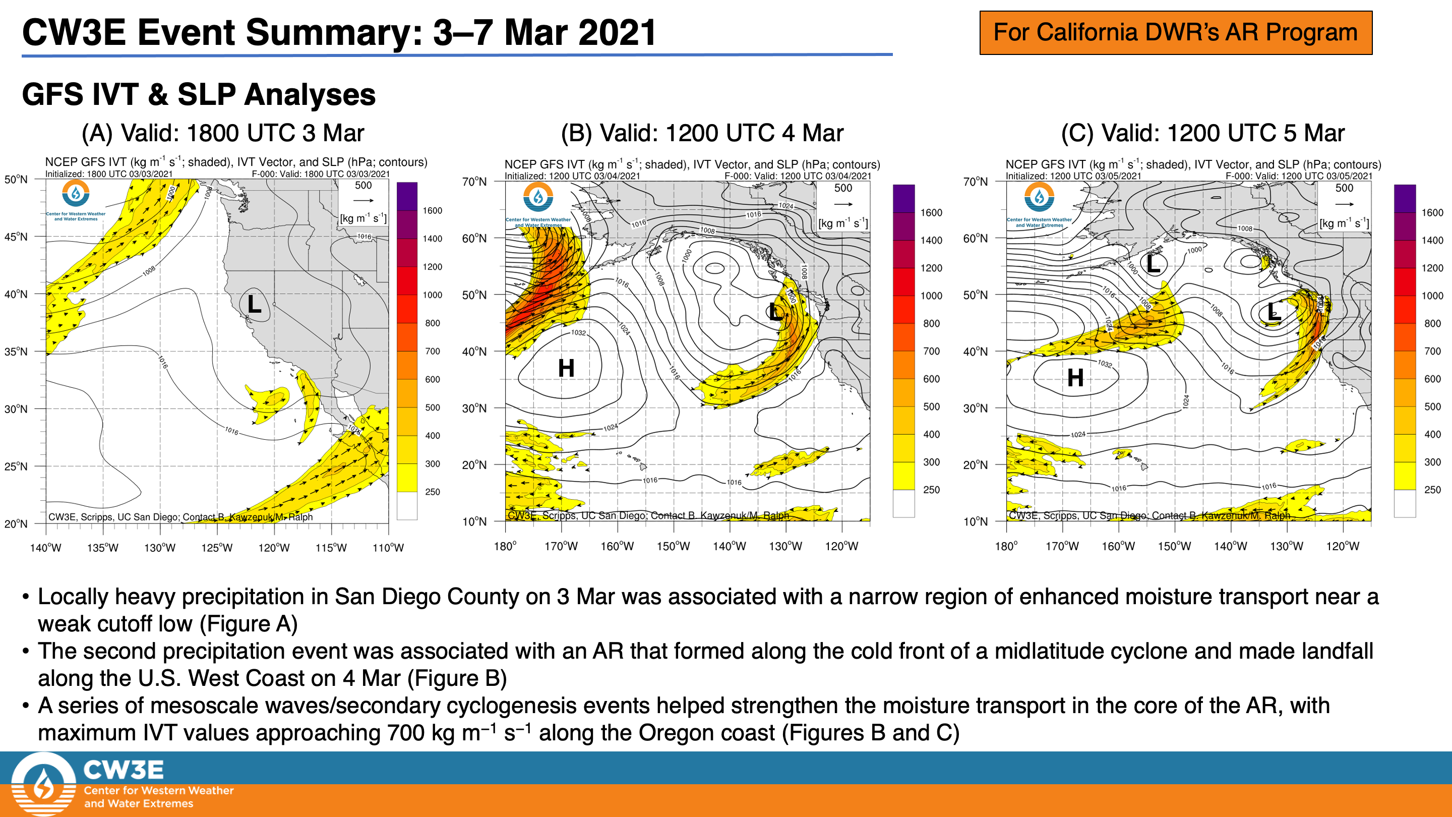
- Two separate systems impacted Southern California and Northern California last week
- A cutoff low produced locally heavy rain in San Diego County on 3 Mar
- A slow-moving AR and associated midlatitude cyclone produced 3–5 inches of precipitation in portions of the Pacific Coast Ranges during 4–7 Mar
- A mid-tropospheric trough and low pressure system will make landfall over CA mid week
- This system is forecast to produce precipitation throughout nearly all of California
- Precipitation amounts are forecast to be ~1–2 inches over the Northern Sierra Nevada and Transverse ranges with up to 3 inches in San Diego and Shasta Counties
- While precipitation amounts are not forecasted to be extremely high with this event, the precipitation could help improve drought conditions throughout the state
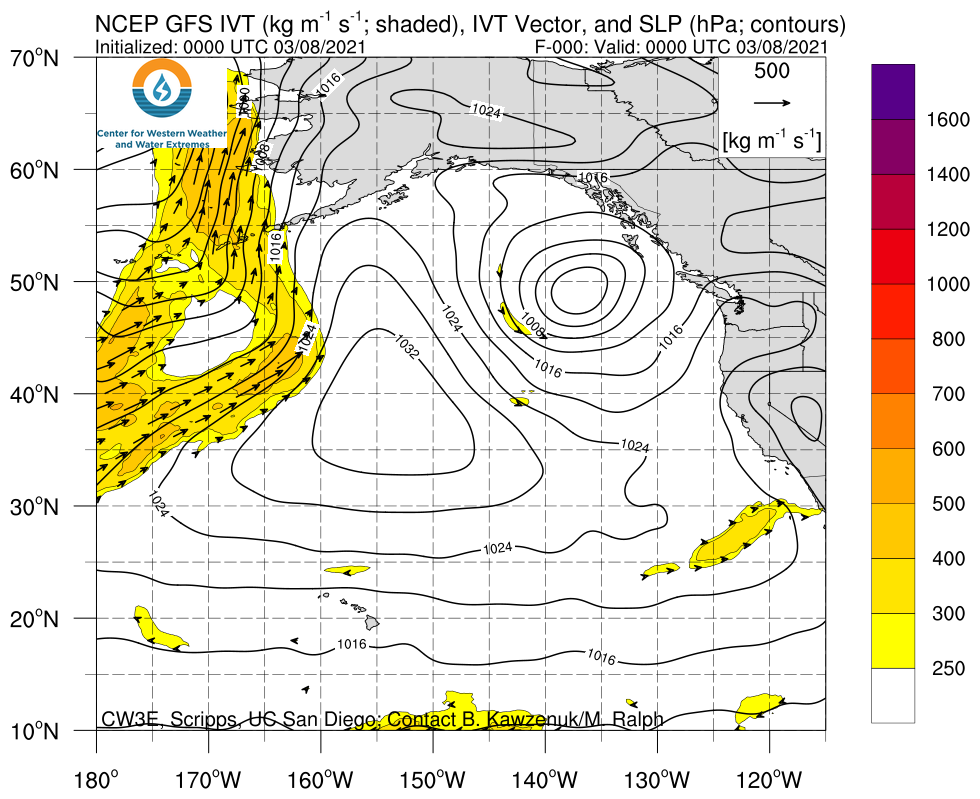
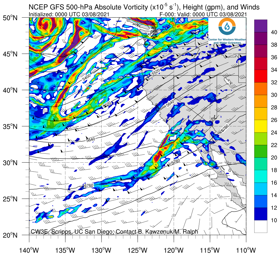
Click images to see loops of GFS IVT & 500-hPa absolute vorticity forecasts Valid 1200 UTC 8 March – 1200 UTC 13 March 2021 |
|
 |
 |
Summary provided by C. Castellano, J. Kalansky, B. Kawzenuk, and F. M. Ralph; 8 March 2021
*Outlook products are considered experimental


