CW3E AR Update: 8 December 2021 Outlook
December 8, 2021
Click here for a pdf of this information.
Potential for Long-duration Atmospheric River and Heavy Precipitation in California
- A weak system will bring AR conditions and light-to-moderate precipitation to Southern California and the Colorado River Basin tomorrow
- A stronger and more complex system is forecasted to bring landfalling AR activity and heavy precipitation to much of California early next week
- There is still considerable uncertainty in the timing, magnitude, and duration of AR conditions and precipitation, but the forecast models are starting to converge toward a similar outcome
- The 00Z ECMWF EPS control run is forecasting AR 4 conditions over the San Francisco Bay Area, whereas the 00Z GEFS control run is only forecasting an AR 1 at this location
- The NWS Weather Prediction Center is forecasting more than 5 inches of total precipitation over the Pacific Coast Ranges and the Sierra Nevada during the next 7 days
- The 00Z GFS and ECMWF models were showing large differences in forecasted precipitation in association with the second AR over the Russian River watershed
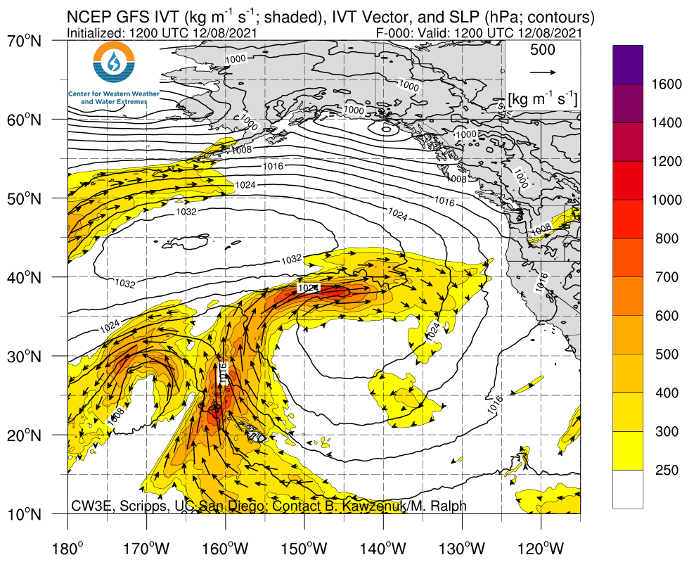
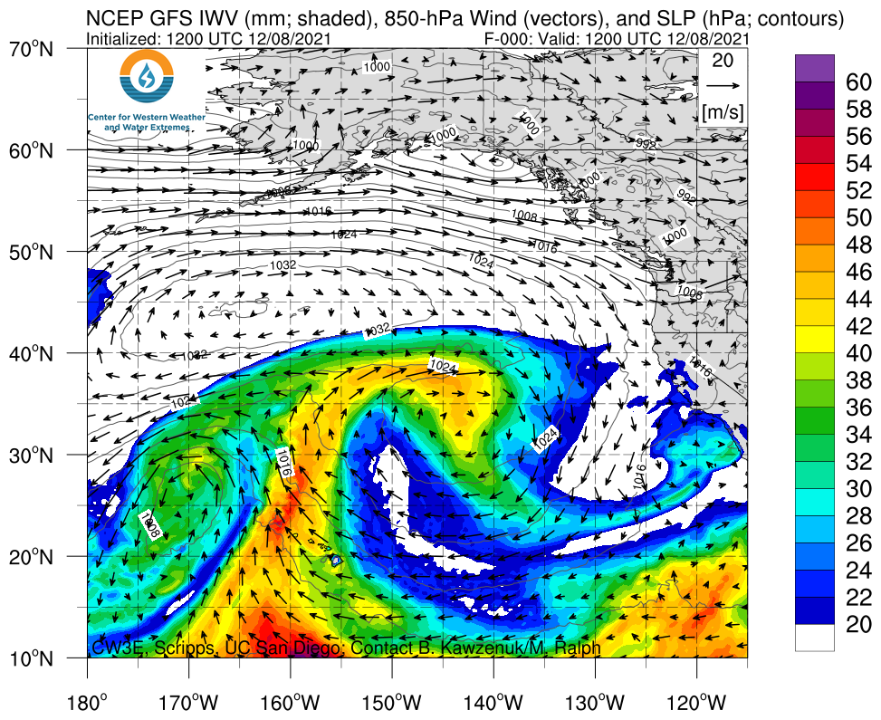
Click images to see loops of GFS IVT & IWV forecasts Valid 1200 UTC 8 December – 1200 UTC 15 December 2021 |
|
 |
 |
Summary provided by C. Castellano, C. Hecht, S. Roj, B. Kawzenuk, J. Kalansky, and F. M. Ralph; 8 December 2021
To sign up for email alerts when CW3E post new AR updates click here.
*Outlook products are considered experimental


