CW3E AR Update: 24 March 2022 Outlook
March 24, 2022
Click here for a pdf of this information.
Weak Atmospheric River and Low-Pressure System to Bring Precipitation to Southern and Central CA
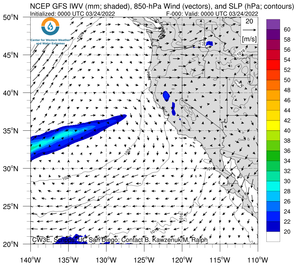
- A weak atmospheric river (AR) is forecasted to make landfall over the Pacific Northwest tomorrow night
- A secondary cyclone is forecasted to develop west of the AR and slowly approach the California coast, bringing a brief period of AR conditions to much of the state
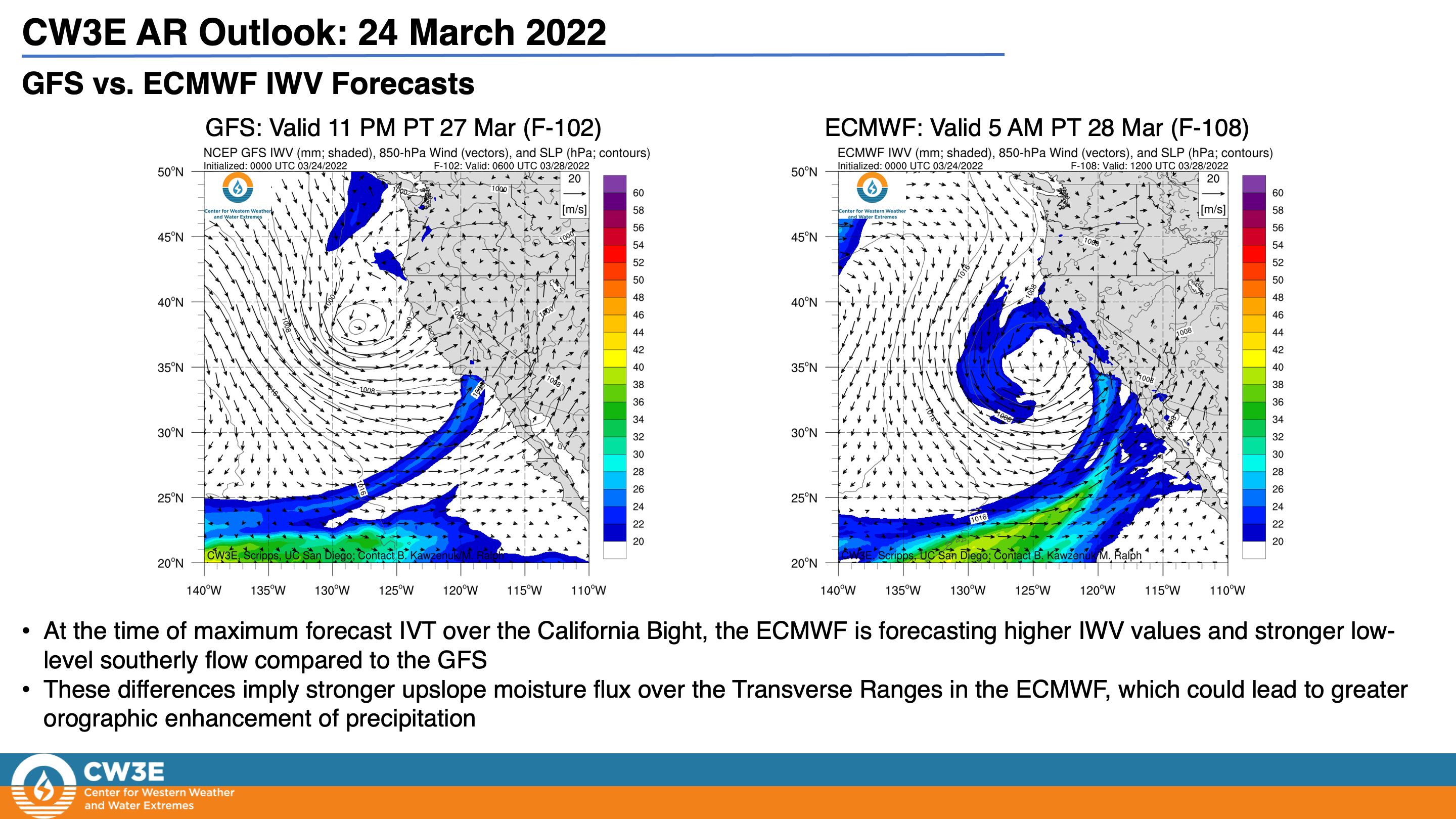
- Model-to-model differences in the forecast evolution of the surface cyclone and AR are leading to large differences in the forecast timing and location of the heaviest precipitation in California
- The NWS Weather Prediction Center is forecasting 1–3 inches of precipitation over portions of coastal Southern California and the Sierra Nevada, with the highest amounts in the Transverse Ranges
- The 00Z GEFS is forecasting the second AR to make landfall later and bring stronger AR conditions to northern Oregon and southern Washington
- Compared to the GFS, the ECMWF is forecasting higher (lower) precipitation amounts over the Transverse Ranges (Sierra Nevada)
Click images to see loops of GFS IVT & IWV forecasts Valid 0000 UTC 24 March – 0000 UTC 29 March 2022 |
|
 |
 |
Summary provided by C. Castellano, S. Bartlett, J. Kalansky, B. Kawzenuk, S. Roj, and F. M. Ralph; 24 March 2022
To sign up for email alerts when CW3E post new AR updates click here.
*Outlook products are considered experimental


