AR Recon Milestones – Flight Plans for the Gulf of Mexico and Atlantic Ocean
January 25, 2023
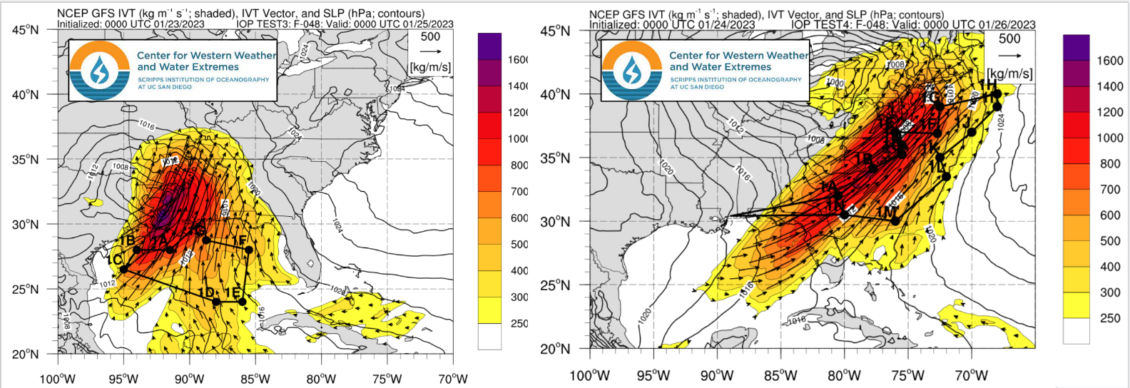
The Atmospheric River Reconnaissance (AR Recon) field campaign recently achieved a milestone by having designed and received official tasking for observational flights over the Gulf of Mexico and the Atlantic Ocean along the U.S. East Coast. These flights were scheduled to be centered at 00Z 25 Jan and 00Z 26 Jan, respectively, tracking an intense AR as it develops over the western Gulf of Mexico and moves rapidly eastward in association with a deepening low pressure system over the Eastern U.S. (requested flight tracks shown below).

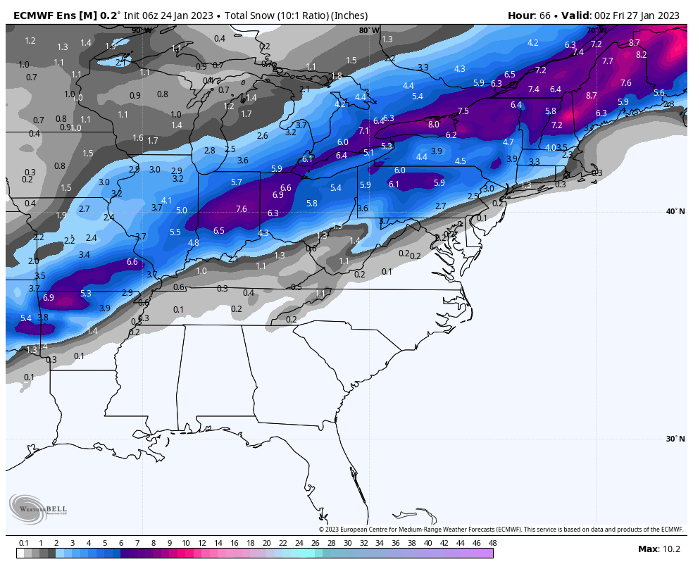
This storm is predicted to produce severe weather across portions of the Southeastern U.S., as well as a broad swath of ~6″ snowfall across the Central and Eastern U.S.
 |
 |
 |
The planning process for these flights included evaluation of scientific objectives within different geographic environments, consideration of a more complex network of flight avoidance zones, and coordination amongst the CW3E AR Recon Team, US Air Force Reserve Command, NCEP, WPC, and other NWS offices. In order to prepare for this event, the team used a weaker storm system taking a similar track on 22 and 23 Jan as a test case — mocking up flight paths and running through the process for gaining approval. In addition, a Pacific flight was also planned for the same day (00Z 26 Jan) as the Atlantic flight, another first for AR Recon.
The significance of this achievement is that formerly, AR Recon operations were limited to the Northeast Pacific Ocean, where ARs impacting the Western U.S. typically originate. The ability to sample storms developing in the Gulf of Mexico or just off the U.S. East Coast means that portions of the Central and Eastern U.S. can also benefit from increased forecast skill as a result of additional observations provided by AR Recon.
AR Recon is led by PI Marty Ralph (CW3E) and Co-PI Vijay Tallapragada (NCEP).
