CW3E AR Update: 21 February 2023 Outlook
February 21, 2023
Click here for a pdf of this information.
Winter Storm and Atmospheric River Forecast to Bring Heavy Rain and Snow to Southern California
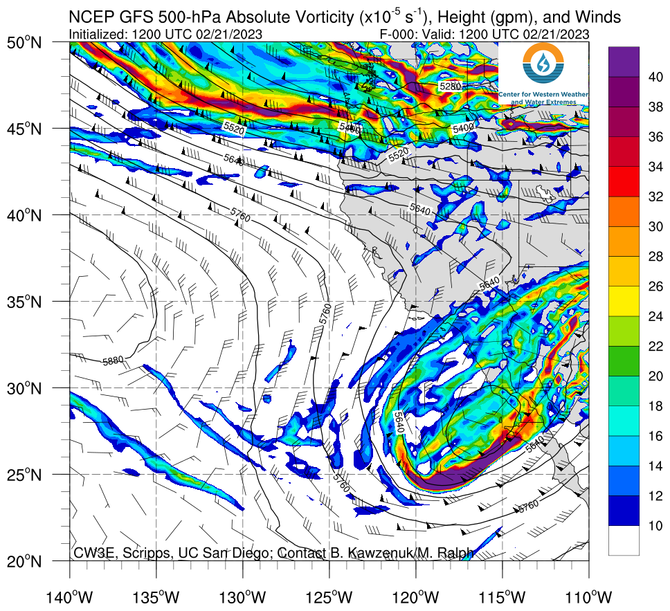
- An amplifying upper-level shortwave trough will continue to produce unsettled weather over much of the western US during the next few days
- As time progresses, a cutoff low and a weak atmospheric river (AR) are forecast to develop near the California coast and bring a period of heavy precipitation to Southern California
- The 00Z ECMWF EPS control is predicting AR 1 conditions (based on the Ralph et al. 2019 AR Scale) over coastal San Diego County and AR 2 conditions near the California–Mexico border
- The NWS CNRFC is forecasting at least 2–5 inches of total precipitation in the Sierra Nevada and coastal Southern California, with higher amounts expected in the eastern Transverse Ranges and Peninsular Ranges
- The NWS Weather Prediction Center has issued a marginal risk of rainfall exceeding flash flood guidance in coastal Southern California Friday into Sunday
- Major winter storm impacts are expected over portions of the Sierra Nevada and Transverse Ranges from Thursday through Saturday
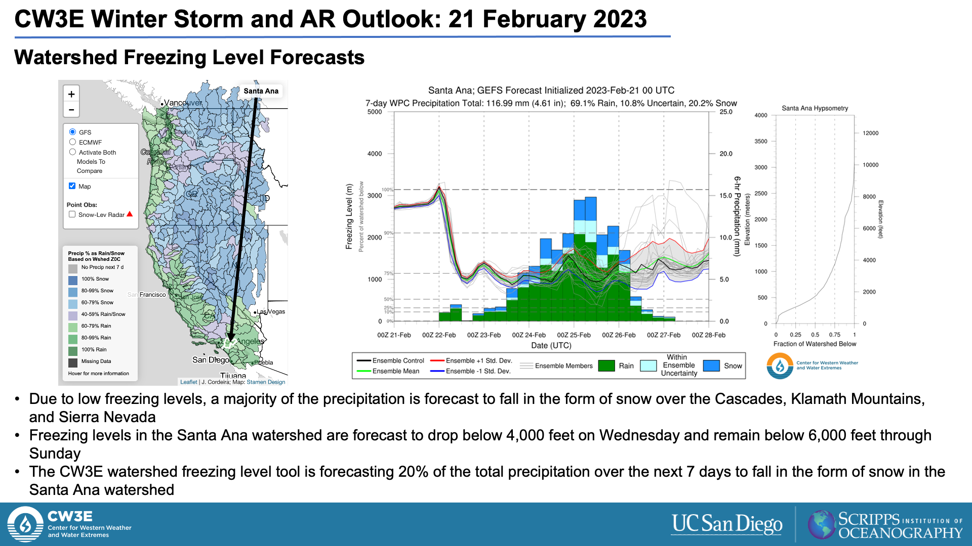
- Low freezing levels will support significant snowfall accumulations in the higher terrain in Southern California
- Damaging wind gusts are also possible over much of the southwestern US today into Thursday
- As part of CW3E’s Atmospheric River Reconnaissance Program (AR Recon), the 53rd Weather Reconnaissance Squadron will continue to provide additional weather observations over the North Pacific, sampling the atmosphere upstream of this storm
Click images to see loops of GFS IVT and IWV forecasts Valid 1200 UTC 21 February – 0000 UTC 27 February 2023 |
|
 |
 |
Summary provided by C. Castellano, S. Bartlett, and J. Cordeira; 21 February 2023
To sign up for email alerts when CW3E post new AR updates click here.
*Outlook products are considered experimental


