CW3E AR Update: 22 September 2023 Outlook
September 22, 2023
Click here for a pdf of this information.
Atmospheric River Forecast to Impact Pacific Northwest and Northern California
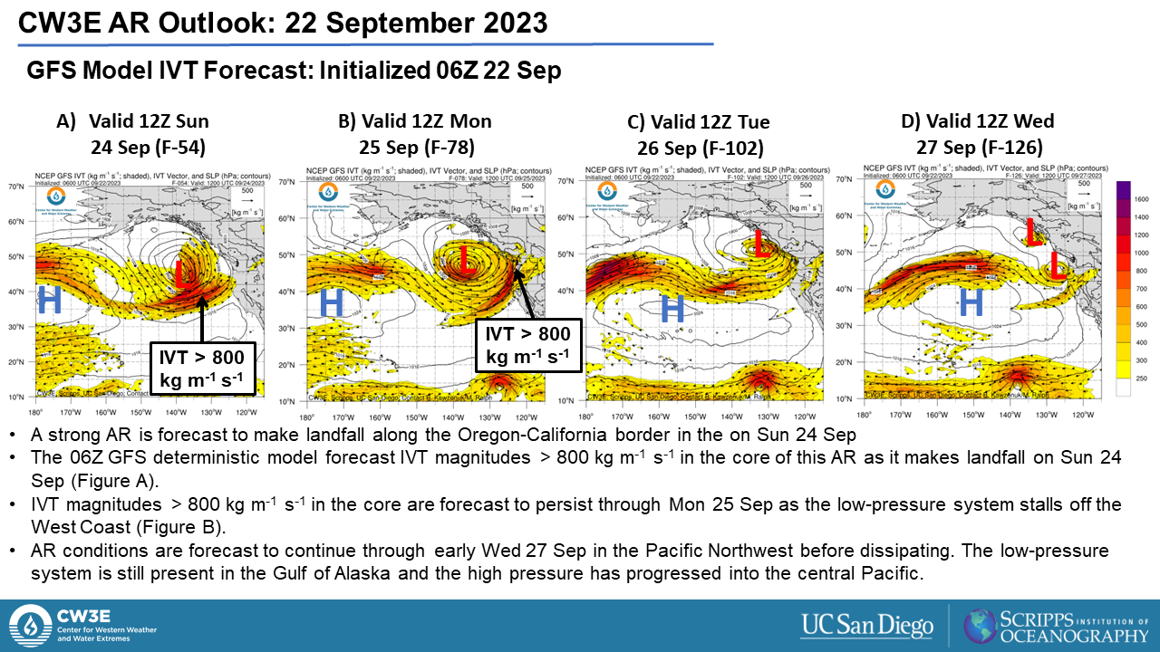
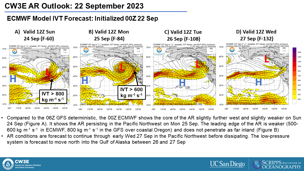
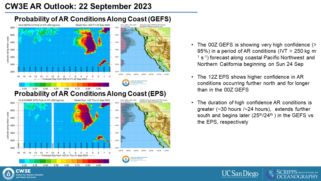
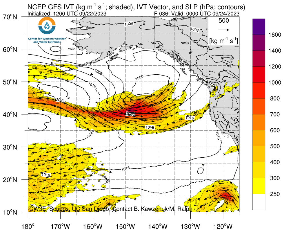
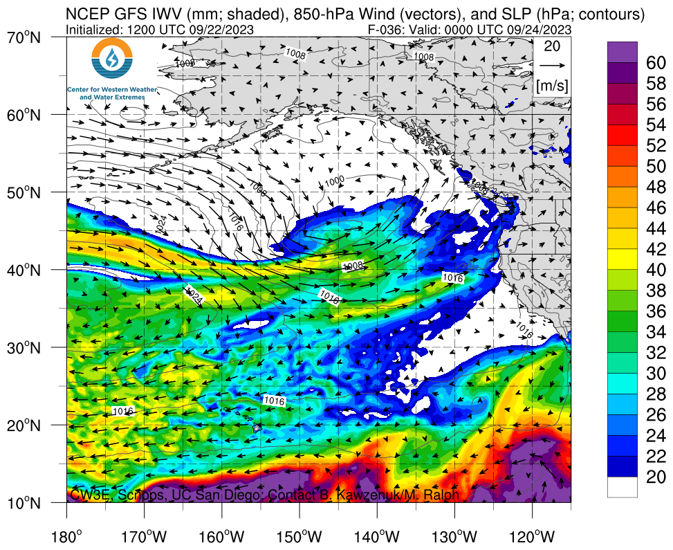
- An atmospheric river (AR) is forecast to make landfall in the Pacific Northwest early Sun 24 Sep with the greatest IVT making landfall along the Oregon-California Border late Sun 24 Sep. IVT values above 250 kg m-1 s-1 are forecast to persist in the Pacific Northwest through Wed 27 Sep
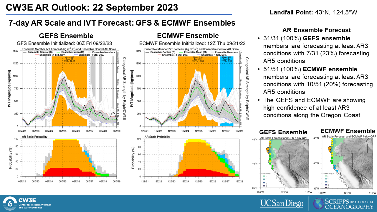
- AR 4 conditions (based on the Ralph et al. 2019 AR Scale) are forecast along the Oregon coast while AR3 conditions are forecast along the Washington and northern California coasts in both the GFS and ECMWF
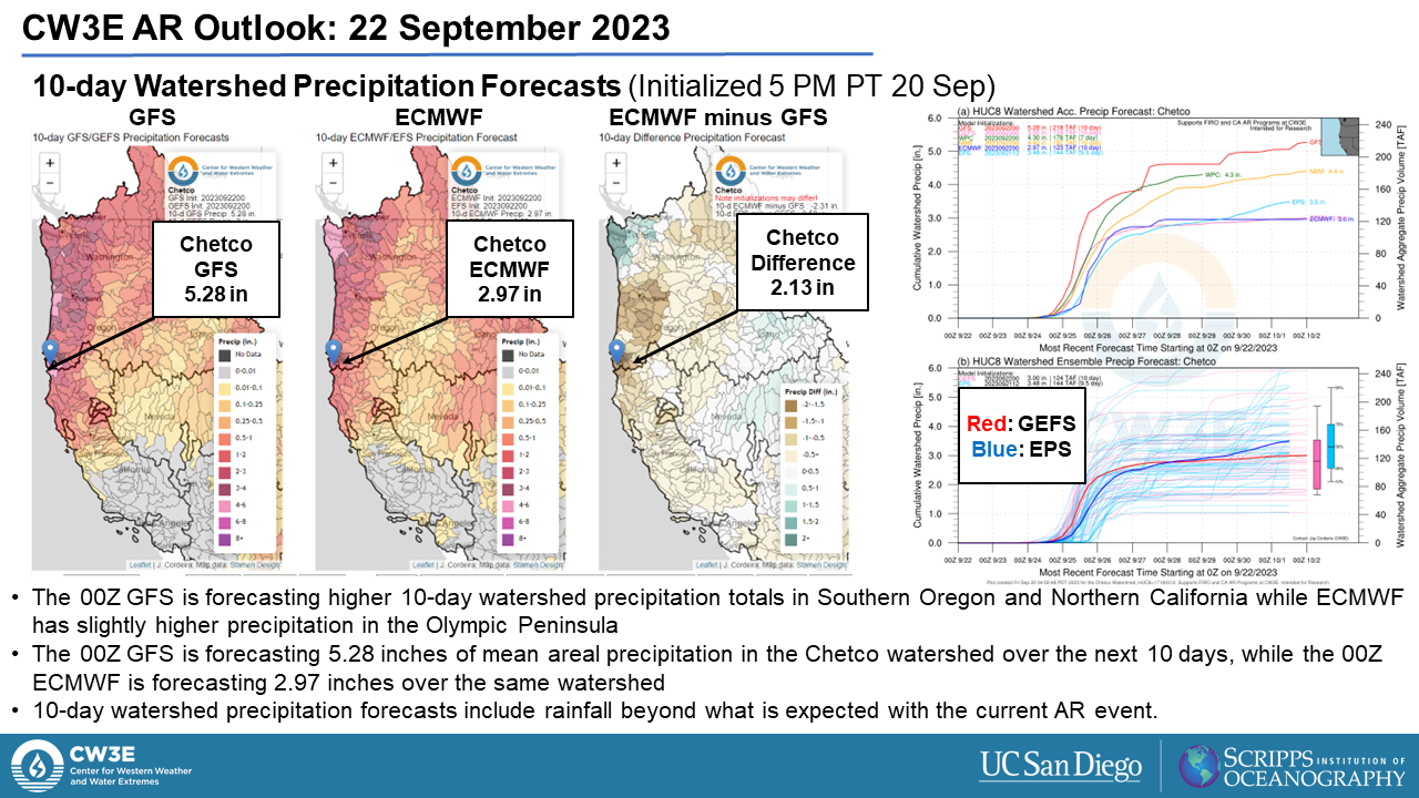
- The 00Z GFS is forecasting 5.28 inches of precipitation over the next 10 days in the Chetco Watershed, located in SW Oregon along the Oregon-California border, while the 00Z ECMWF is forecasting 2.97 inches over the same period. Some of the precipitation is forecast to fall after this AR
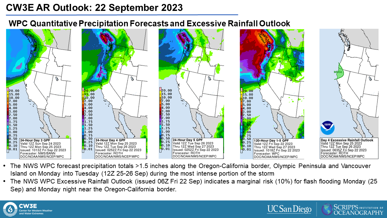
- The NWS Weather Prediction Center (WPC) is forecasting 5-day precipitation totals >3 inches over the Olympic Peninsula and the Oregon-California border with >1.5 inches along the Oregon and Washington coasts. WPC excessive rainfall outlooks have a marginal risk for rainfall exceeding flash flooding guidance along the Oregon-California Border for 12Z Mon 25 Sep -12Z Tues 26 Sep
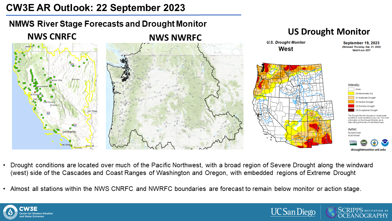
- Despite higher amounts of precipitation along much of the Pacific Northwest Coast, both the CNRFC and NWRFC do not forecast any river stage locations to pass above action stage. This is largely tied to much of the Pacific Northwest currently experiencing Severe Drought conditions or worse
Click images to see loops of GFS IVT and IWV forecasts Valid 0000 UTC 24 September – 1800 UTC 27 September 2023 |
|
 |
 |
Summary provided by M. Steen, S. Roj, P. Iniguez and S. Bartlett; 22 September 2023
To sign up for email alerts when CW3E post new AR updates click here.
*Outlook products are considered experimental

