CW3E AR Update: 22 December 2023 Outlook
December 22, 2023
Click here for a pdf of this information.
Pair of Atmospheric Rivers Forecast to Make Landfall along US West Coast
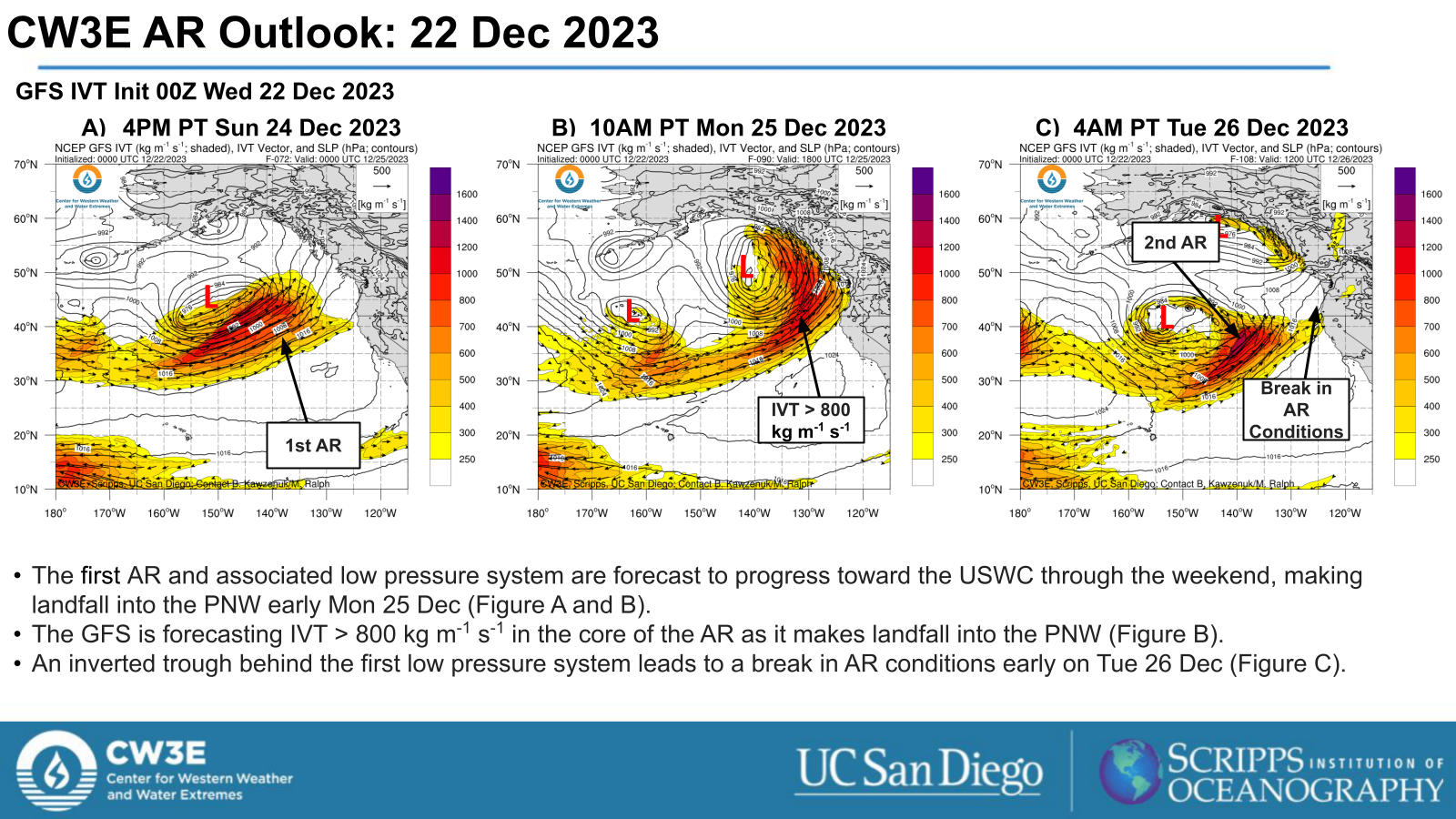
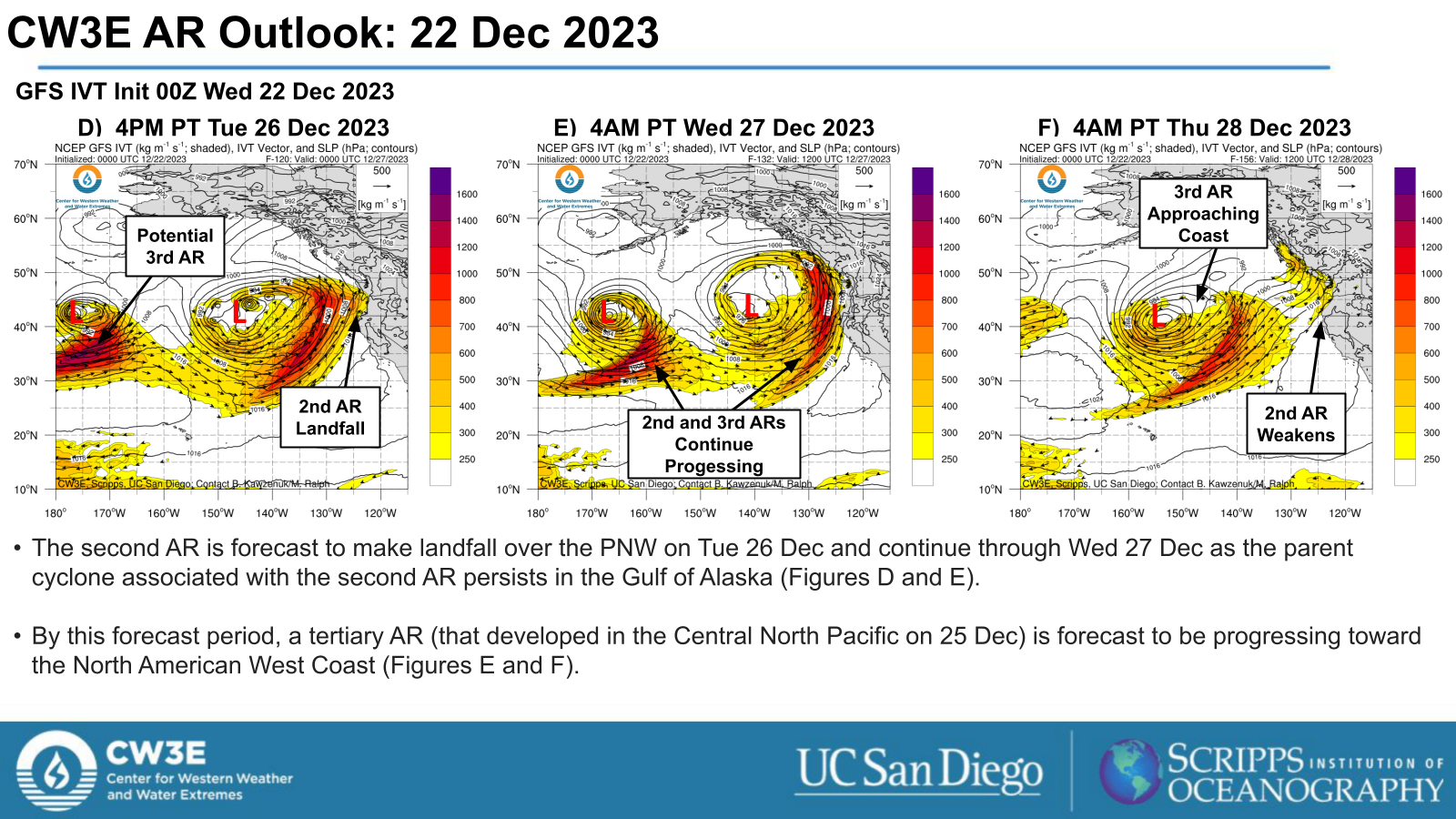
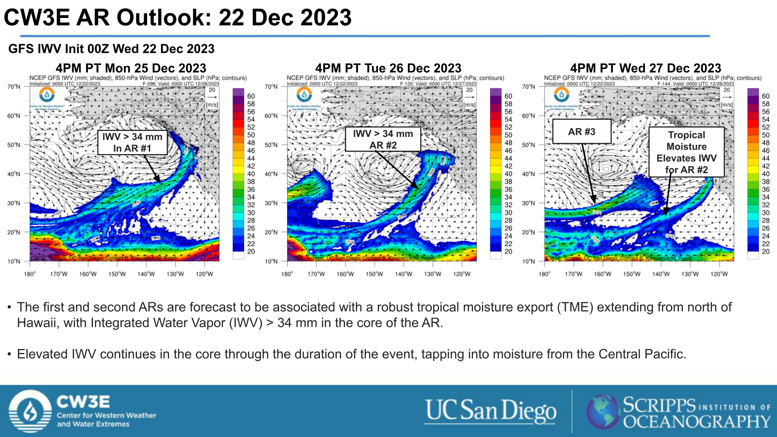
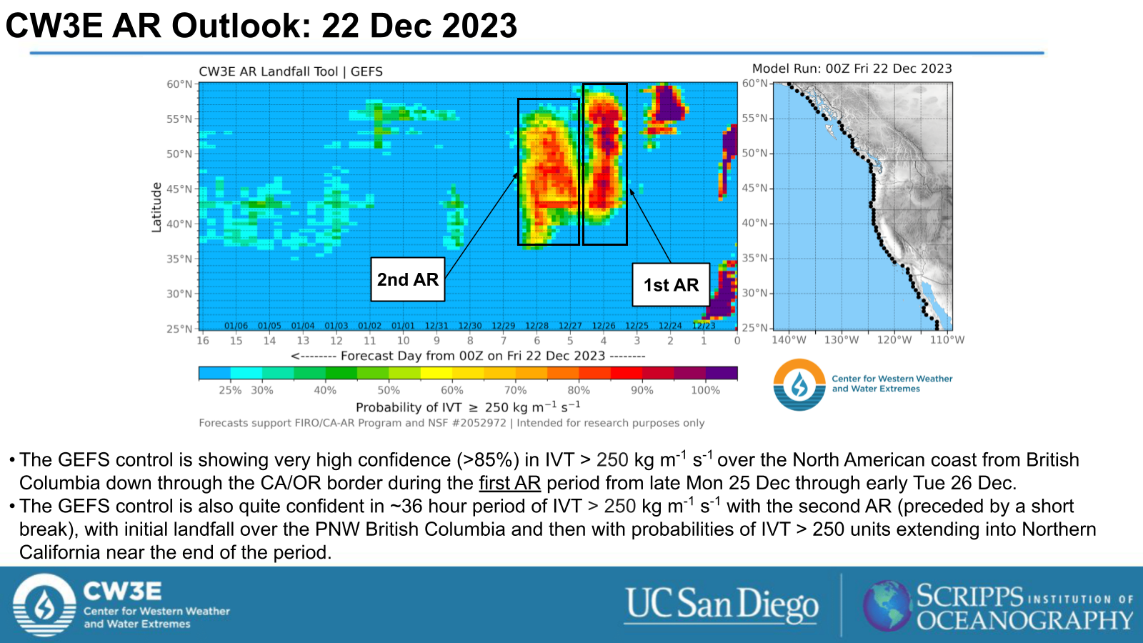
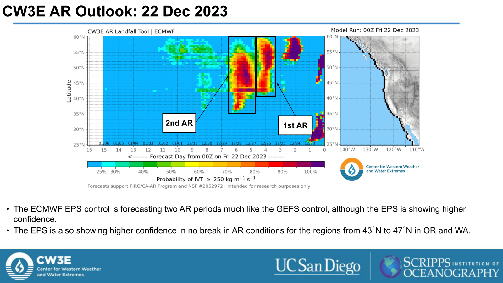
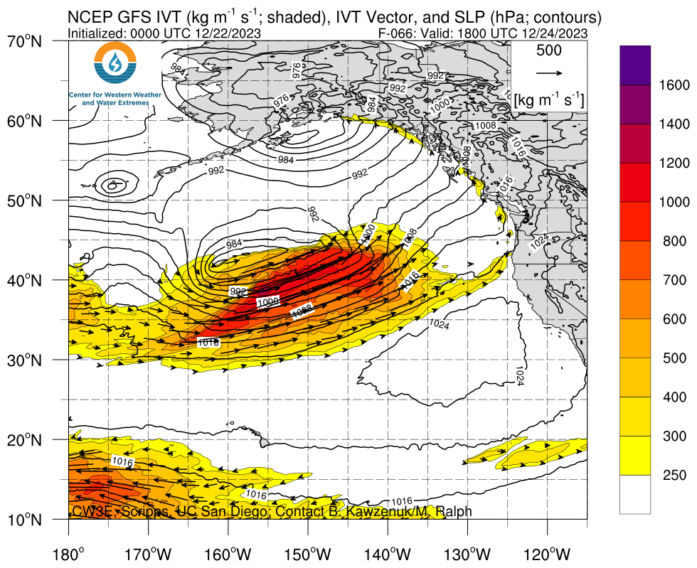
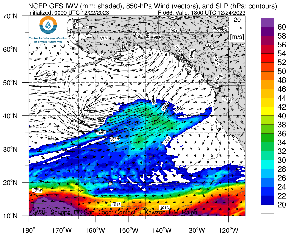
- A pair of Atmospheric Rivers (AR) are forecast to make landfall in the Pacific Northwest (PNW) early Mon 25 Dec and continue through Wed 27 Dec.
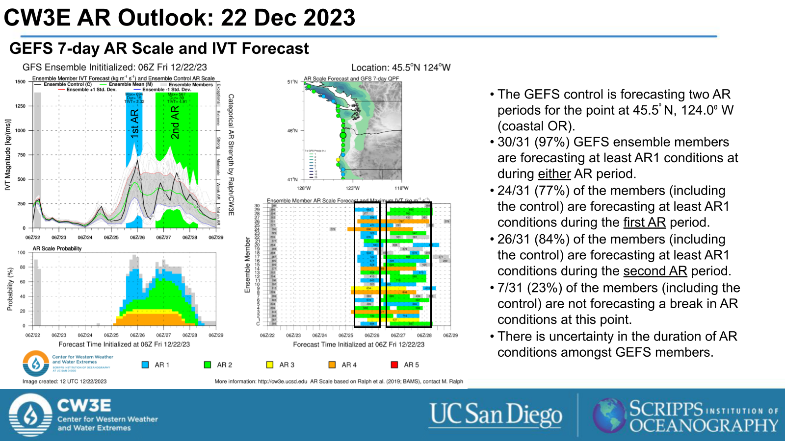
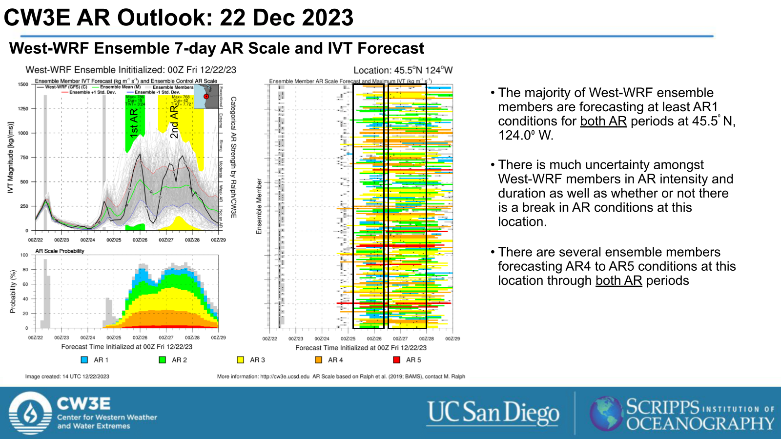
- The GEFS control run is forecasting AR1 to AR2 conditions (based on Ralph et al. 2019 AR scale) for the first AR period and AR2 to AR3 conditions for the second AR period for the PNW.
- The GEFS control run is forecasting up to AR1 for the first AR period and AR1 to AR2 conditions for the second AR period for Northern CA.
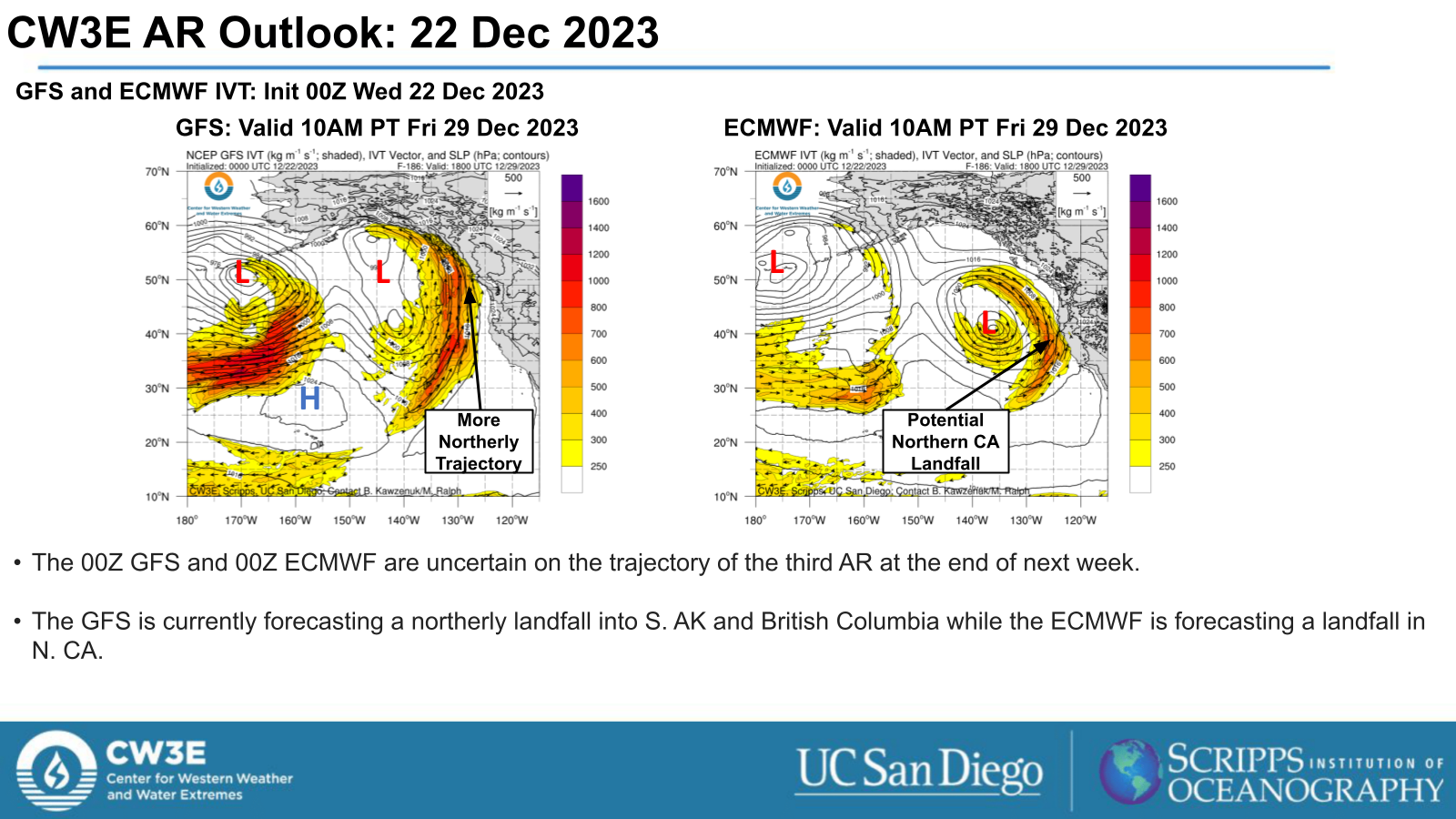
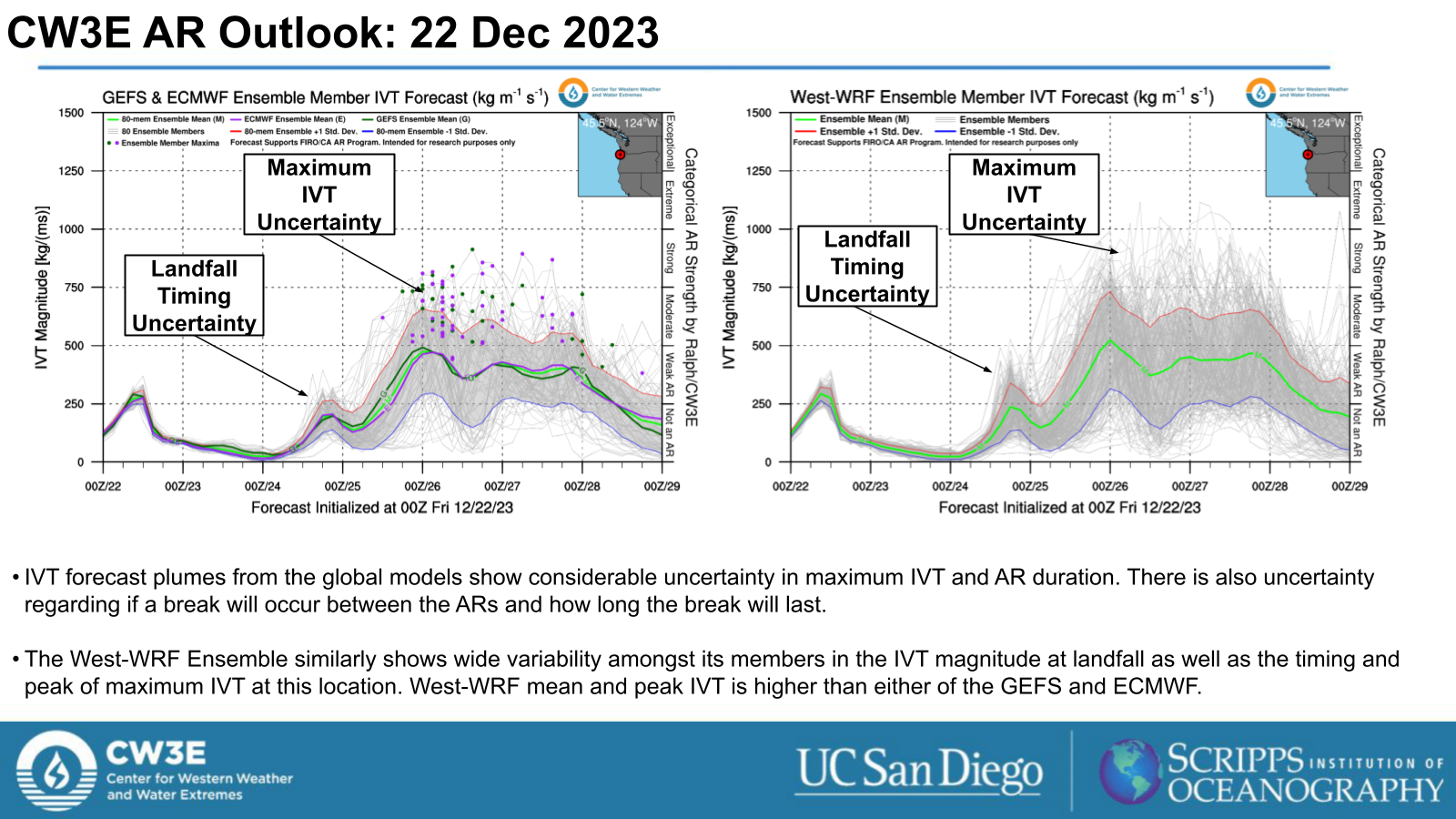
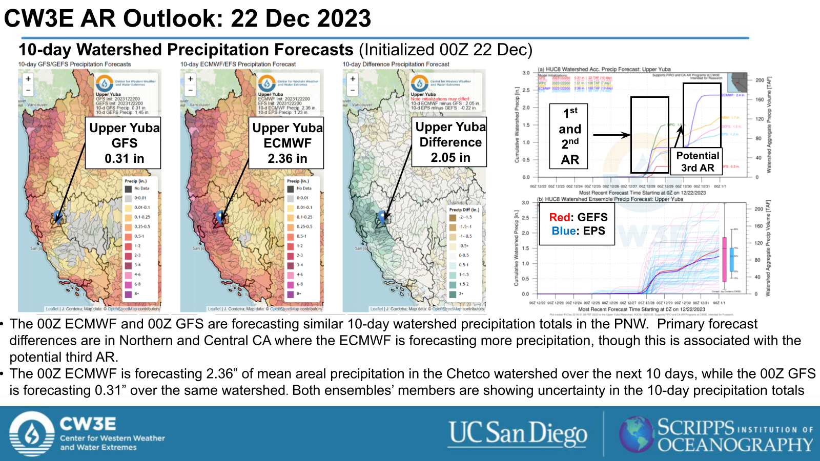
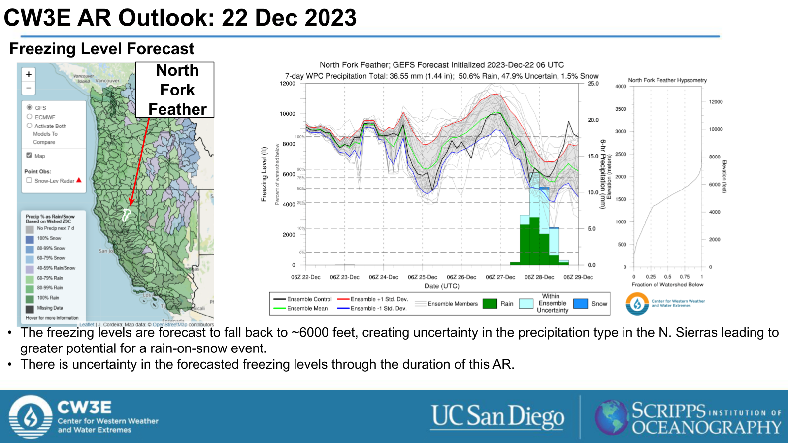
- There is uncertainty in the AR landfall timing, duration and possible break in AR conditions in the GEFS, ECMWF EPS and West-WRF Ensembles.
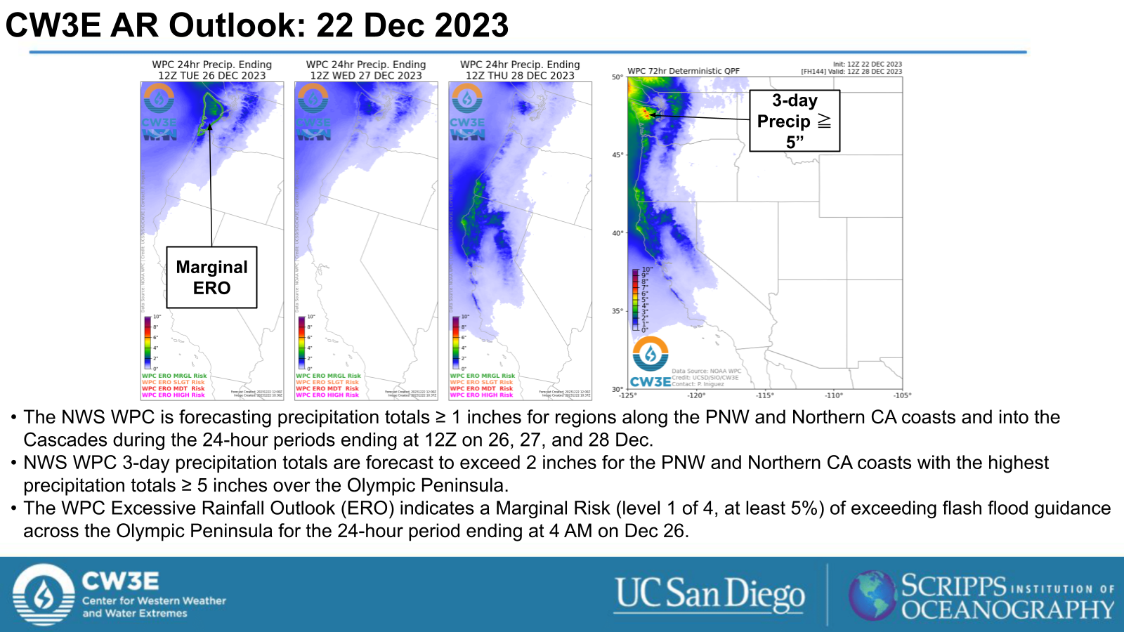
- The National Weather Service (NWS) Weather Prediction Center (WPC) is currently forecasting 3-day precipitation totals ≥ 2” with highest precipitation totals over the Olympic Peninsula and CA/OR border.
- The WPC Excessive Rainfall Outlook (ERO) indicates a Marginal Risk (level 1 of 4, at least 5%) of exceeding flash flood guidance for the Olympic Peninsula for the 24-hour period ending at 4 AM Tue 26 Dec.
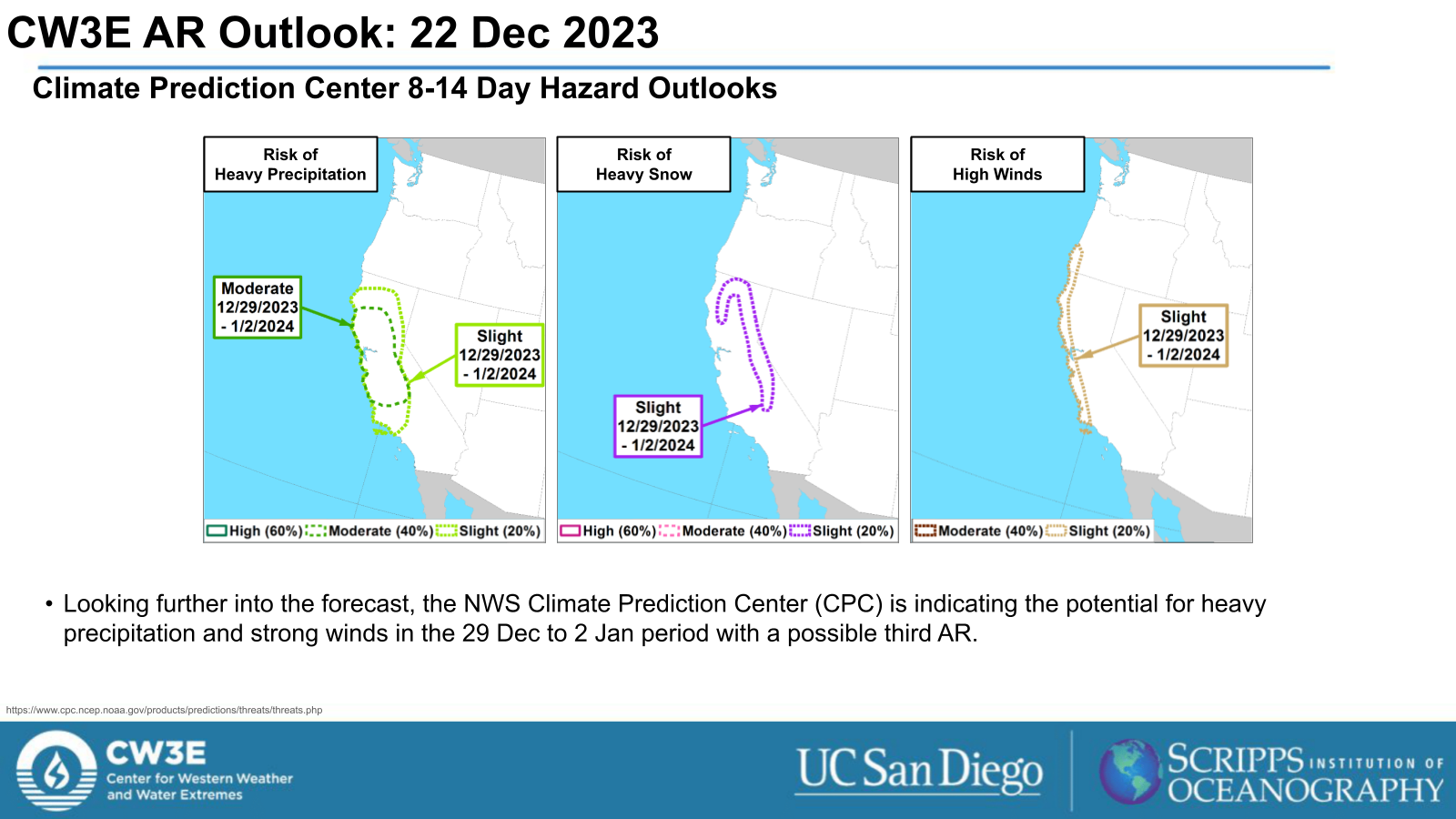
- The NWS Climate Prediction Center’s Day 8-14 Hazard Outlook shows risks of heavy precipitation for Northern and Central CA from 29 Dec 2023 through 2 Jan 2024 with the surface low and the associated frontal boundary and potential third AR at the end of next week.
Click images to see loops of GFS IVT and IWV forecasts Valid 1800 UTC 24 December 2023 – 1800 UTC 28 December 2023 |
|
 |
 |
Summary provided by M. Steen, P. Iniguez, S. Roj, S. Bartlett and J. Kalansky; 22 December 2023
To sign up for email alerts when CW3E post new AR updates click here.
*Outlook products are considered experimental

