CW3E Event Summary: 17-20 October 2024
28 October 2024
Click here for a pdf of this information.
Complex Storm Produces Heavy Snow in CO and Record-Breaking Rainfall in NM
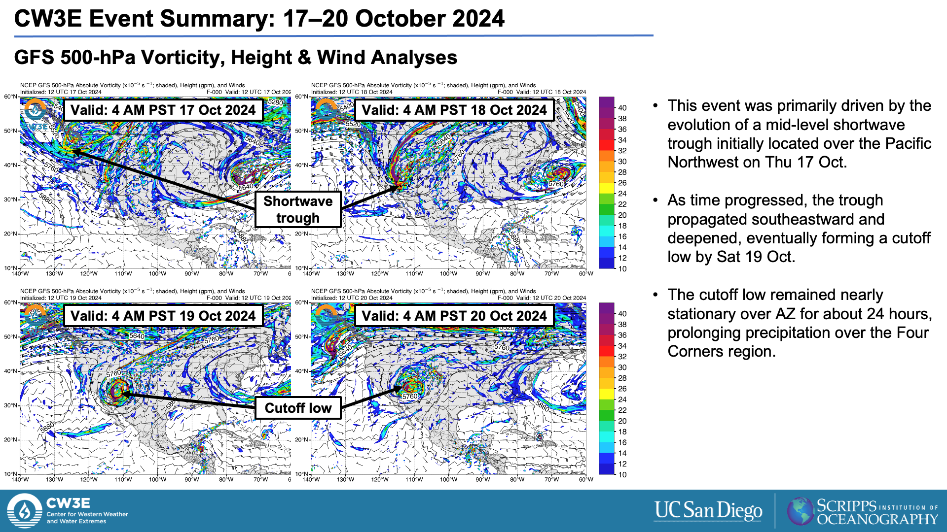
- An amplifying mid-level shortwave trough over the western US evolved into a cutoff low over AZ, setting the stage for widespread precipitation in the Four Corners region.
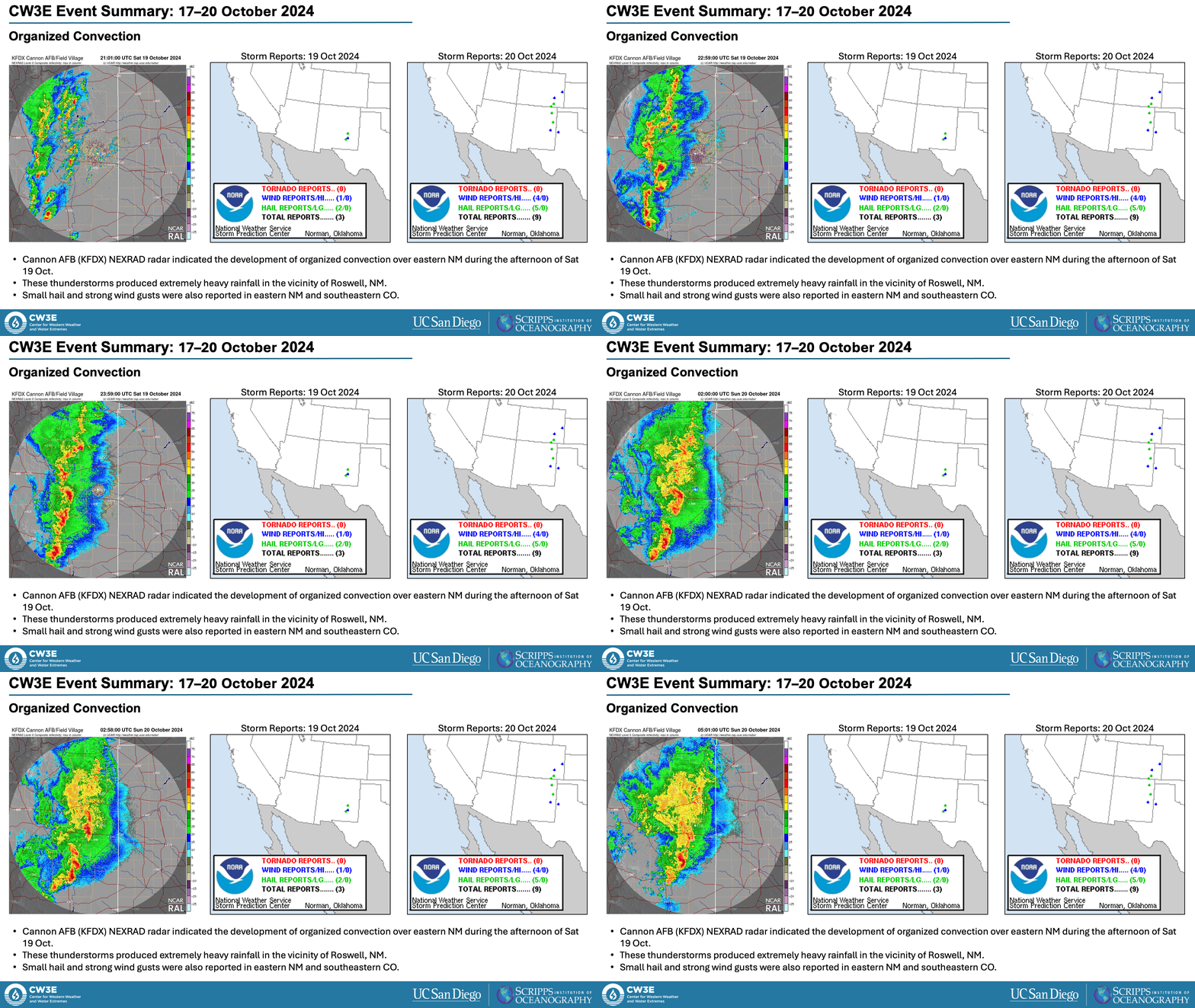
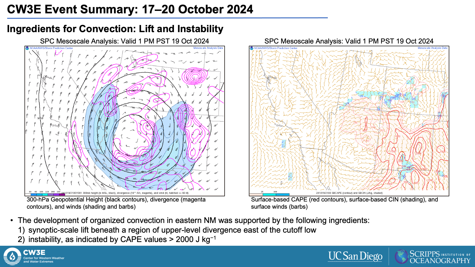
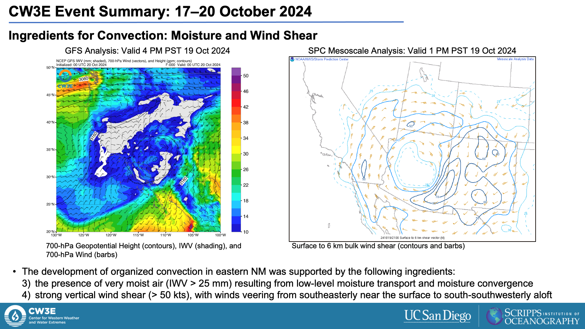
- The combination of strong synoptic-scale forcing, large instability, ample moisture, and strong vertical wind shear created favorable conditions for the development of organized convection over eastern NM on Sat 19 Oct.
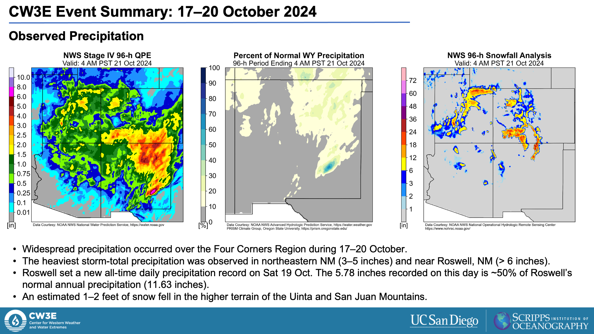
- These thunderstorms produced very heavy rainfall, particularly in the vicinity of Roswell, NM (> 6 inches).
- Roswell received nearly 50% of its annual precipitation in a 6-hour period and set a new all-time daily precipitation record (5.78 inches).
- Based on NOAA Atlas 14, the observed 6-hour rainfall at Roswell exceeded the 500-year storm.
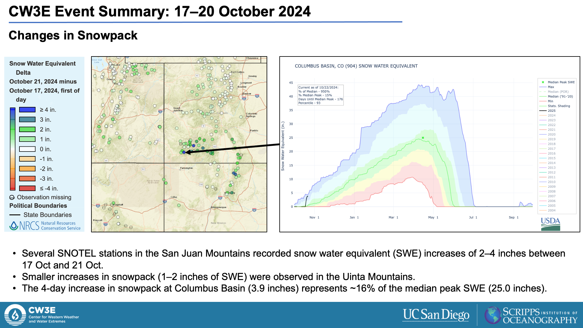
- Snowfall accumulations of 1–2 feet were also observed in the Uinta and San Juan Mountains.
- Some locations received the equivalent of ~15% of their typical annual peak snowpack during this event.
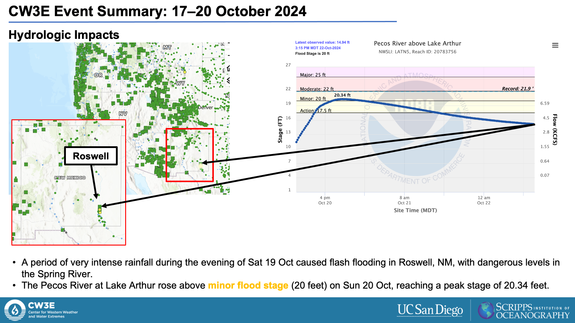
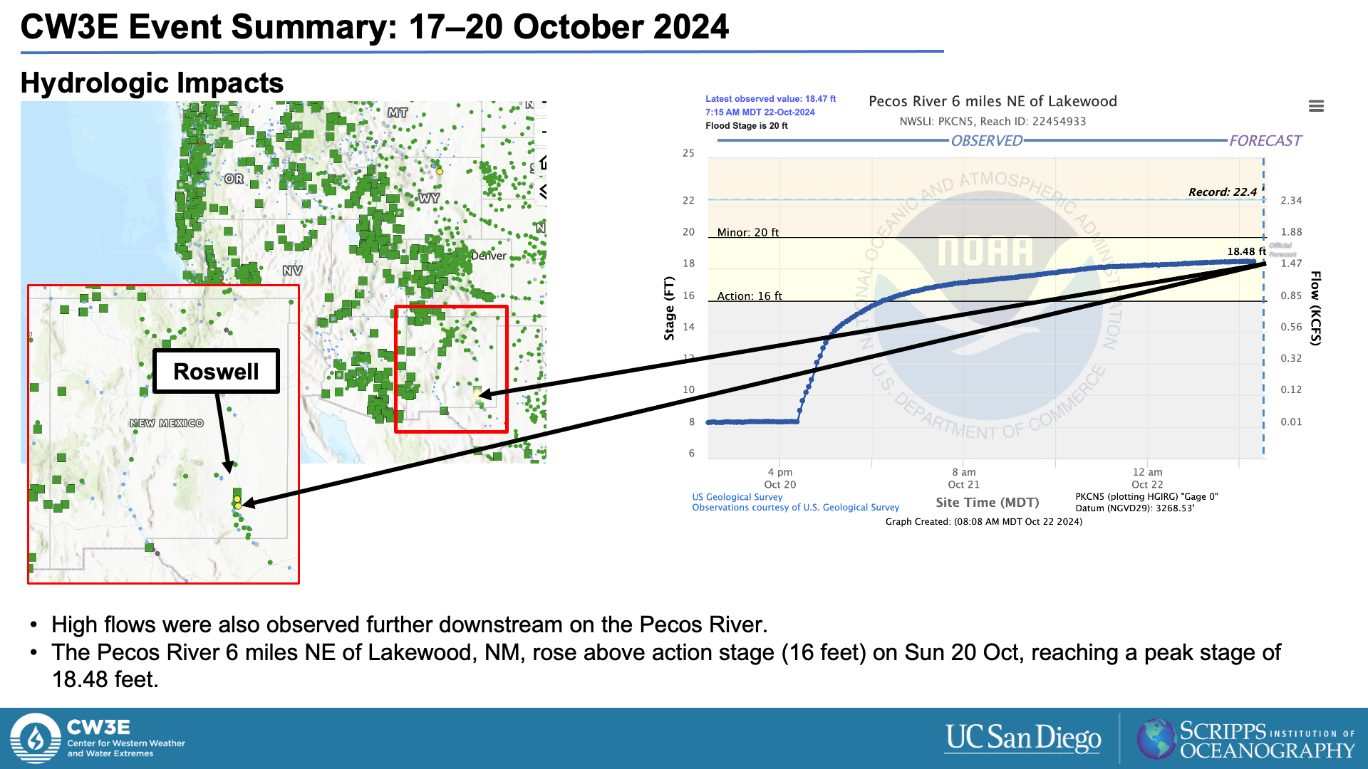
- Extremely heavy rainfall in southeastern NM caused flooding along the Pecos River south of Roswell.
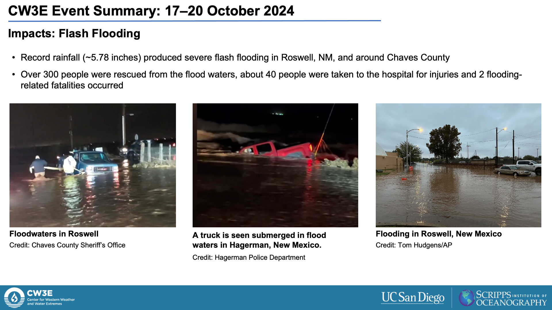
- Life-threatening flash flooding occurred in Roswell and Chaves County, where more than 300 people were rescued from floodwaters.
- Nearly 40 people were hospitalized and two fatalities were reported.
Summary provided by C. Castellano, D. Nash, S. Bartlett, and J. Rutz; 28 Oct 2024
To sign up for email alerts when CW3E post new AR updates click here.

