CW3E Event Summary: 19-23 November 2024
3 December 2024
Click here for a pdf of this information.
Heavy Precipitation Event Driven by Atmospheric River and Bomb Cyclone
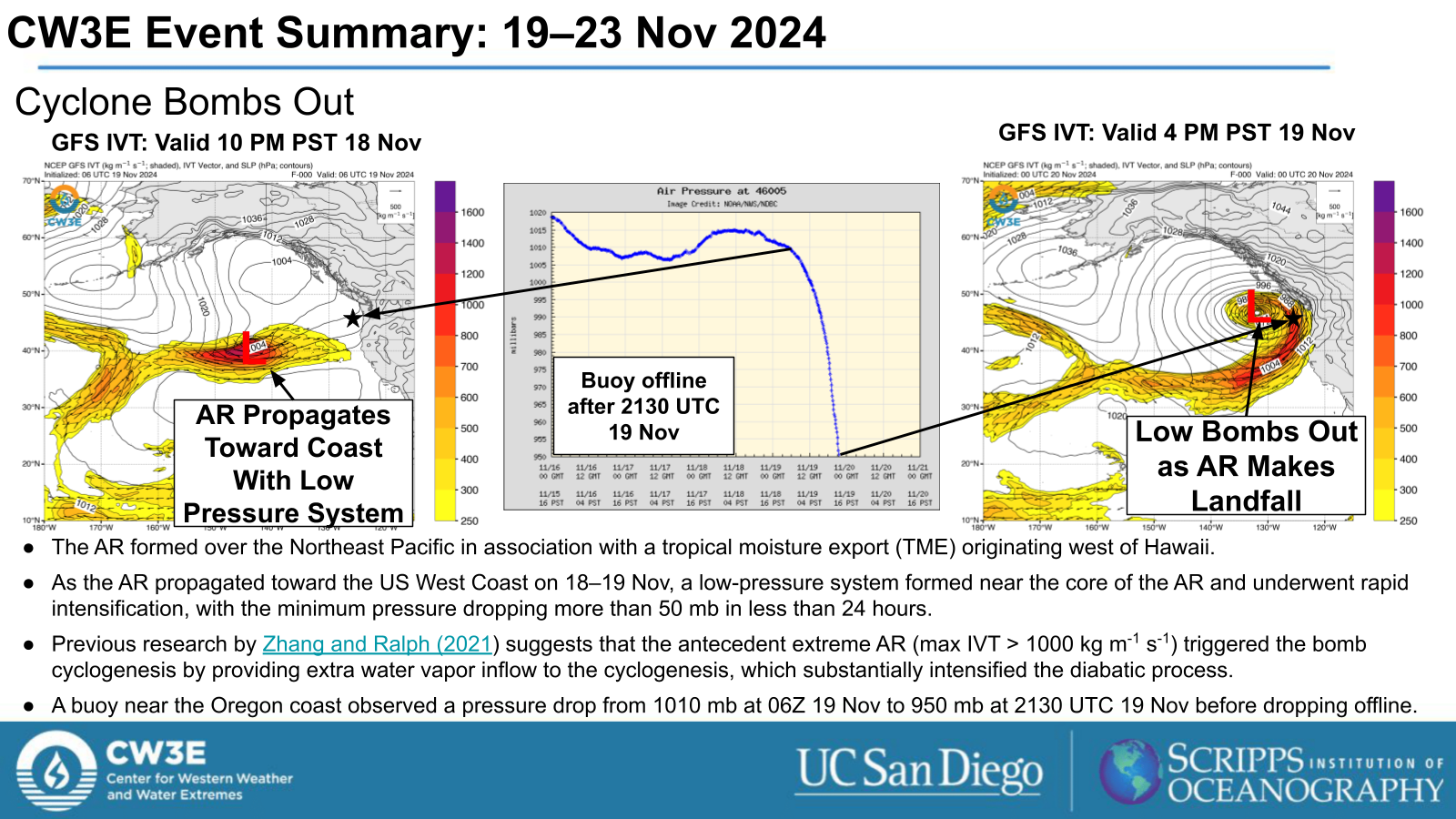
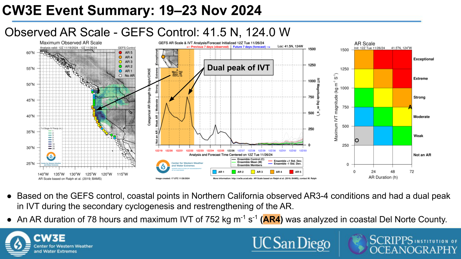
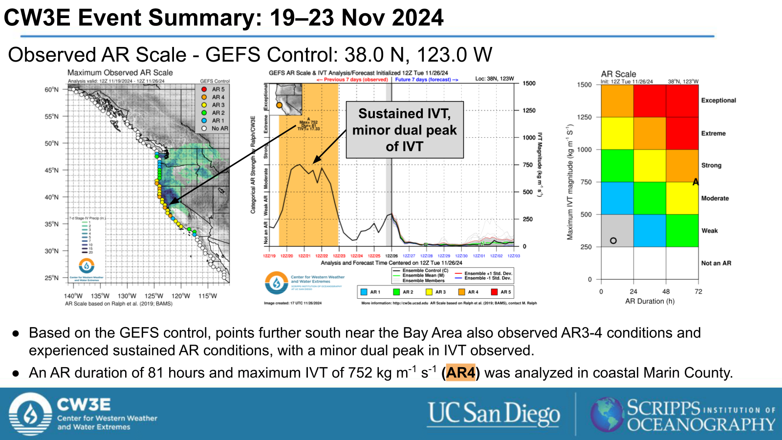
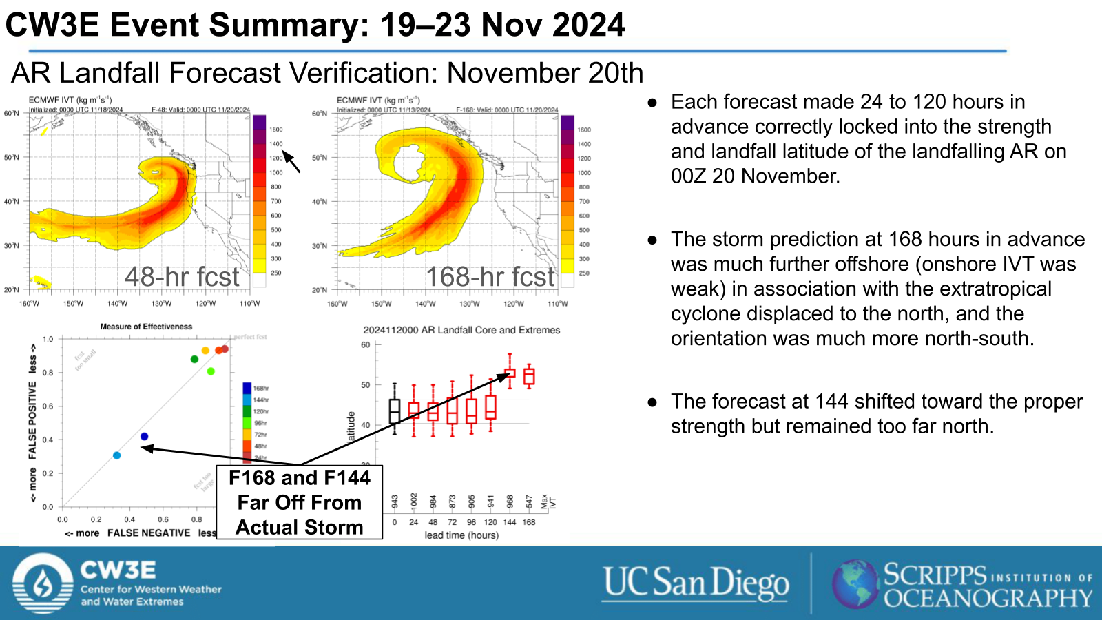
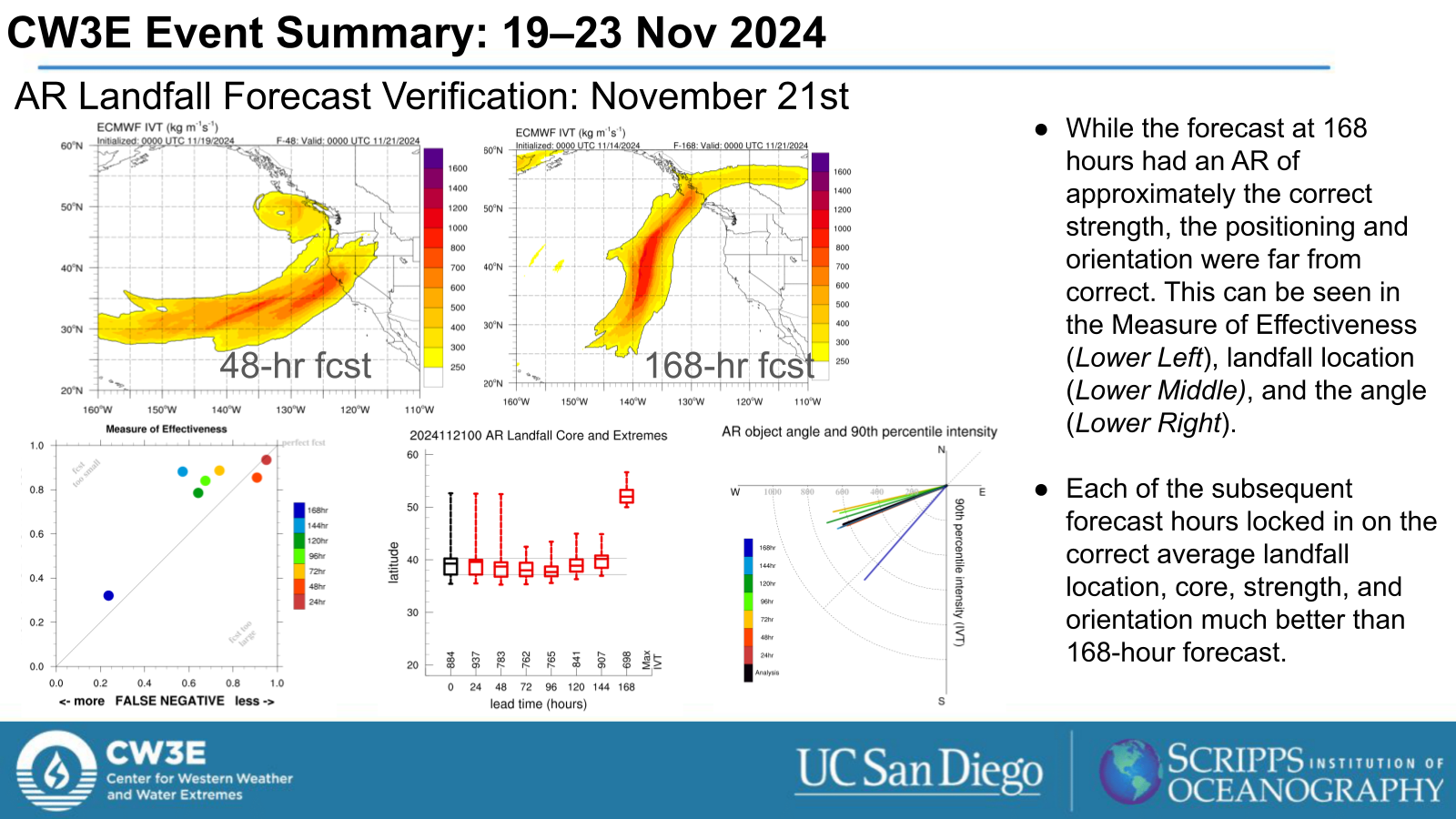
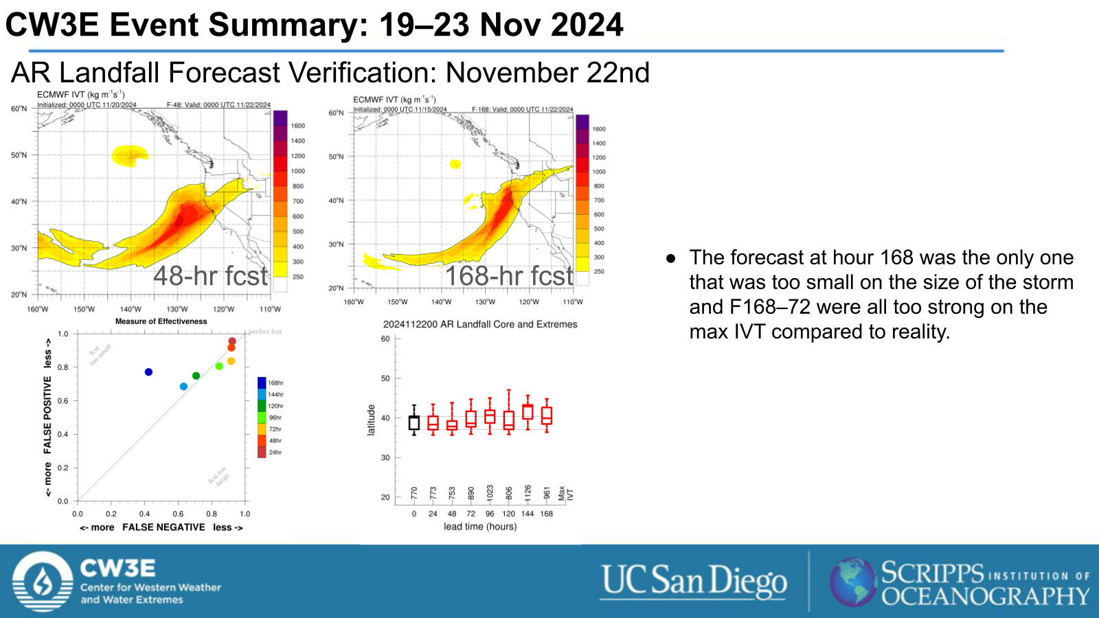
- An atmospheric river (AR) and bomb cyclone impacted the US West Coast from 19-23 Nov, as heavy precipitation, snowfall and high winds brought impacts across the coast.
The AR:
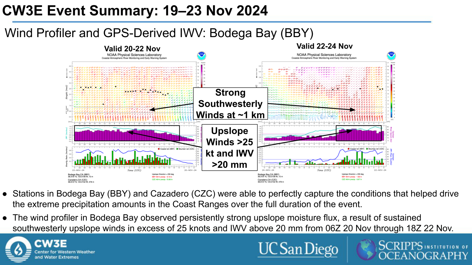
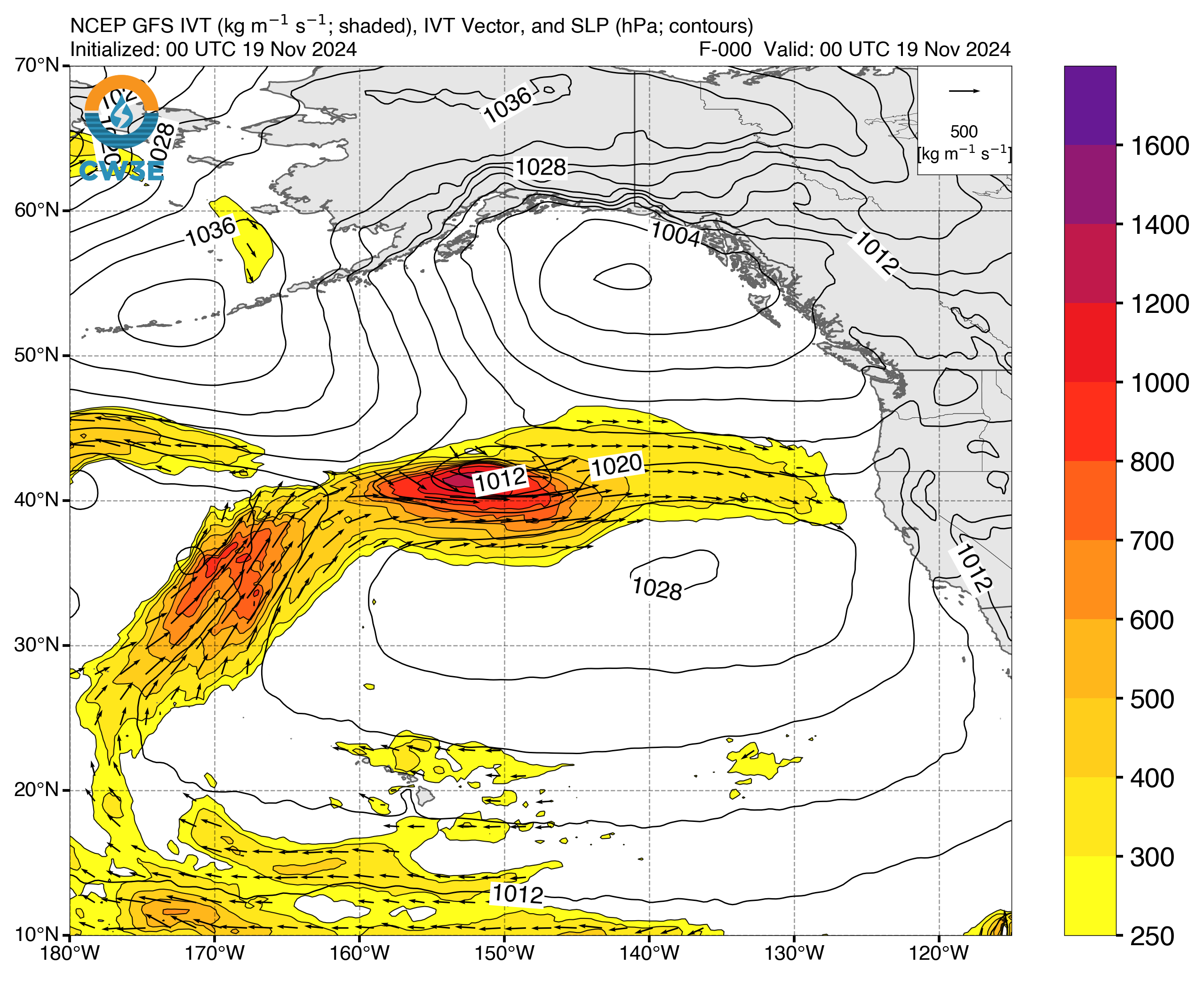
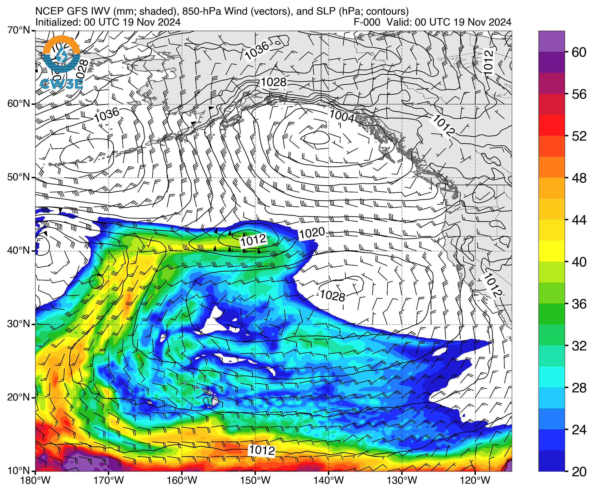
- A strong AR developed in the Northeast Pacific in association with a tropical moisture export (TME) west of Hawaii.
- As the AR propagated toward the US West Coast on 18–19 Nov, its presence helped fuel a bomb cyclogenesis event, with the developing cyclone’s minimum pressure dropping more than 50 mb in less than 24 hours.
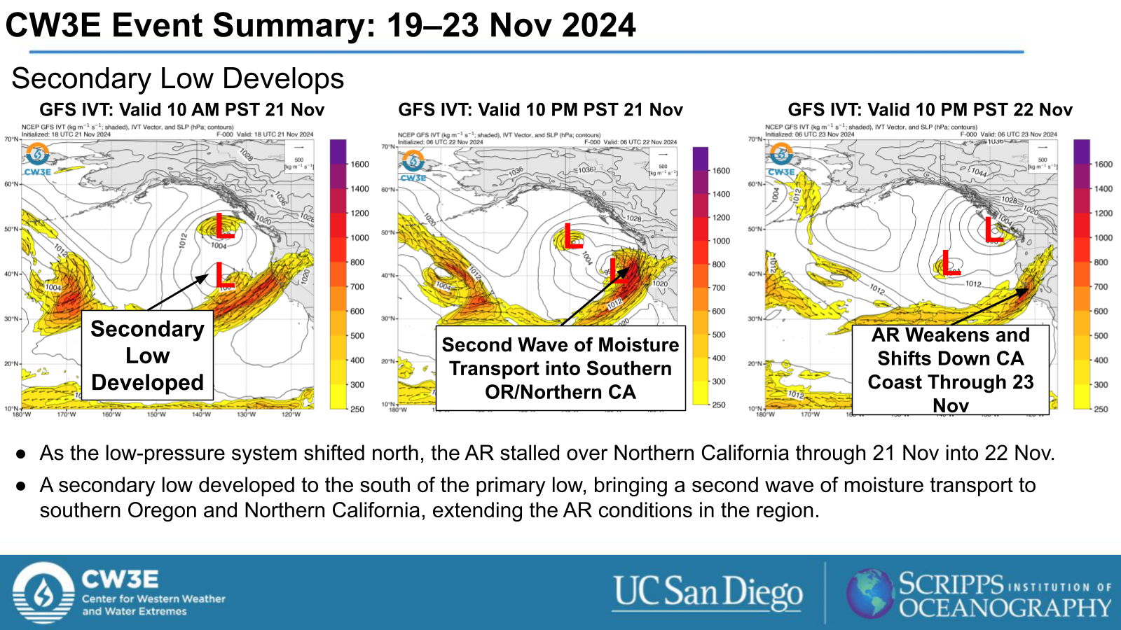
- A secondary low-pressure system developed south of the primary low as the AR stalled over Northern California, driving a second wave of moisture transport into
Southern Oregon and Northern California and extending AR conditions in the region.
Impacts:
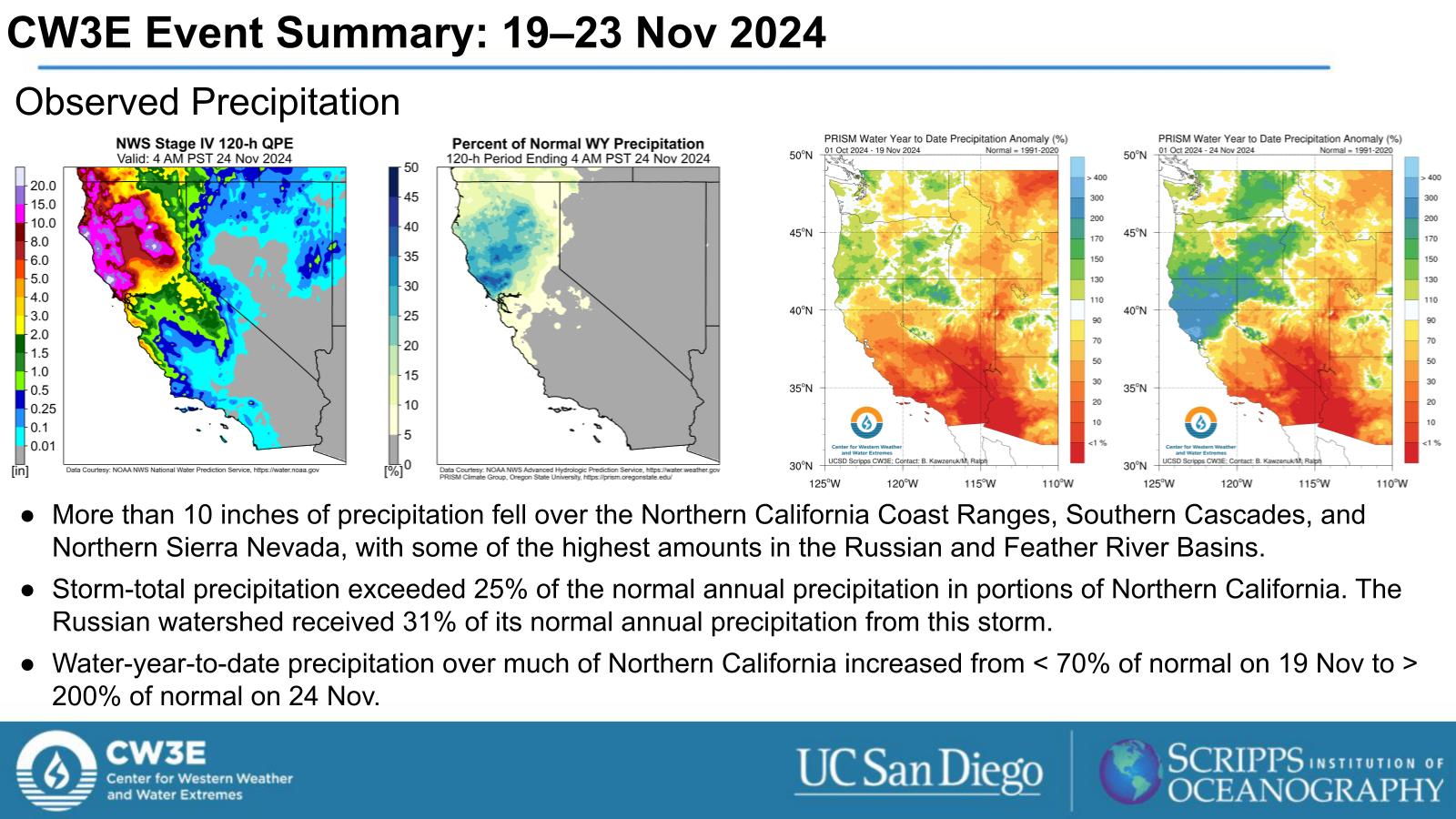
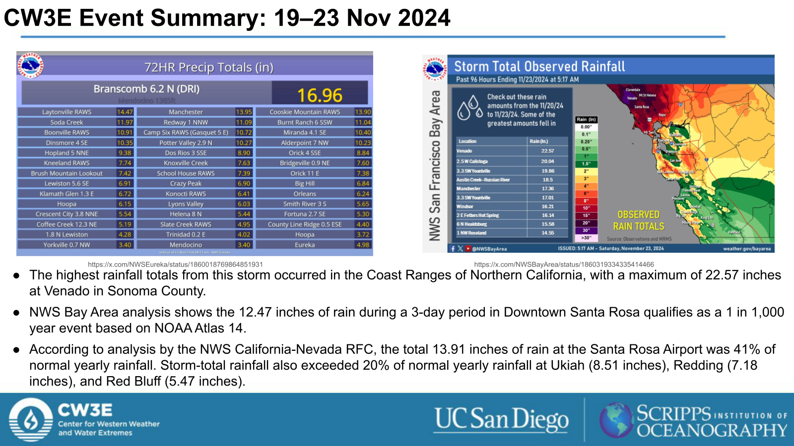
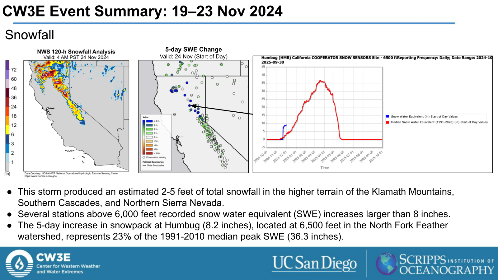
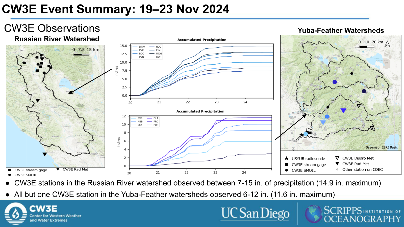
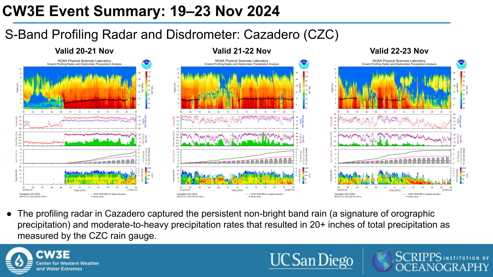
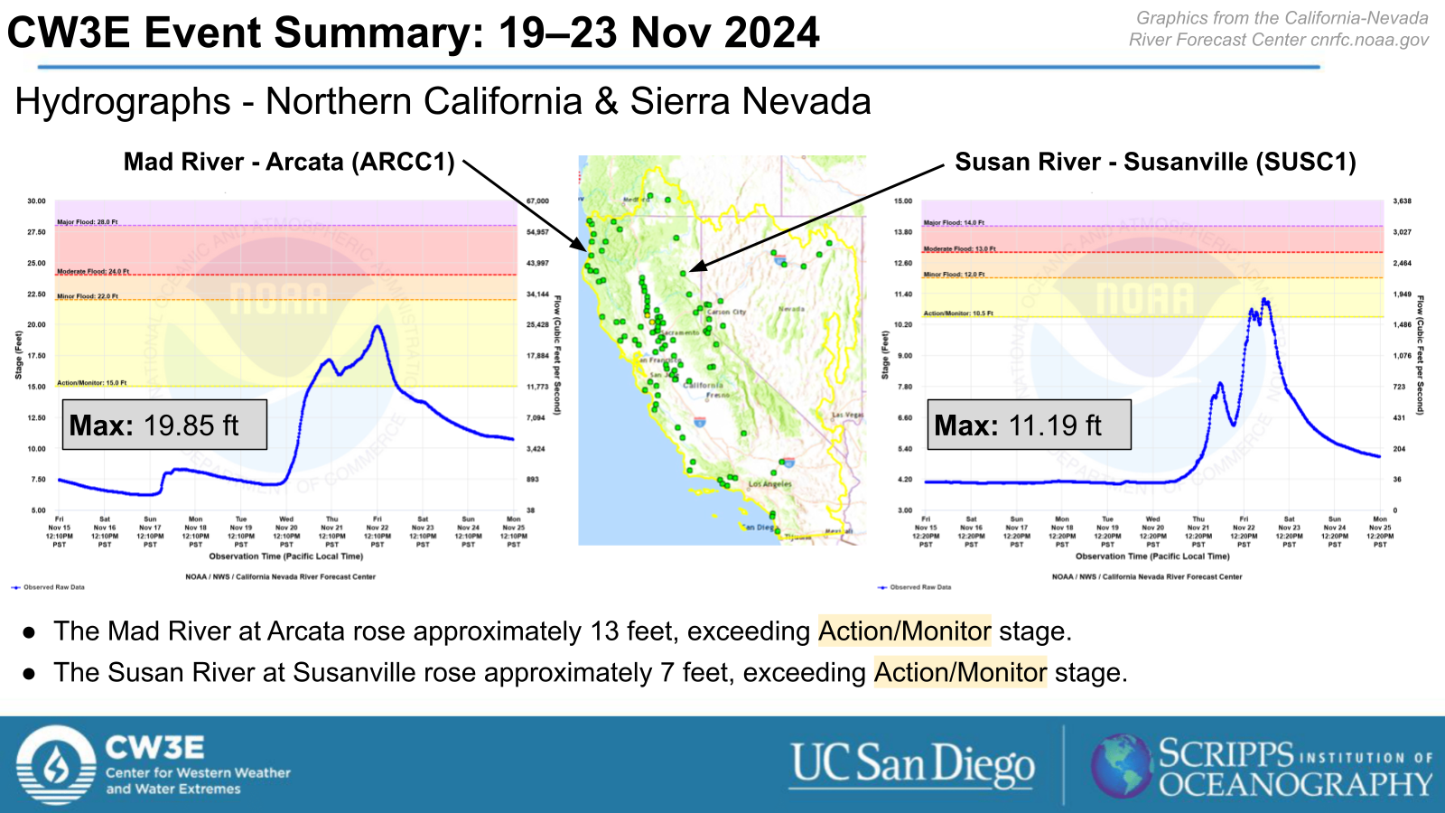
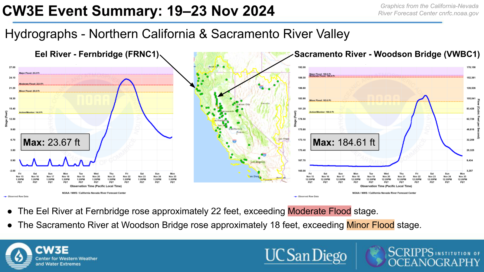
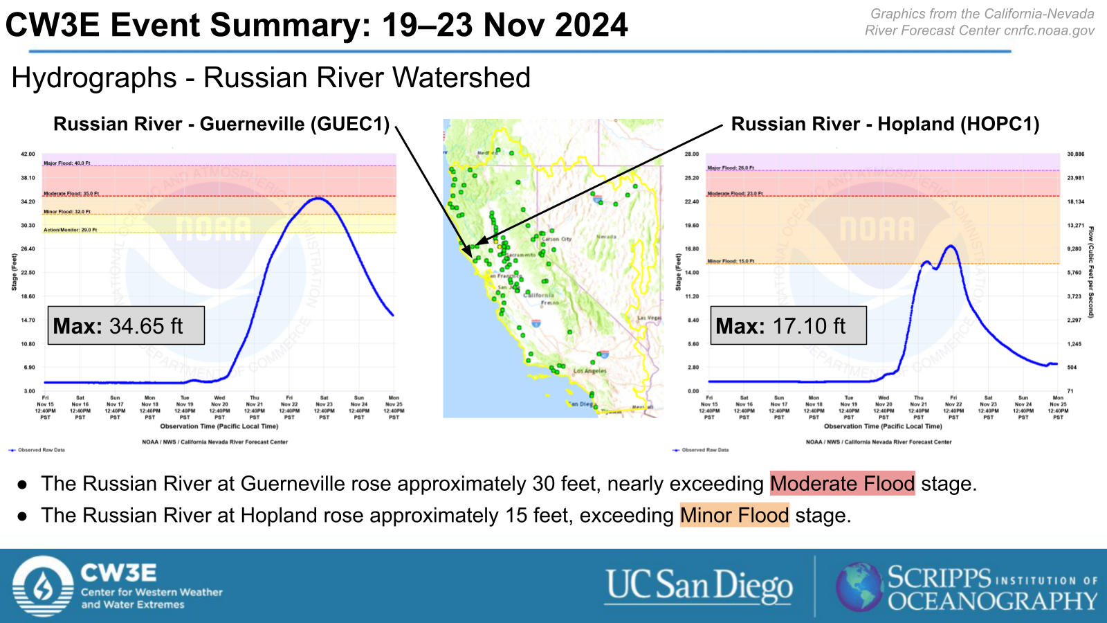
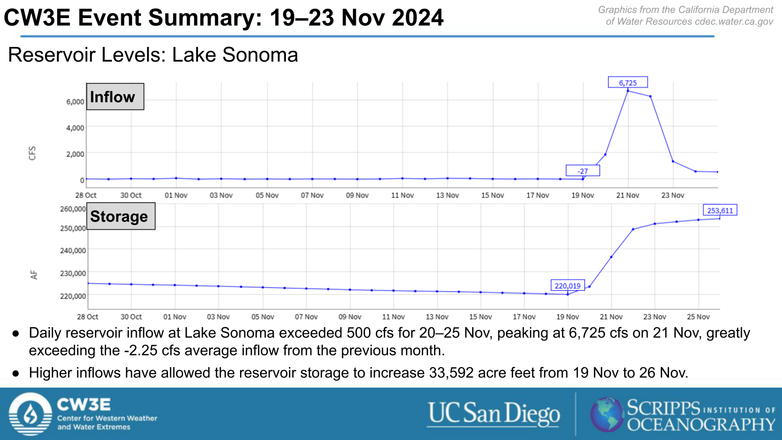
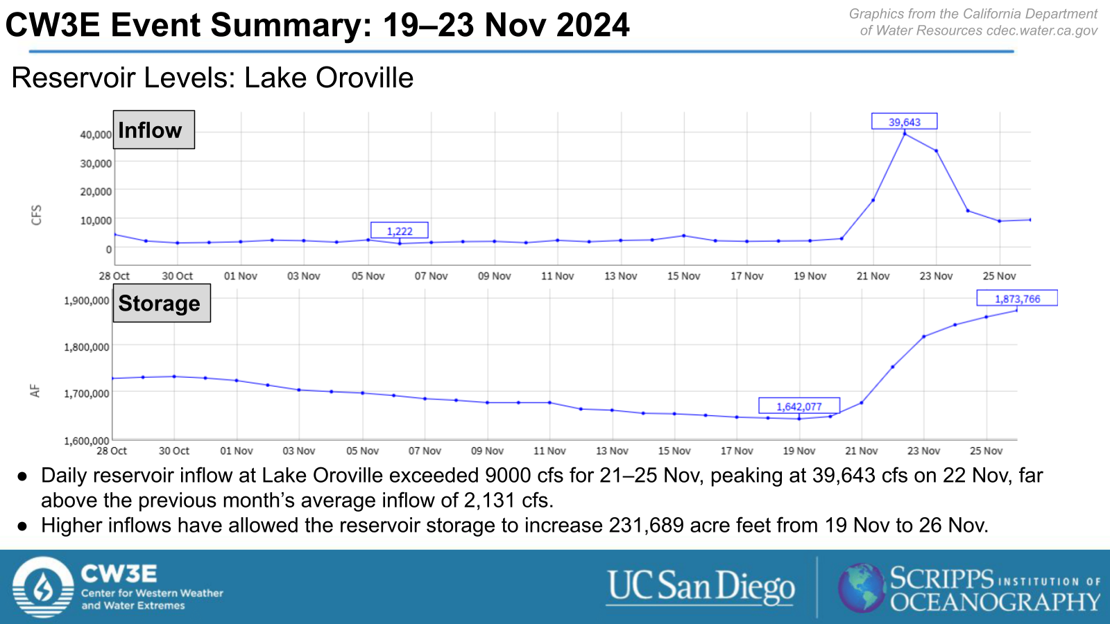
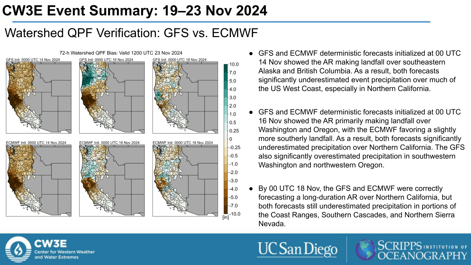
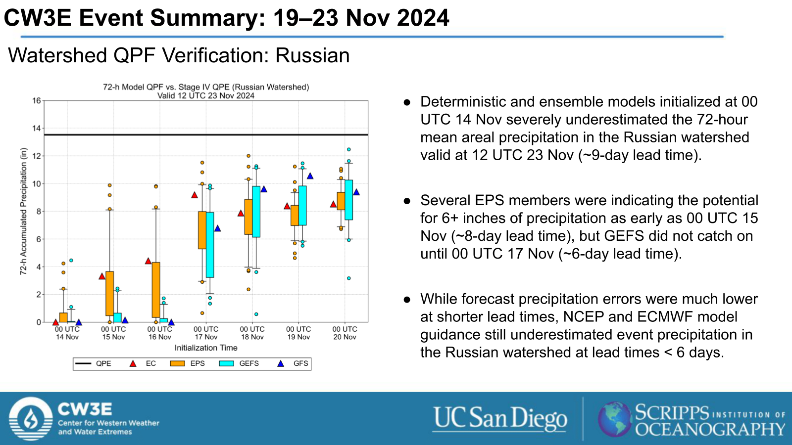
- This storm produced > 10 inches of precipitation over much of Northern California and an estimated 2-5 feet of snow in the higher terrain of the Klamath Mountains, Southern Cascades, and Northern Sierra Nevada.
- Portions of Northern California received > 25% of the normal annual precipitation from this storm.
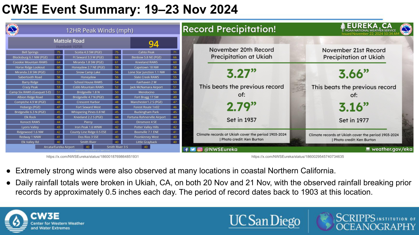
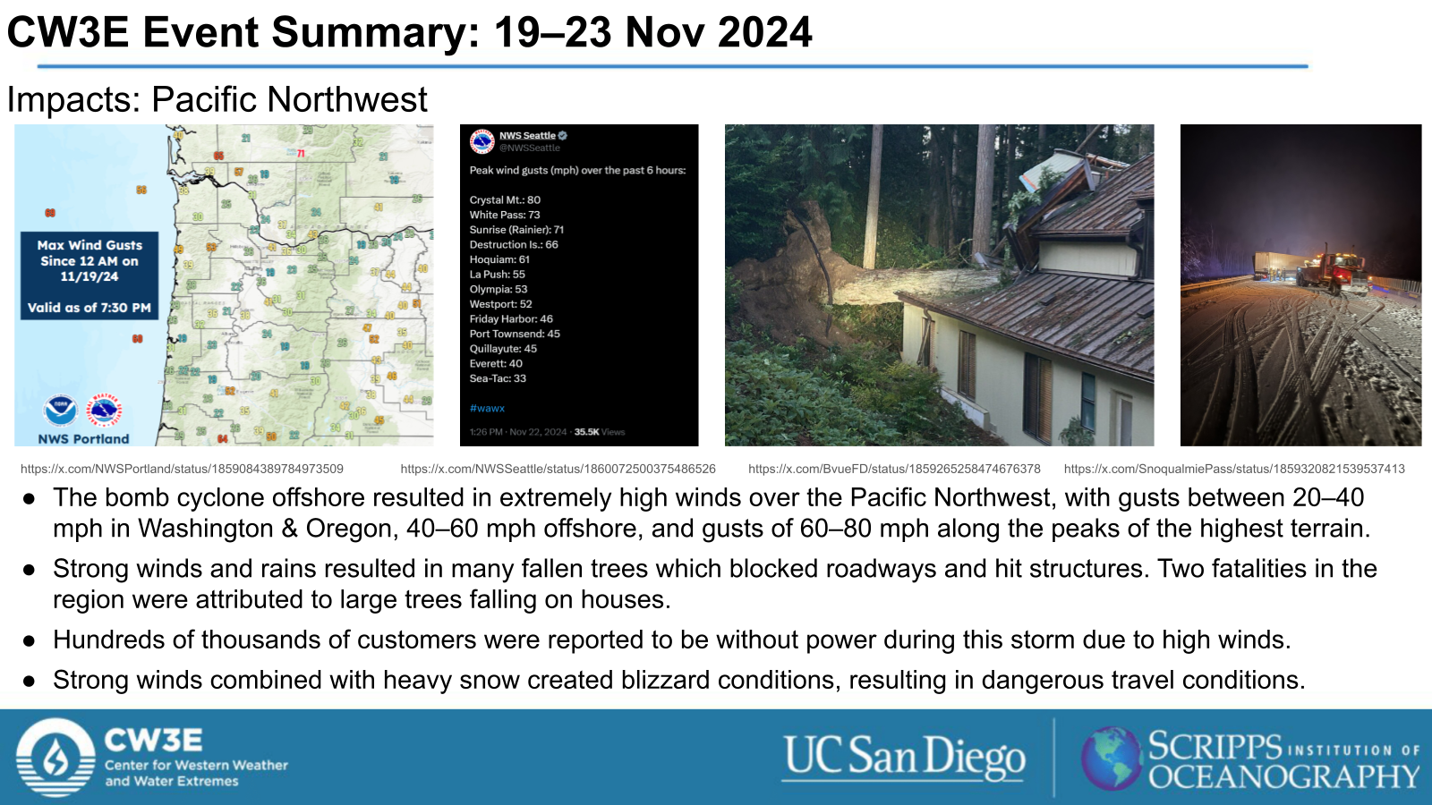
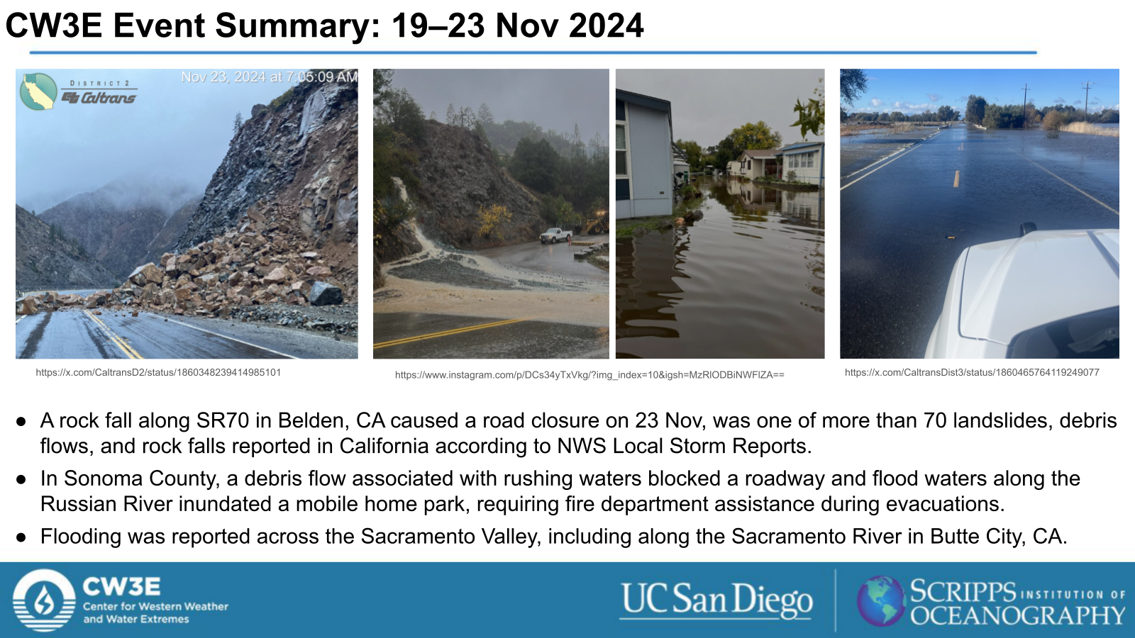
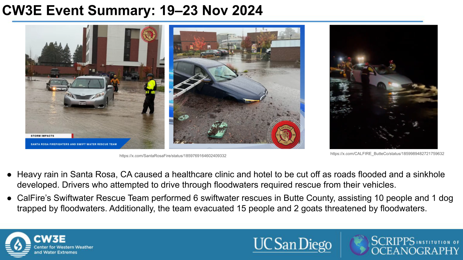
- High winds and heavy rain caused significant impacts in the Pacific Northwest and Northern California, with numerous reports of fallen trees, power outages, flooding, and landslides/debris flows/rockfalls.
Two fatalities due to falling trees and two fatalities due to flood waters were reported during this AR.
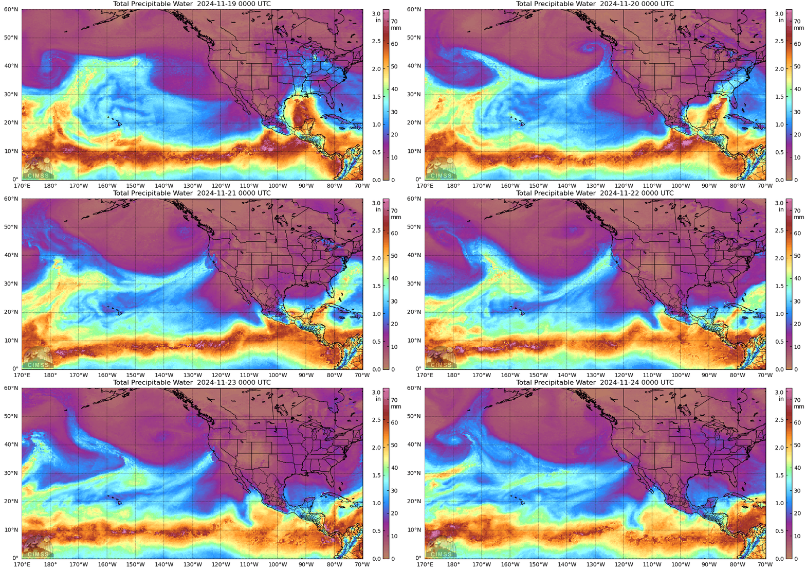
MIMIC-TPW2 Total Precipitable Water
Valid: 0000 UTC 19 November – 0000 UTC 23 November 2024
Click images to see loops of GFS IVT/IWV analyses Valid 0000 UTC 19 November – 0000 UTC 23 November 2024 |
|
 |
 |
Summary provided by M. Steen, S. Bartlett, C. Castellano, L. DeHaan, R. Weihs, A. Cooper and J. Kalansky; 3 Dec 2024
To sign up for email alerts when CW3E post new AR updates click here.

