CW3E AR Update: 13-17 December 2016 Outlook
December 13, 2016
Click here for a pdf of this information.

- Current NWS precipitation forecasts predict higher precipitation amounts of over 10 inches in 3 days over the higher elevations of the Sierra Nevada Mts. with other locations in northern CA receiving 2-10 inches
- Recent heavy precipitation has primed soil conditions and river flows to raise concern for flooding in some locations in northern California, as seen in NWS river forecasts
|
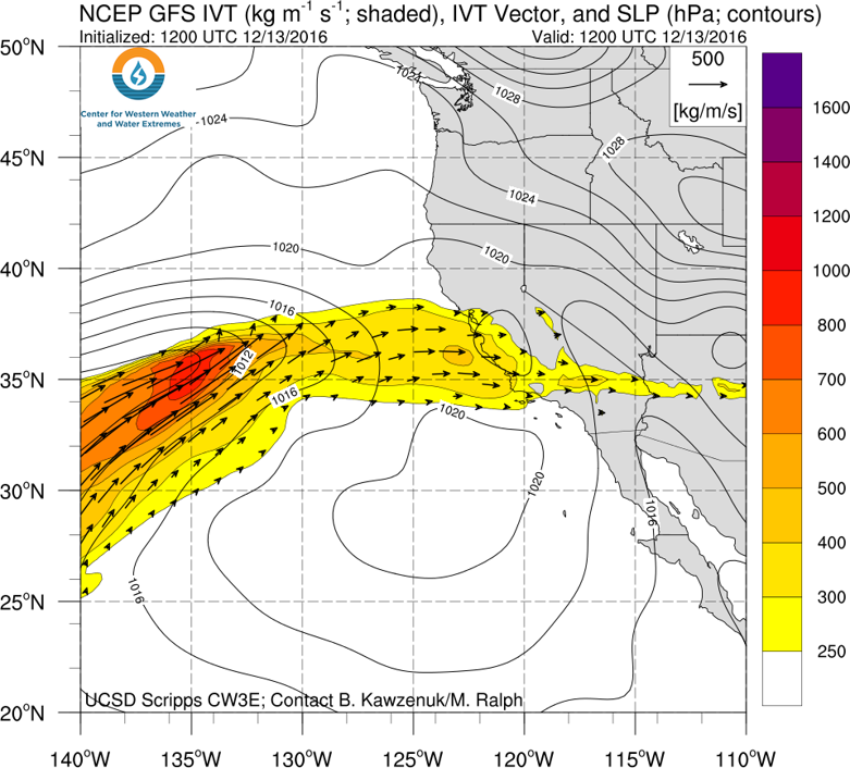
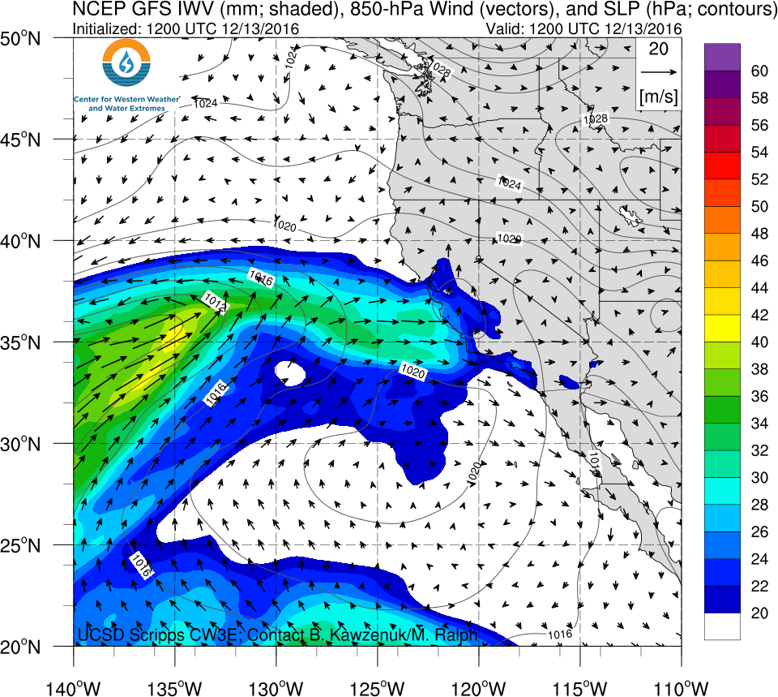
Landfalling AR to impact California
- A moderate-strength AR is expected to make landfall in north/central California tonight, and could reach “strong” AR level
- The AR propagates southward later in the week bringing AR conditions to portions of southern California
Click IVT or IWV image to see loop of 0-90 hour GFS forecast (Valid 1200 UTC 13 Dec – 0600 17 Dec)

|


Summary provided by C. Hecht, and F.M. Ralph; 12 PM PT Tue 13 Dec. 2016