CW3E AR Update: 8 December 2022 Outlook
December 8, 2022
Click here for a pdf of this information.
Atmospheric River to Bring Impactful Winter Weather to California
- An initial weak AR associated with a shortwave trough will bring rain and snow to the Coast Ranges of Northern California Thursday evening into early Friday
- A stronger AR will make landfall near the border of Oregon and California late Friday, bringing AR 1/AR 2 conditions (based on the Ralph et al. 2019 AR scale) to much of California through Sunday afternoon
- Precipitation associated with this storm will fall primarily as snow in higher elevations, with freezing levels remaining between 3,500–5,000 feet in the Sierra Nevada
- NWS WPC’s QPF for the Northern California Coast Ranges and Sierra Nevada regions are between 3–6 inches, with CW3E’s watershed precipitation forecast tool showing strong model agreement between the GEFS and ECMWF EPS ensembles
- This storm is forecast to bring major winter weather impacts to the Sierra Nevada, with NWS WPC’s Winter Storm Severity Index forecasting the potential for “Major” or “Extreme” impacts and disruption to daily life
- NWS Weather Forecast Offices have issued snowfall forecasts for between 48–60 inches the Northern Sierra and 36–48 inches for the southern Sierra
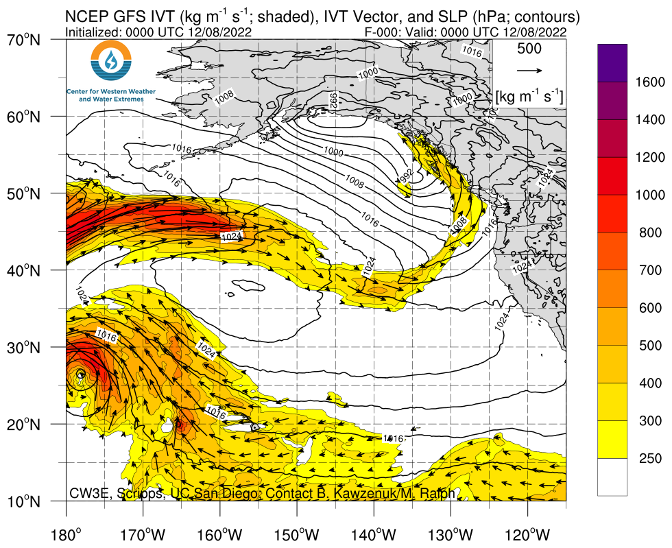
Click images to see loops of GFS IVT and IWV forecasts Valid 0000 UTC 8 December – 0000 UTC 13 December 2022 |
|
 |
 |
Summary provided by S. Bartlett, C. Castellano, S. Roj, J. Kalansky, and F. M. Ralph; 08 December 2022
To sign up for email alerts when CW3E post new AR updates click here.
*Outlook products are considered experimental


