CW3E AR Update: 1 February 2023 Outlook
February 1, 2023
Click here for a pdf of this information.
Multiple Atmospheric Rivers Forecast to Bring Precipitation to the US West Coast
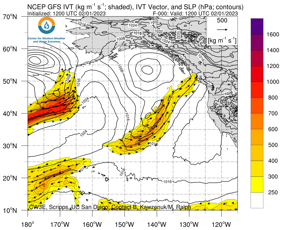
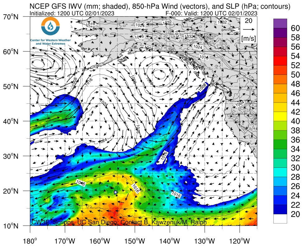
- Two atmospheric rivers (ARs) are forecast to make landfall along the US West Coast over the next several days
- An AR 2 (based on the Ralph et al. 2019 AR Scale) is currently forecast in southern coastal Oregon, where weak AR conditions may persist for more than 48 hours across both storms
- The NWS Weather Prediction Center is forecasting 2–4 inches of total precipitation in the Pacific Coast Ranges, Cascades, and Sierra Nevada during the next 5 days, with higher amounts possible in the Olympic Mountains
- Significant snowfall accumulations are possible in the Olympic Mountains and North Cascades during the first storm, as well as in the Sierra Nevada during the second storm
- Freezing levels in the Sierra Nevada are forecast to drop during the second AR, allowing for accumulating snowfall below 5,000 feet
Click images to see loops of GFS IVT and IWV forecasts Valid 1200 UTC 1 February – 1200 UTC 6 February 2023 |
|
 |
 |
Summary provided by C. Castellano, S. Bartlett, J. Kalansky, and S. Roj; 1 February 2023
To sign up for email alerts when CW3E post new AR updates click here.
*Outlook products are considered experimental


