
CW3E AR Update: 10 January 2022 Outlook
January 10, 2022
Click here for a pdf of this information.
Long-duration Atmospheric River to Bring Heavy Rainfall to Washington and British Columbia
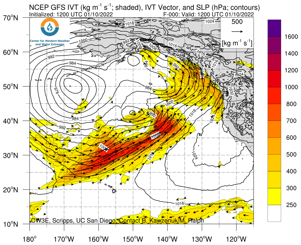
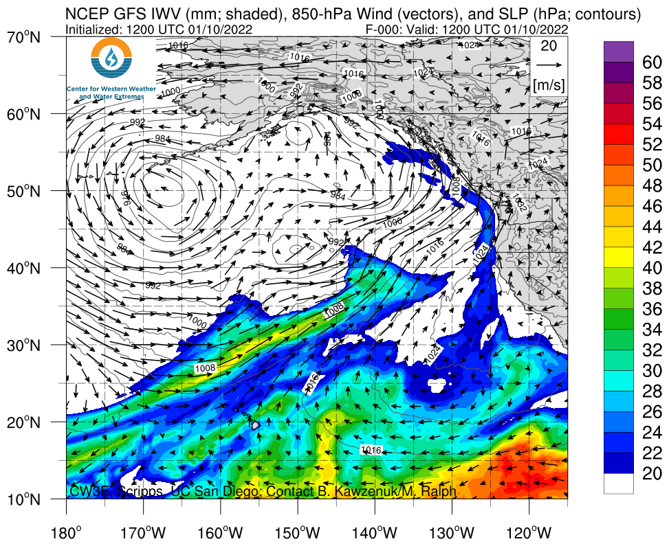
- AR activity and heavy precipitation is expected over much of the western US today through Friday
- An atmospheric river (AR) is forecasted to make landfall over Washington and Oregon later this evening
- An AR 3 (based on the Ralph et al. 2019 AR Scale) is forecasted in coastal Washington and northern coastal Oregon, where AR conditions are expected to persist for more than 48 consecutive hours
- There is still some uncertainty in the timing and magnitude of maximum IVT, as well as the overall duration of AR conditions
- More than 7 inches of precipitation are forecasted over portions of the Olympic Peninsula and Vancouver Island
- Flooding is possible in western Washington and southwestern British Columbia due to the combination of heavy rainfall, moist soils, and existing snowpack at lower elevations
- High freezing levels will increase the potential for rain-on-snow, which may exacerbate surface runoff and flooding
Click images to see loops of GFS IVT & IWV forecasts Valid 1200 UTC 10 January – 1200 UTC 13 January 2022 |
|
 |
 |


Summary provided by C. Castellano, S. Roj, J. Kalansky, and F. M. Ralph; 10 January 2022
To sign up for email alerts when CW3E post new AR updates click here.
*Outlook products are considered experimental