CW3E AR Update: 10 January 2024 Outlook
January 10, 2024
Click here for a pdf of this information.
Atmospheric River Will Fuel Winter Weather in Pacific Northwest and Northern California This Weekend
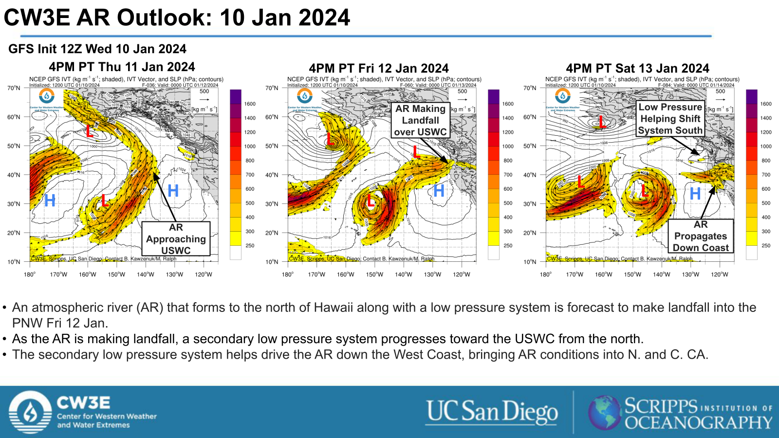
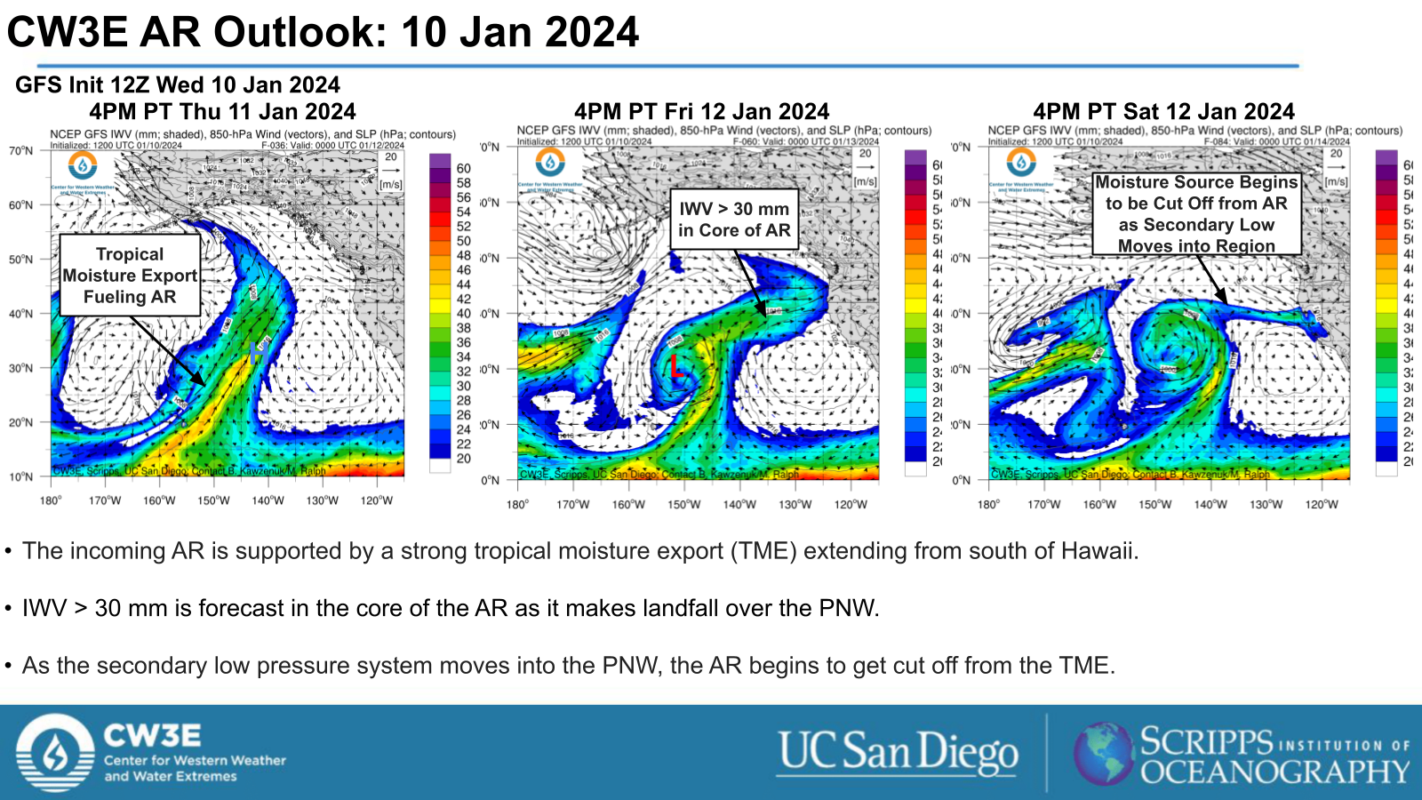
- An atmospheric river (AR) will help drive winter weather set to impact the PNW from Fri 12 Jan through the end of the weekend.
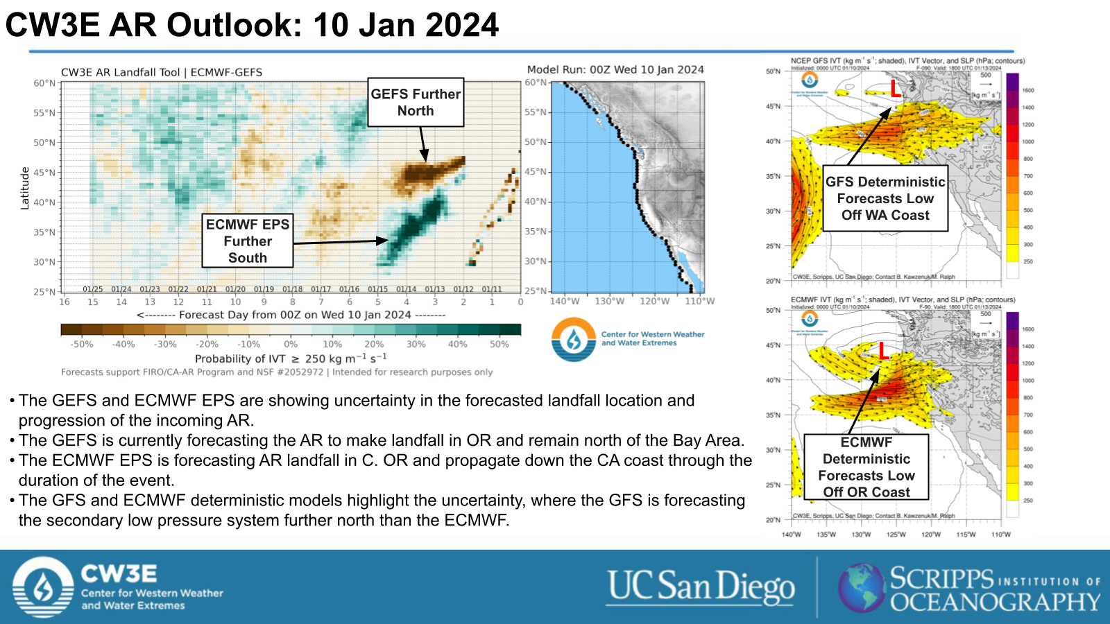
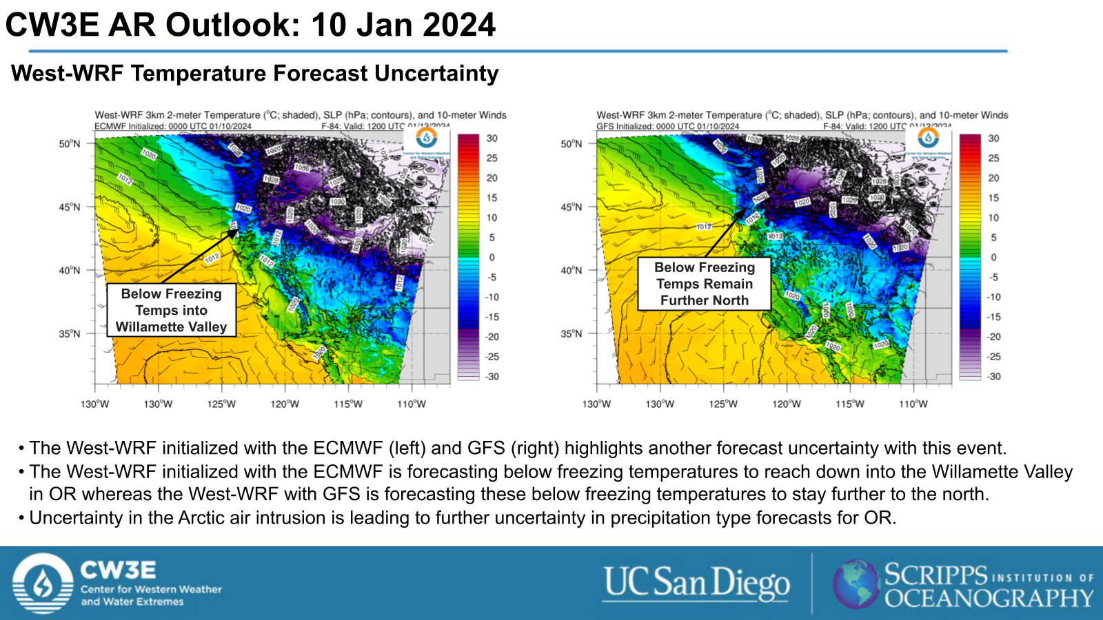
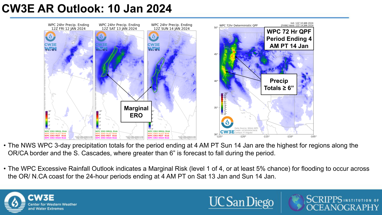
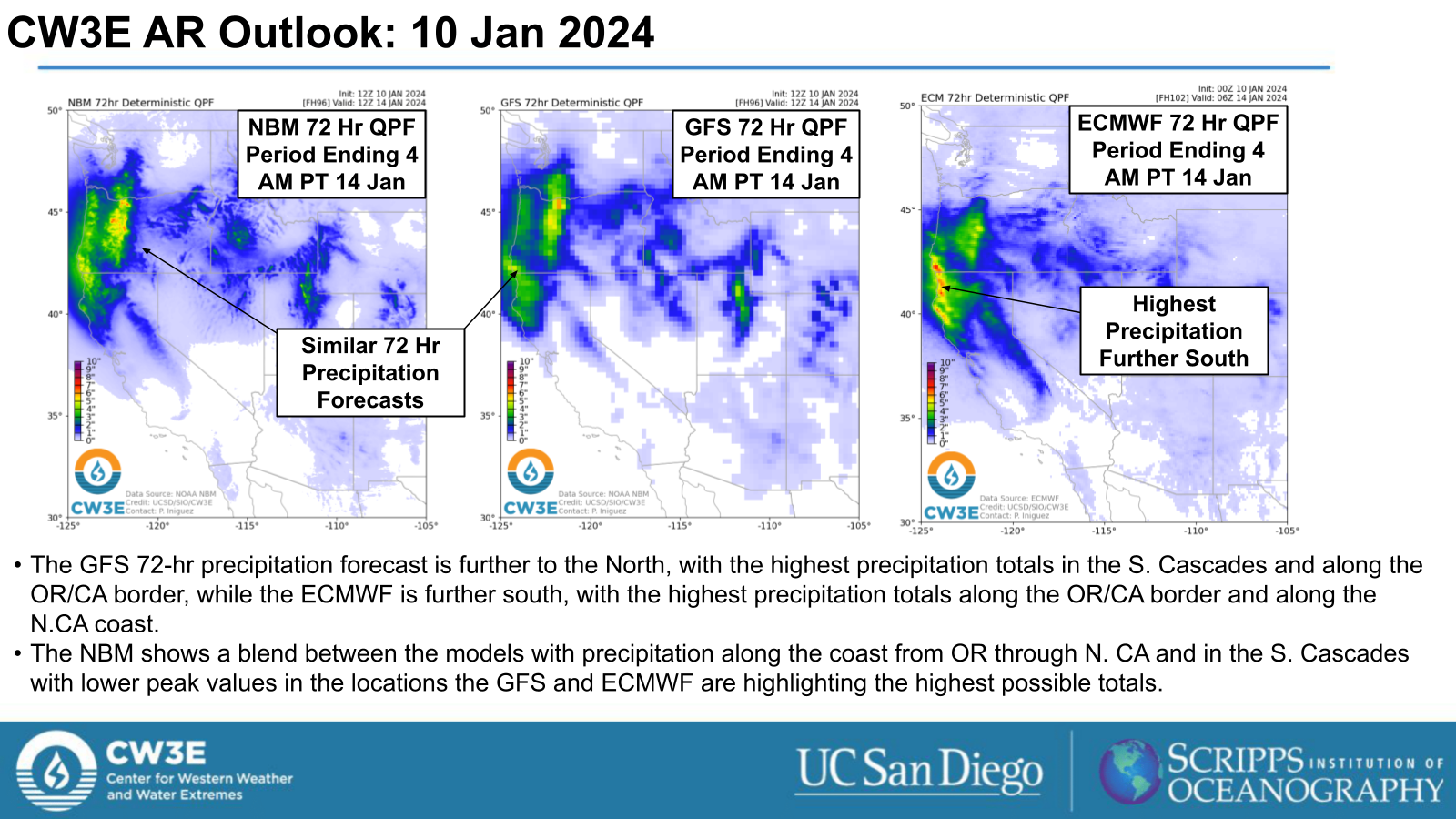
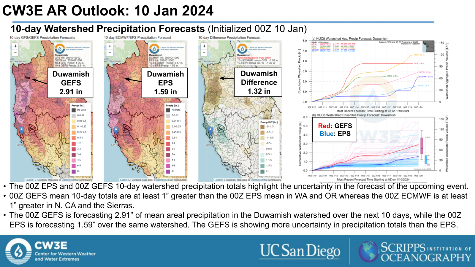
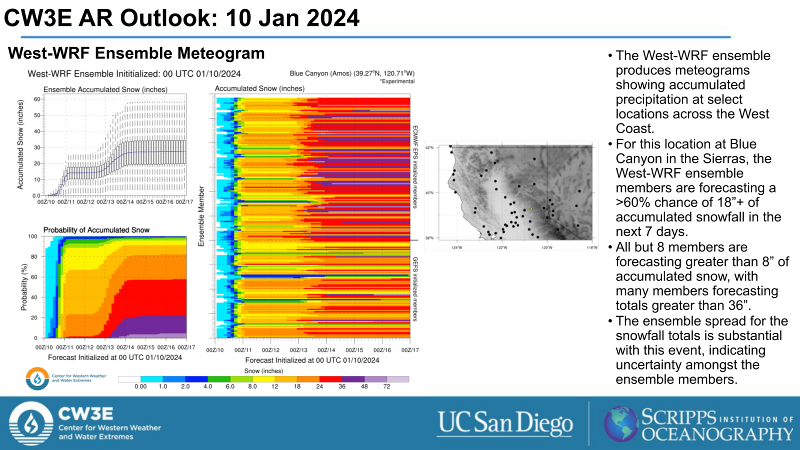
- Model guidance is showing significant uncertainty in AR landfall location, as well as precipitation amounts and precipitation type, especially over the Willamette Basin.
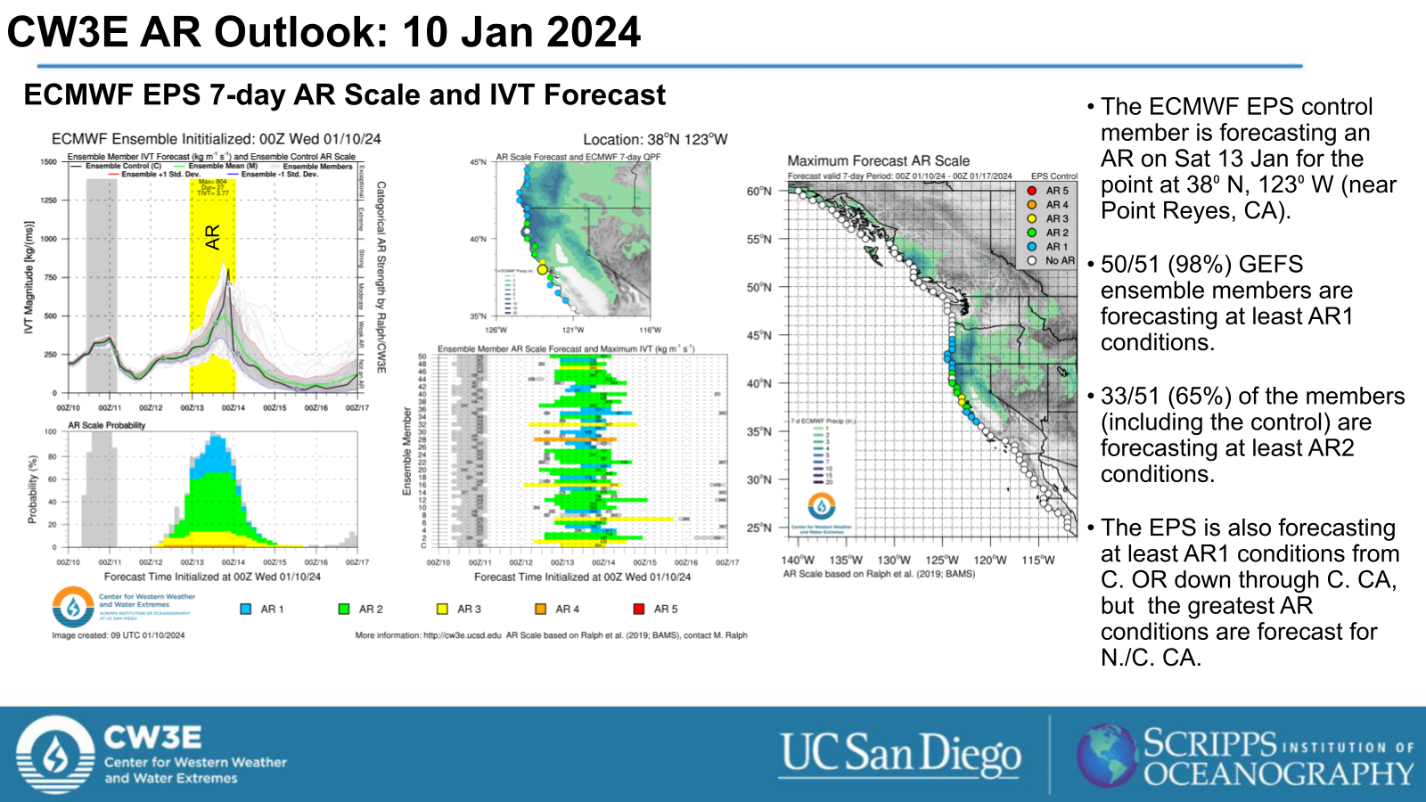
- The GEFS is forecasting the AR to make landfall in and primarily impact the PNW while the ECMWF EPS is forecasting the AR to make landfall in Central/Southern OR and propagate down the CA coast through the weekend.
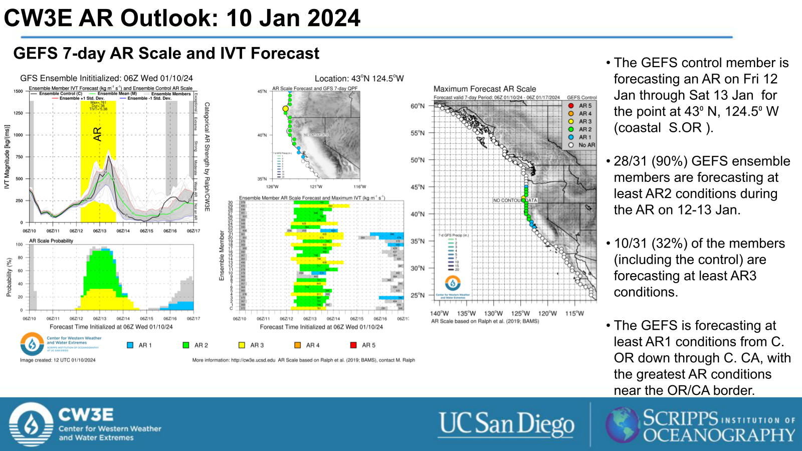
- The GEFS control run is forecasting AR1 conditions (based on Ralph et al. 2019 AR scale) from Central OR down through Central CA, with the greatest AR conditions (AR2/AR3) near the OR/CA border.
- The ECMWF EPS is also forecasting at least AR1 conditions (based on Ralph et al. 2019 AR scale) from Cen. OR down through Central CA, but the greatest AR conditions (AR2/AR3) are forecast for Northern/Central CA.
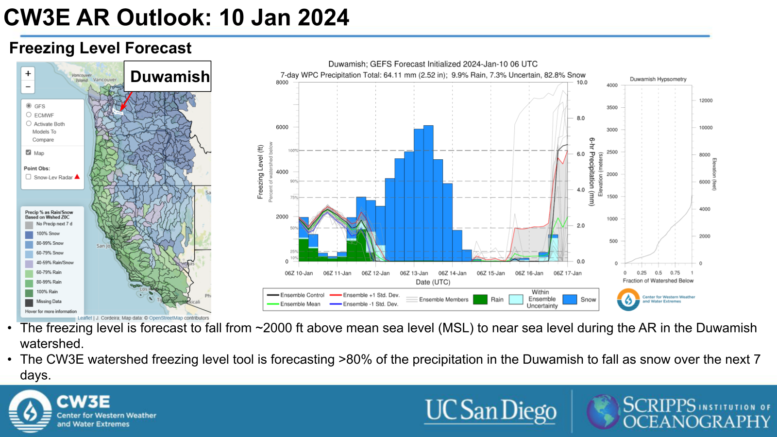
- Further uncertainty in how far south into OR an Arctic Air Mass progresses also presents uncertainty in precipitation type in the Willamette Valley.
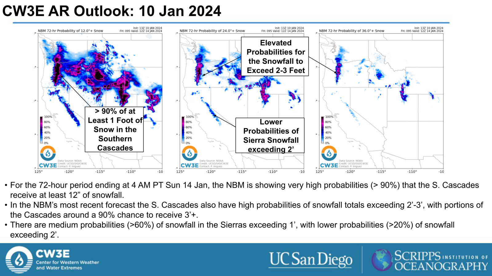
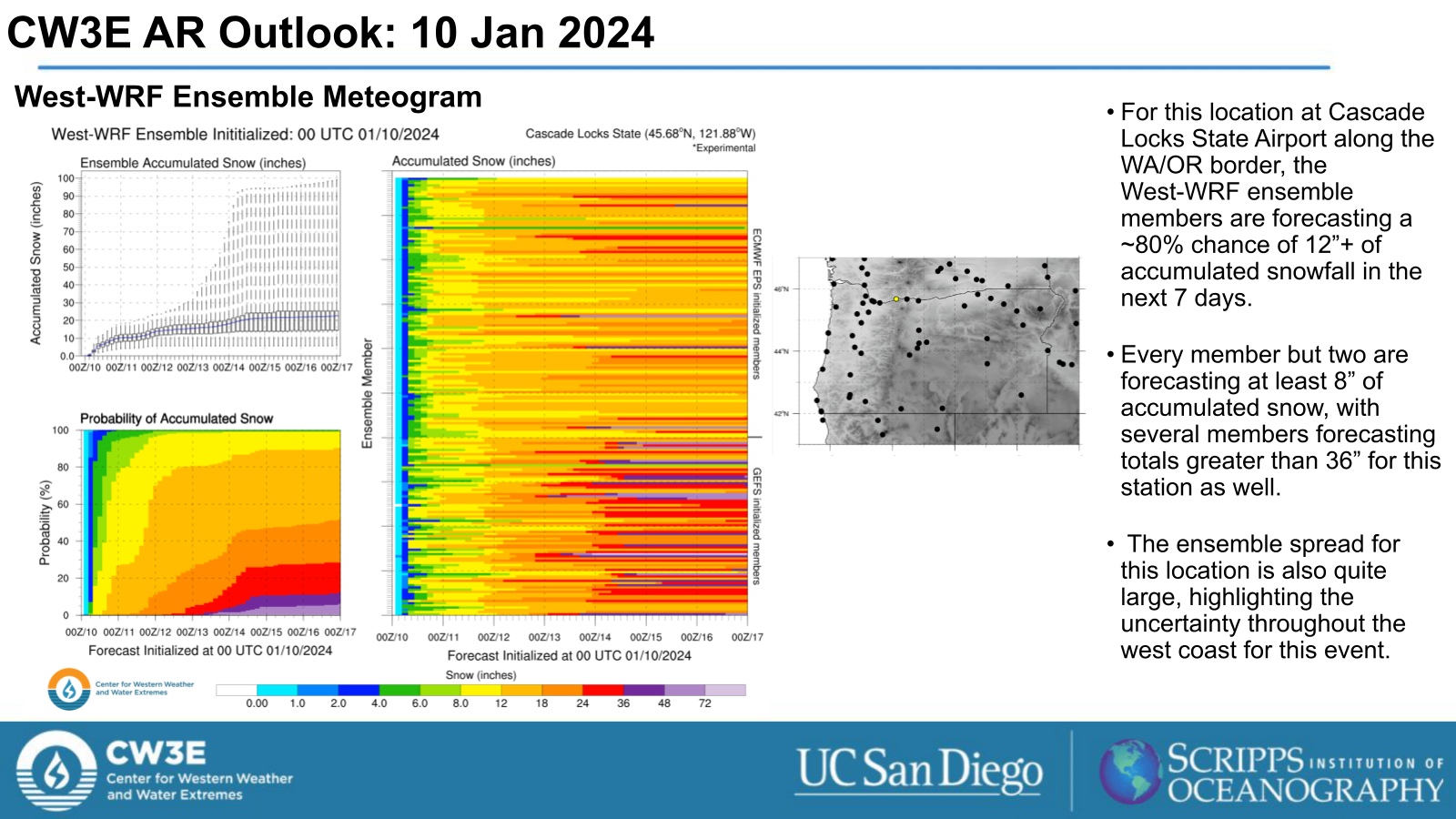
- Significant snowfall accumulations are expected throughout the Cascades.
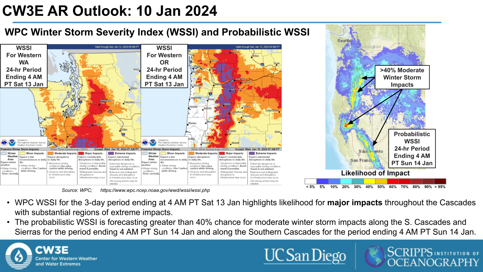
- The Weather Prediction Center’s (WPC) Winter Storm Severity Index (WSSI) indicates that major impacts are expected throughout the Cascades for the period ending 4 AM PT on Sat 13 Jan.
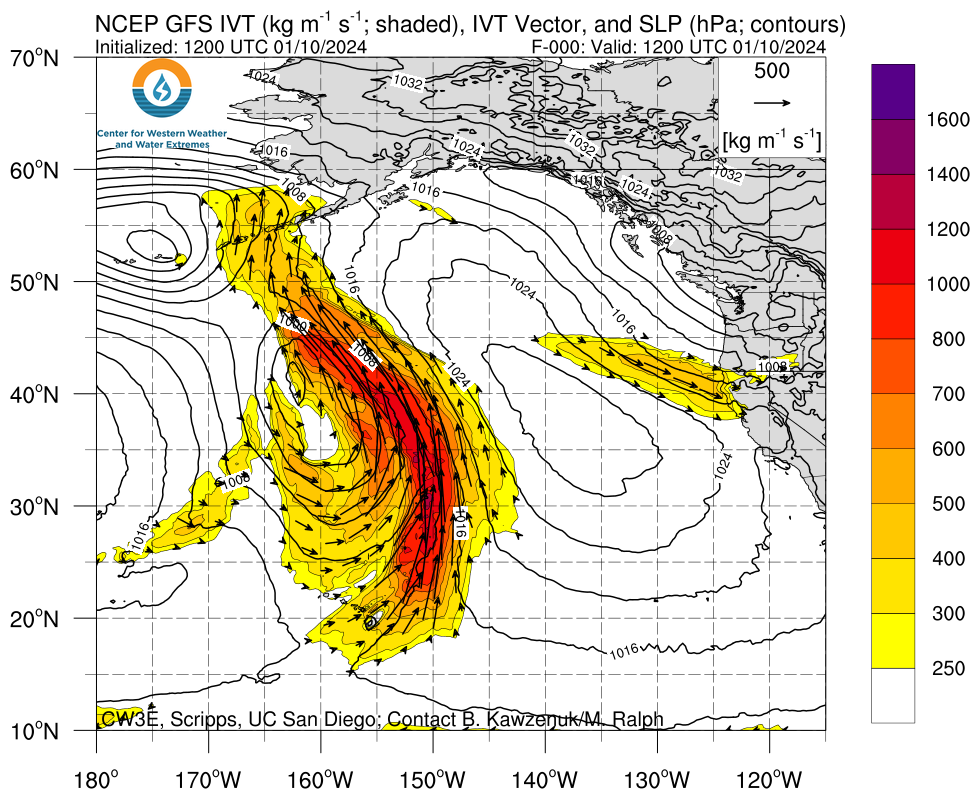
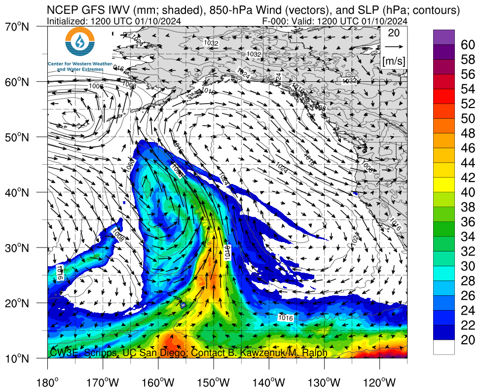
Click images to see loops of GFS IVT and IWV forecasts Valid 1200 UTC 10 January 2024 – 1500 UTC 14 January 2024 |
|
 |
 |
Summary provided by M. Steen, C. Castellano, P. Iniguez and S. Bartlett; 10 January 2024
To sign up for email alerts when CW3E post new AR updates click here.
*Outlook products are considered experimental

