CW3E AR Update: 10 March 2023 Outlook
March 10, 2023
Click here for a pdf of this information.
Atmospheric River Continues to Bring Moisture and High Snow Levels to California with another Atmospheric River Forecast to Make Landfall in Northern California Shortly After
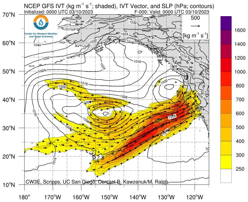
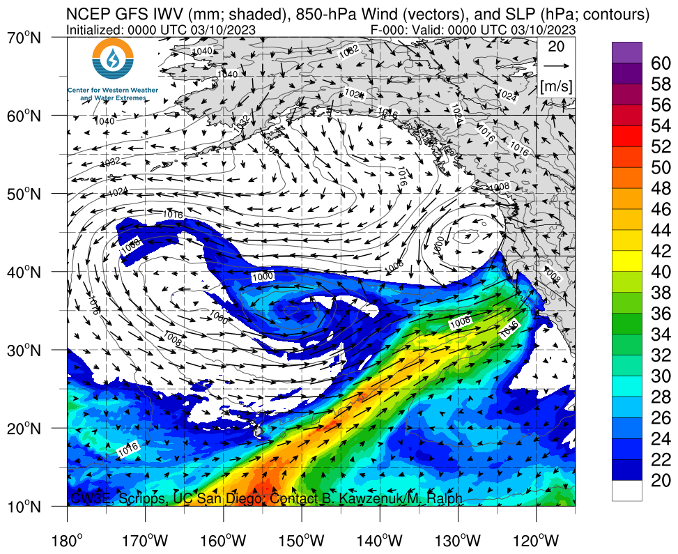
- Current atmospheric river (AR) made landfall in Northern California around 10am PT 9 March and will continue to push moisture into California over the next couple days
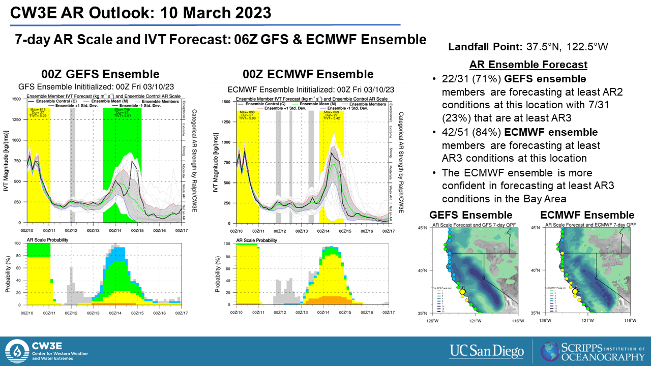
- IVT will values remain above 250 kg m -1 s -1 off the US West Coast ahead of the next AR which is forecast to make landfall on 14 March and bring AR2/3 conditions (based on the Ralph et al. 2019 AR Scale) to the majority of coastal Central California
- There is substantial uncertainty between the GFS and ECMWF global models in the timing and location of AR conditions, including direction of IVT, which is mostly due to how each model handles the location of a pair of mid-level troughs
- As compared to the GEFS, the ECMWF EPS has more confidence in a broader area of AR3 conditions for coastal areas around the San Francisco Bay area
- The NWS Weather Prediction Center (WPC) has forecast 48-hour precipitation totals >2 inches over the Coast Ranges of Northern and Central California, >3 inches for the Western Transverse Range of Southern California and >5 inches over the Sierra
- Experimental excessive rainfall outlooks have been issued by the WPC for Monday through Wednesday with a moderate risk (at least 40%) of rainfall exceeding flash flood guidance in the Northern Sierra and parts of the Northern California coast for Monday-Tuesday, and a moderate risk for the Sierra Nevada and Big Sur coast for Tuesday-Wednesday
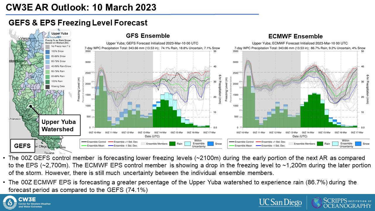
- The 00Z GFS is forecasting 11.31 inches of mean areal precipitation in the Upper Yuba watershed over the next 7 days, while the 00Z ECMWF is forecasting 8.11 inches over the same watershed, however, these totals include precipitation forecasted to fall during the current AR
- Forecast freezing levels are expected to remain quite high (~2,000m) in the Sierra Nevada. This may lead to high fractions of most Sierra watersheds exposed to rain-on-snow
Click images to see loops of GFS IVT and IWV forecasts Valid 0000 UTC 10 March – 1200 UTC 16 March 2023 |
|
 |
 |
Summary provided by S. Roj, S. Bartlett, J. Cordeira, and J. Kalansky; 10 March 2023
To sign up for email alerts when CW3E post new AR updates click here.
*Outlook products are considered experimental


