CW3E AR Update: 13 December 2023 Outlook
December 13, 2023
Click here for a pdf of this information. Click here to provide feedback on these outlooks!
Cut Off Low Forecast to Bring Atmospheric River to California
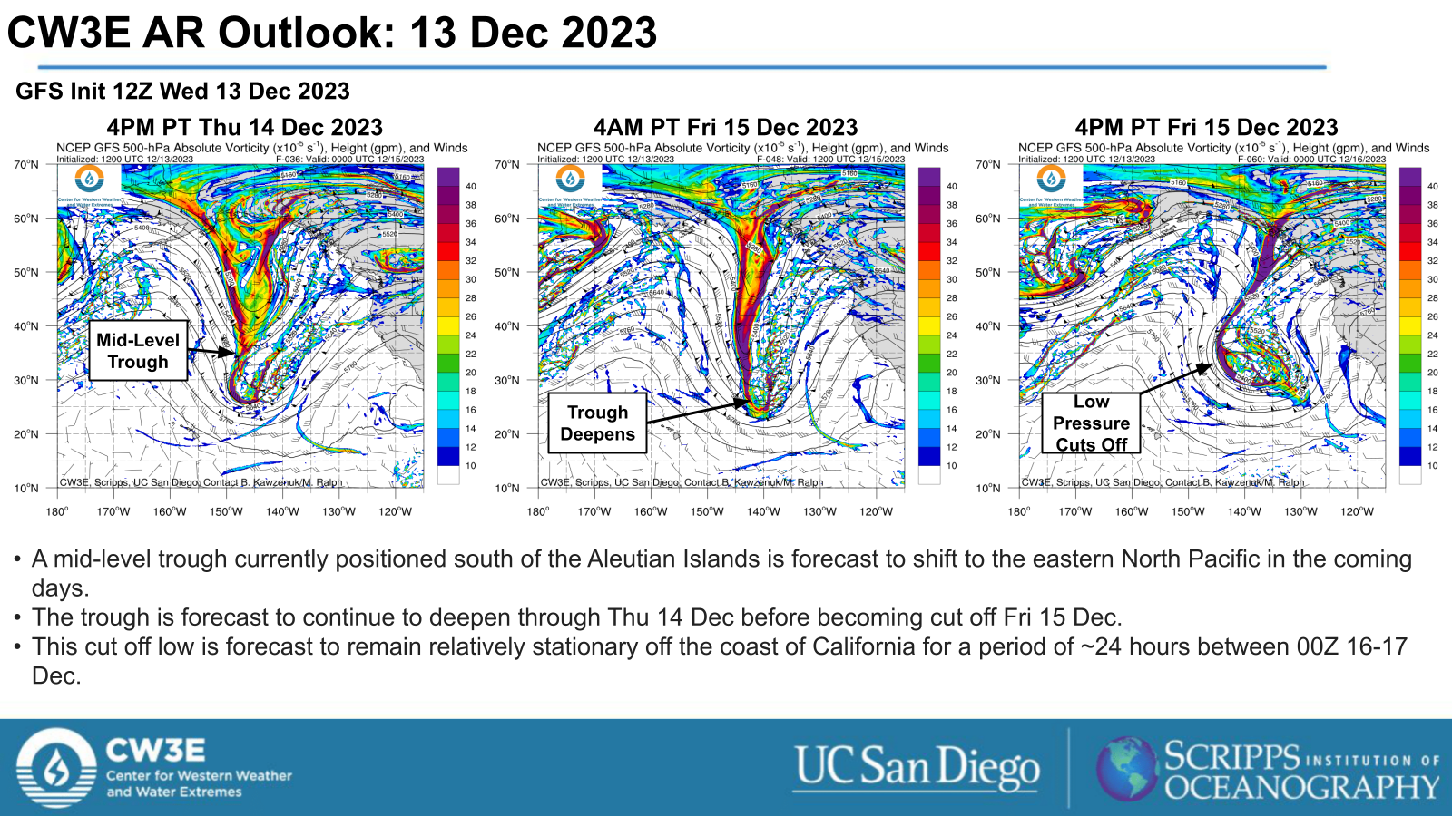
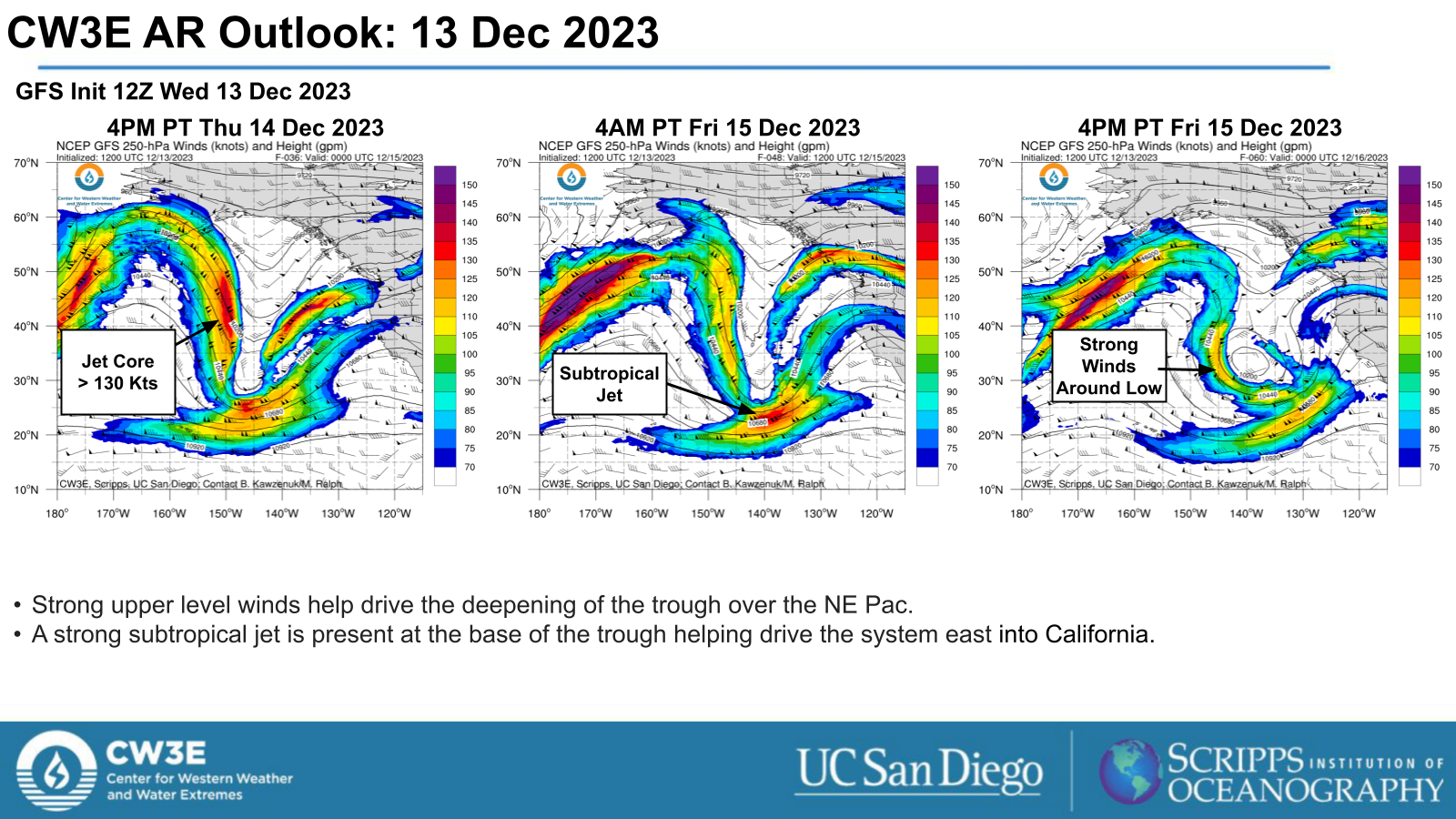
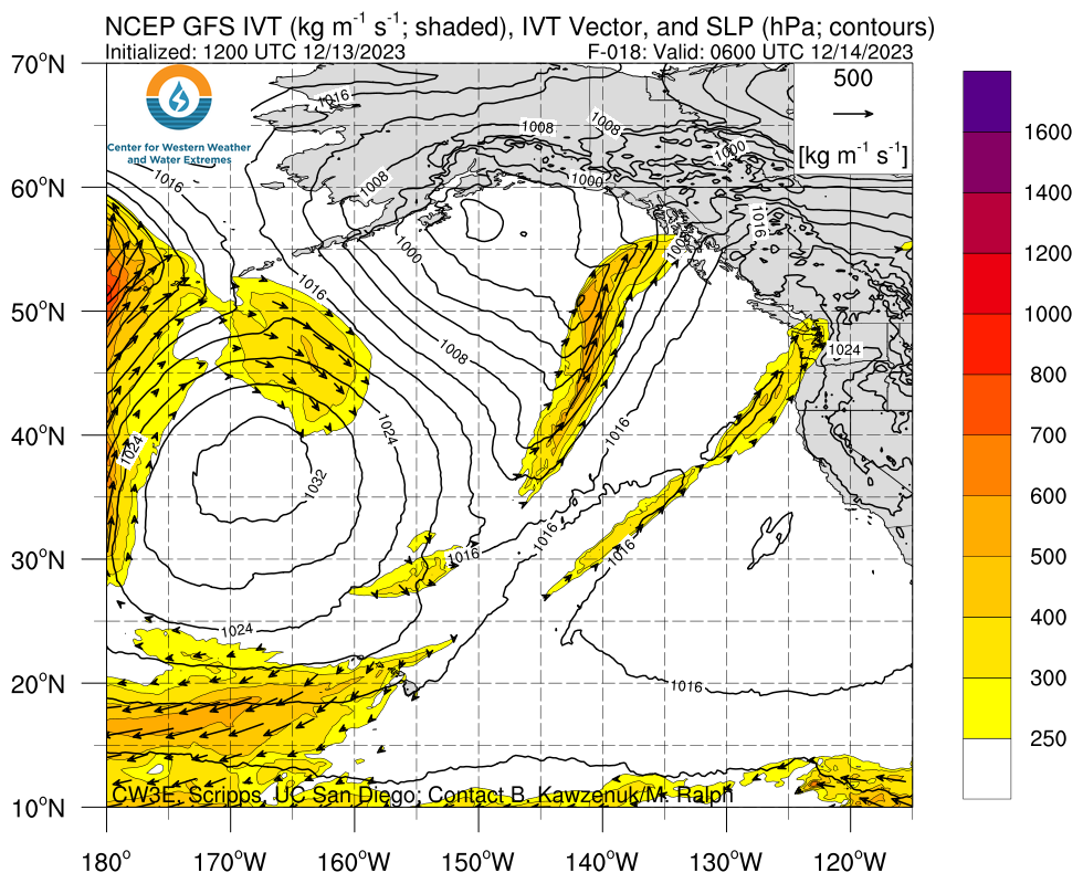
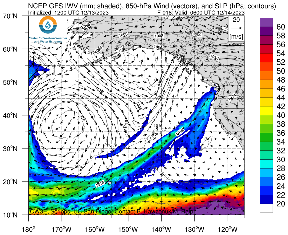
- A mid-level trough currently just south of the Aleutian Islands is forecast to propagate into the Northeast Pacific and continue to deepen, eventually becoming cut off.
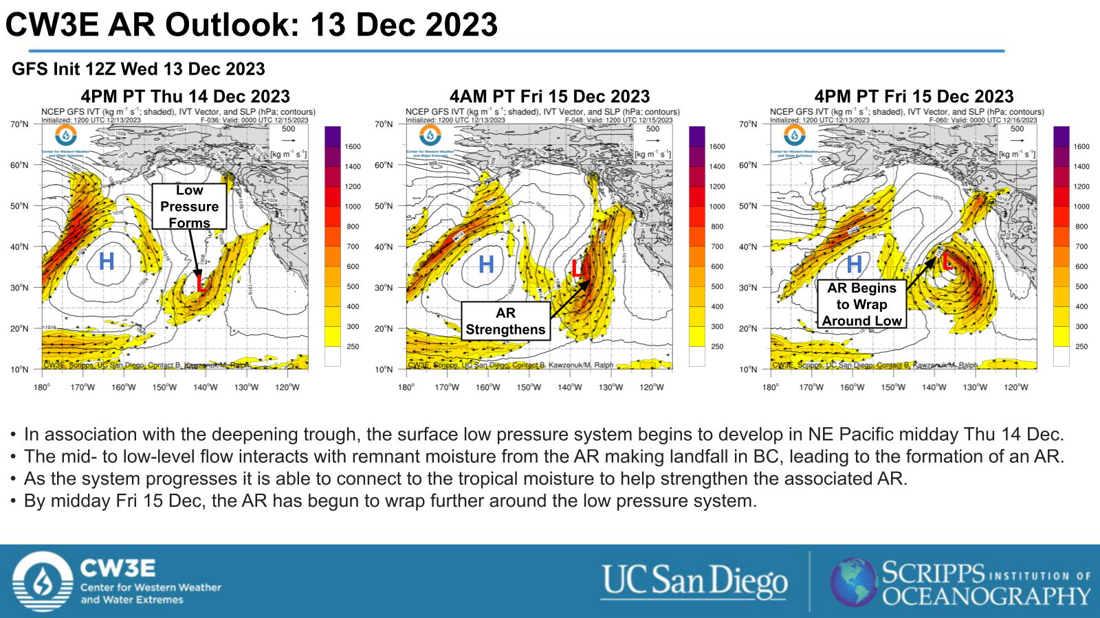
- The cut off low pressure system interacts with elevated moisture in the NE Pacific leading to the formation of an AR.
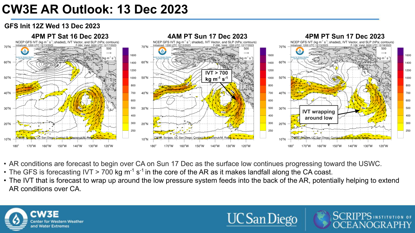
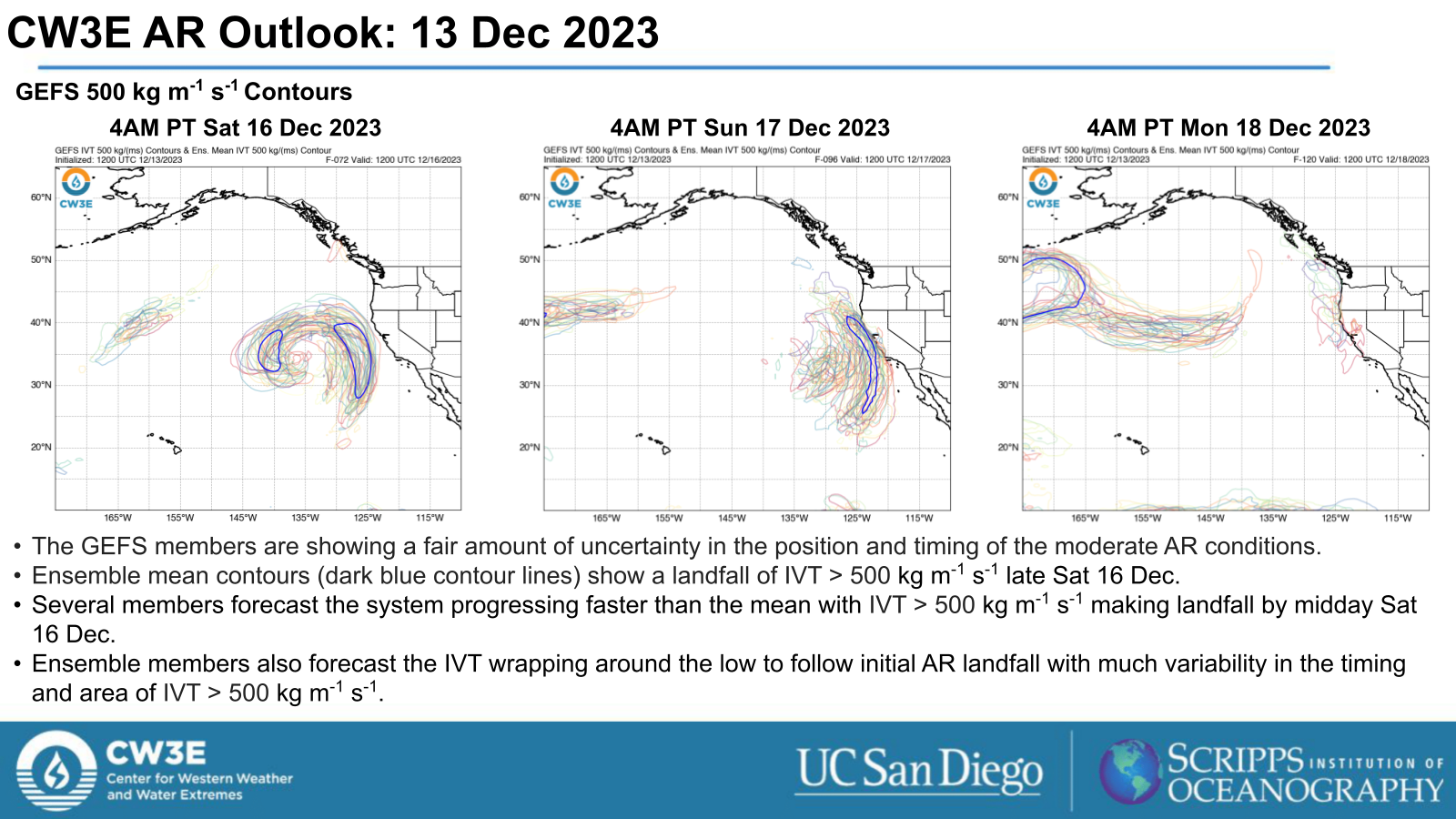
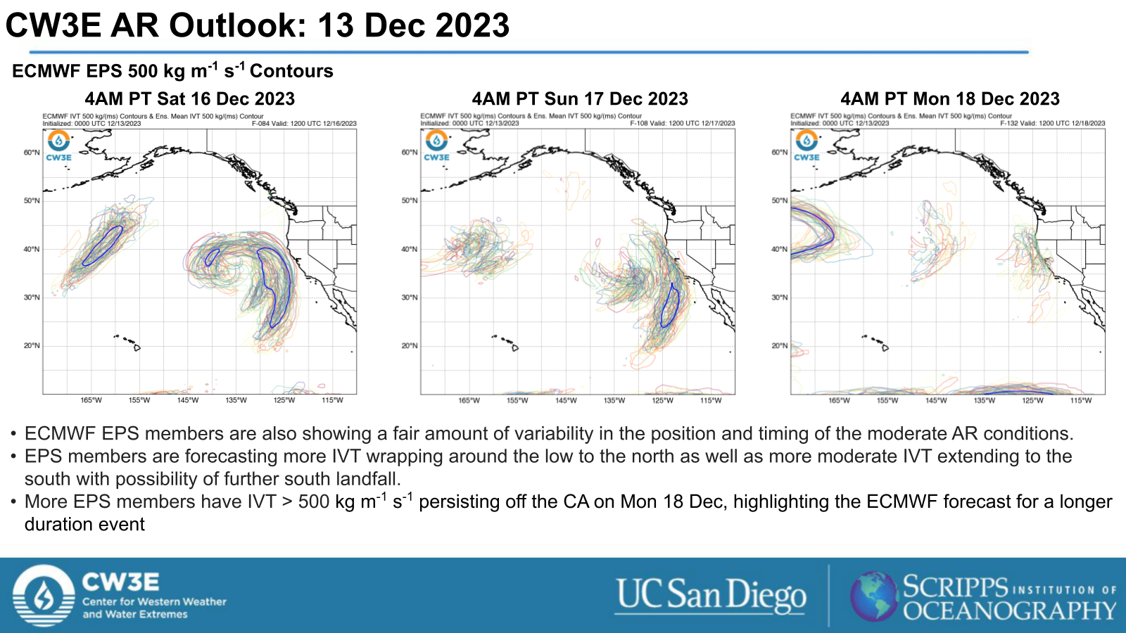
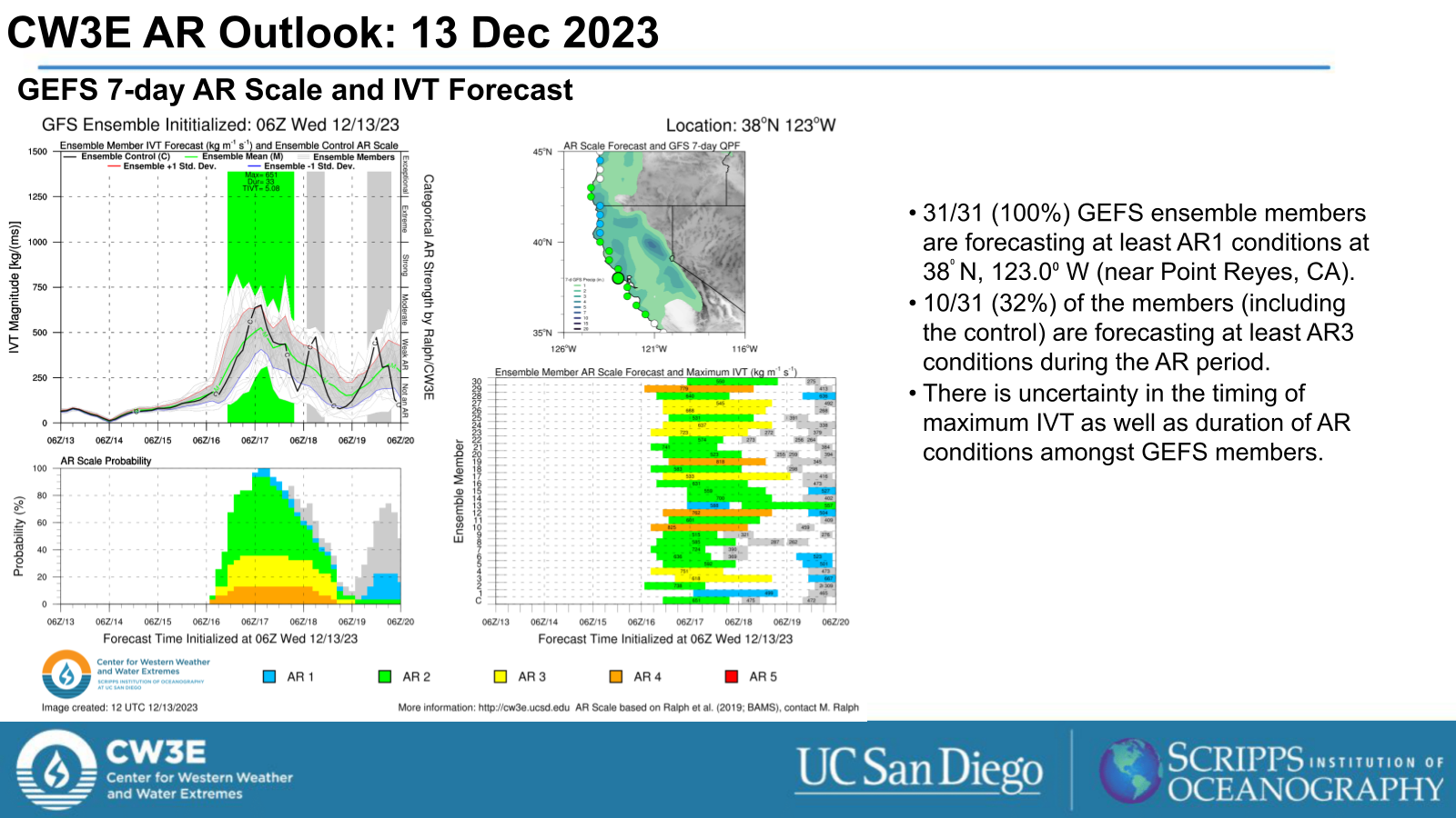
- The low pressure system is forecast to progress toward the USWC and bring AR conditions to CA beginning Sun 16 Dec.
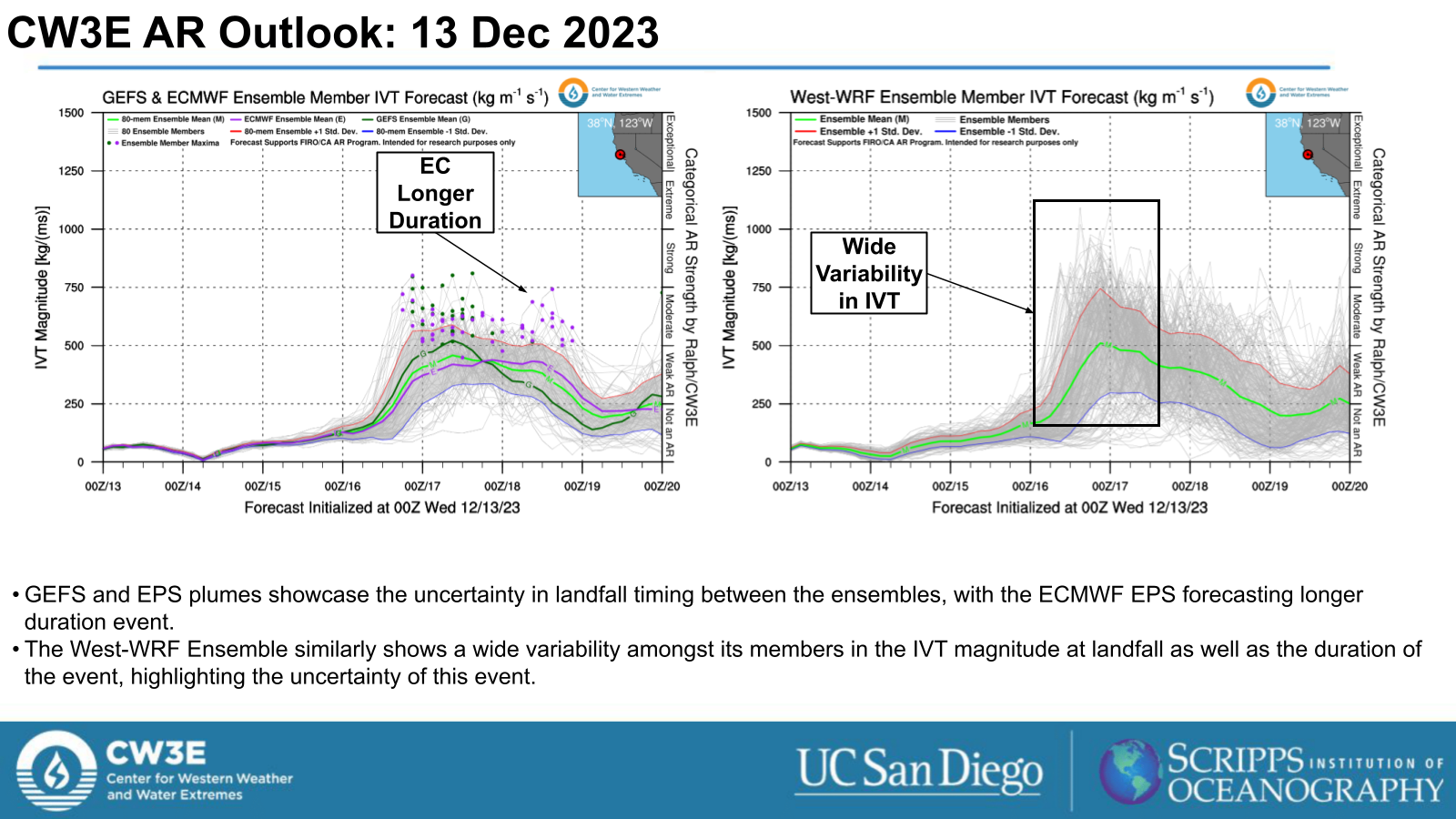
- AR2 conditions (based on Ralph et al. 2019 AR scale) are forecast for this event.
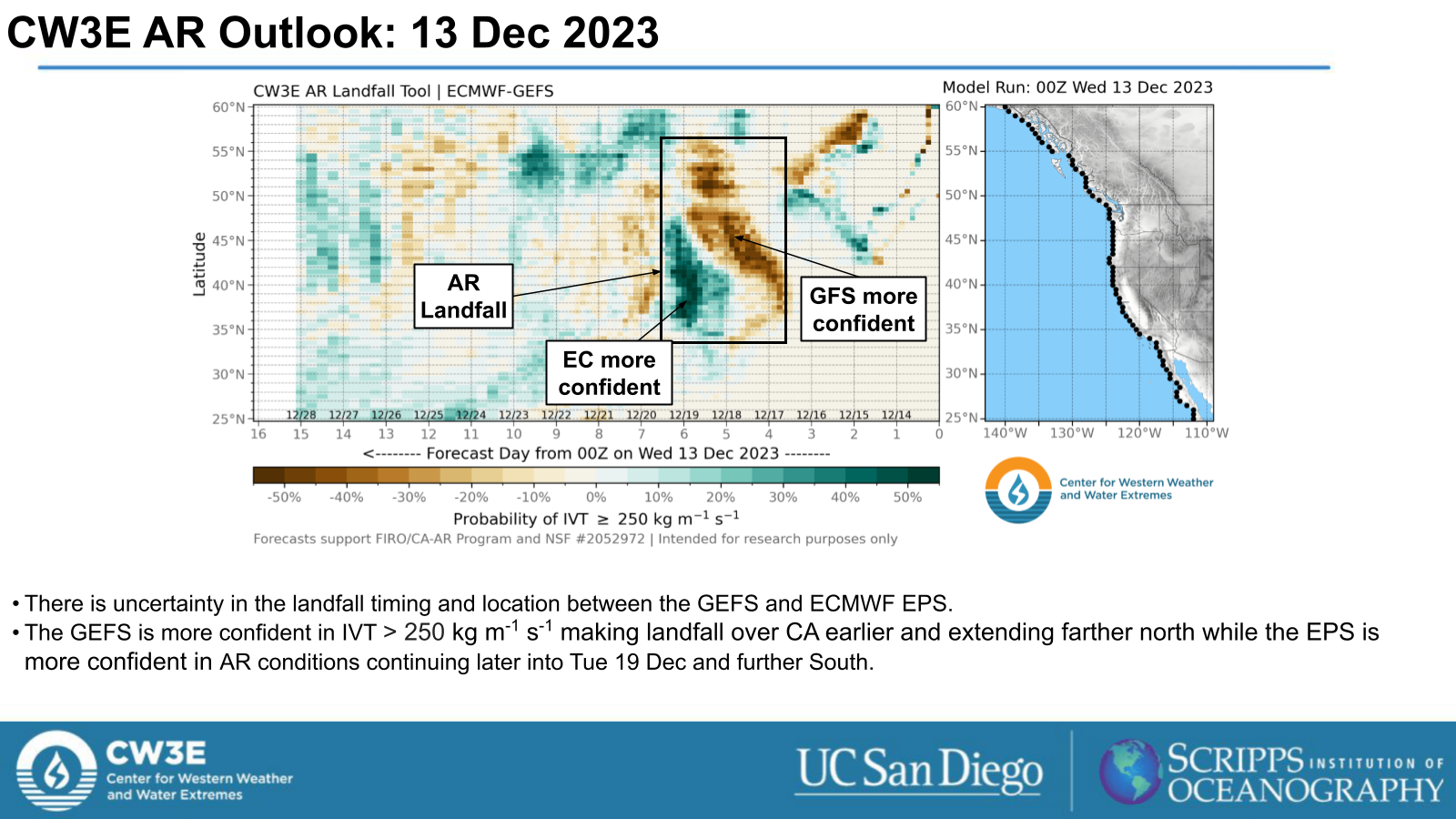
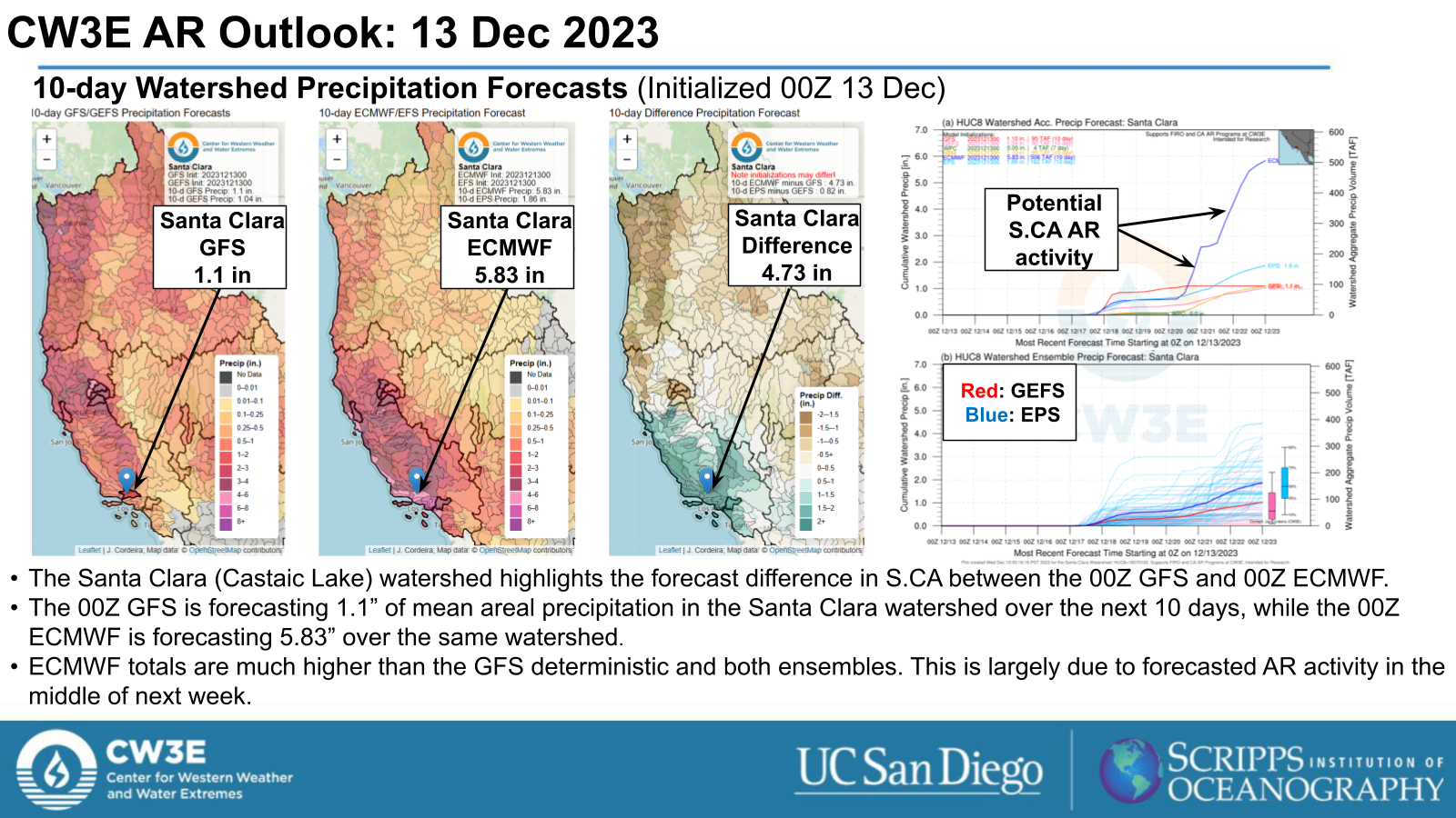
- There is uncertainty in the AR landfall timing and duration in the GEFS, ECMWF EPS and West-WRF Ensemble.
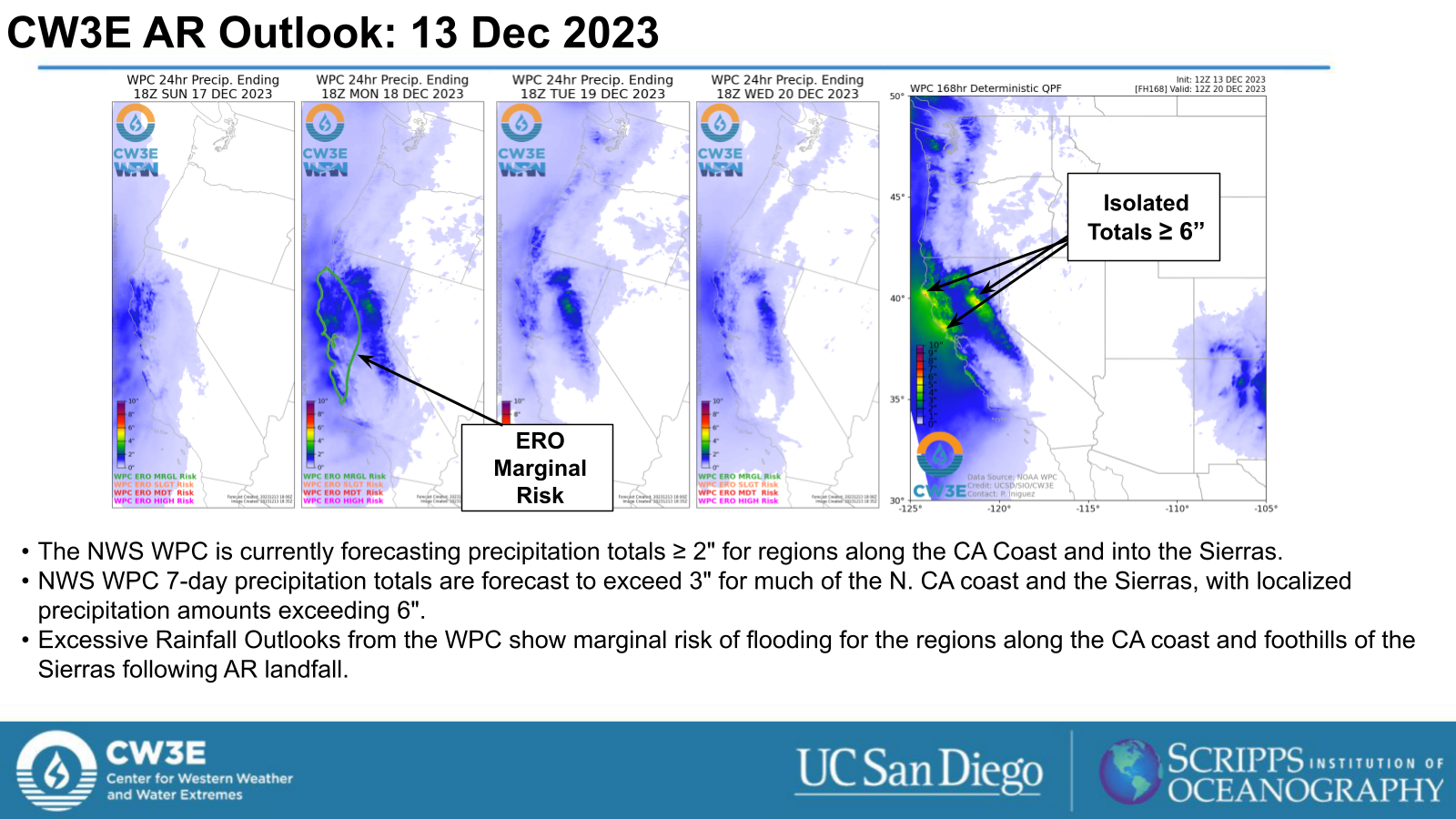
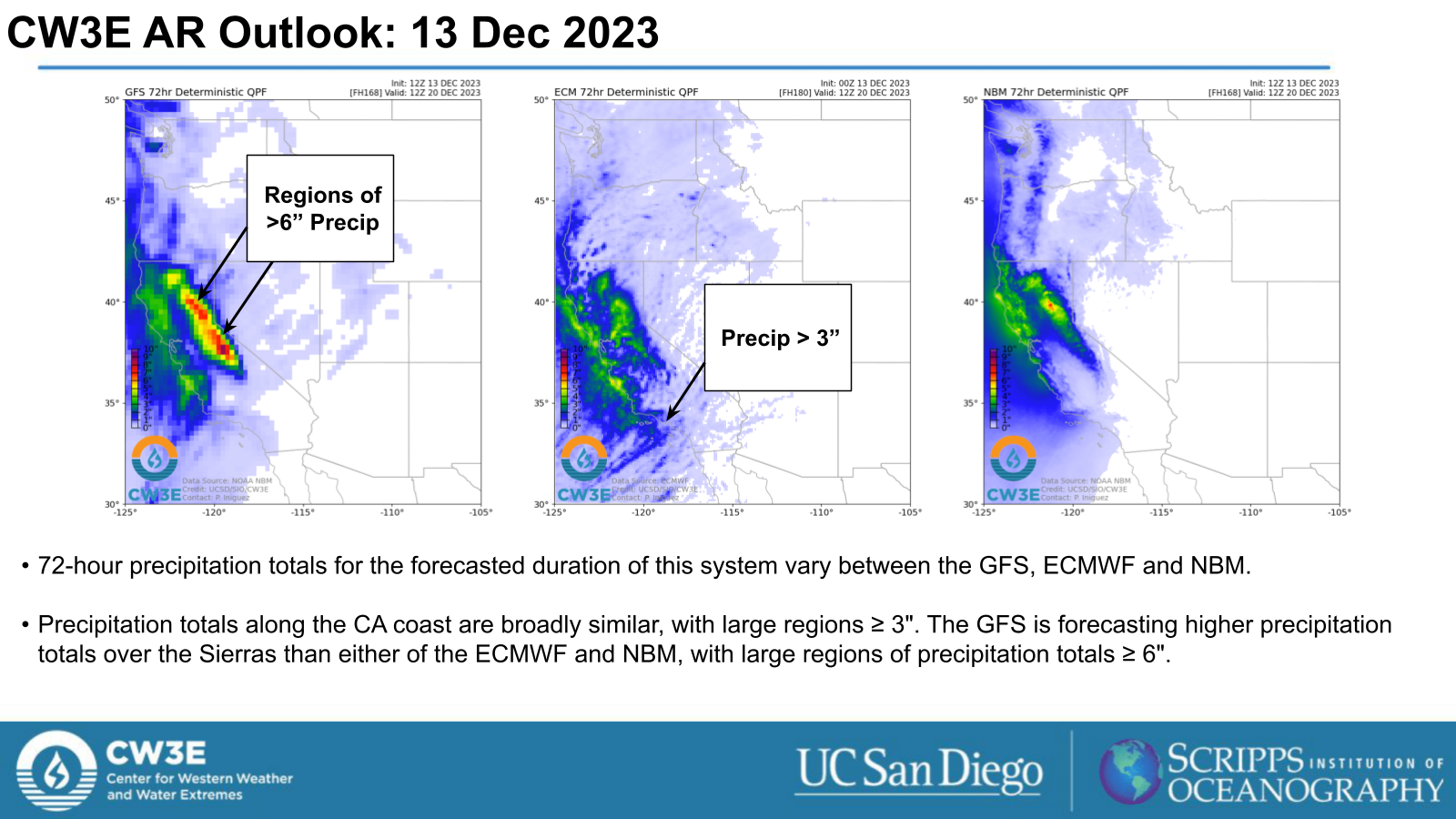
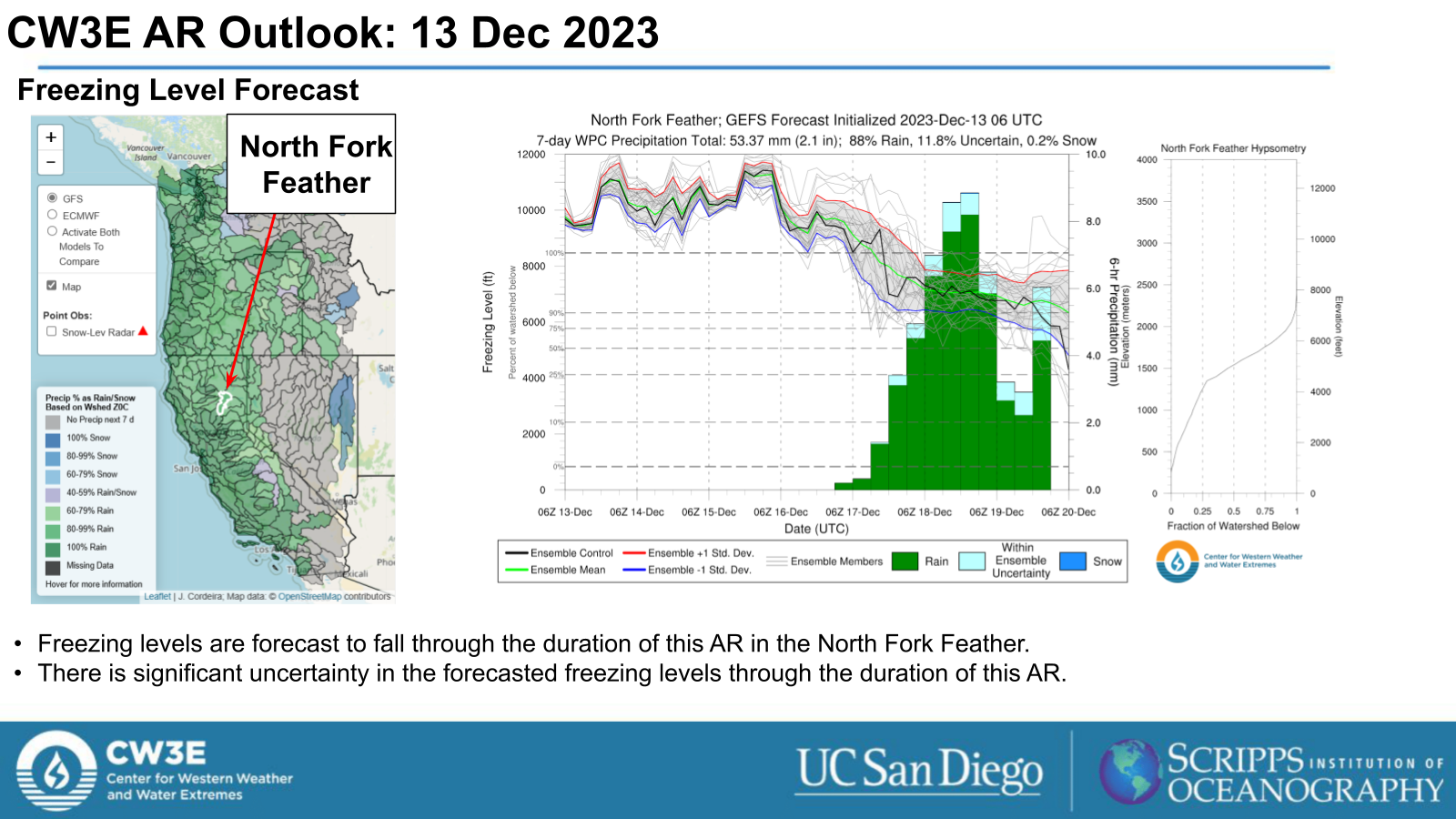
- The NWS Weather Prediction Center (WPC) is currently forecasting 7-day precipitation totals ≥ 3” for much of the CA Coasts as well as the Sierras with isolated areas ≥ 6”.
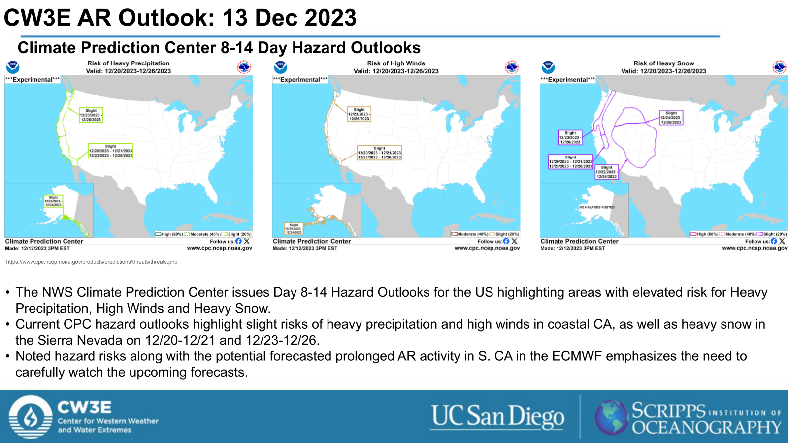
- The NWS Climate Prediction Center’s Day 8-14 Hazard Outlook shows slight risks of heavy precipitation and high winds for the CA coasts and heavy snow in the Sierras 12/20-12/21 and 12/23-12/26.
Click images to see loops of GFS IVT and IWV forecasts Valid 0600 UTC 14 December 2023 – 0000 UTC 19 December 2023 |
|
 |
 |
Summary provided by M. Steen, S. Bartlett, C. Castellano and J. Kalansky; 13 December 2023
To sign up for email alerts when CW3E post new AR updates click here.
*Outlook products are considered experimental

