
CW3E AR Update: 13 September 2021 Outlook
September 13, 2021
Click here for a pdf of this information.
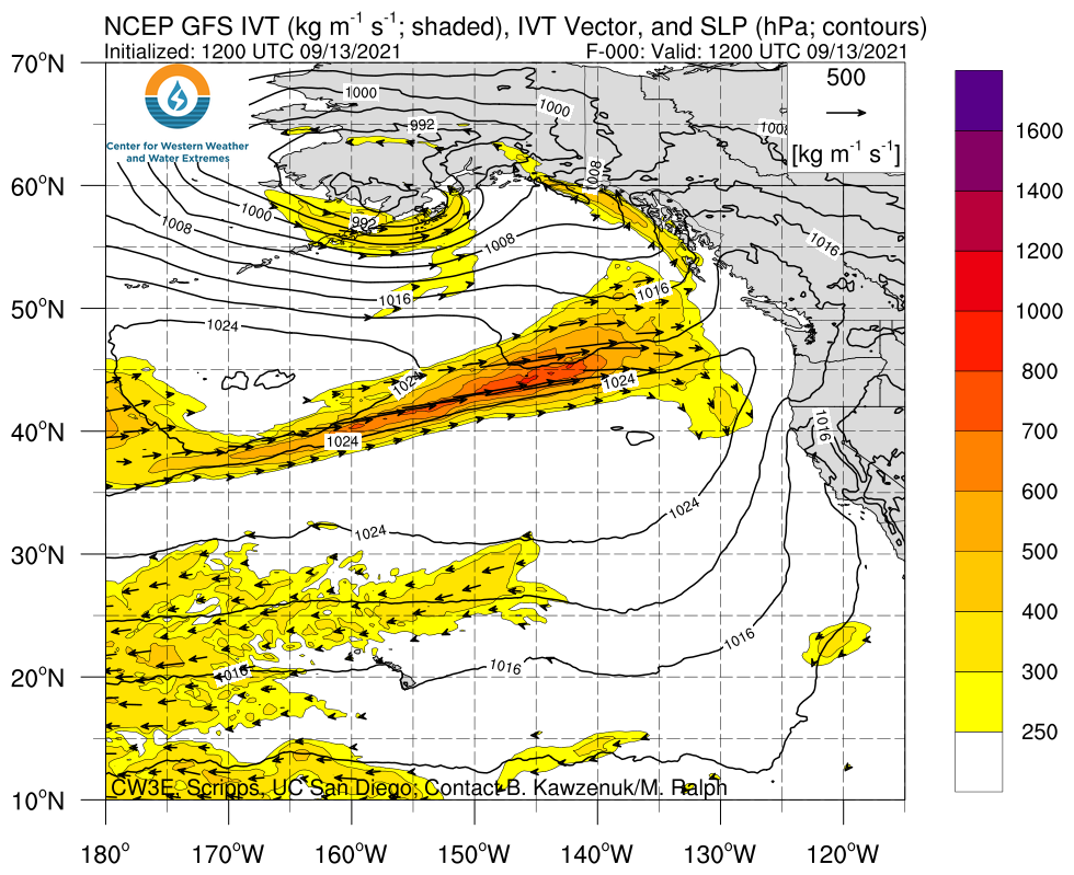
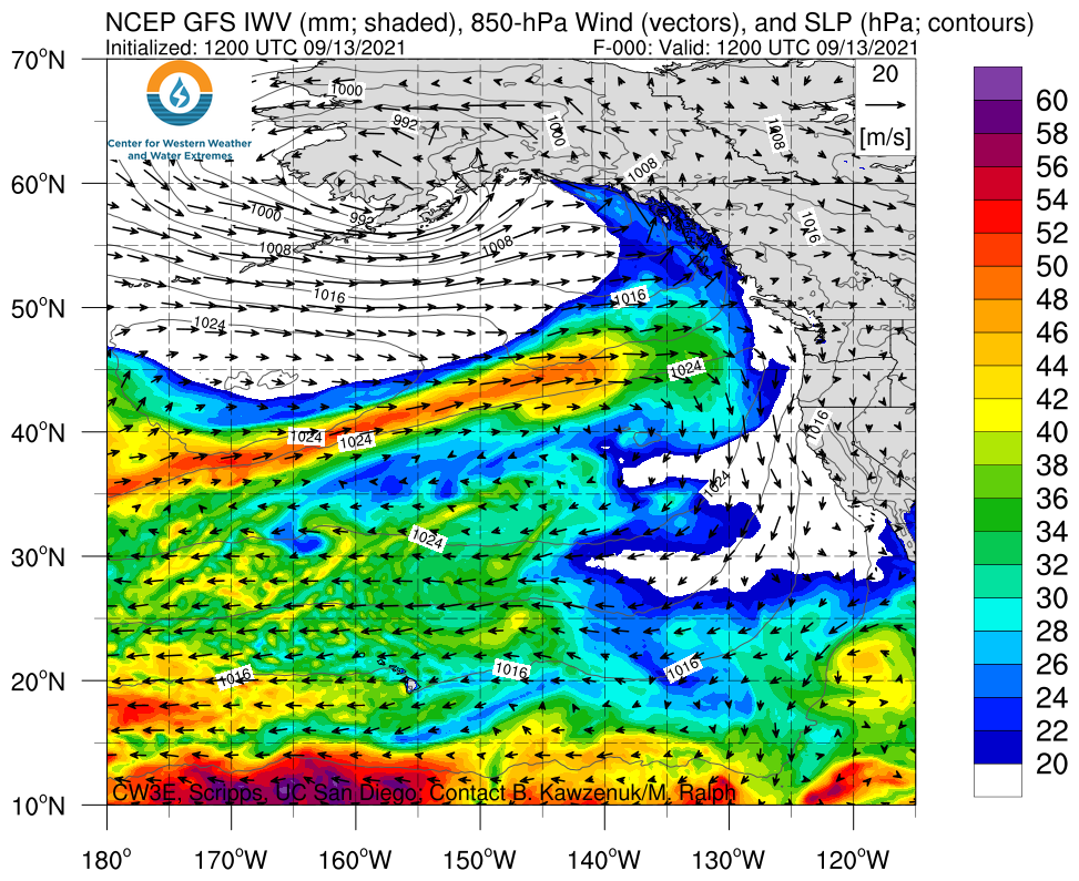
An increase in activity over the Eastern Pacific is forecast to bring multiple ARs to the Pacific Northwest
- The first AR is forecast to be weak and brief, bringing as much as 1 inch of precipitation to far Northwestern Washington
- The second AR is forecast to bring much stronger and a longer duration of AR conditions to the Pacific Northwest, though there is currently much higher ensemble spread in timing, magnitude, and overall duration of AR conditions
- ~12 GEFS ensemble members are predicting the second AR to bring AR 4 or higher conditions to Coastal Oregon
- The NWS Weather Prediction Center is currently forecasting as much as 7 inches of precipitation to fall across several high elevation locations in the Pacific Northwest during the next seven days
- While early season ARs tend to produce less precipitation than their mid-winter counterparts, any precipitation that these two ARs produce will bring much needed relief to the numerous active wildfires and drought conditions in the Pacific Northwest
Click images to see loops of GFS IVT & IWV forecasts Valid 1200 UTC 13 September – 1200 UTC 23 September 2021 |
|
 |
 |


Summary provided by C. Hecht, C. Castellano, J. Kalansky, and F. M. Ralph; 13 September 2021
*Outlook products are considered experimental