CW3E AR Update: 14 April 2022 Outlook
April 14, 2022
Click here for a pdf of this information.
Atmospheric Rivers to Bring Beneficial Precipitation to Northern portions of the US West Coast
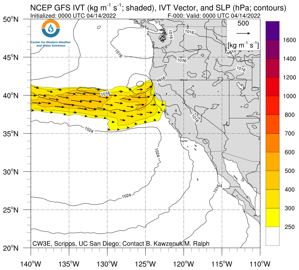
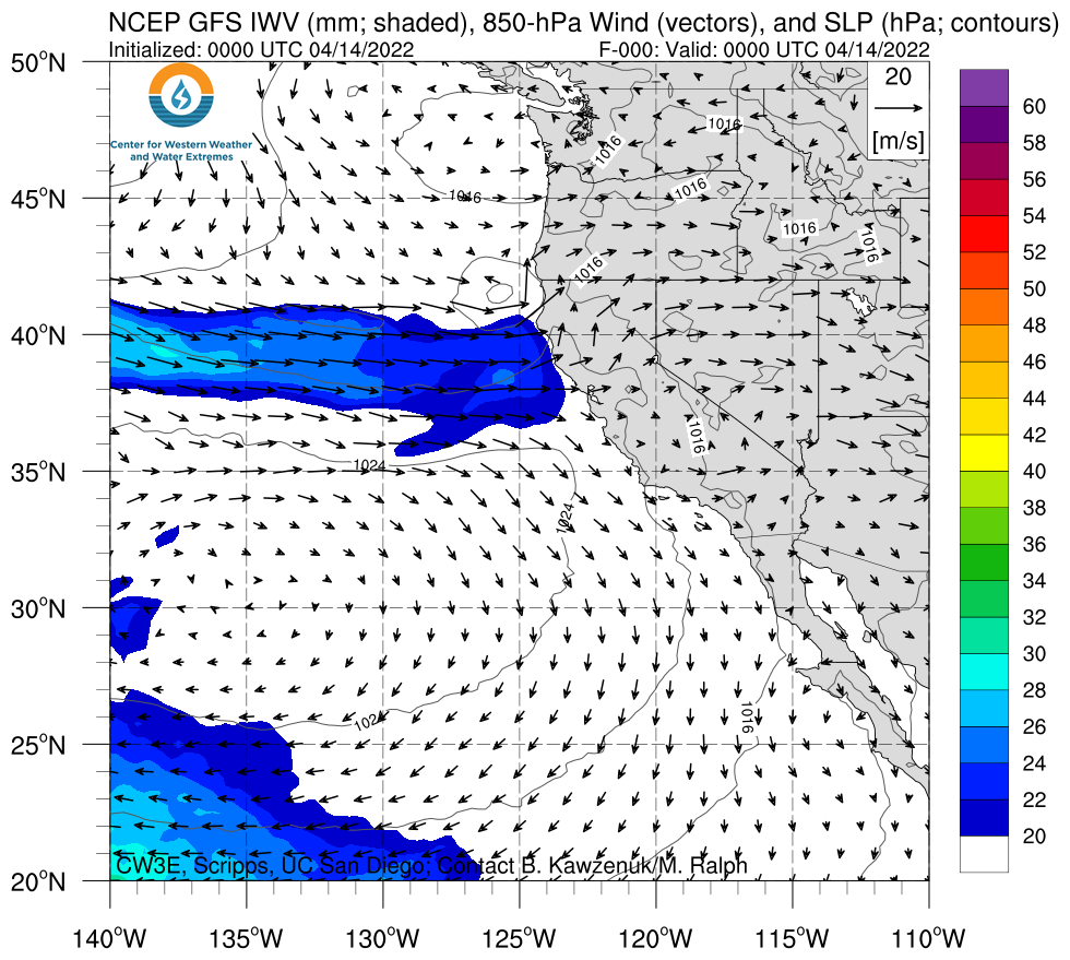
- Ongoing atmospheric river (AR) is expected to continue to bring precipitation to Northern CA through this evening with additional AR activity forecasted over Oregon and Northern CA over the next 5 days
- A quick-moving shortwave trough is forecast to bring additional precipitation to Northern CA on 16 Apr
- A second AR is forecasted to make landfall on 18 Apr and bring AR 1-2 conditions (based on the Ralph et al. 2019 AR Scale) to coastal Northern California and Oregon, but there is uncertainty in the timing, location, and duration of AR conditions
- Compared to the 00Z ECMWF, the 00Z GFS is forecasting higher precipitation totals over the Northern California Coast Ranges and over western Washington and Oregon
- The sequence of weak ARs will bring beneficial late season precipitation to regions currently experiencing severe and prolonged drought, although it likely will not end the severe drought conditions across the region
Click images to see loops of GFS IVT & IWV forecasts Valid 0000 UTC 14 April – 0000 UTC 19 March 2022 |
|
 |
 |
Summary provided by S. Roj, S. Bartlett, C. Castellano, C. Hecht, J. Kalansky, and F. M. Ralph; 14 April 2022
To sign up for email alerts when CW3E post new AR updates click here.
*Outlook products are considered experimental


