
CW3E AR Update: 14 February 2024 Outlook
February 14, 2024
Click here for a pdf of this information.
Trio of Storms to Bring Precipitation to California
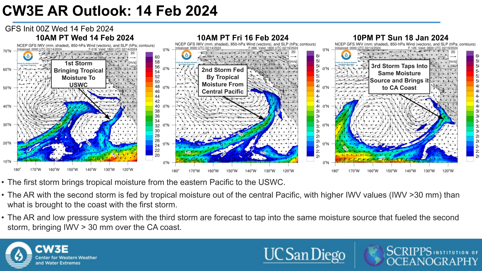
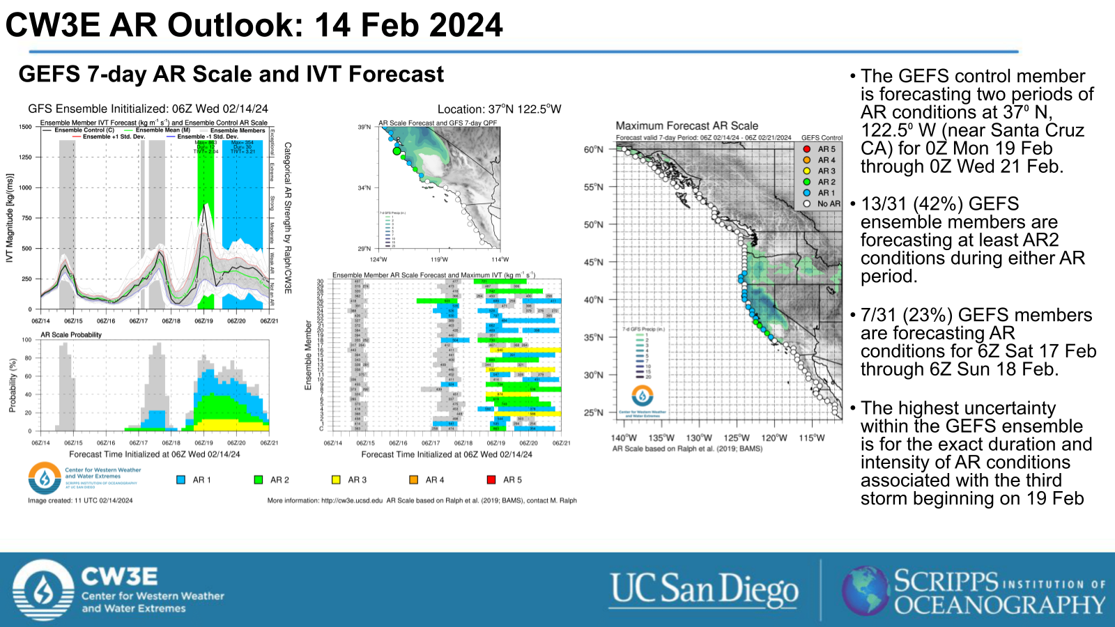
- A trio of storms are forecast to make landfall over the US West Coast in the next 7 days.
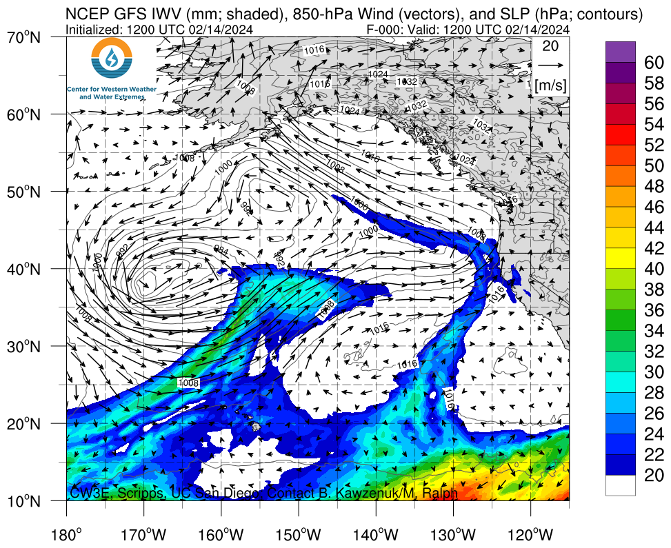
- The first storm is driven by a low pressure system that brings a burst of IVT to the USWC on Wed 14 Feb. This low pressure system persists off the PNW coast through Thu 15 Feb as the second AR propagates toward the USWC.
- The second storm is an atmospheric river (AR) that makes landfall across the USWC on Fri 16 Feb. The landfall direction of the AR is likely to be suboptimal for precipitation, potentially limiting the precipitation potential of this system.
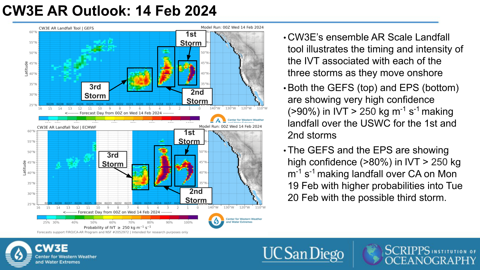
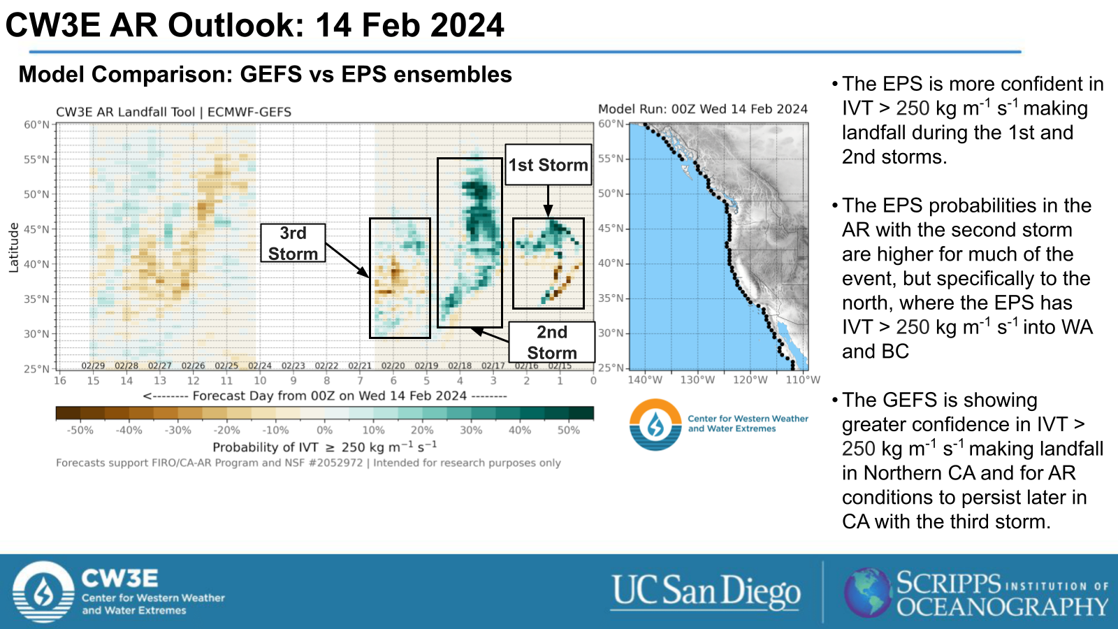
- The ECMWF EPS is forecasting greater probabilities of IVT > 250 kg m-1 s-1 making landfall over the PNW with the second AR than the GEFS.
- The third storm is a second AR that is forecast to make landfall alongside a low pressure system into central CA on Sun 18 Feb.
- There is uncertainty amongst GEFS and EPS ensemble members regarding the duration and strength of AR conditions with the second and third ARs across CA.
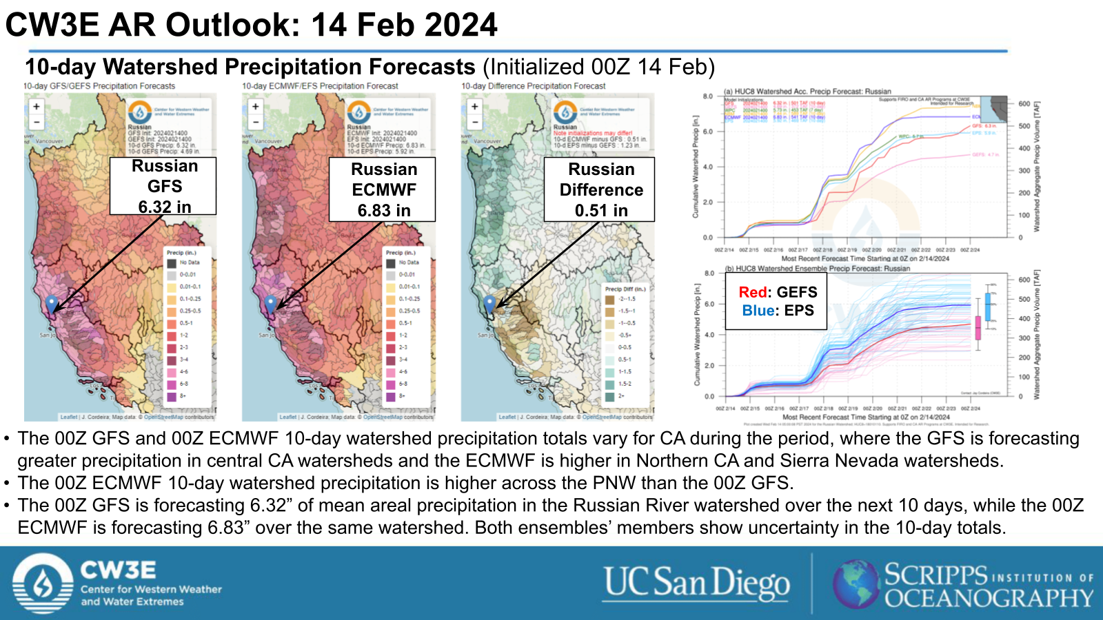
- The WPC is forecasting significant 7 day precipitation over the northern and central CA coasts and the Sierra Nevada.
- The WPC Excessive Rainfall Outlook indicates a Slight Risk (level 2 of 4, or at least 15% chance) for flash flooding over the northern CA coast for the 24 hour period ending 4 AM PT Sun 18 Feb with the second AR.
- The NWS WPC has issued Excessive Rainfall Outlooks highlighting the potential for flash flood conditions in various locations along the coast of California in association with precipitation during each of the three storms during this period.
Click images to see loops of GFS IVT and IWV forecasts Valid 1200 UTC 14 February 2024 – 0000 UTC 22 February 2024 |
|
 |
 |


Summary provided by M. Steen, S. Bartlett and P. Iniguez; 14 February 2024
To sign up for email alerts when CW3E post new AR updates click here.
*Outlook products are considered experimental
For any unfamiliar terms, please refer to the American Meteorological Society Glossary.