CW3E AR Update: 14 May 2020 Outlook
April 14, 2020
Click here for a pdf of this information.
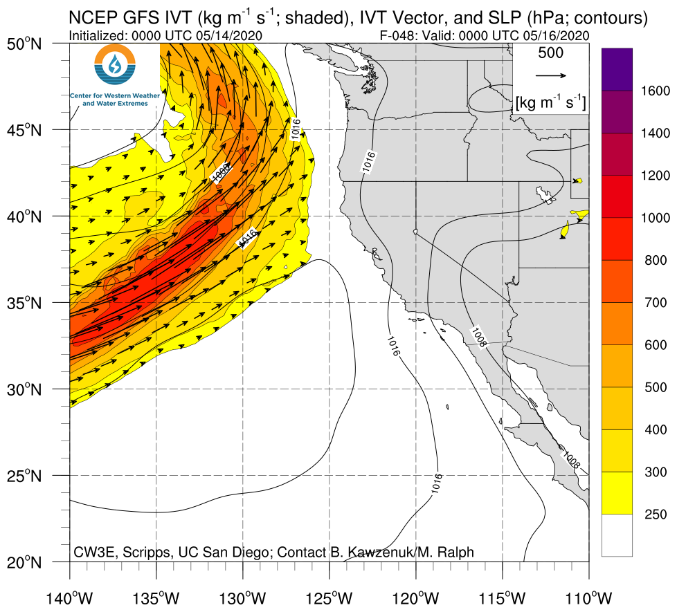
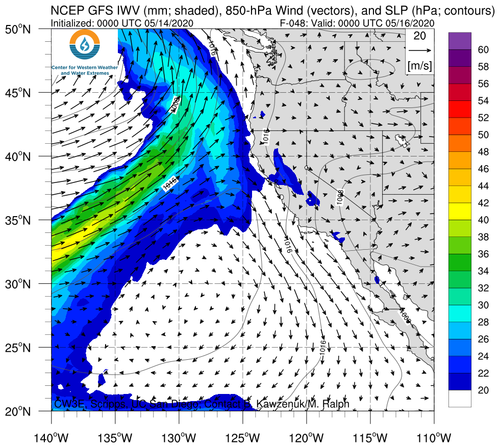
A landfalling AR is expected to bring precipitation to portions of California, Oregon, and the interior Northwestern US
- An AR associated with a closed upper-level low is forecast to make landfall along the coast of Northern California and Oregon over the next couple of days
- Interior portions of the western U.S. are expected to experience AR conditions for more than 24 hours
- The highest precipitation amounts (2–5 inches) are forecast in the Oregon Cascades, the southern Oregon Coast Ranges, the Northern California Coast Ranges, the Klamath Mountains, and the Northern Sierra Nevada
- More than 2 inches of precipitation are also possible over the higher terrain in North Central Idaho and western Montana
Click IVT or IWV image to see loop of GFS analyses/forecasts Valid 0000 UTC 16 May – 0000 UTC 19 May 2020 |
|
 |
 |
Summary provided by C. Castellano, C. Hecht, B. Kawzenuk, and F. M. Ralph; 14 May 2020
*Outlook products are considered experimental


