CW3E AR Update: 16 February 2017 Outlook
February 16, 2017
Click here for a pdf of this information.
Update on ARs Currently Impacting and Forecast to Impact West Coast
- As much as 6 inches of precipitation has fallen over the past 24-hrs over the high elevations of Northern CA, OR, and WA
- The second AR, which develops in conjunction with a mesoscale frontal wave, is forecast to impact Southern CA
- Over 12 inches of precipitation is forecast to fall over the Transverse Ranges, raising concern for flooding and landslides
- The lower elevations of Los Angeles and San Diego are forecast to receive 1–4.5 inches over the next 72 hours
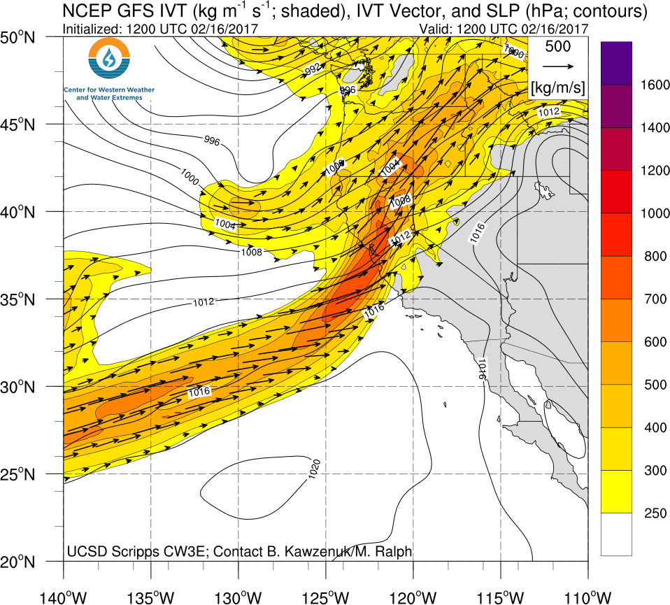
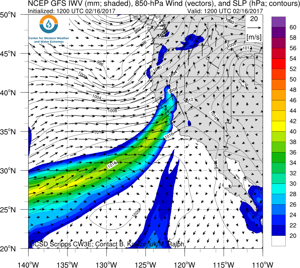
Click IVT or IWV image to see loop of 0-126 hour GFS forecast Valid 1200 UTC 16 Feb – 1800 UTC 21 Feb 2017 |
|
 |
 |
- A mesoscale frontal wave is forecast to develop off of the current AR which will bring AR conditions to Southern CA.
- The proximity and propagation of the low-pressure system will bring non-AR related precipitation the North/Central CA
- Another AR is forecast to make landfall over Northern CA from 20 – 22 Feb.
Summary provided by C. Hecht and F.M. Ralph; 1 PM PT Thurs 16 Feb. 2017

