
CW3E AR Update: 16 February 2024 Outlook
February 16, 2024
Click here for a pdf of this information.
Pair of Storms to Bring Precipitation to California
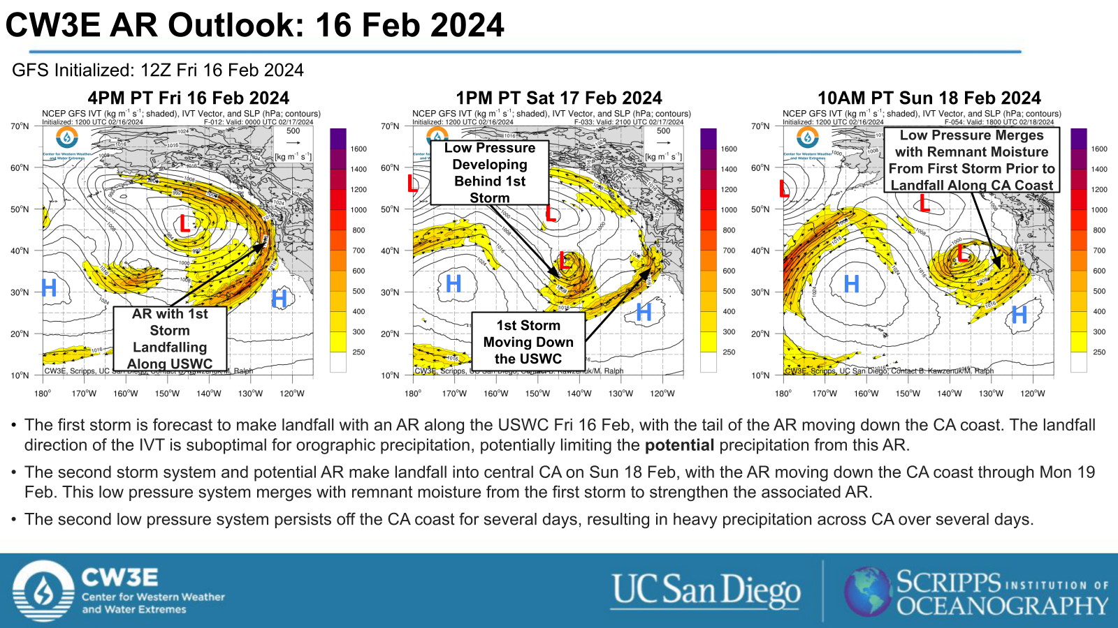
- A pair of storms are forecast to impact the US West Coast during the next several days.
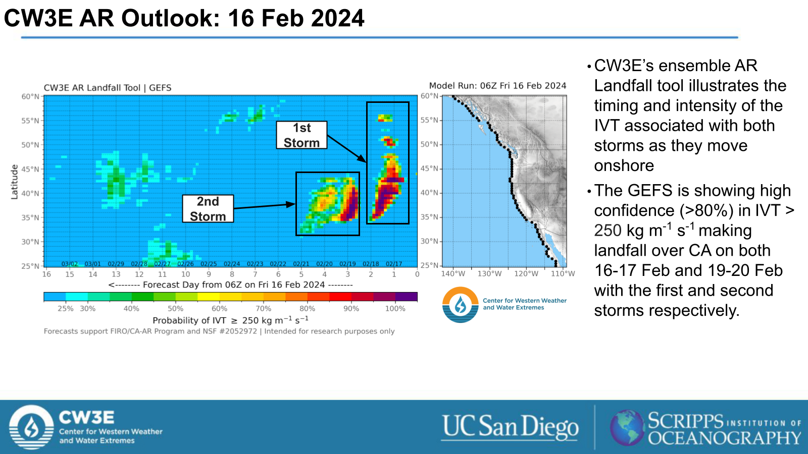
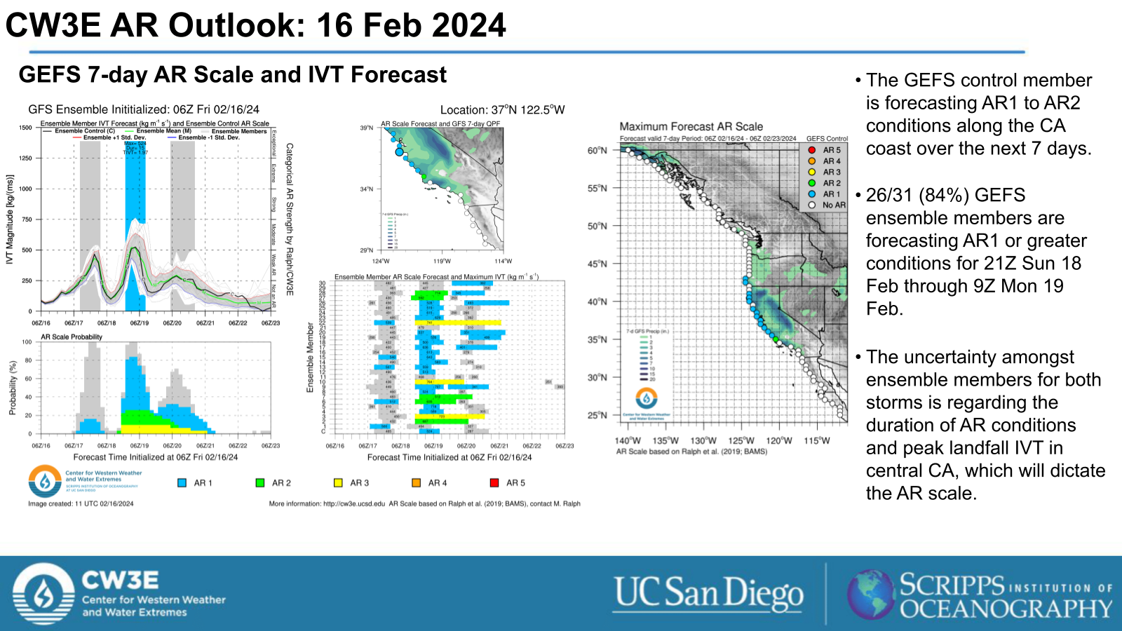
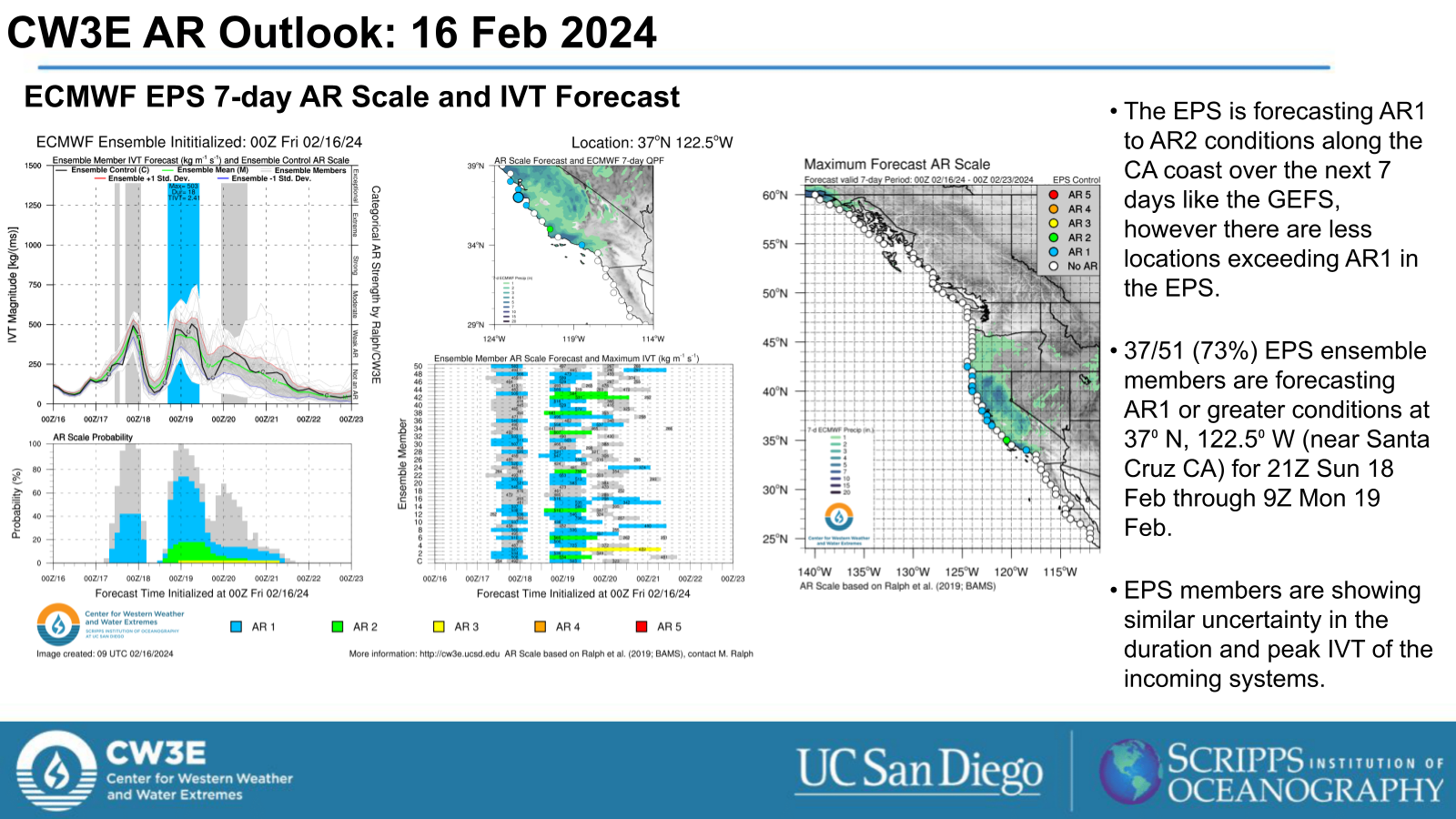
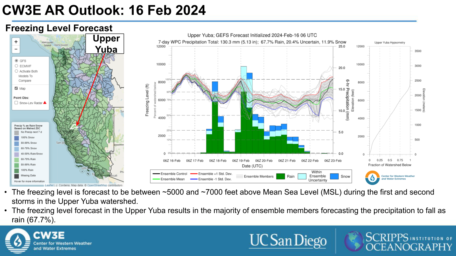
- The first storm is an atmospheric river (AR) that makes landfall across the USWC on Fri 16 Feb.
- The landfall orientation of the this AR is likely to be suboptimal for orographic precipitation, potentially limiting the precipitation potential of this system.
- The second storm is a second AR that is forecast to make landfall alongside a low pressure system into central CA on Sun 18 Feb.
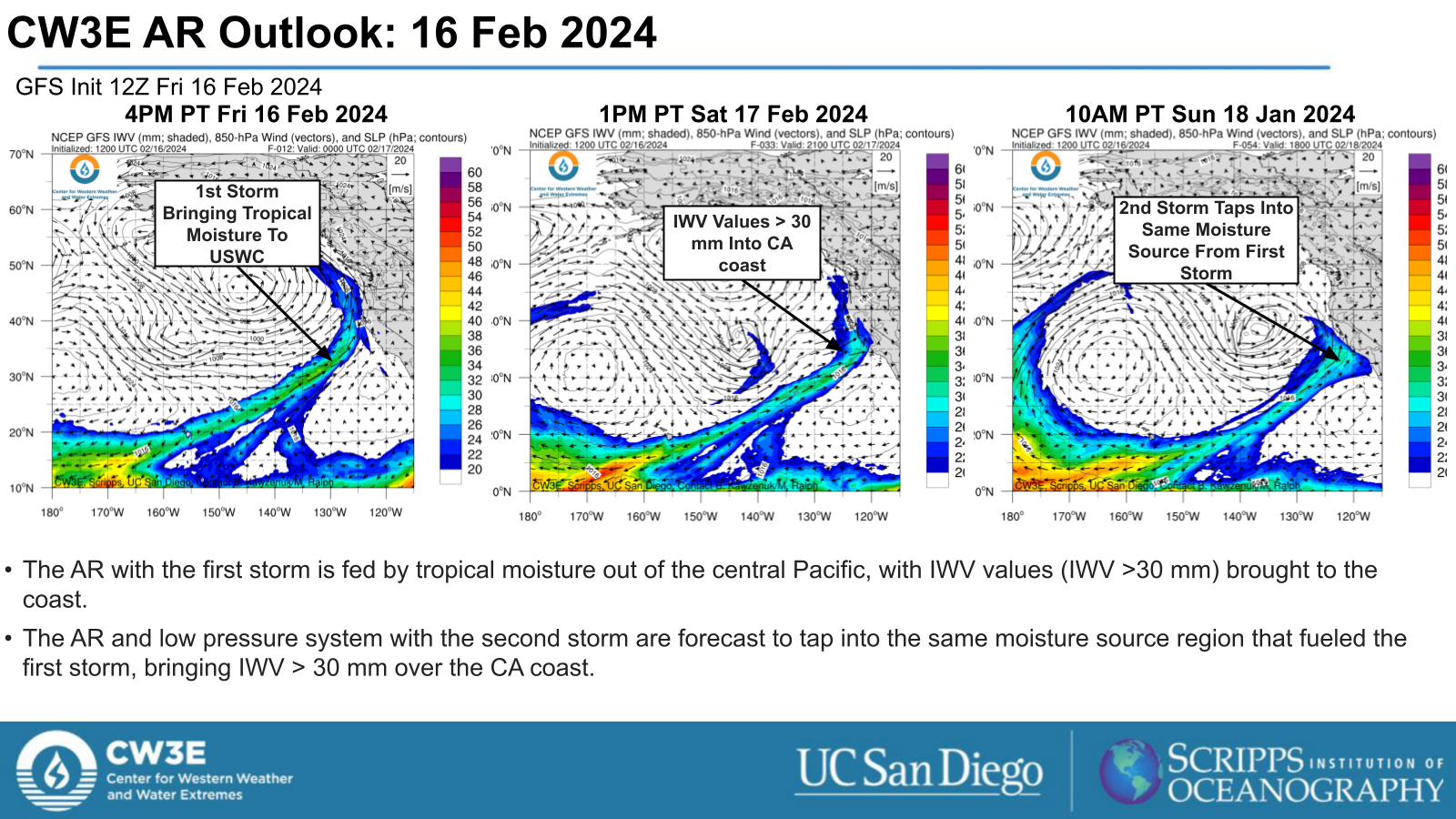
- The second system taps into remnant moisture from the first system, which combined with the persistence of the stationary low pressure system off the CA coast, will result in a multi-day precipitation event for the state.
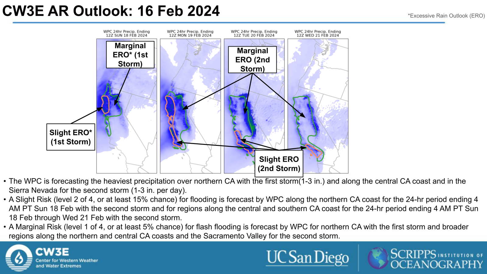
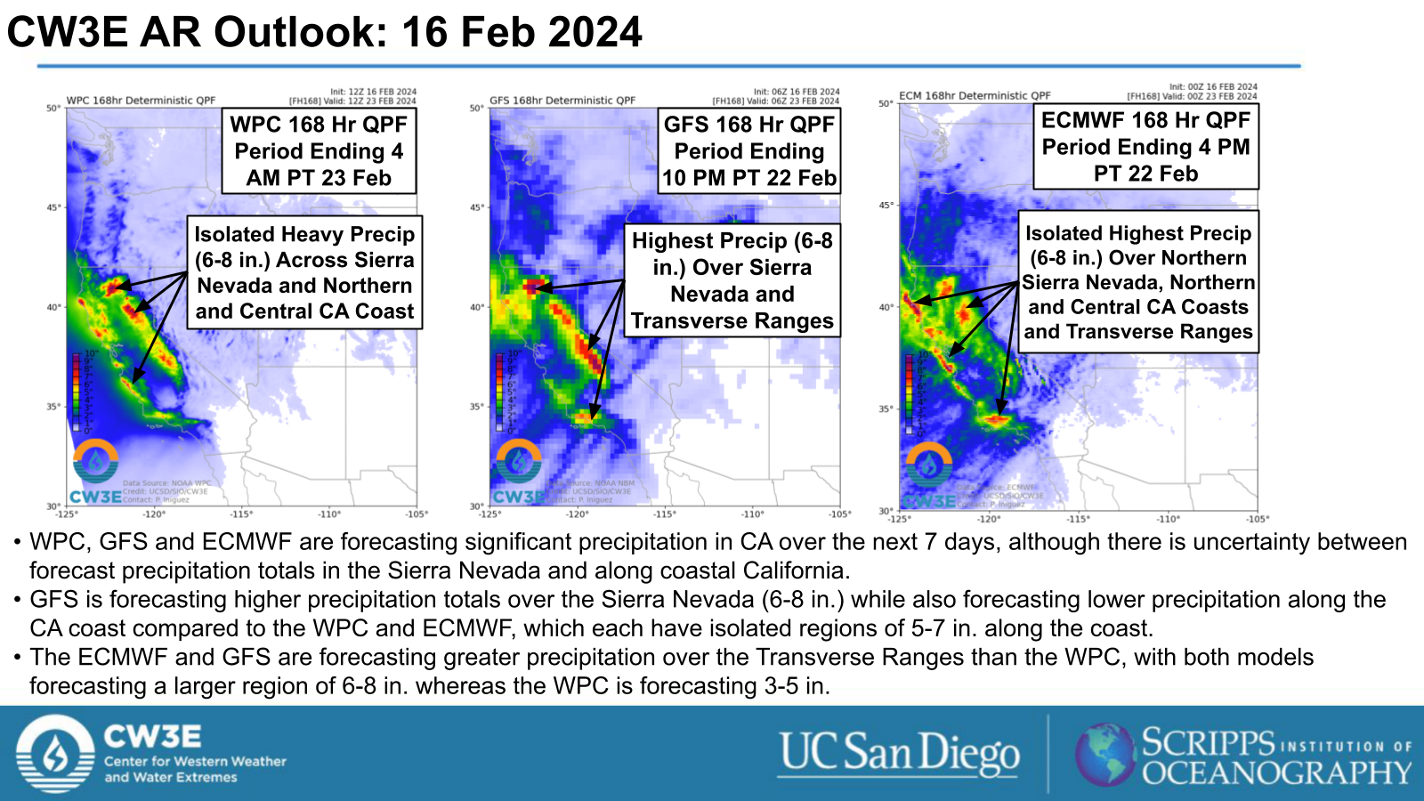
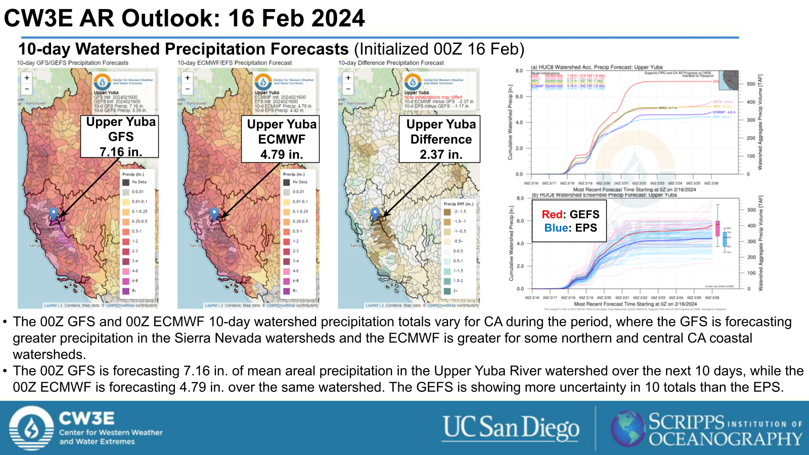
- The NWS Weather Prediction Center (WPC) is forecast significant precipitation over the next 7 days along the northern and central CA coasts and in the Sierra Nevada.
- The WPC Excessive Rainfall Outlook (ERO) indicates a Slight Risk (level 2 of 4, or at least 15% chance) for flooding over the northern CA coast with the first storm and along the northern and central CA coasts with the second storm.
- The WPC ERO also indicates a Marginal Risk (level 1 of 4, or at least 5% chance) for flooding across broader areas.
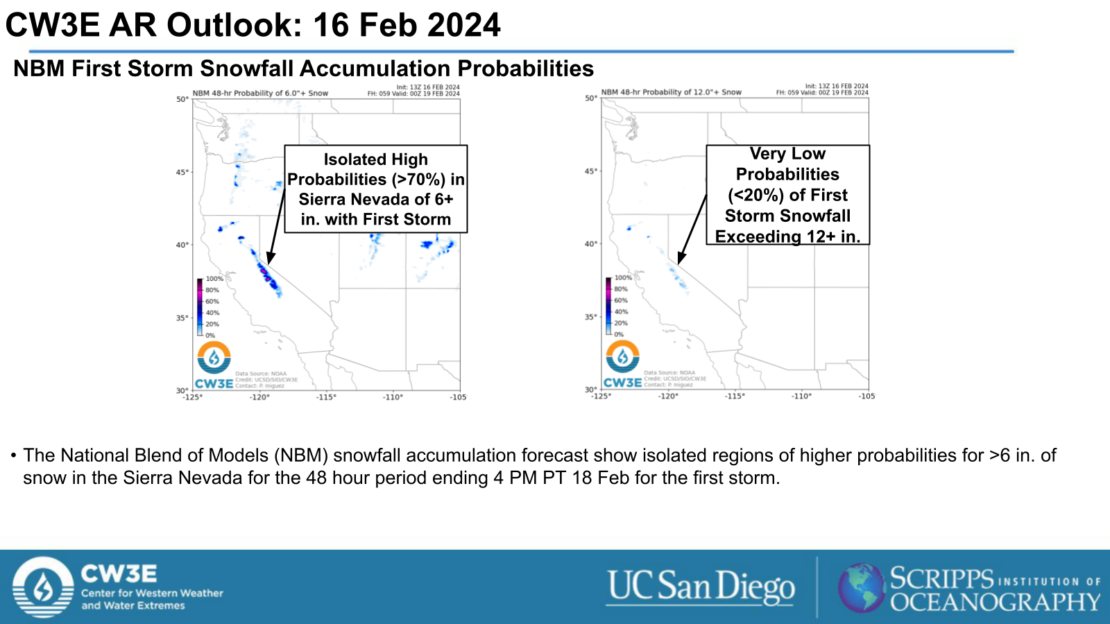
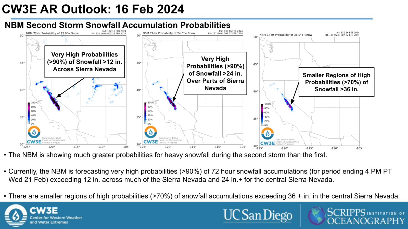
- The second storm is likely to bring heavy snowfall to the Sierra Nevada. The National Blend of Models (NBM) indicates very high probabilities (>90%) of snowfall accumulations exceeding 24”.
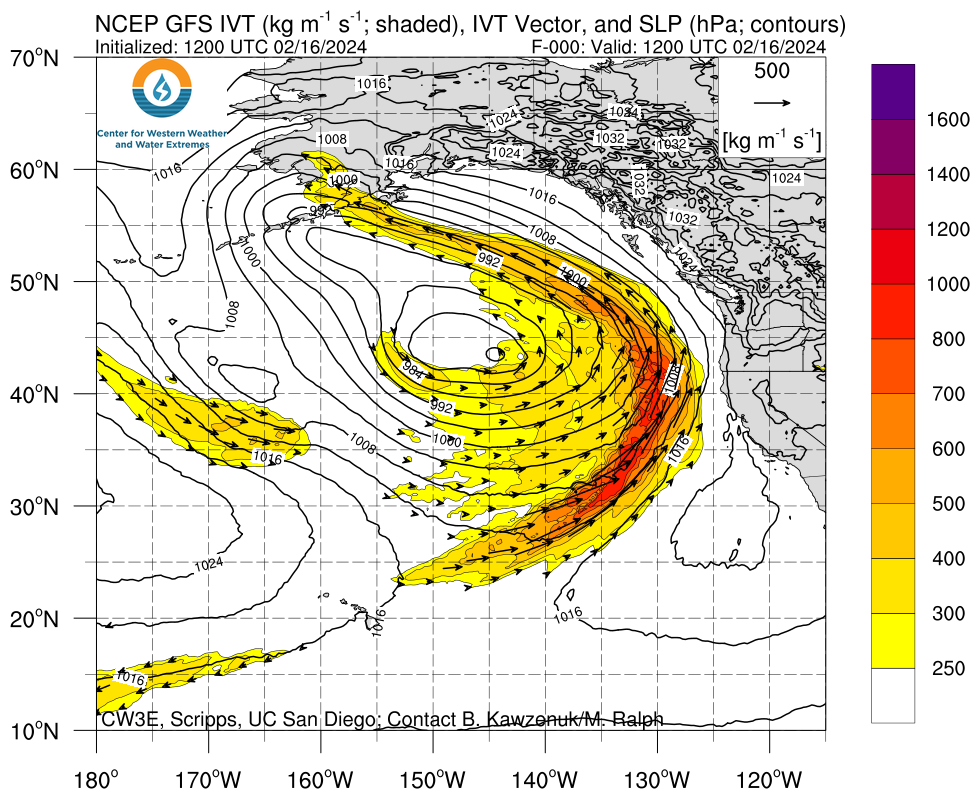
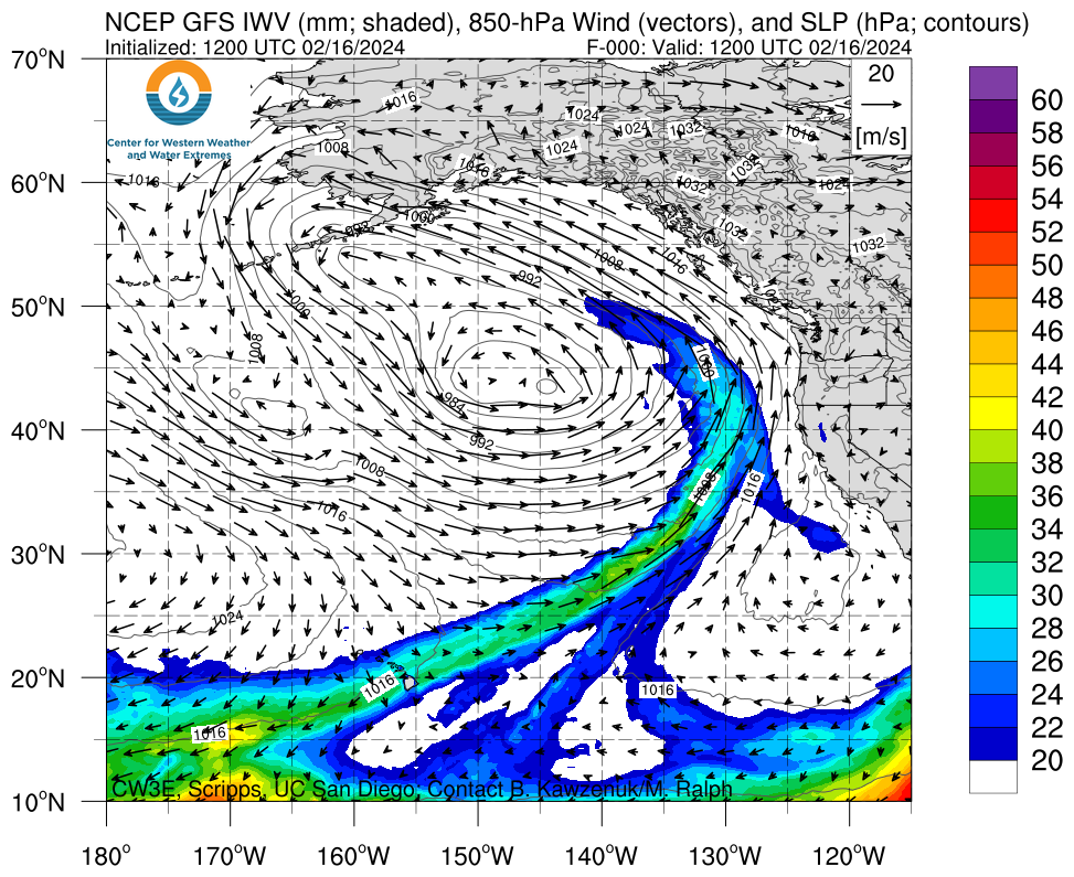
Click images to see loops of GFS IVT and IWV forecasts Valid 1200 UTC 16 February 2024 – 1200 UTC 21 February 2024 |
|
 |
 |
Summary provided by M. Steen, P. Iniguez, S. Bartlett and C. Castellano; 16 February 2024
To sign up for email alerts when CW3E post new AR updates click here.
*Outlook products are considered experimental
For any unfamiliar terms, please refer to the American Meteorological Society Glossary.