CW3E AR Update: 16 January 2024 Outlook
January 16, 2024
Click here for a pdf of this information.
Active Weather Pattern to Bring Precipitation to US West Coast
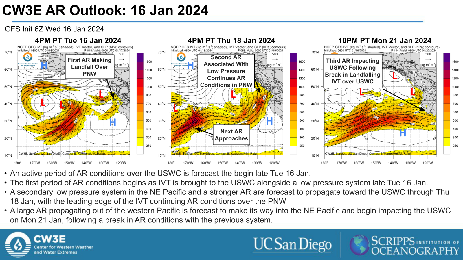
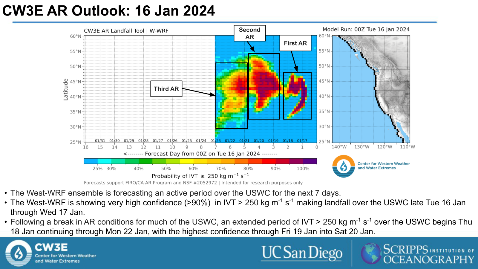
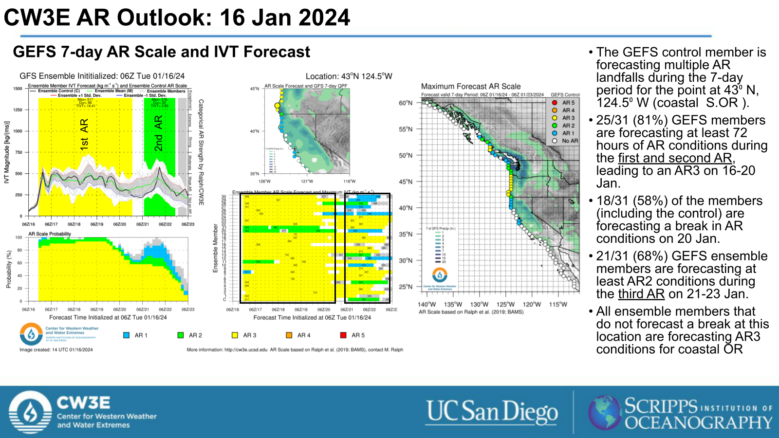
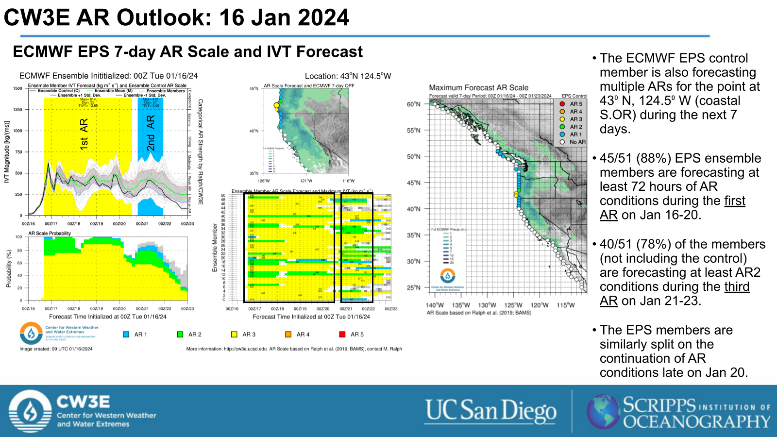
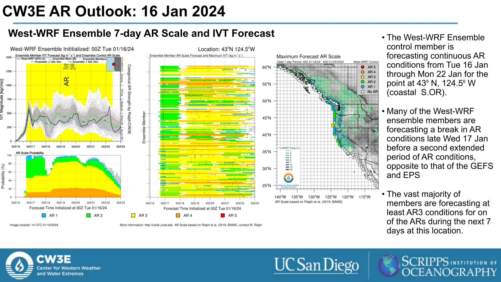
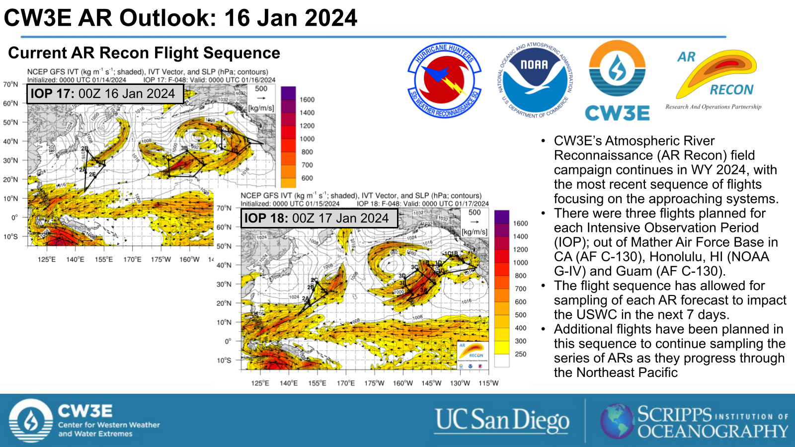
- An active weather pattern for the US West Coast is forecast to begin late Tue 16 Jan, when the first of three AR periods begins.
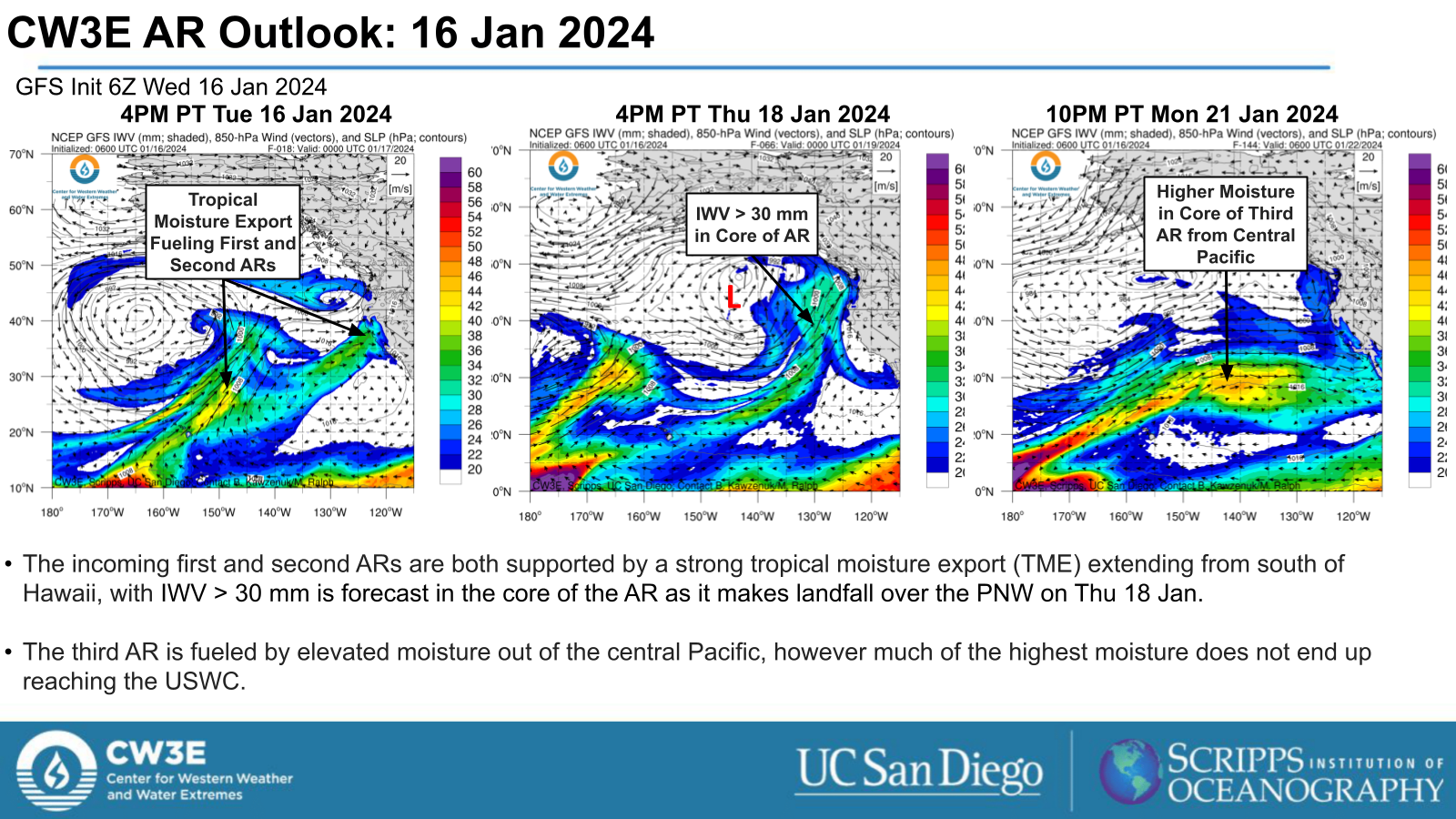
- The first AR period begins late Tue 16 Jan and continues through Wed 17 Jan. The second AR follows close behind on Thu 18 Jan.
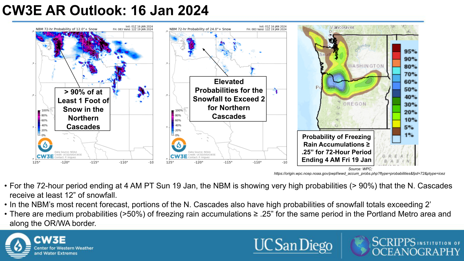
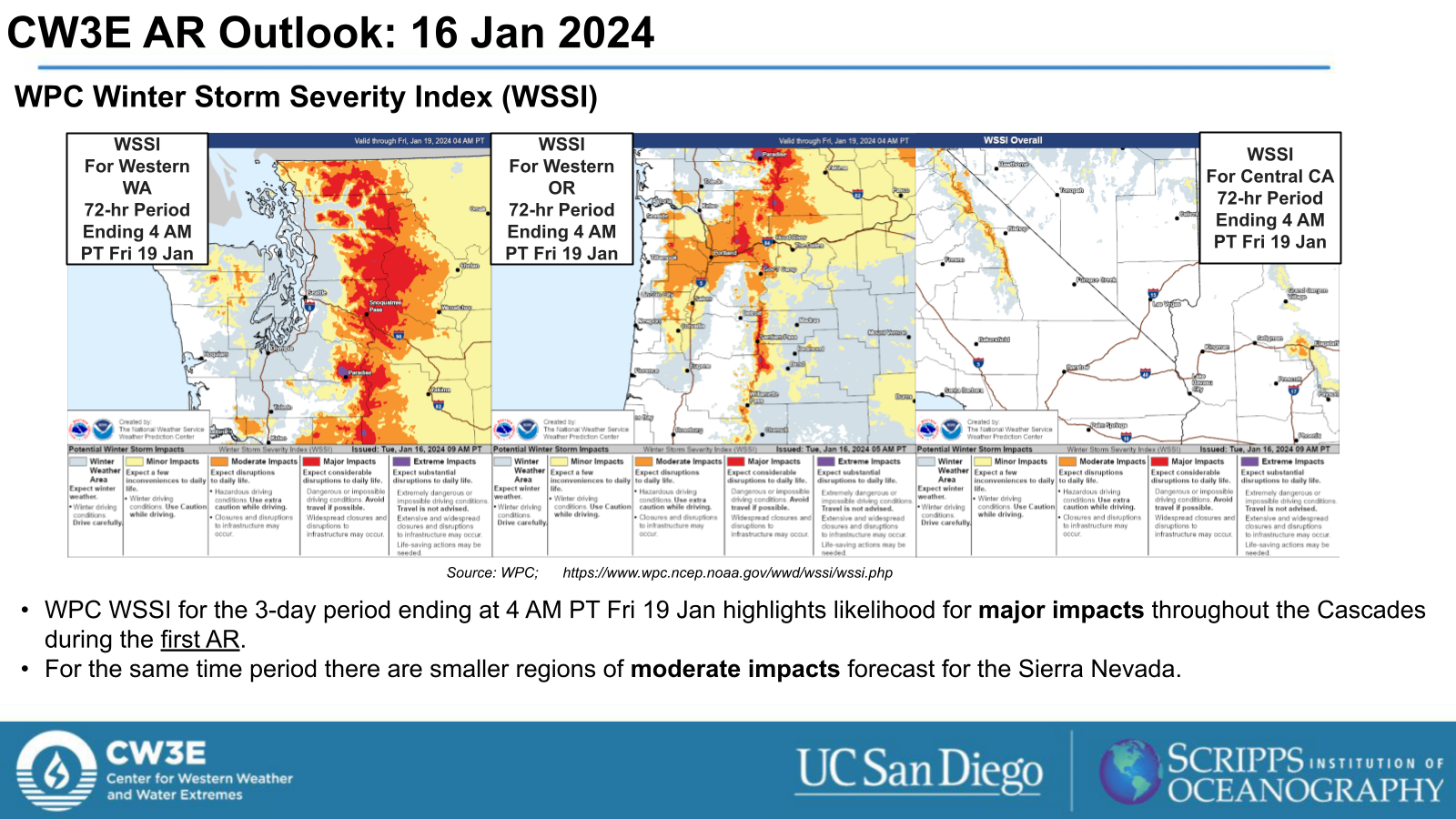
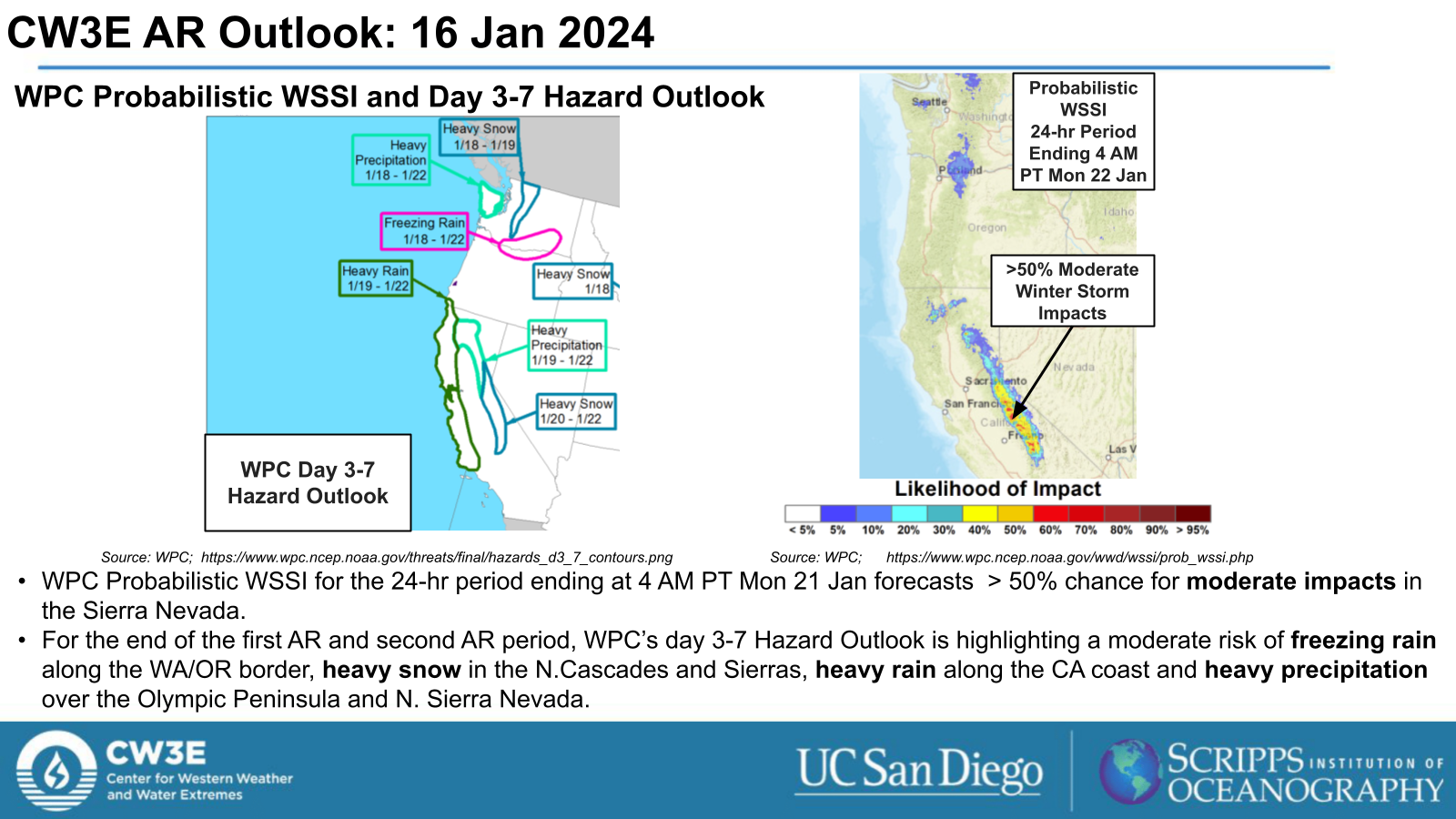
- The first and second ARs are forecast to bring heavy precipitation to the PNW, including heavy snowfall (>12”) in the Northern Cascades and freezing rain in the Portland Metro area and regions along the WA/OR border through early Fri 19 Jan.
- The third AR period begins late Sun 20 Jan as a large AR begins to make landfall across the USWC.
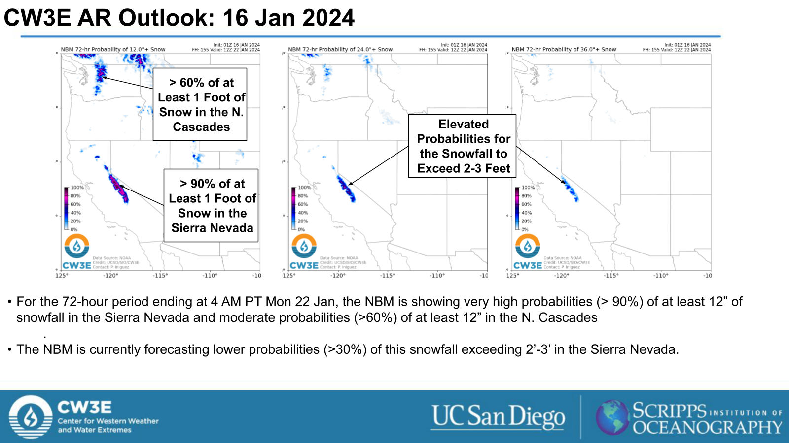
- The third AR period is forecast to bring precipitation to the USWC, with the heaviest precipitation expected over the CA coast and in the Sierra Nevada, where heavy snowfall (>12”) is forecast through Tue 22 Jan.
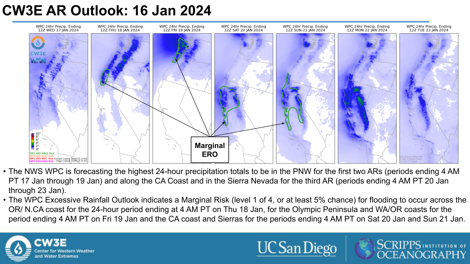
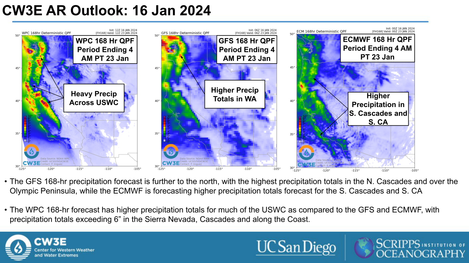
- The NWS Weather Prediction Center is forecasting > 6 inches of precipitation in the Cascades, Sierra Nevada and for regions along the WA, OR and CA coasts over the next 7 days.
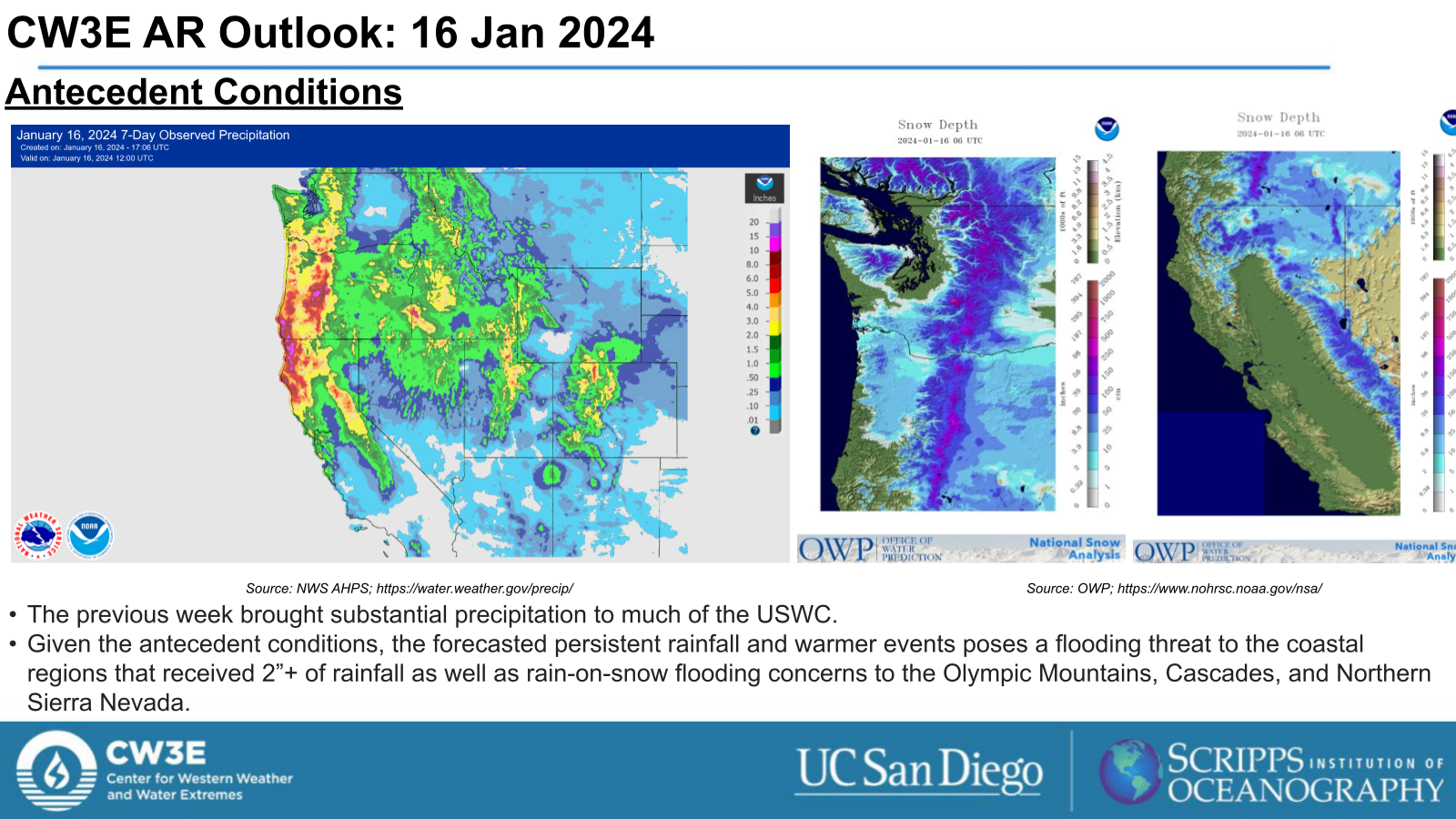
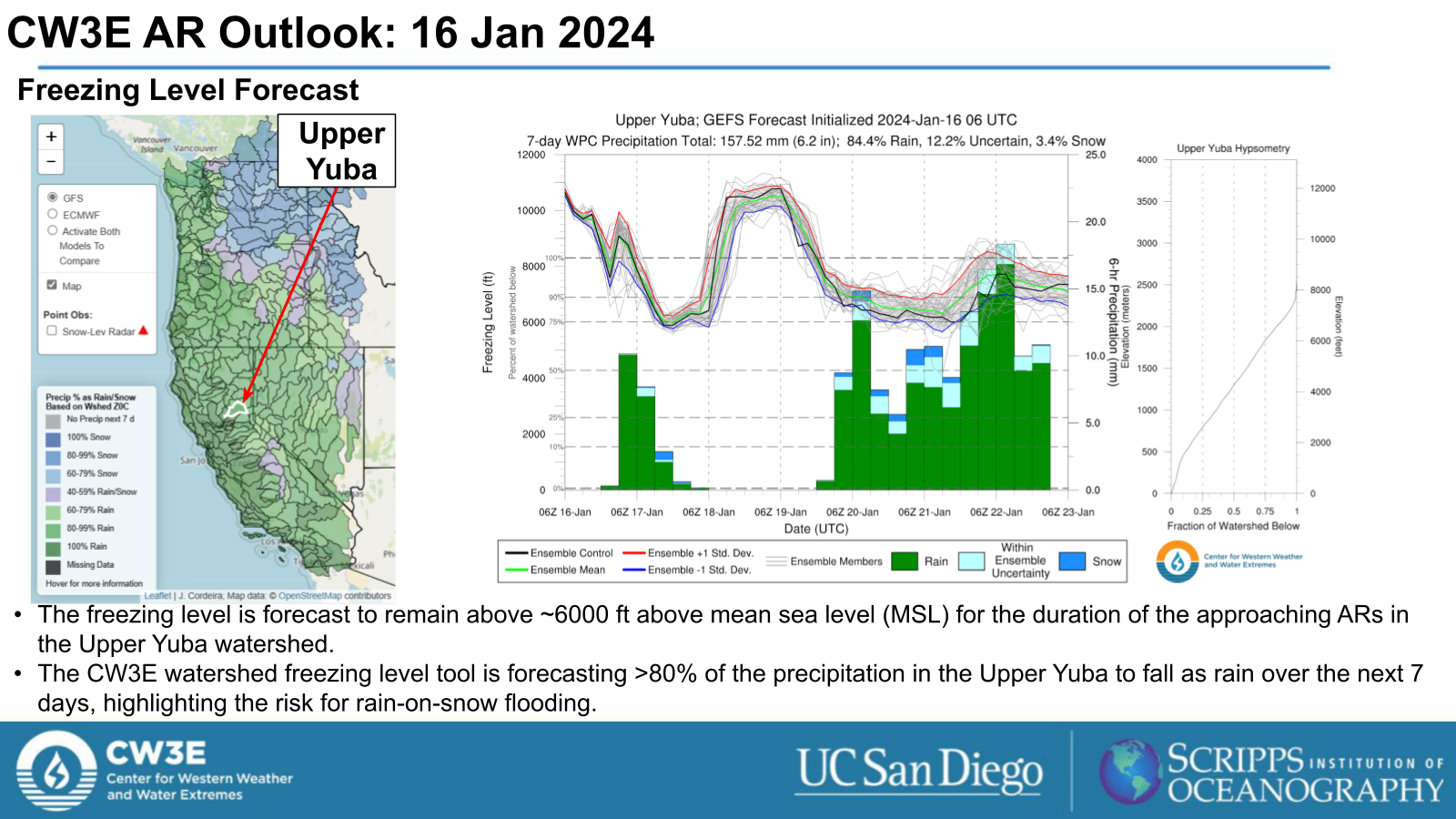
- Fresh snowpack and moist soils from previous events that impacted the USWC present the risk for rain-on-snow flooding.
- The WPC Excessive Rainfall Outlook indicates a Marginal Risk (level 1 of 4, or at least 5% chance) for flooding in days 2 through 5 (24-hour periods ending 4 AM PT Thu 18 Jan through Sun 21 Jan).
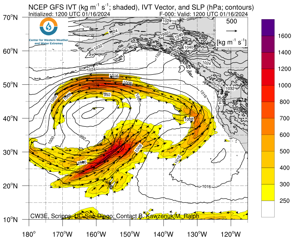
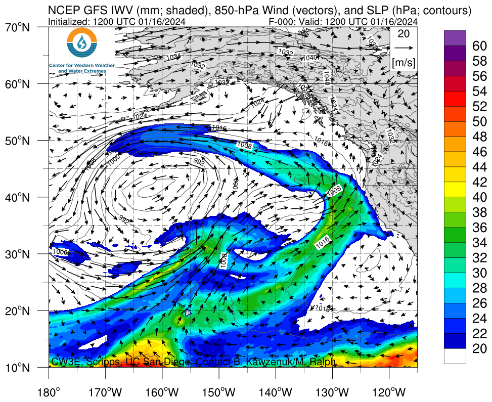
Click images to see loops of GFS IVT and IWV forecasts Valid 1200 UTC 16 January 2024 – 0000 UTC 23 January 2024 |
|
 |
 |
Summary provided by M. Steen, C. Castellano, P. Iniguez and S. Roj; 16 January 2024
To sign up for email alerts when CW3E post new AR updates click here.
*Outlook products are considered experimental

