CW3E AR Update: 18 January 2024 Outlook
January 18, 2024
Click here for a pdf of this information.
Active Weather Pattern Continues in Pacific, Bringing Precipitation to US West Coast
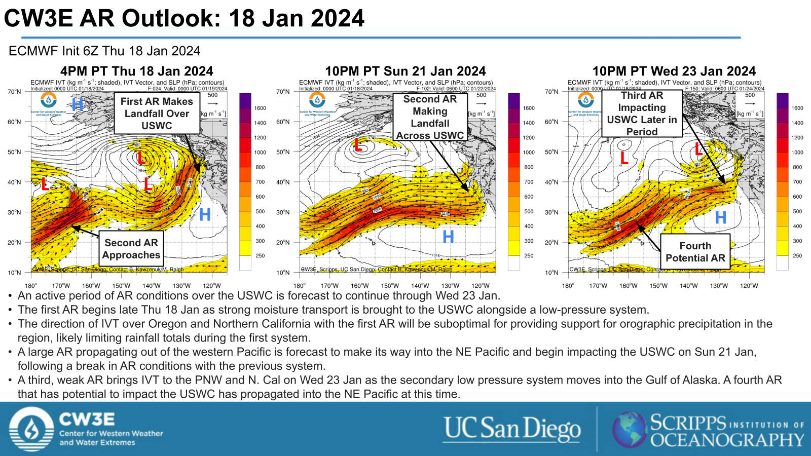
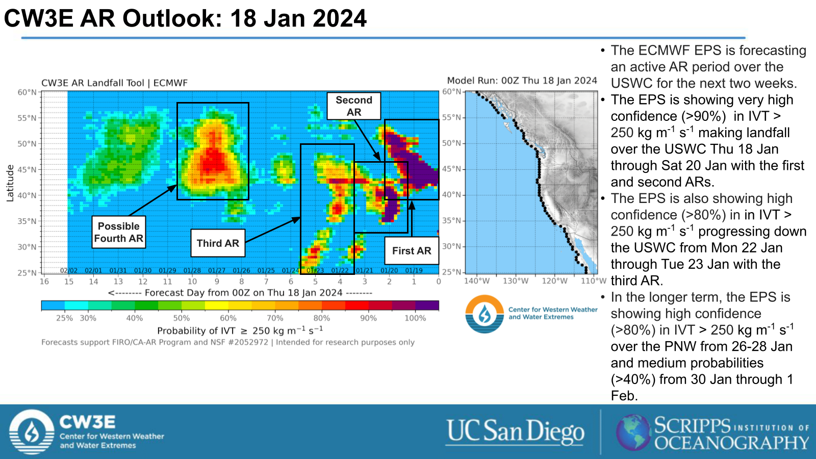
- An active weather pattern for the US West Coast is forecast to continue through Wed 23 Jan and potentially beyond.
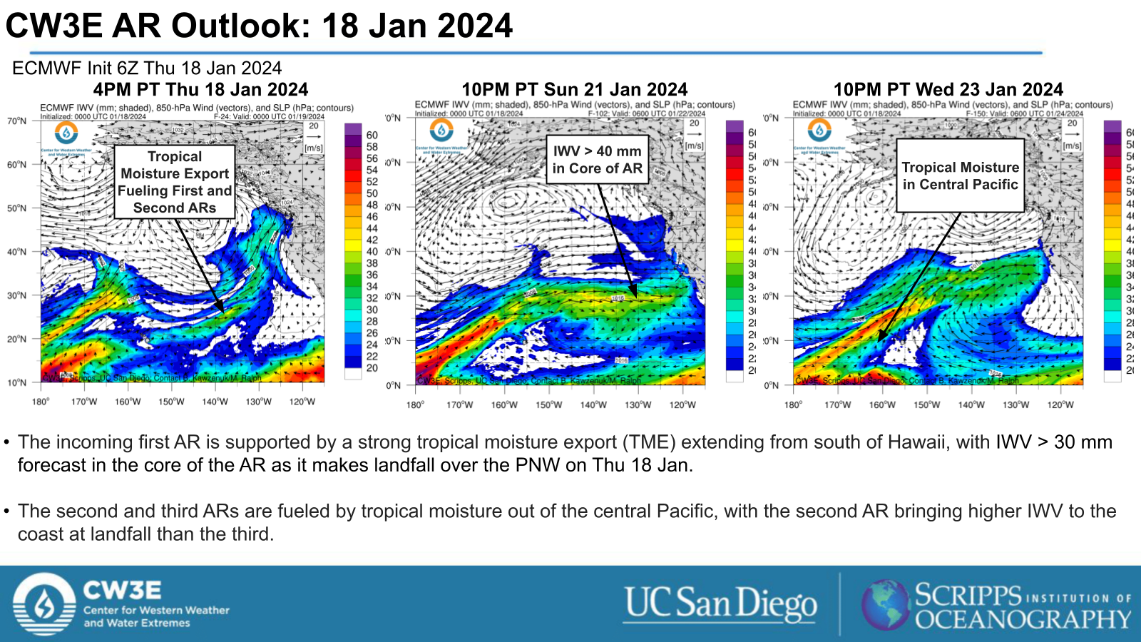
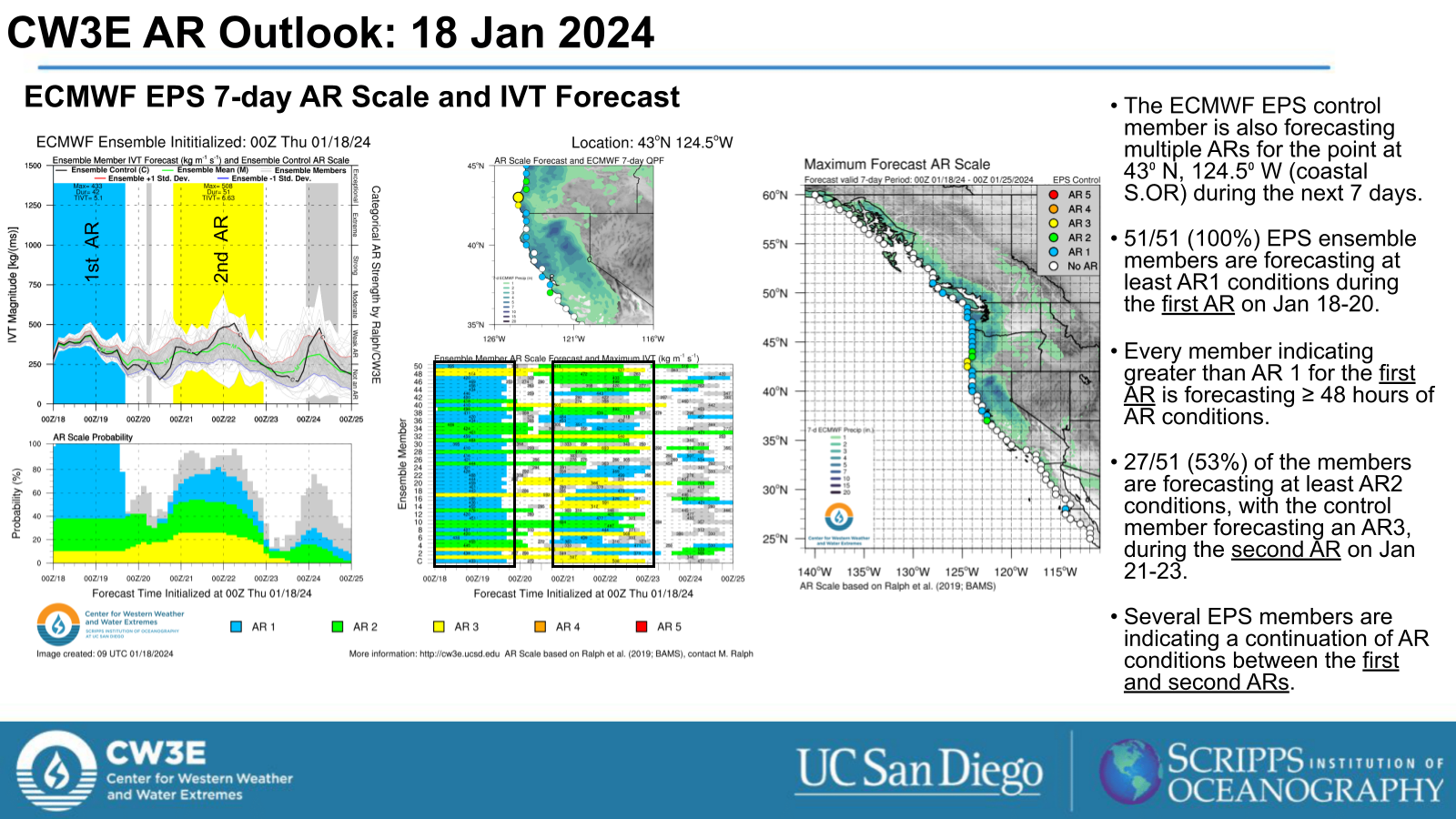
- The first AR begins on Thu 18 Jan as a low-pressure system drives it up the USWC.
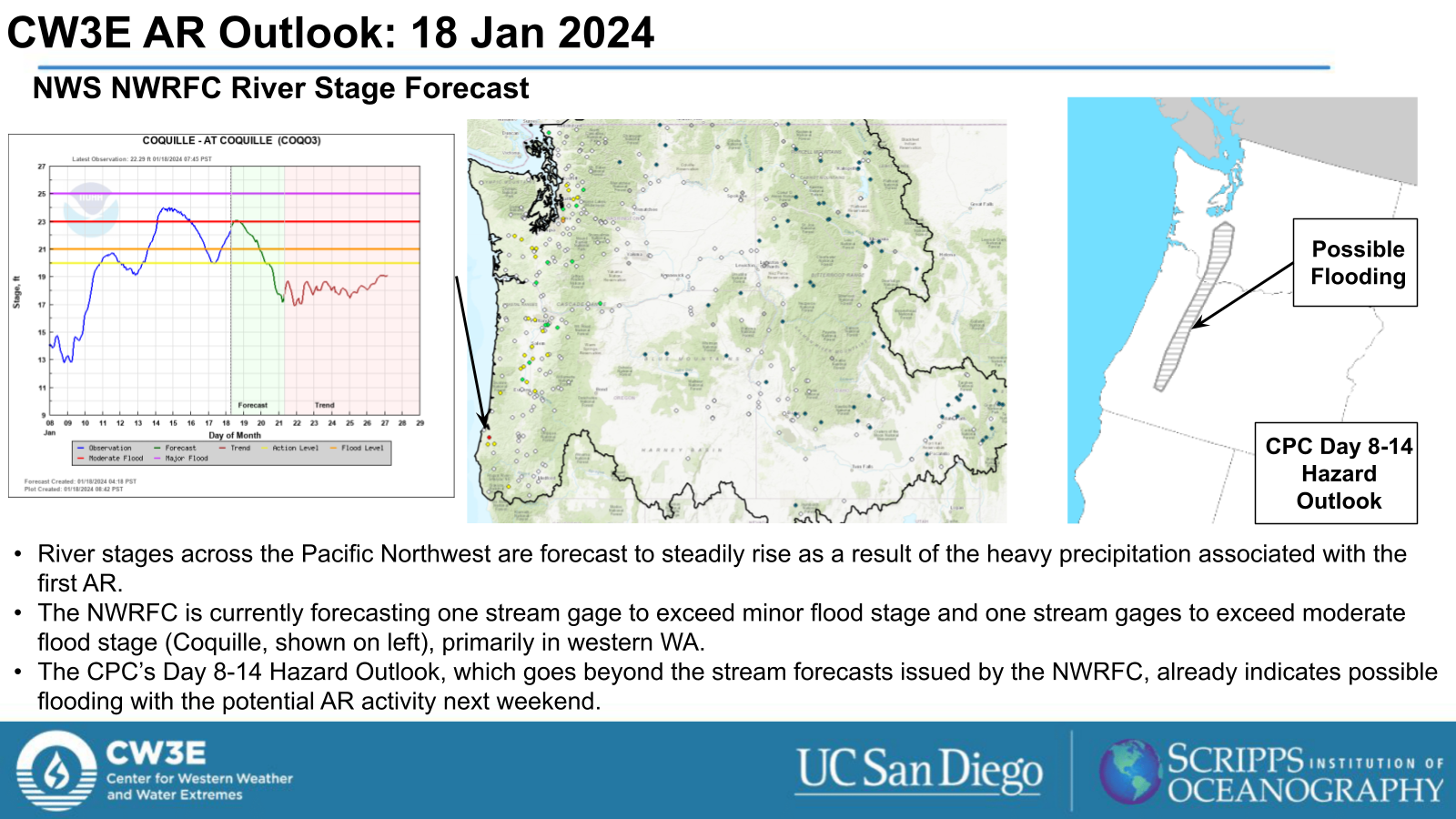
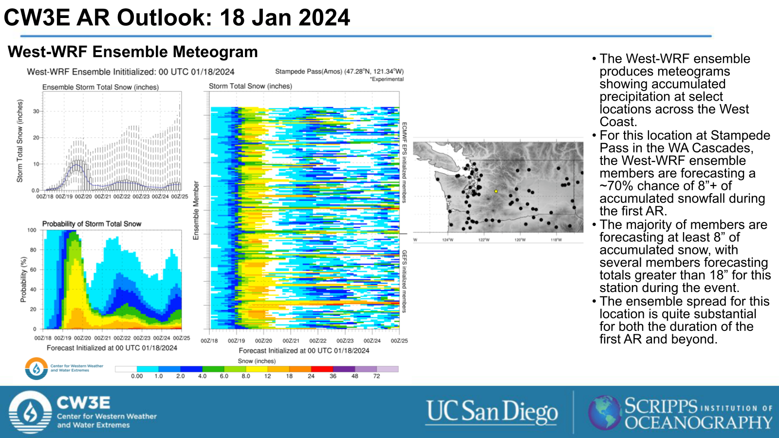
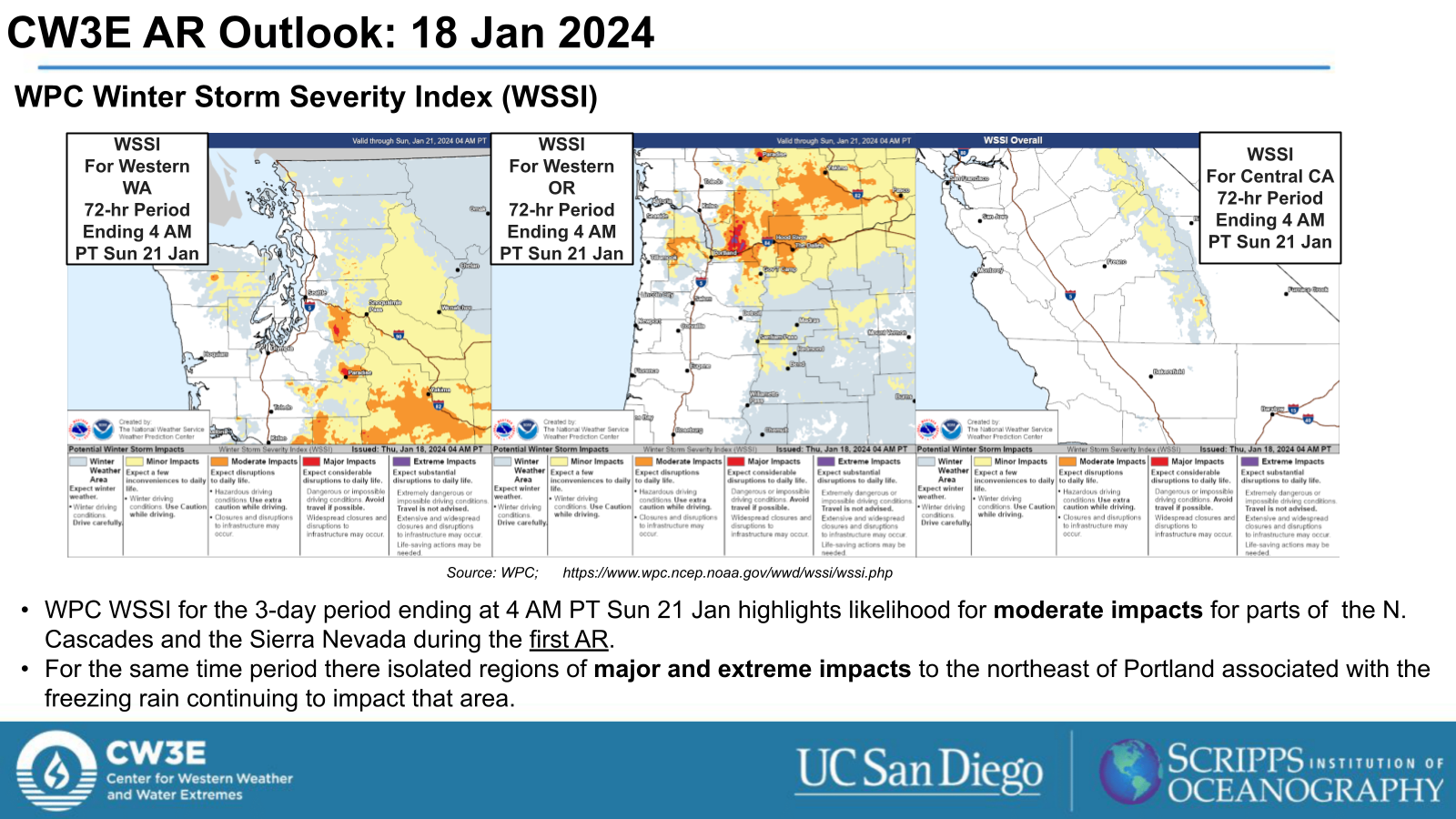
- The first AR is forecast to bring heavy precipitation to the PNW, including snowfall in the Northern Cascades and freezing rain in the Portland Metro area and regions along the WA/OR border through early Fri 19 Jan.
- The second AR period begins late Sun 20 Jan as a large AR begins to make landfall across the USWC.
- A potential third AR follows shortly behind with a short burst of IVT into the PNW on Tue 23 Jan.
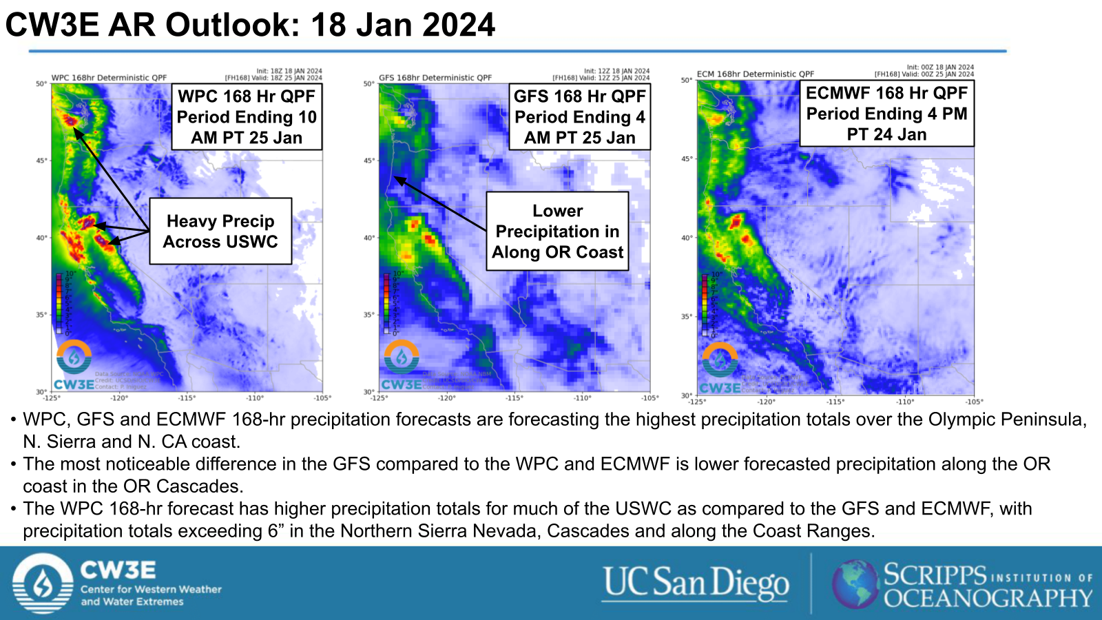
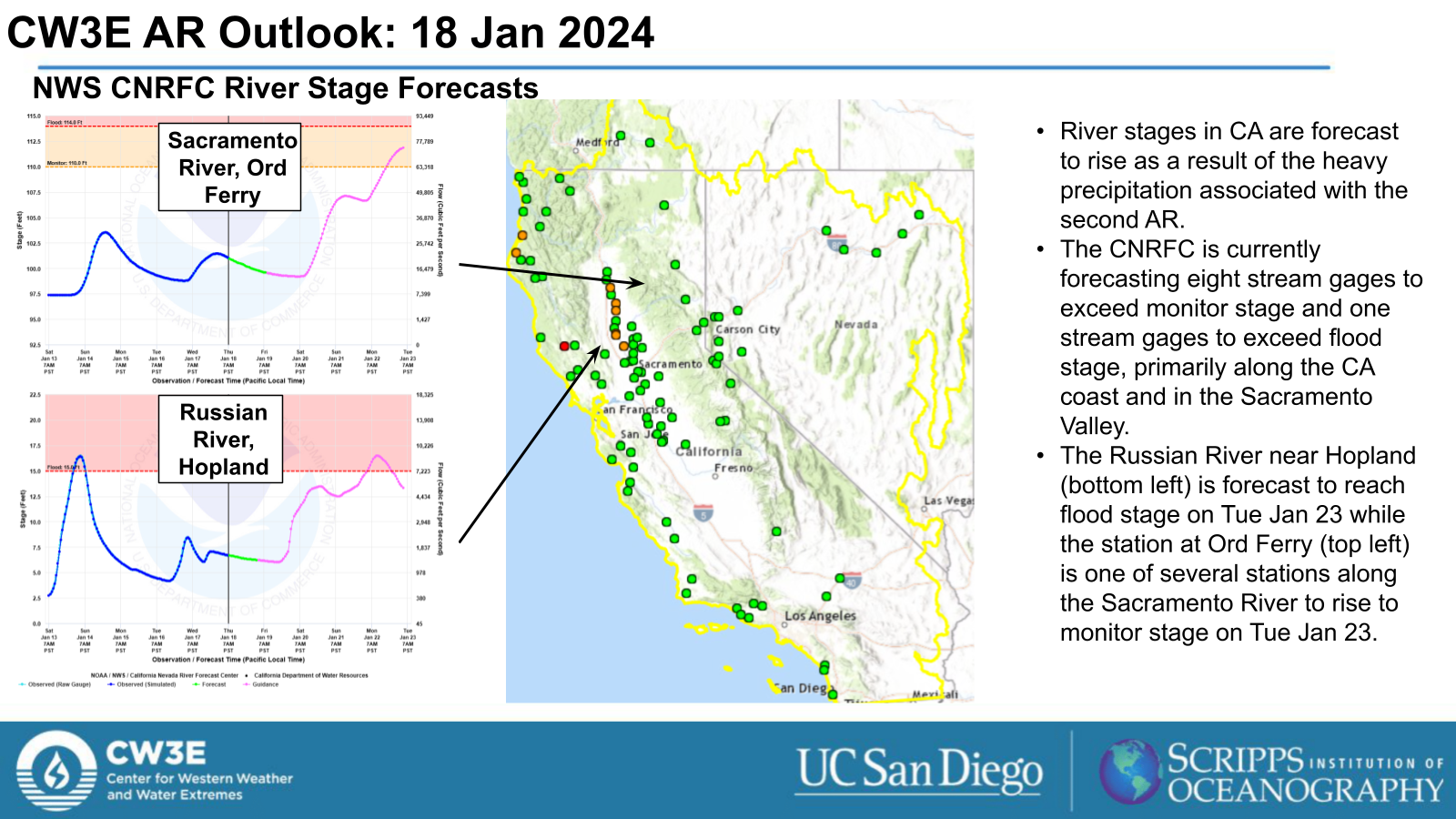
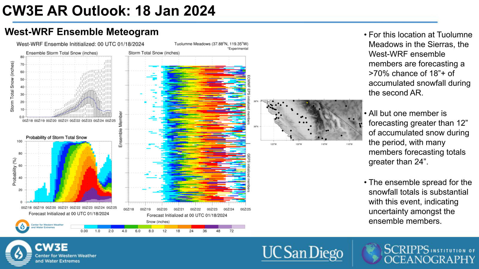
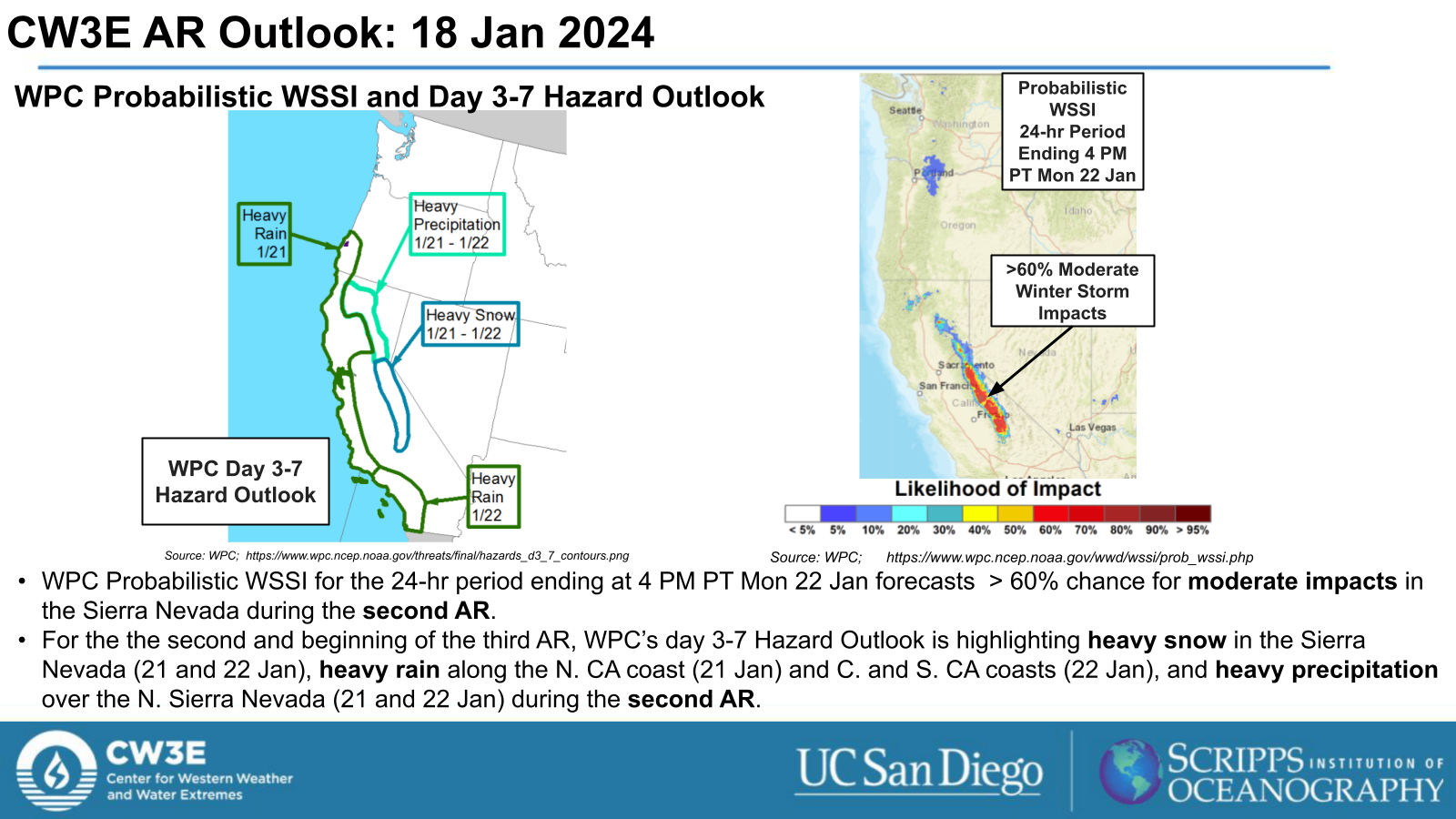
- The second and third ARs are forecast to bring precipitation to the USWC, with the heaviest precipitation expected from the second AR over the CA coast and in the Sierra Nevada, where heavy snowfall (>12”) is forecast through Tue 22 Jan.
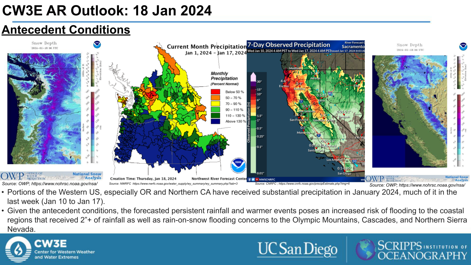
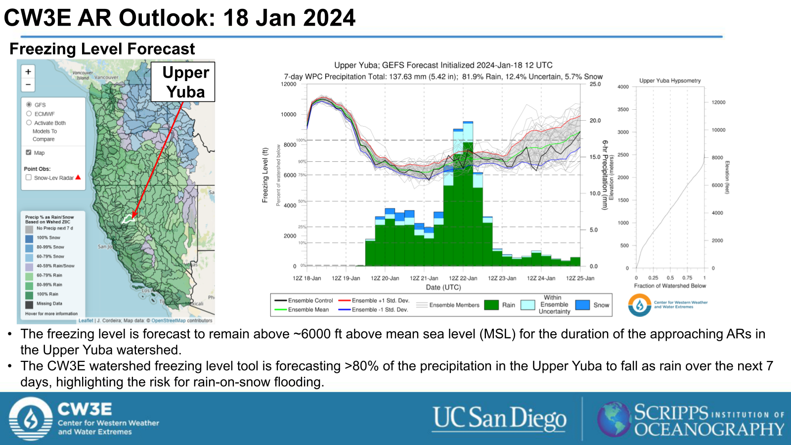
- Fresh snowpack and moist soils from previous events that impacted the USWC present the risk for rain-on-snow flooding.
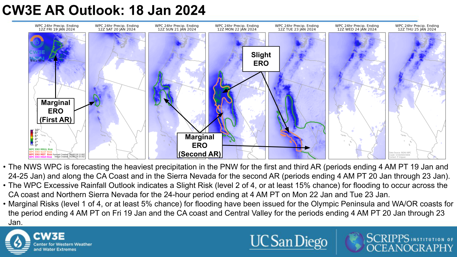
- The WPC Excessive Rainfall Outlook indicates a Slight Risk (level 2 of 4, or at least 15% chance) for flooding in days 4 and 5 (24-hour periods ending 4 AM PT Mon 22 Jan and Tue 23 Jan) for much of the CA coast.
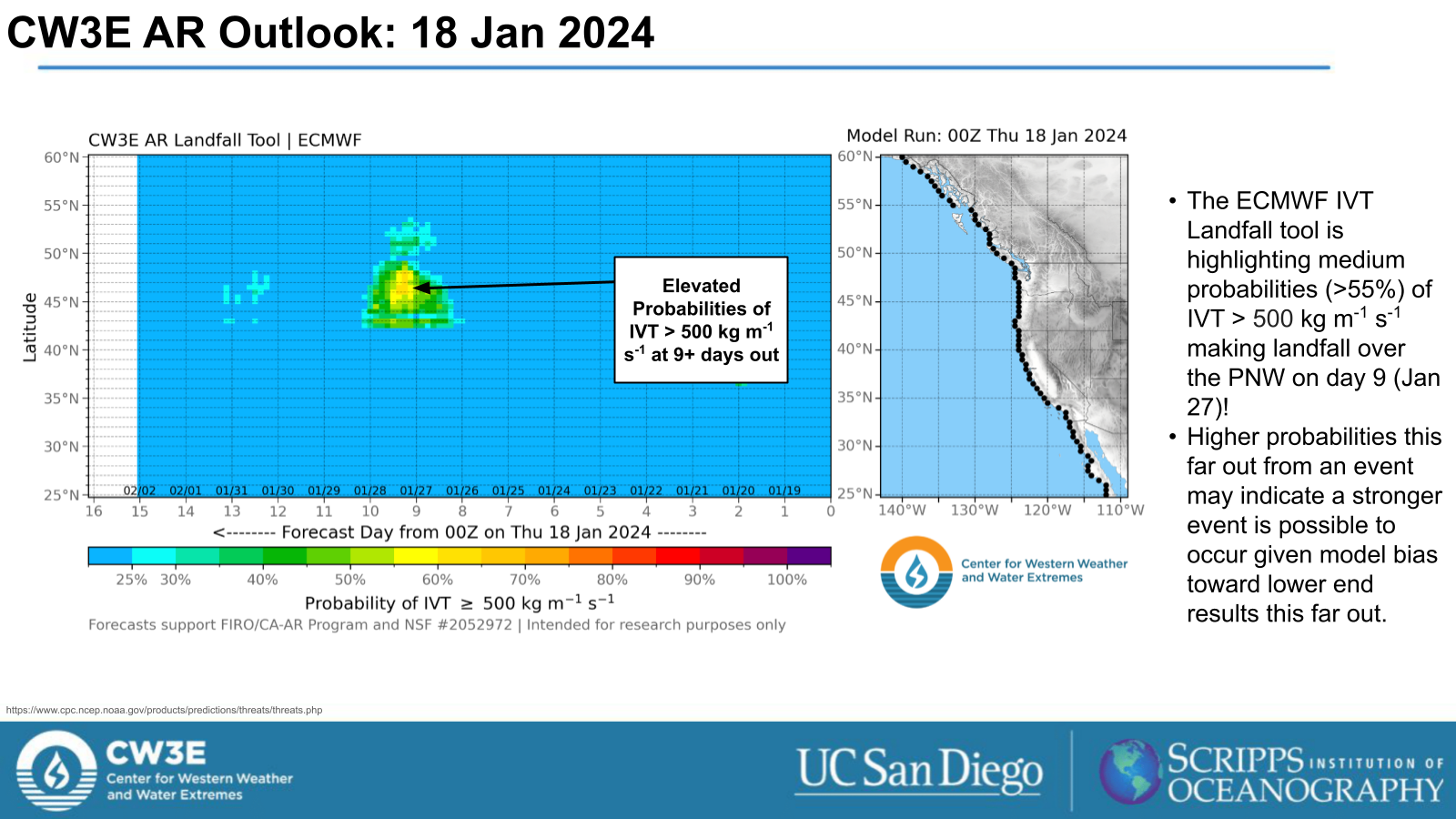
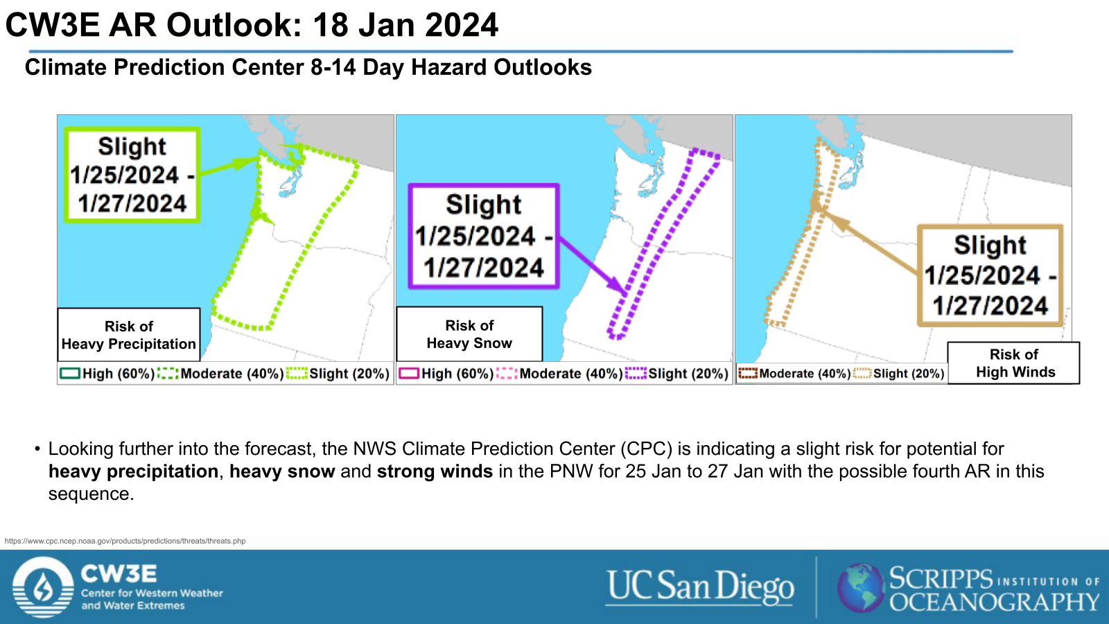
- There is potential for a fourth AR to make landfall in the PNW indicated by the ECMWF EPS. The Climate Prediction Center (CPC) has already indicated a slight risk for heavy precipitation, heavy snow, and high winds in the PNW for Jan 25-27 when it may make landfall.
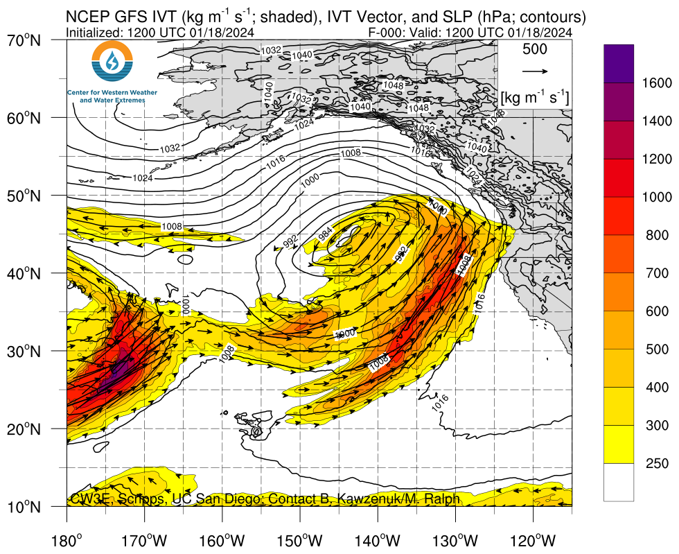
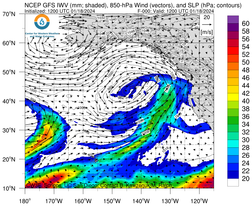
Click images to see loops of GFS IVT and IWV forecasts Valid 1200 UTC 18 January 2024 – 0000 UTC 25 January 2024 |
|
 |
 |
Summary provided by M. Steen, C. Castellano, S. Bartlett and P. Iniguez; 18 January 2024
To sign up for email alerts when CW3E post new AR updates click here.
*Outlook products are considered experimental

