CW3E AR Update: 20 December 2021 Outlook
December 20, 2021
Click here for a pdf of this information.
Atmospheric River Conditions are Forecast Over the US West Coast this Week with Heavy Precipitation in California
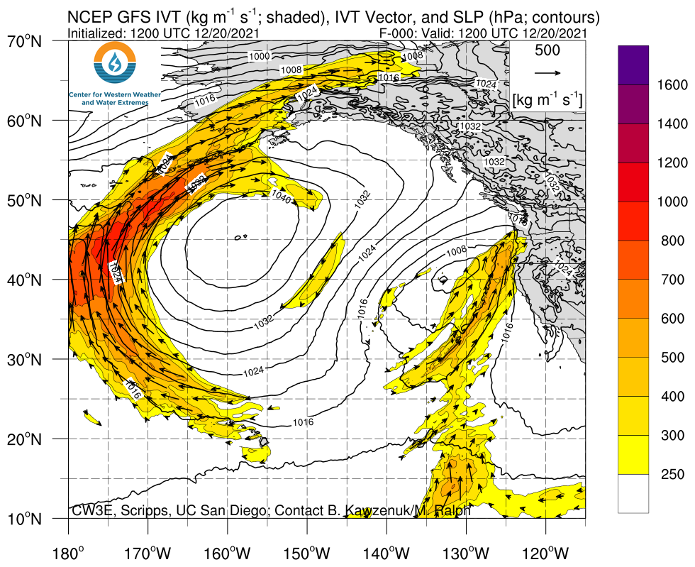
- AR activity is forecasted to bring stormy conditions from the Pacific Northwest to Baja California this week
- The current AR and its parent low continue to bring rain to parts of the Pacific Northwest through tomorrow afternoon
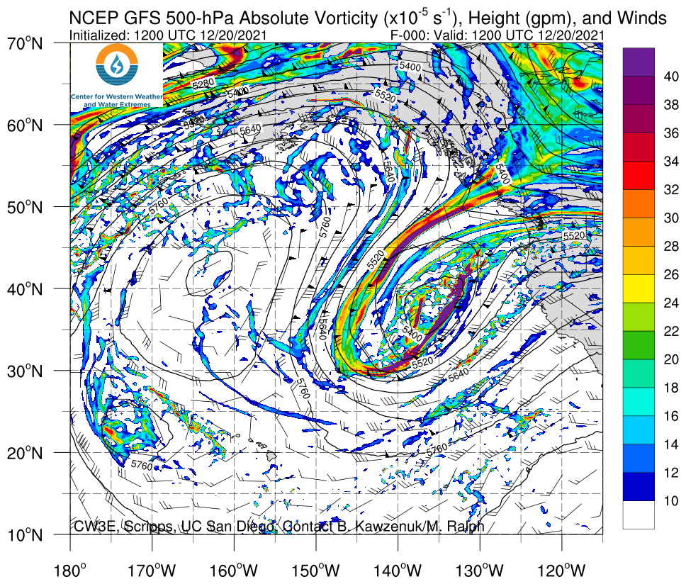
- The break will be short-lived though, as additional precipitation moves onshore in association with multiple shortwave troughs
- The trough associated with the current AR is expected to cut off from the main flow and weaken
- As it weakens, tropical moisture is exported towards Southern California and Baja California as part of the 2nd AR
- There is still considerable uncertainty in the timing, magnitude, and duration of AR conditions and precipitation
- The 12Z GEFS control member is forecasting AR 4 conditions for northern Baja California and AR 3 conditions in San Diego County
- Over the next seven days, the NWS Weather Prediction Center (WPC) is forecasting 5–10 inches of total precipitation (locally > 10 inches) over the Sierra Nevada and 1–3 inches of total precipitation over coastal Southern California, the Transverse Ranges, and the Peninsular Ranges
- Several feet of snow are possible in the Sierra Nevada
Click images to see loops of GFS IVT & 500-hPa vorticity forecasts Valid 1200 UTC 20 December – 0000 UTC 28 December 2021 |
|
 |
 |
Summary provided by S. Roj, C. Castellano, J. Kalansky, and F. M. Ralph; 20 December 2021
To sign up for email alerts when CW3E post new AR updates click here.
*Outlook products are considered
