CW3E AR Update: 22 February Outlook
February 22, 2019
Click here for a pdf of this information.
Multiple ARs Forecast to impact the USWC in the coming Week
- A shift into an active flow pattern may result in the landfall of successive atmospheric rivers starting this weekend
- The first AR is forecast to make landfall over Southern Oregon and propagate southward over Northern California on 2/25
- Cyclogenesis along the first AR will result in multiple pulses of enhanced IVT over the Coast and long duration of AR conditions
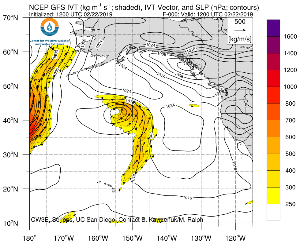
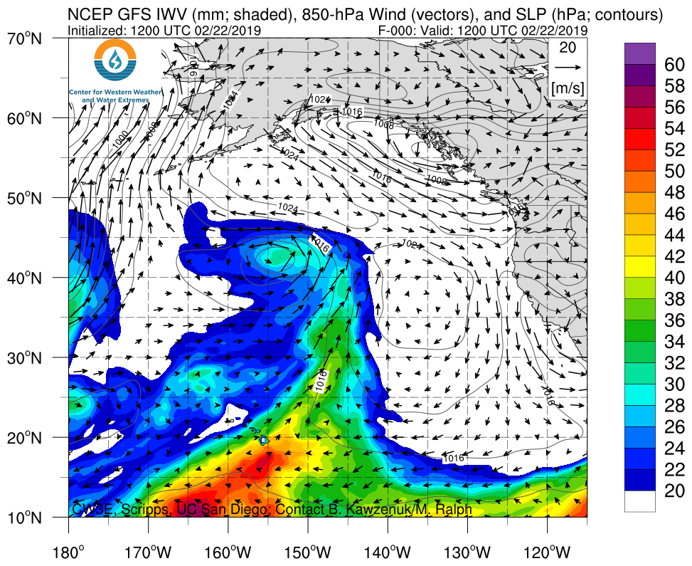
- A cyclone and concomitant AR is forecast to generate northeast of HI, propagate eastward, and make landfall over Northern California on 02 March 2019
- Forecast precipitation associated with the first AR could be as high as 4 inches over the Coastal Mountains of Southern Oregon and Northern California
- 7-day WPC precipitation forecasts are currently as high as 10 inches over Southern Oregon and Northern California in association with both landfalling ARs
- The GEFS is currently suggesting the possible landfall of a third AR between 11 and 13 March 2019
Click IVT or IWV image to see loop of 0-180 hour GFS forecasts Valid 1200 UTC 22 February – 1200 UTC 2 March 2019 |
|
 |
 |
Summary provided by C. Hecht, B.Kawzenuk, J. Kalansky, F. M. Ralph; 3 PM PT 22 February 2019
