CW3E AR Update: 23-25 December 2016 Outlook
December 22, 2016
Click here for a pdf of this information.
- Precipitation accumulations of 1–2 inches from a separate system have primed conditions in southern CA and may combine with precipitation from the expected event to cause the San Diego River to briefly rise above monitor stage
- Freezing levels are forecast to be 4,000–5,000 over southern CA, which could lead to freezing precipitation over higher elevations
|
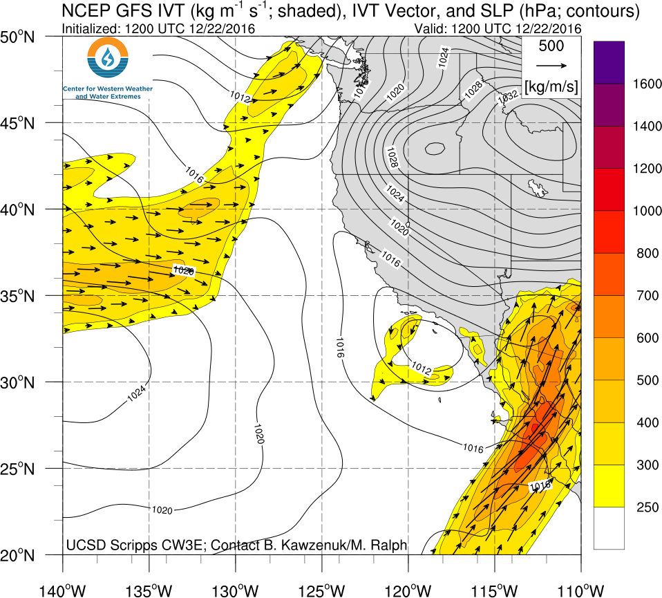
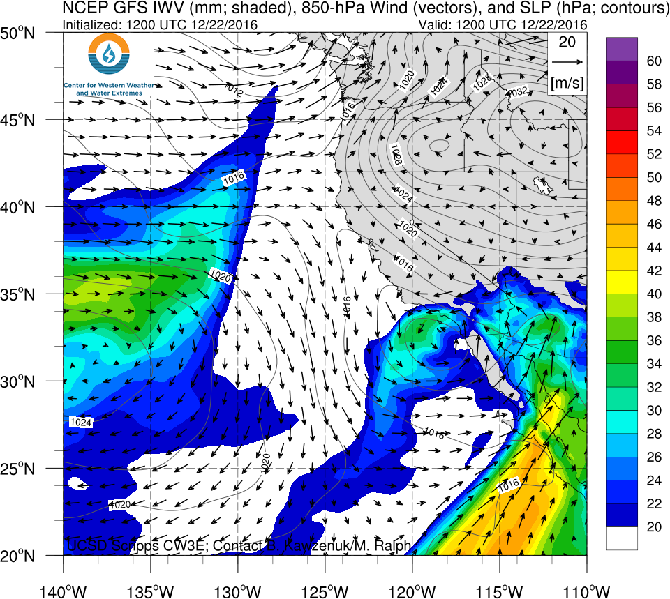
System to Bring Precipitation to CA
- A system is expected to bring precipitation accumulations of 1–3 inches to most of California
- While this event is forecast to have characteristics of an AR (IVT >250 kg/m/s), it does not have the spatial structure of an AR (long and narrow)
Click IVT or IWV image to see loop of 0-60 hour GFS forecast (Valid 1200 UTC 22 Dec – 0000 UTC 25 Dec)
|
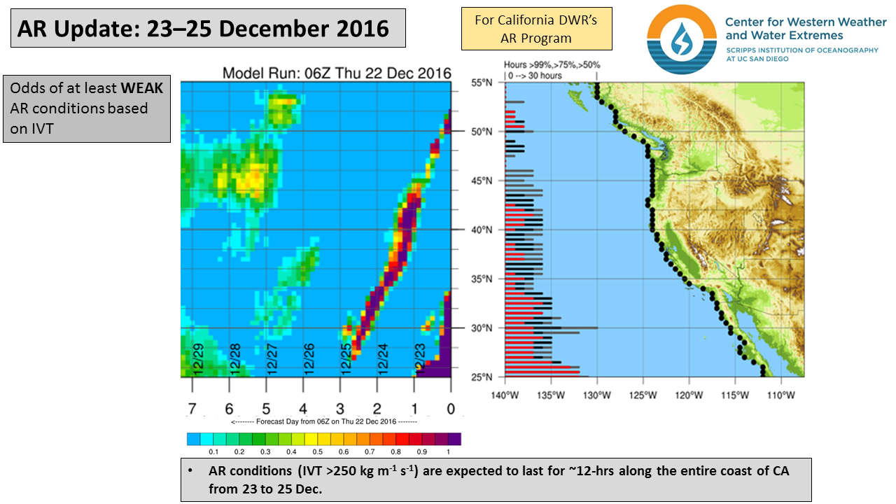


Summary provided by C. Hecht, B. Kawzenuk, and F.M. Ralph; 1 PM PT Thurs 22 Dec. 2016
