CW3E AR Update: 24 September 2020 Outlook
September 24, 2020
Click here for a pdf of this information.
Update on Active Period of Atmospheric Rivers over the Pacific Northwest
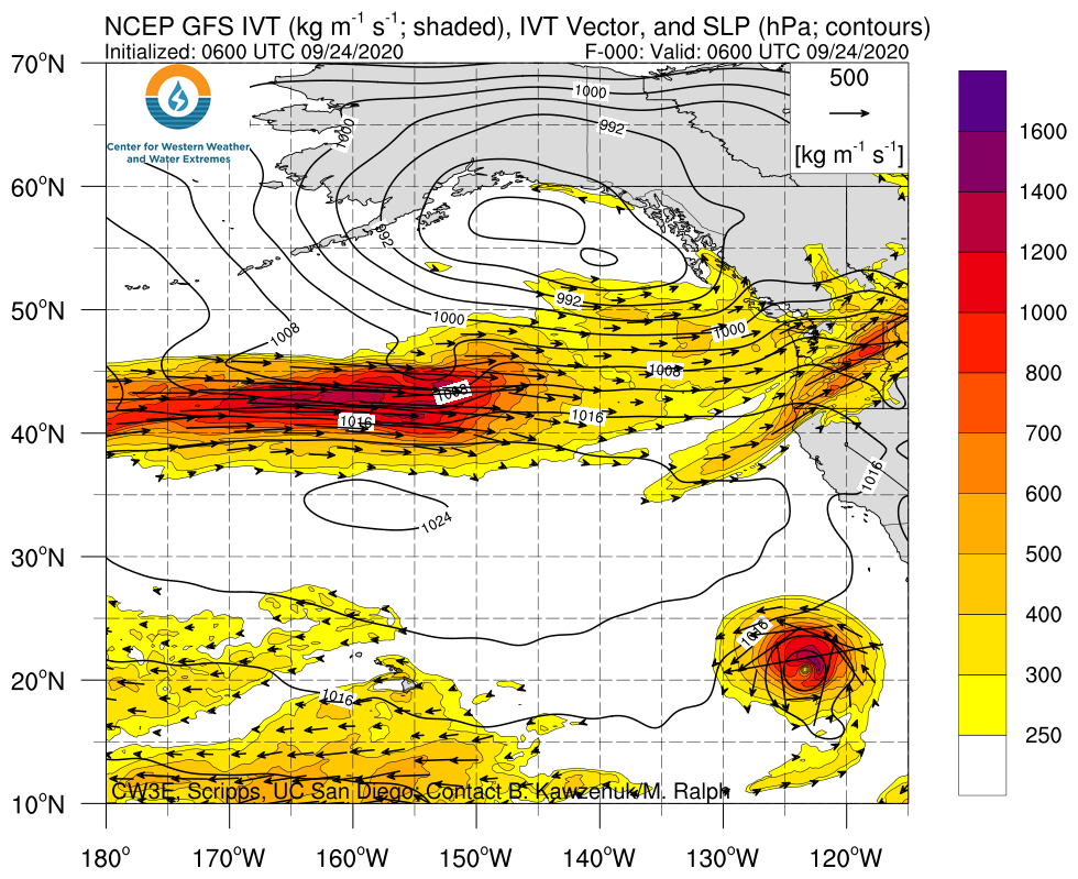
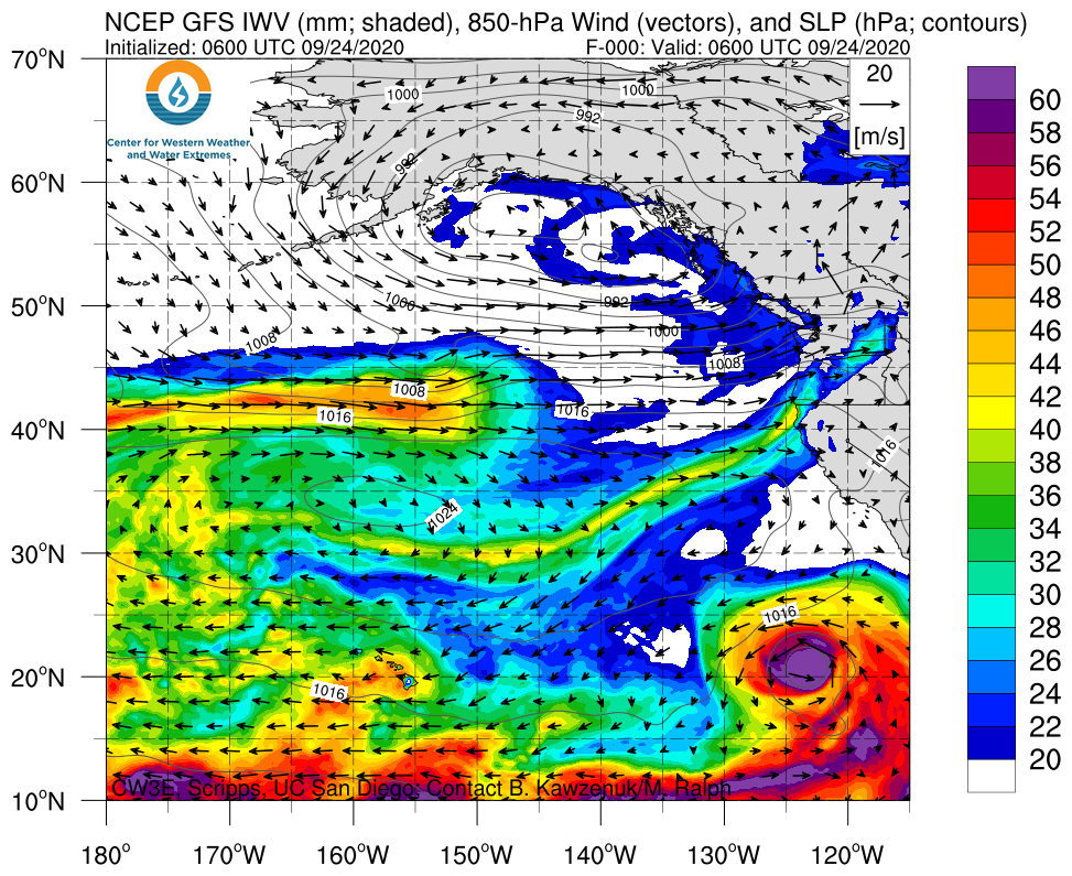
- As an AR is currently impacting the Pacific Northwest, two additional ARs are forecast to bring precipitation to the region and British Columbia
- Current forecasts suggest that IVT magnitudes over northern Oregon may not drop below 250 kg m–1 s–1, which would result in total AR condition duration of ~75 hours
- The combination of strong IVT magnitudes and long durations results in an AR 5 on the AR Scale (Ralph et al. 2019)
- Since this is an early season AR and soil moisture across the PNW is dry, impacts associated with these ARs may not be as hazardous as an AR of similar strength that makes landfall in the middle of winter
- As much as 7 inches of precipitation has already fallen over the Cascade Mountains of northern Washington and an additional 4–5 inches is forecast to fall during the next period of AR activity
GOES-17 PACUS Domain GeoColor
Valid 0000 UTC 22 September – 1200 UTC 24 September 2020
Click images to see loops of GFS IVT/IWV analyses and forecasts Valid 1200 UTC 24 September – 1200 UTC 04 October 2020 Forecasting an active week of ARs in the PNW |
|
 |
 |
Summary provided by C. Hecht, B. Kawzenuk, J. Kalansky, and F. M. Ralph; 21 September 2020
*Outlook products are considered experimental

