CW3E AR Update: 26 February 2024 Outlook
February 26, 2024
Click here for a pdf of this information.
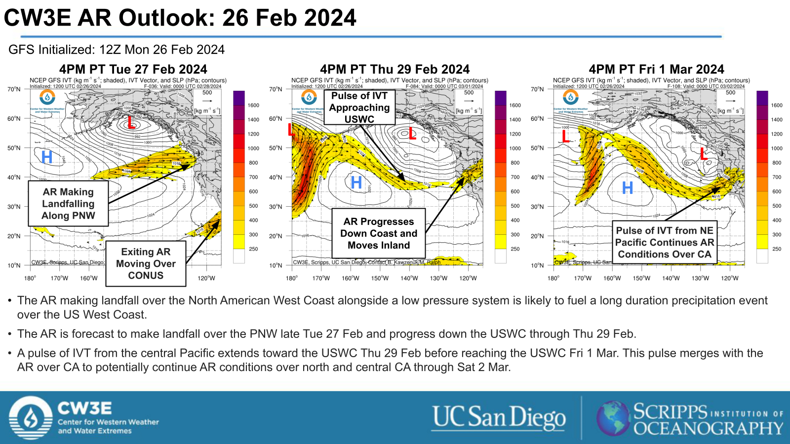
AR and Low Pressure System Fuel Precipitation Event Over USWC
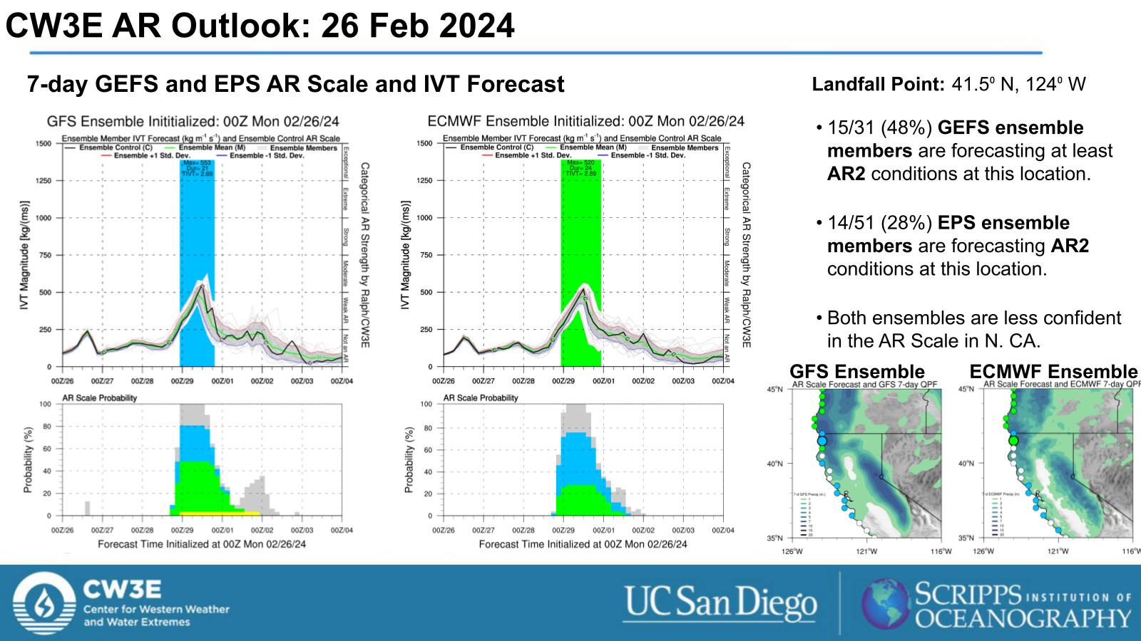
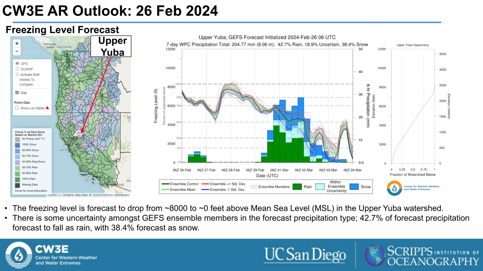
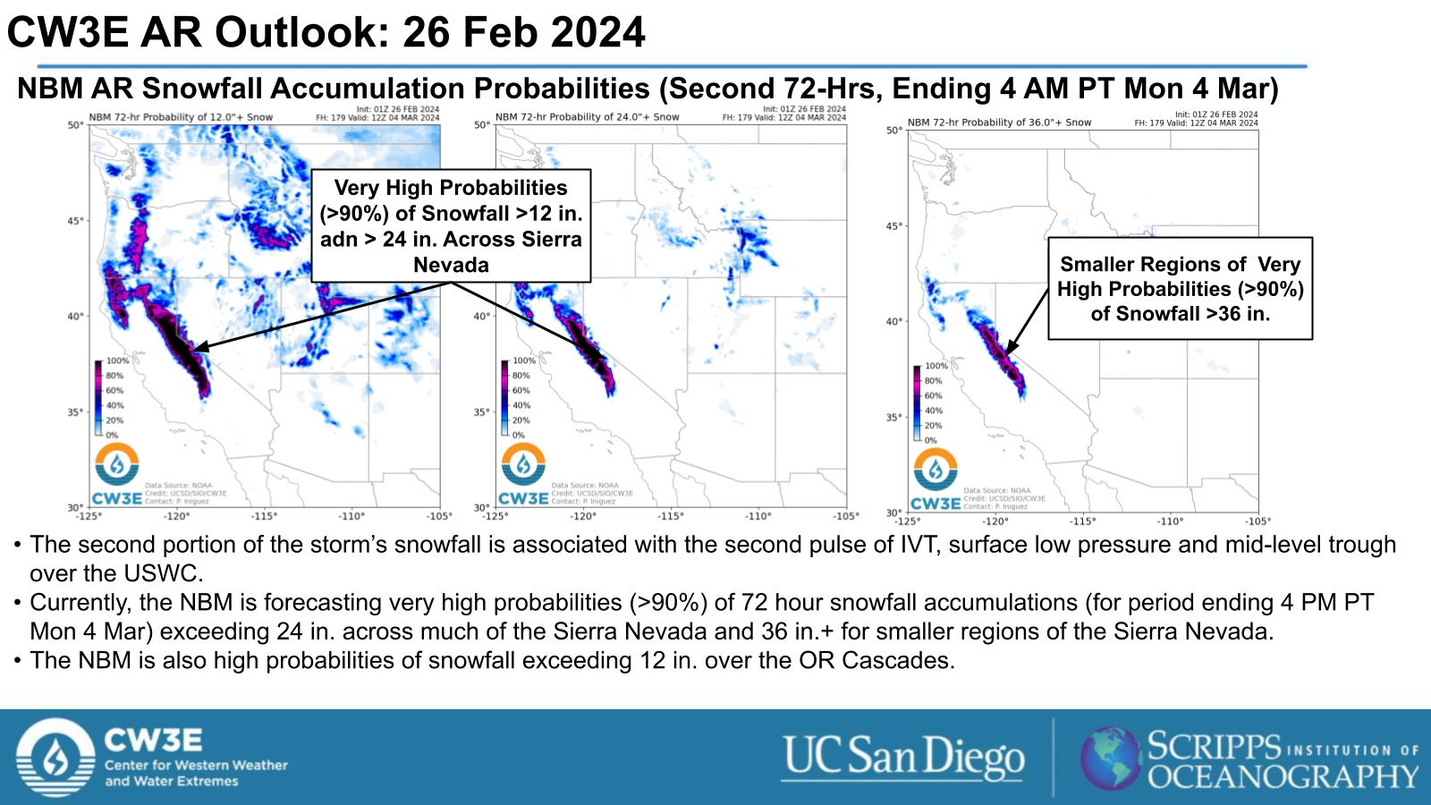
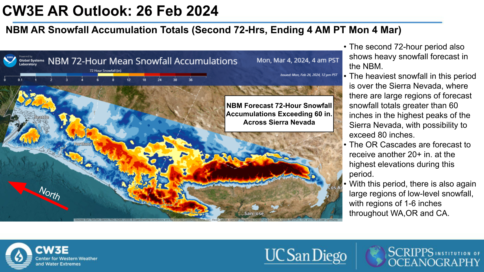
- An atmospheric river (AR) and low pressure system forecast to make landfall over the USWC will help fuel a multi-day precipitation event that is likely to bring heavy snowfall to the Cascades and Sierra Nevada.
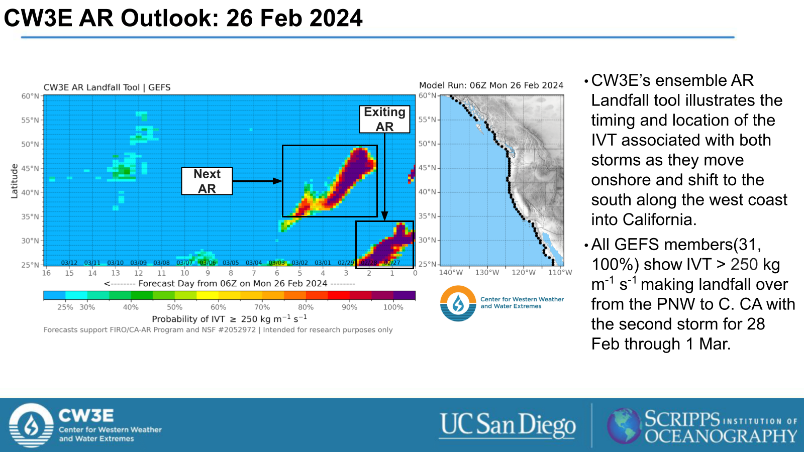
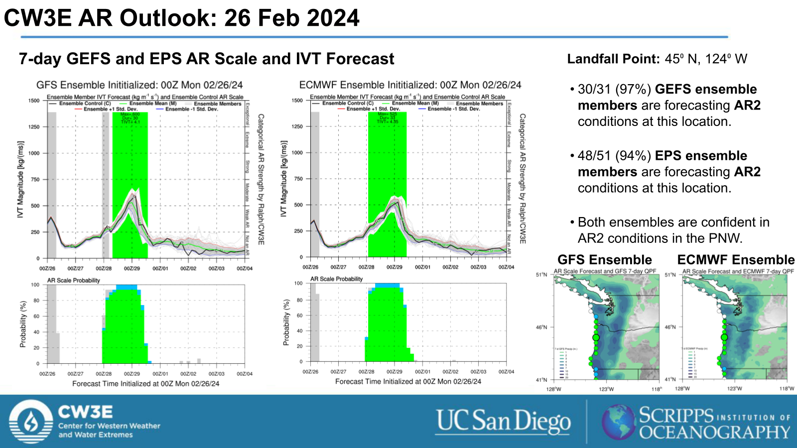
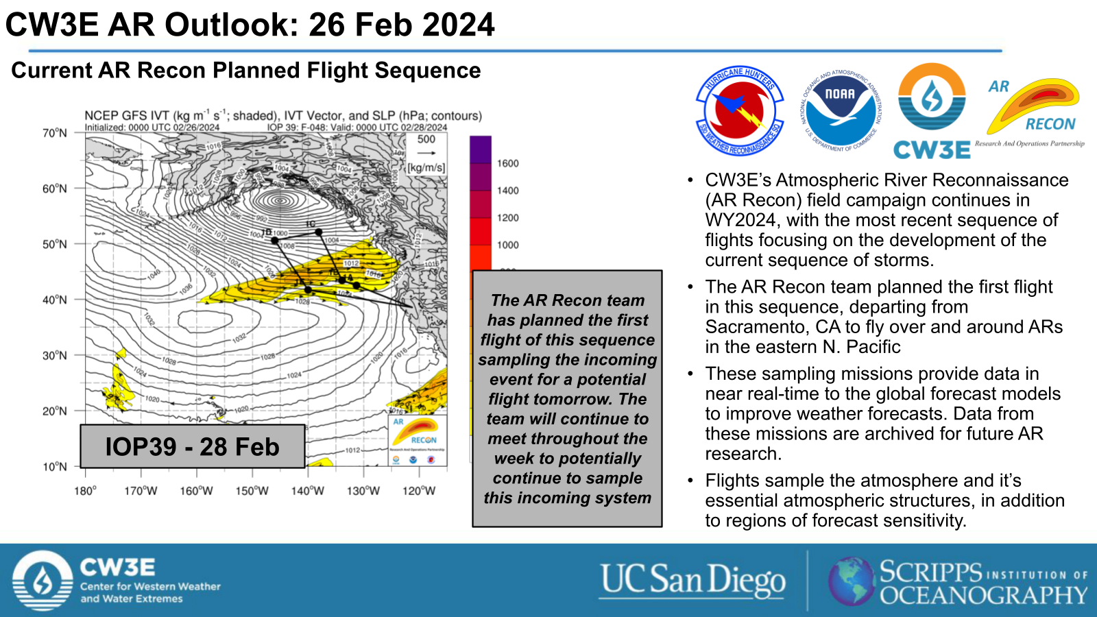
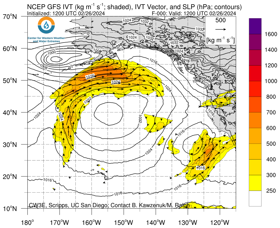
- The AR makes landfall over the PNW late on Tue 27 Feb and moves down the USWC through Fri 1 Mar.
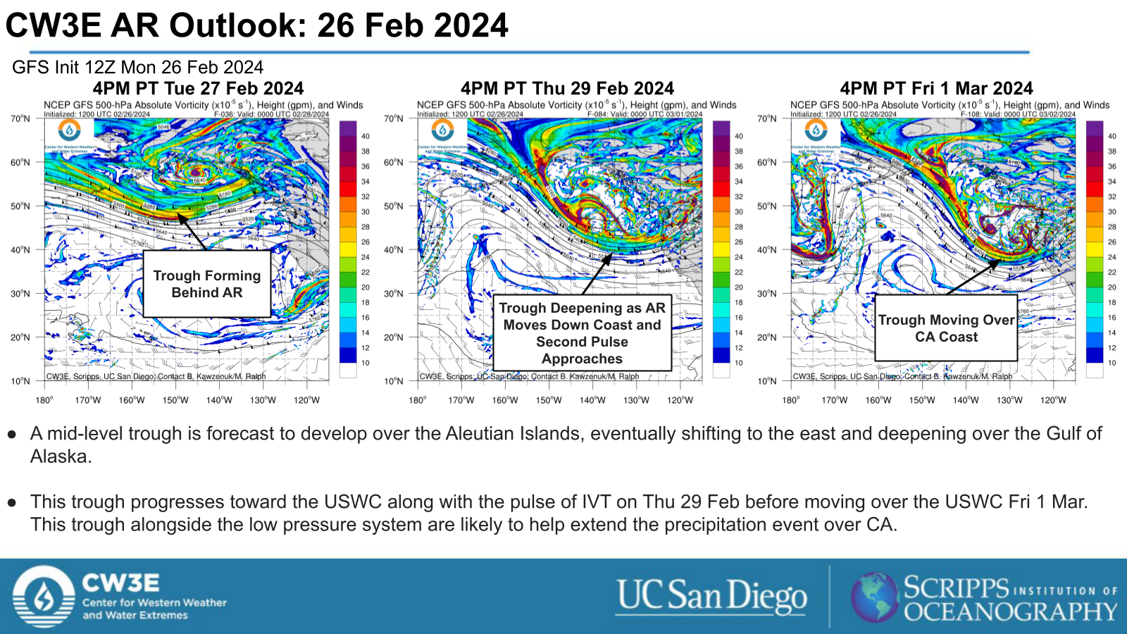
- There is potential for a pulse of IVT from the central Pacific to reach the USWC and extend AR conditions over northern and central CA when it interacts with AR.
- Behind this AR, the associated low pressure system and a mid-level trough will help continue this precipitation event over CA through Sun 3 Mar.
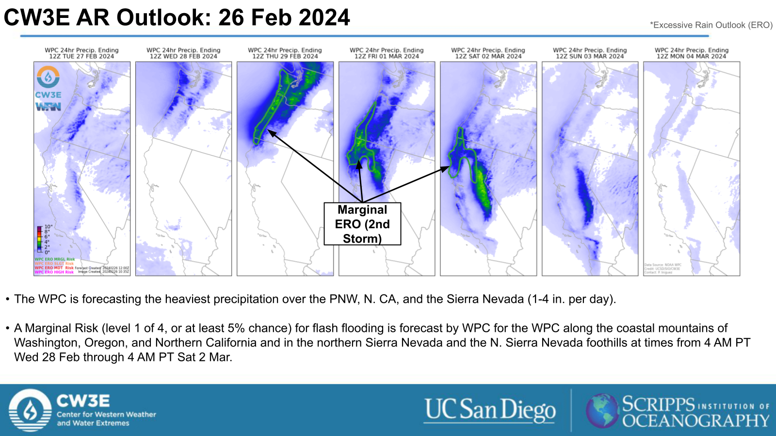
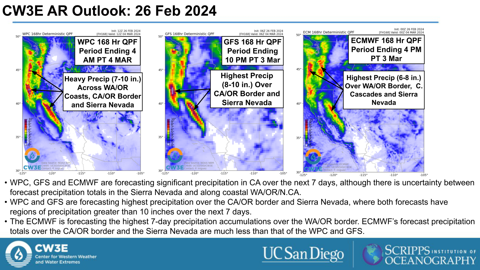
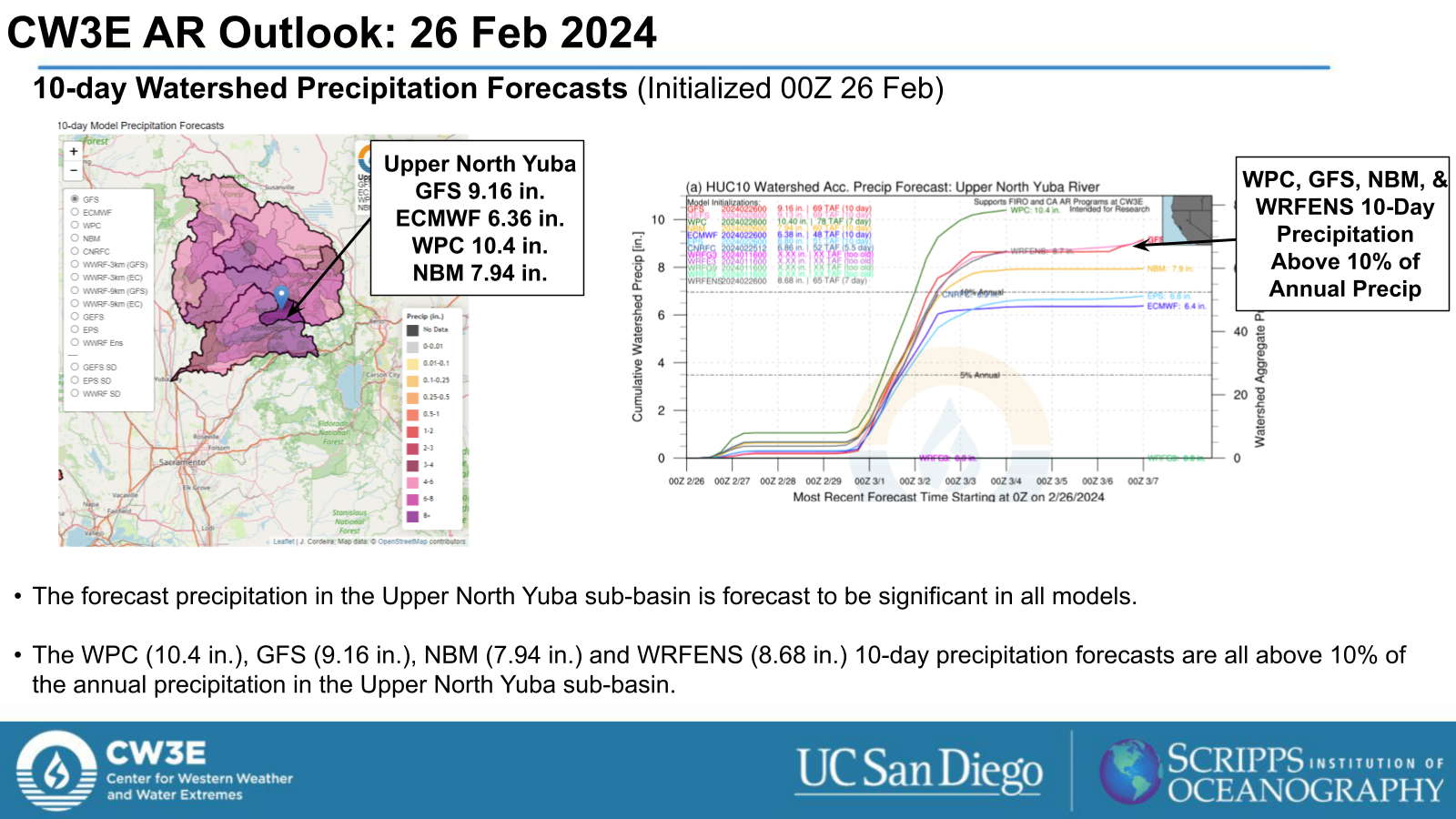
- The NWS Weather Prediction Center (WPC) is forecasting significant precipitation over the next 7 days along the WA/OR coasts and OR/CA border and over the Cascades and Sierra Nevada.
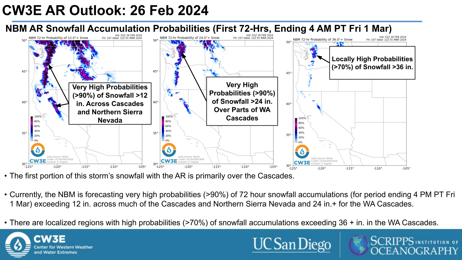
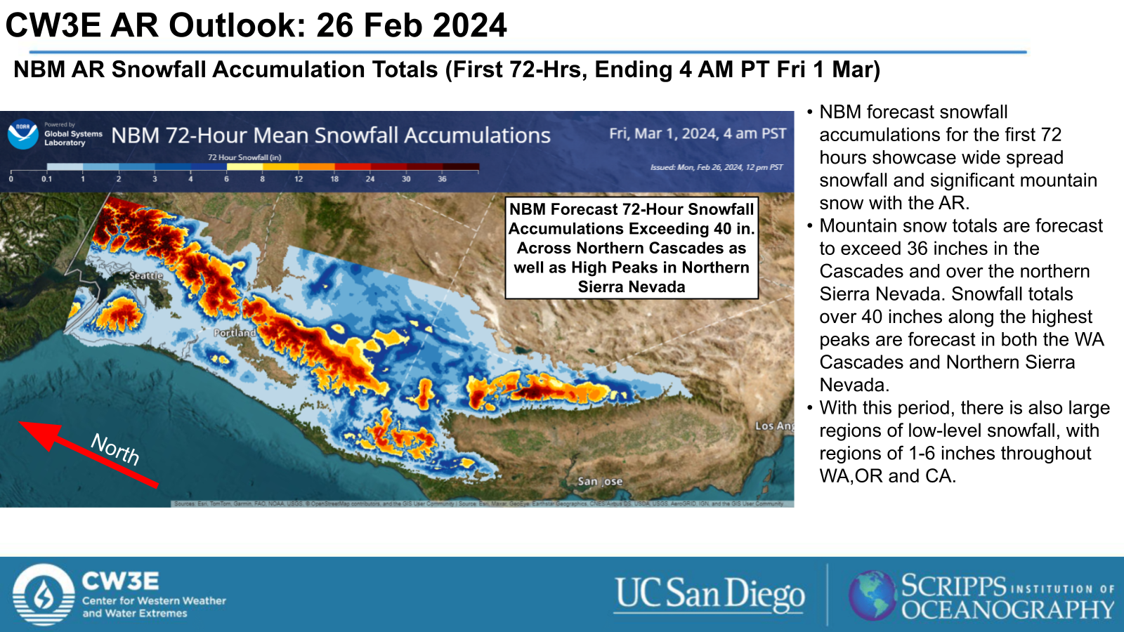
- The National Blend of Models (NBM) showing very high probabilities (>90%) of snowfall exceeding 36+ in. for portions of the Cascades and Sierra Nevada.
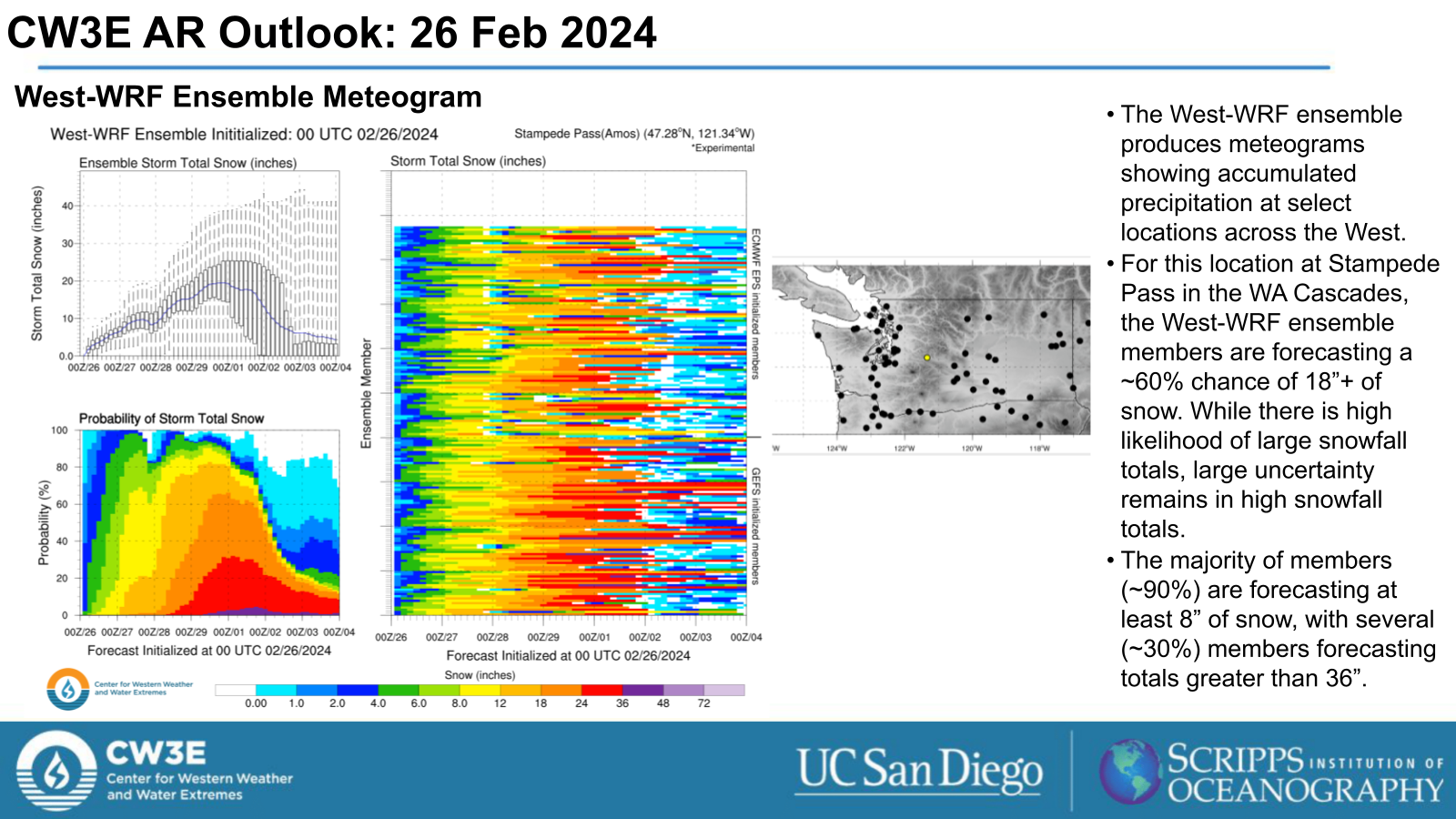
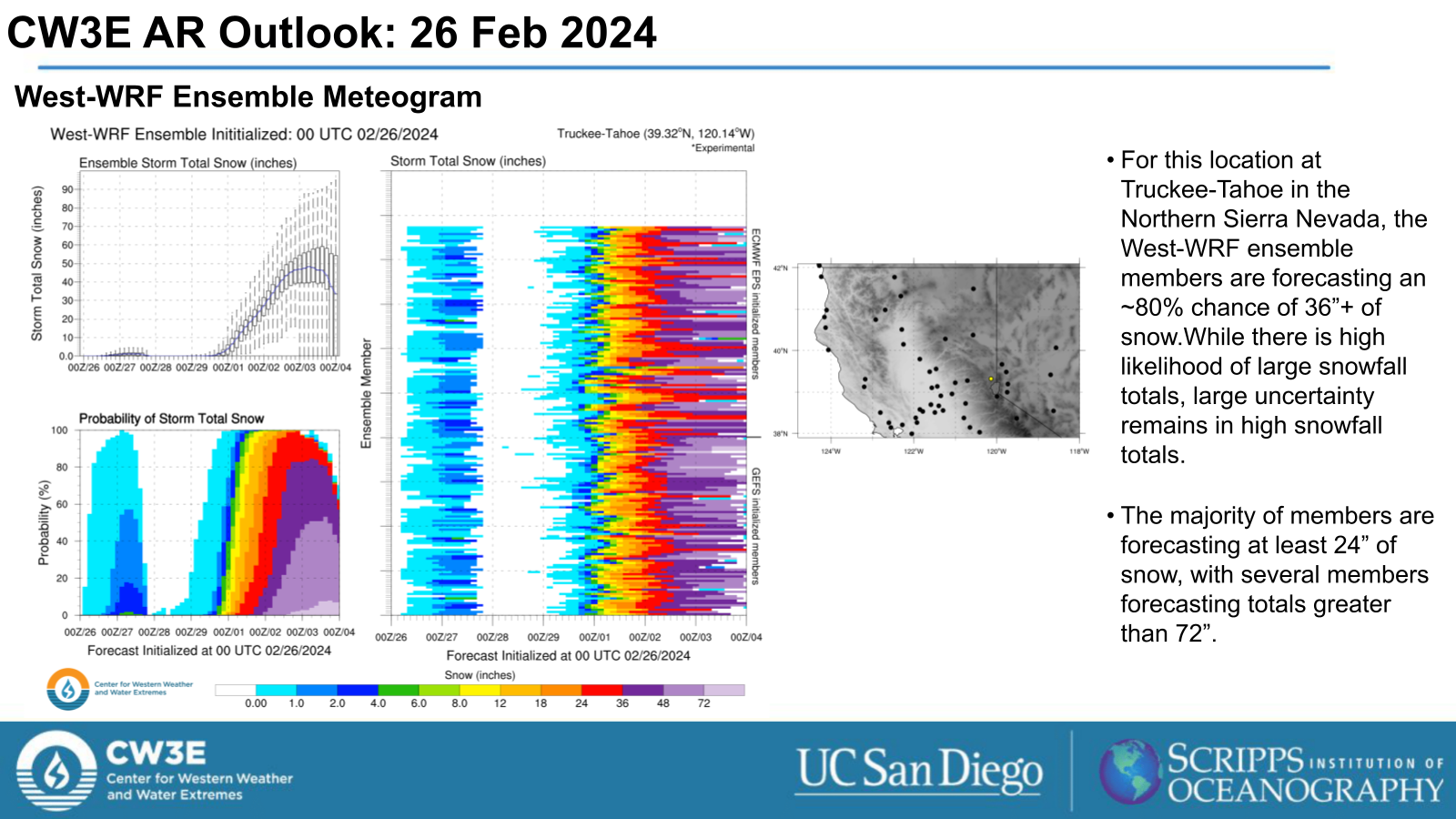
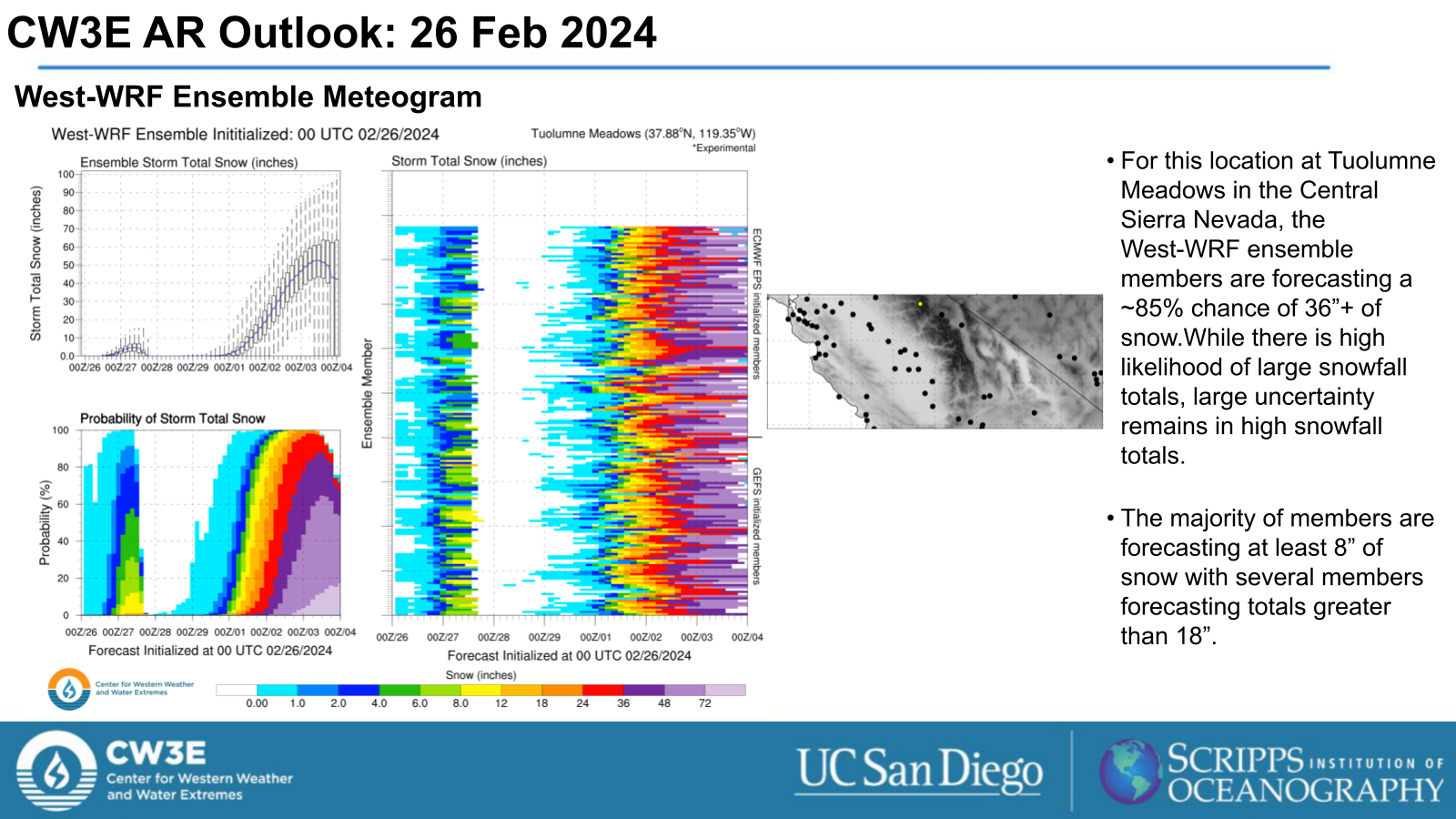
- West-WRF Ensemble Meteograms are also showing very high probabilities of significant snowfall (totals > 24 in.) in the Sierra Nevada.
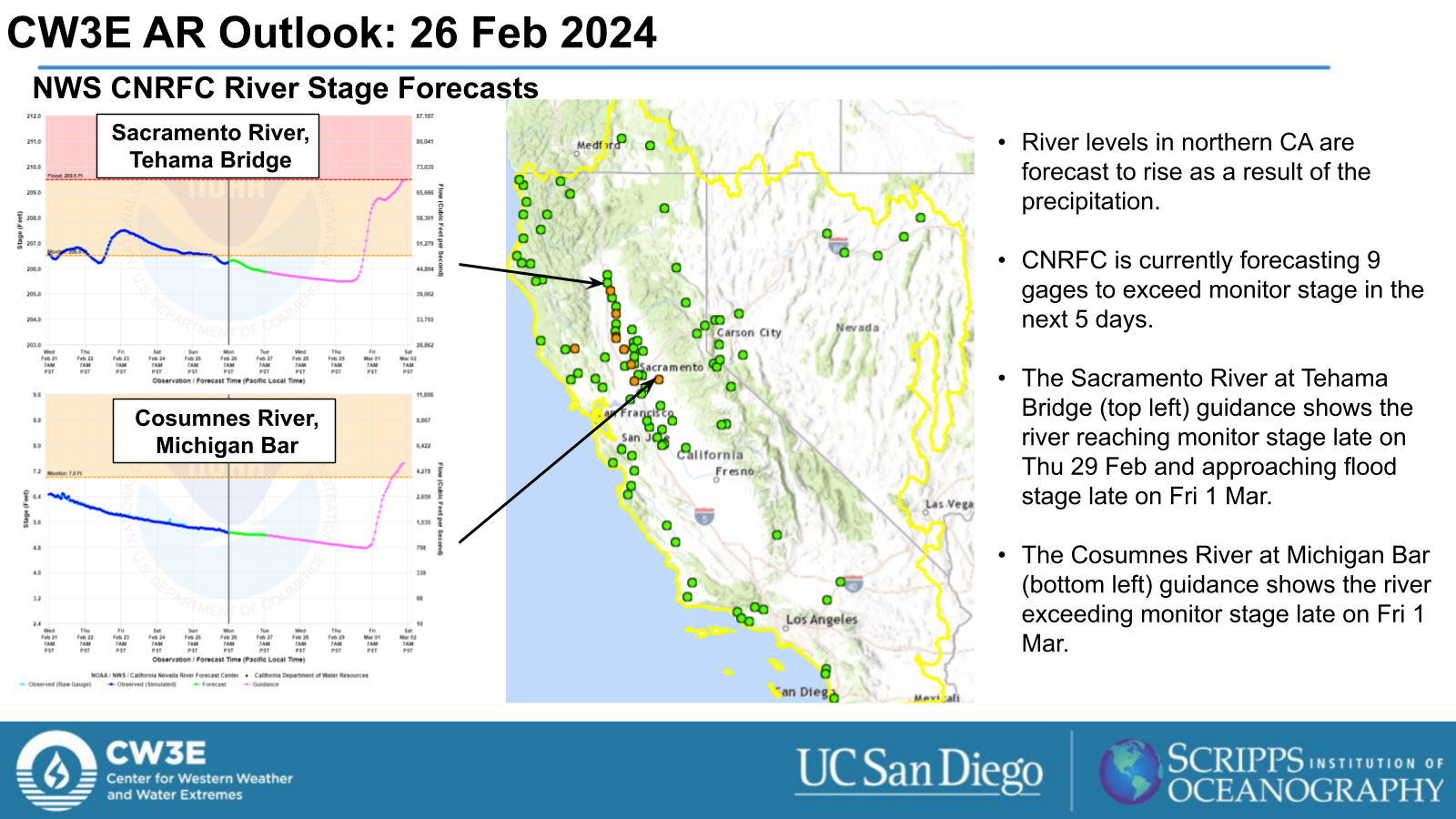
- The WPC Excessive Rainfall Outlooks include a Marginal Risk (level 1 of 4, or at least 5% chance) for flooding for the WA/OR/N. CA coasts and the N. Sierra Nevada with the the AR as it moves down the coast.
- Stay alert to official NWS forecasts, watches, and warnings at weather.gov and follow guidance from local emergency management officials.
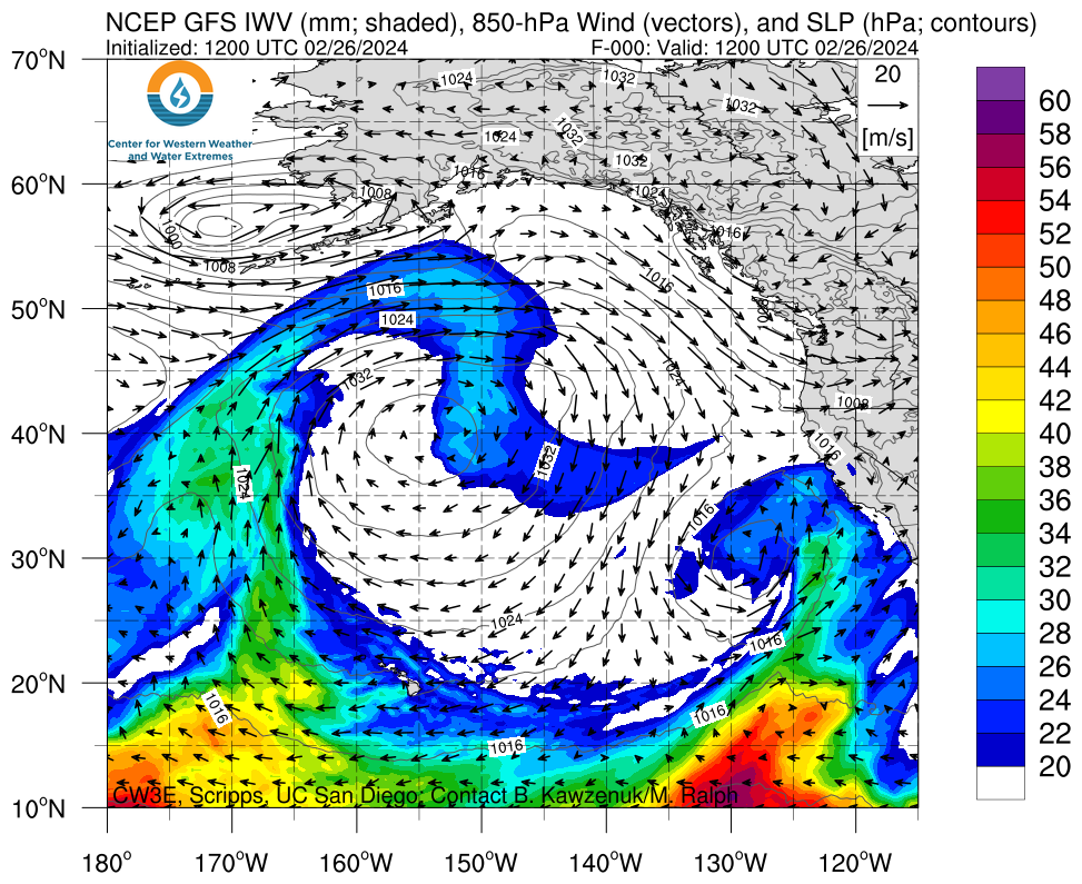
Click images to see loops of GFS IVT and IWV forecasts Valid 1200 UTC 26 February 2024 – 0000 UTC 3 March 2024 |
|
 |
 |
Summary provided by M. Steen, P. Iniguez, S. Bartlett and G. Lewis; 26 February 2024
To sign up for email alerts when CW3E post new AR updates click here.
*Outlook products are considered experimental
For any unfamiliar terms, please refer to the American Meteorological Society Glossary.

