CW3E AR Update: 27 December 2023 Outlook
December 27, 2023
Click here for a pdf of this information.
Pair of Atmospheric Rivers Forecast to Make Landfall along US West Coast
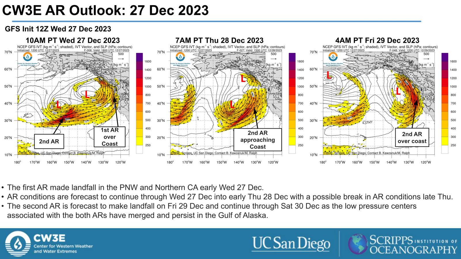
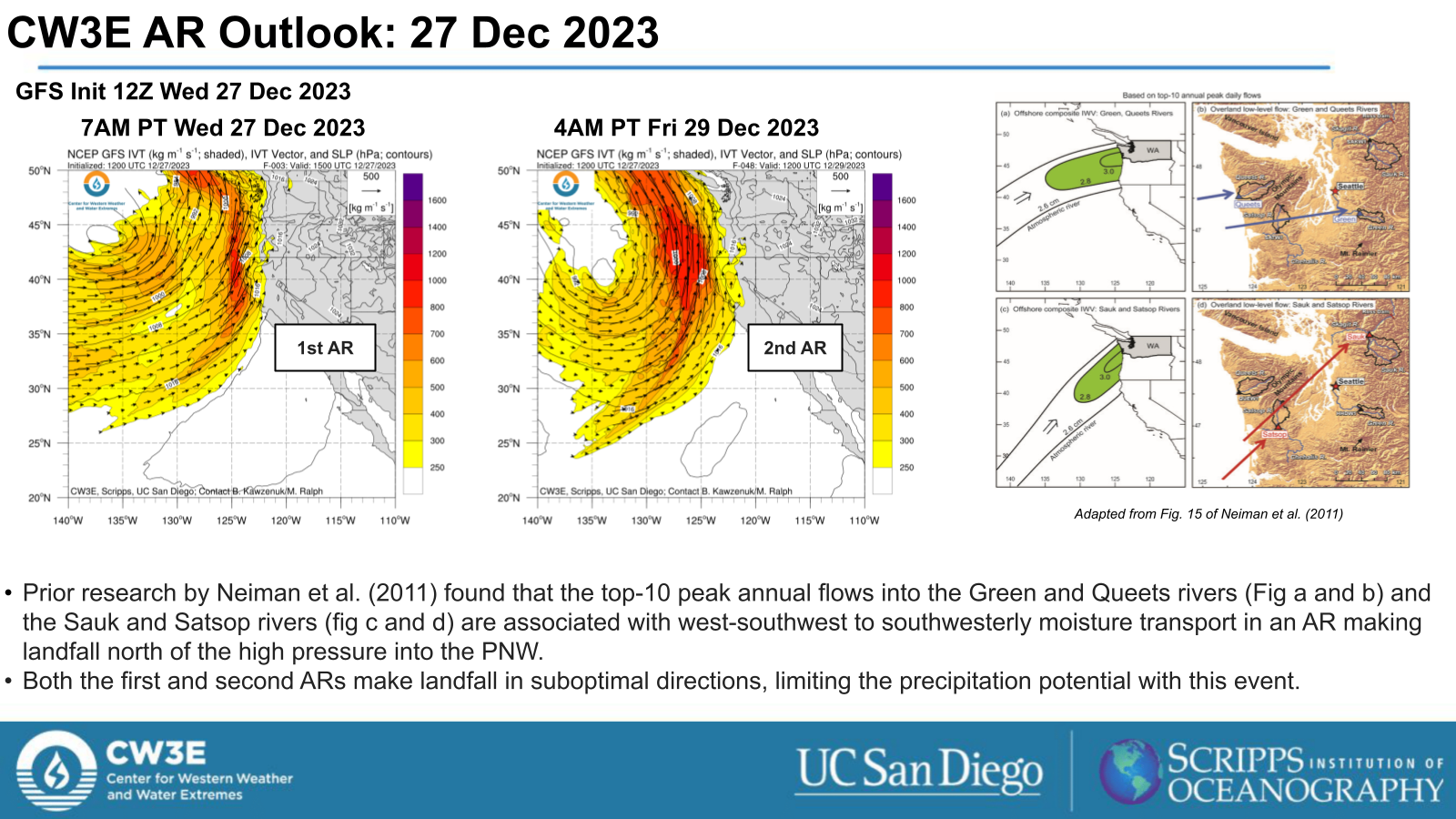
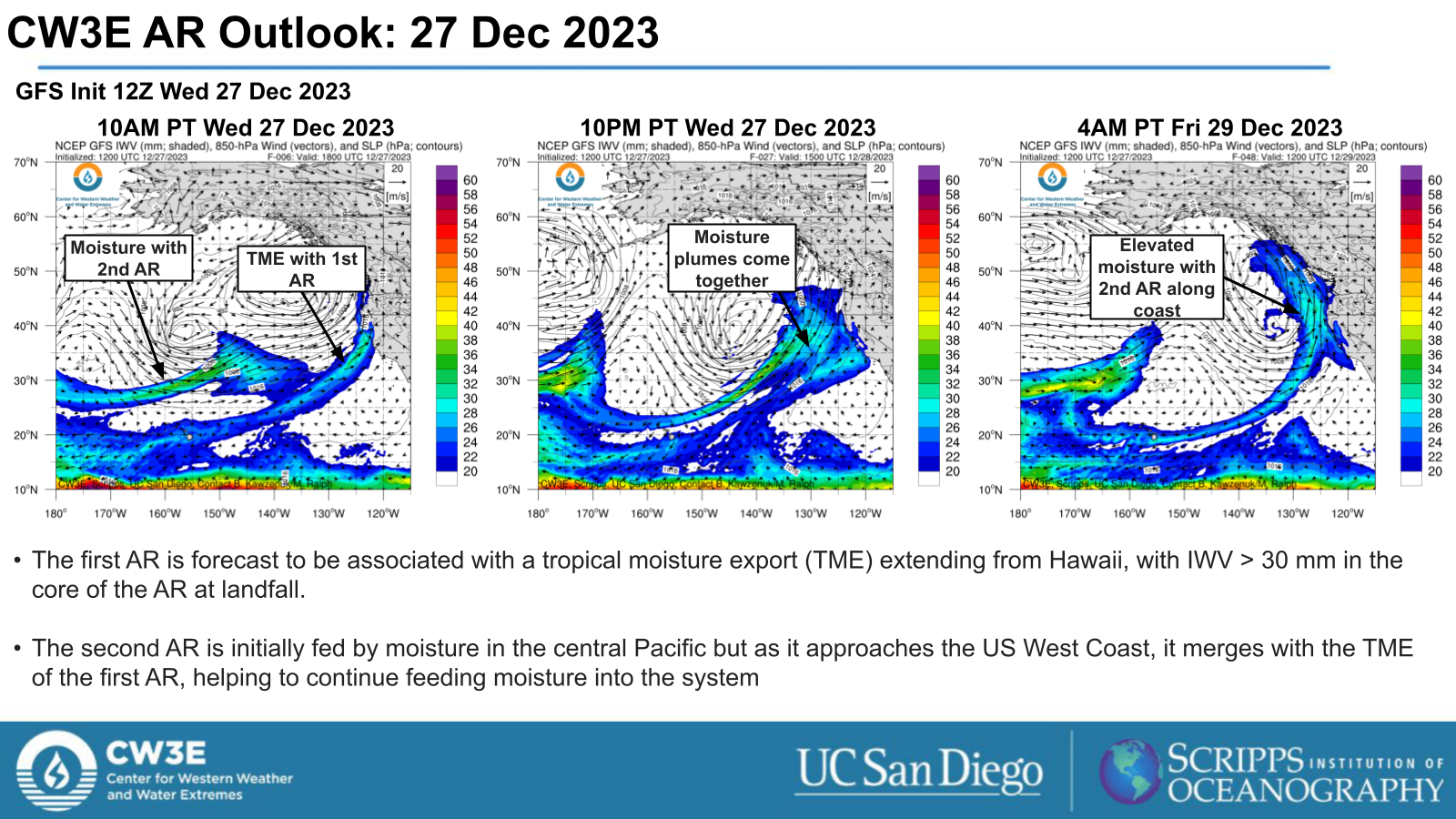
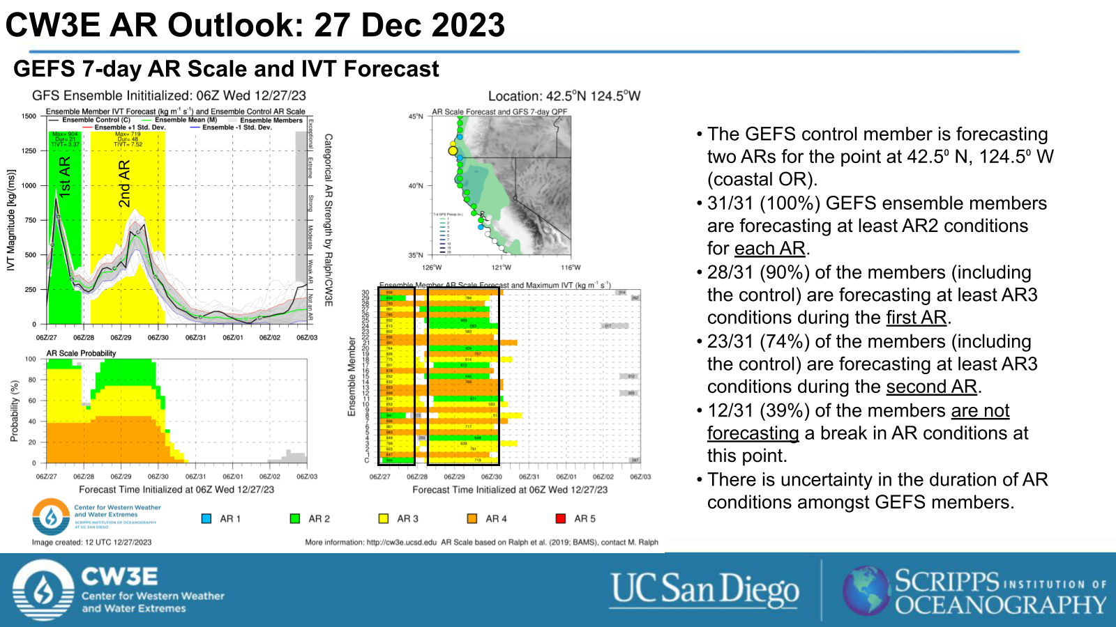
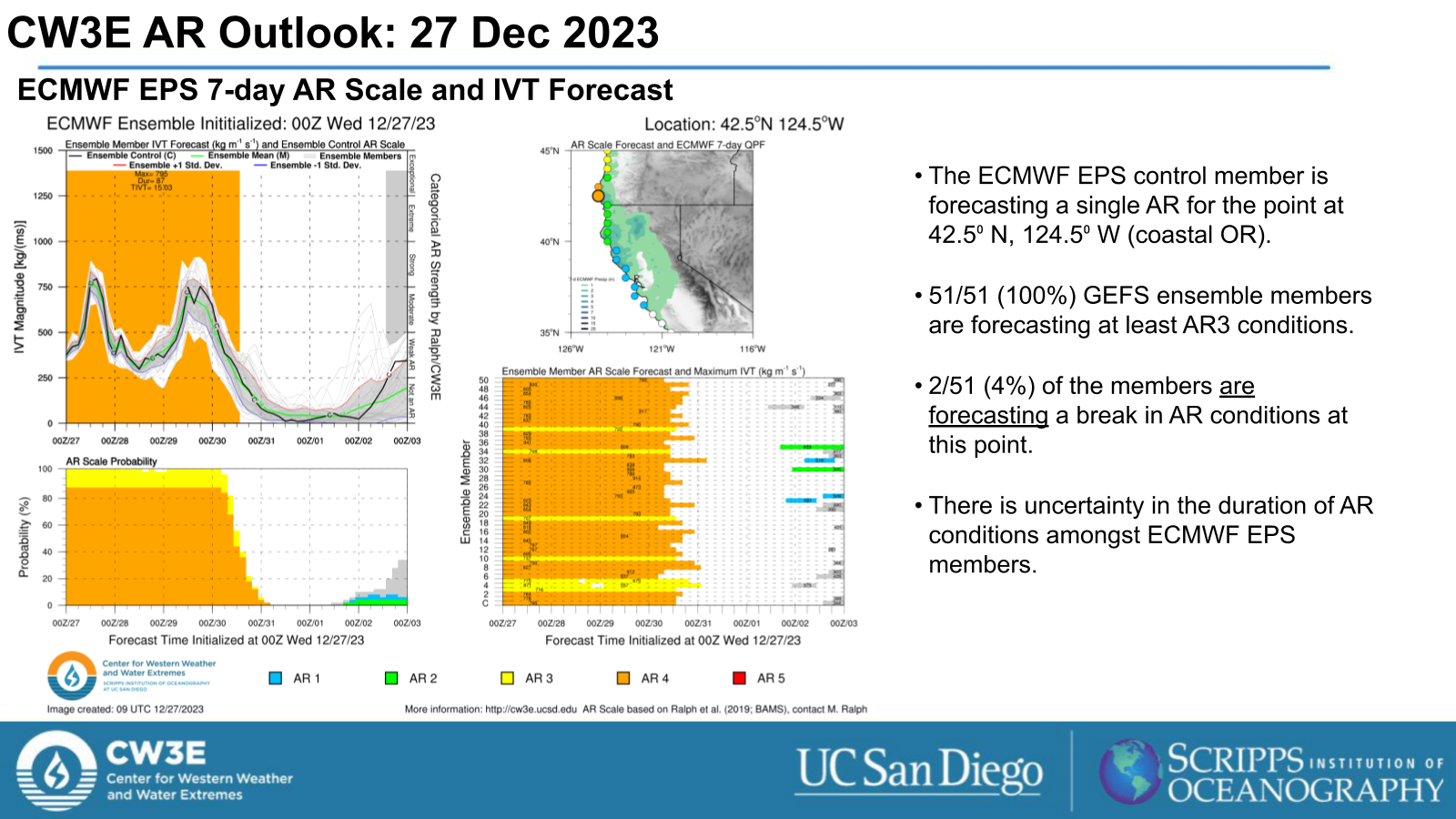
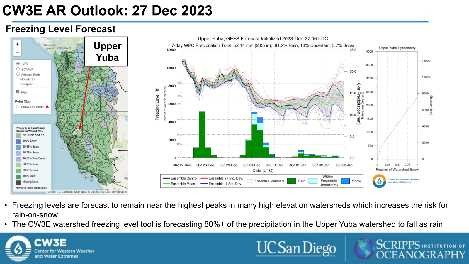
- A pair of Atmospheric Rivers (AR) are forecast to make landfall in the Pacific Northwest (PNW), with the first having already made landfall early Wed 27 Dec. AR conditions are forecast to continue through Sat 30 Dec.
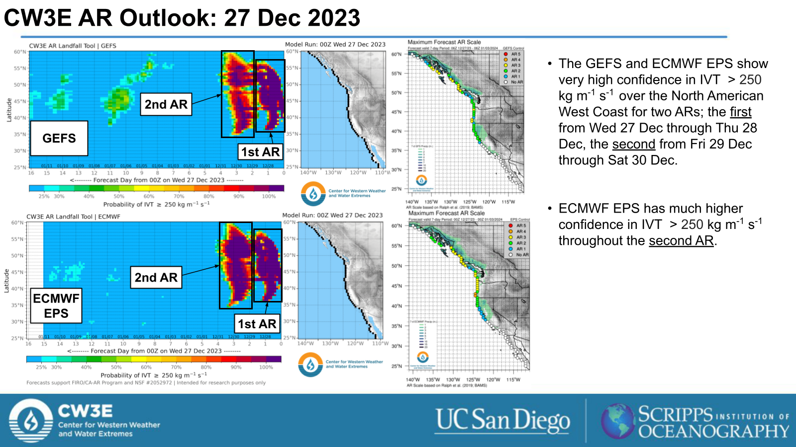
- The GEFS control run is forecasting AR1 to AR3 conditions (based on Ralph et al. 2019 AR scale) for both ARs for the PNW.
- The GEFS control run is forecasting AR1 conditions for the first AR and AR1 to AR2 conditions for the second AR for Northern CA.
- There is uncertainty in the duration of AR conditions and possible break between ARs in the GFS and ECMWF model ensembles.
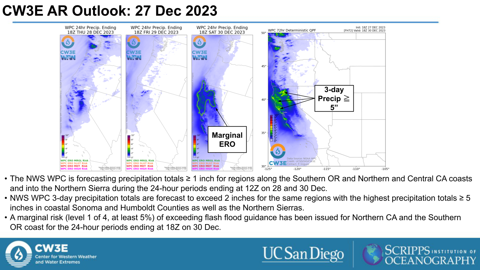
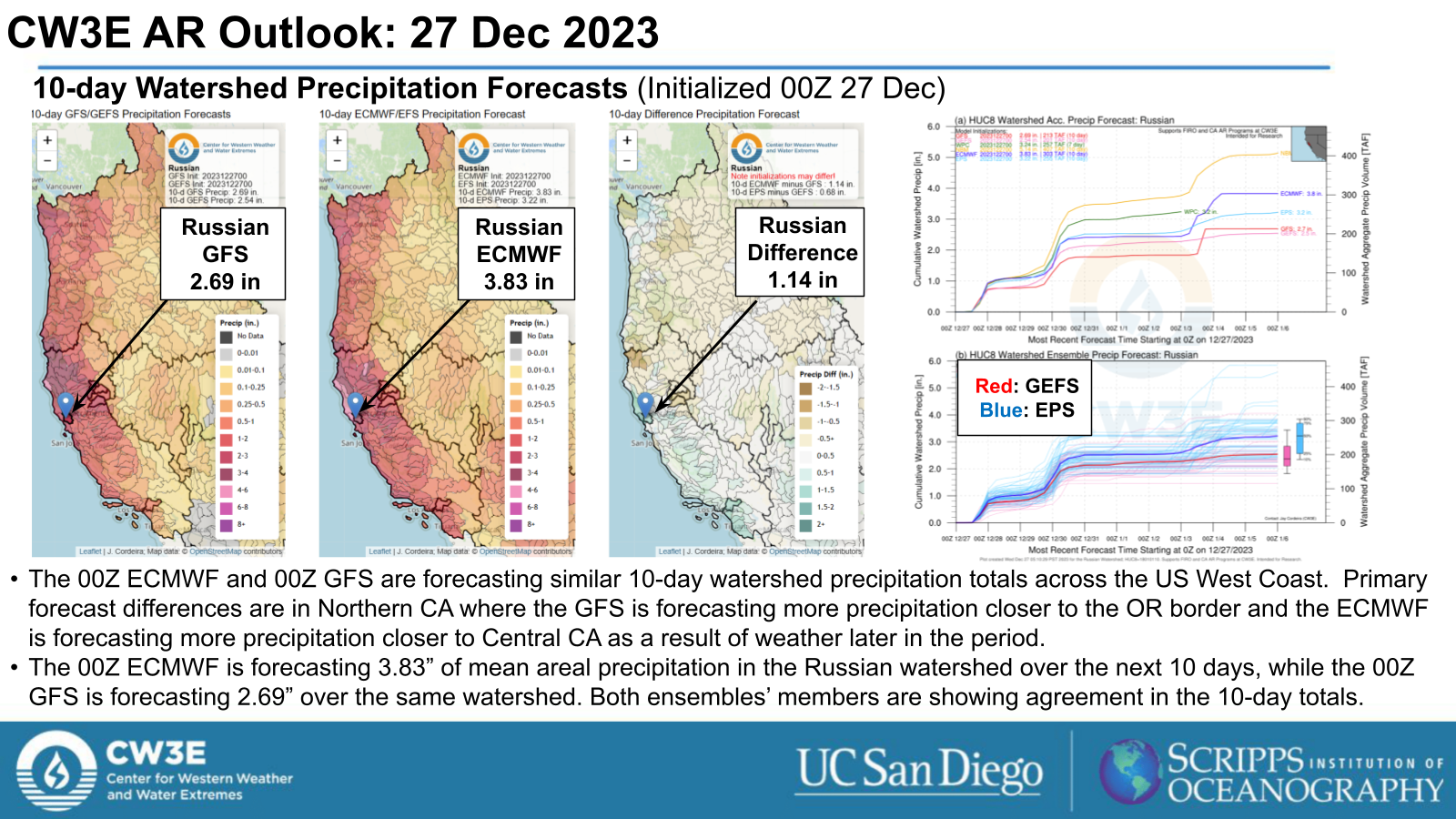
- The National Weather Service (NWS) Weather Prediction Center (WPC) is currently forecasting 3-day precipitation totals ≥ 2” with highest precipitation totals over the Northern CA coast and CA/OR border.
- The WPC Excessive Rainfall Outlook (ERO) indicates a Marginal Risk (level 1 of 4, at least 5%) of exceeding flash flood guidance for Northern CA and the Southern OR coast for the 24-hour periods ending at 18Z on 30 Dec
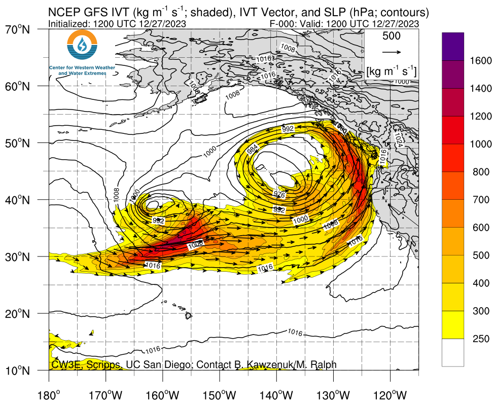
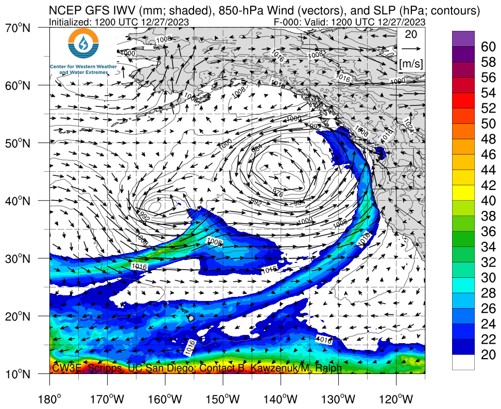
Click images to see loops of GFS IVT and IWV forecasts Valid 1200 UTC 27 December 2023 – 0600 UTC 31 December 2023 |
|
 |
 |
Summary provided by M. Steen and S. Roj; 27 December 2023
To sign up for email alerts when CW3E post new AR updates click here.
*Outlook products are considered experimental

