CW3E AR Update: 27 November Event Summary & Outlook
November 27, 2019
Click here for a pdf of this information.
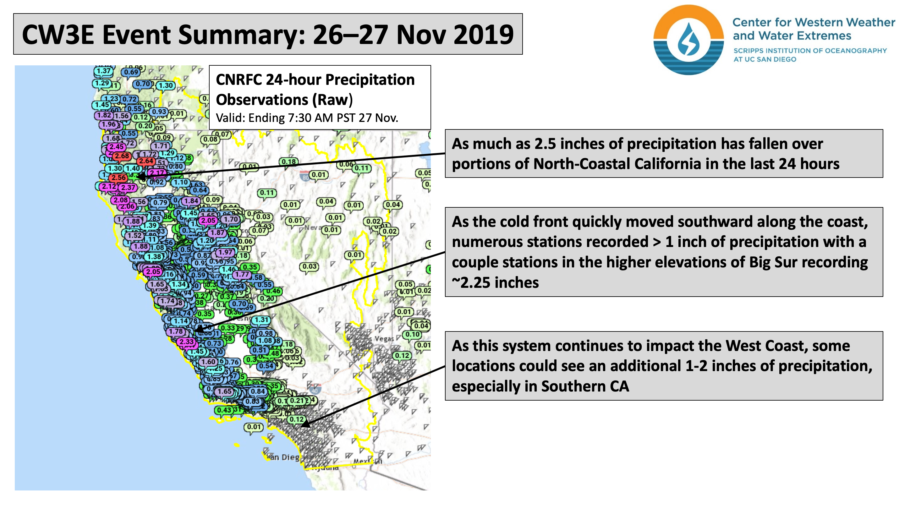
A strong and rapidly intensifying cyclone made landfall over Northern CA and Southern OR resulting in numerous impacts
- A cyclone that underwent rapid intensification moved onshore over Northern CA and Southern OR, bringing strong winds, high precipitation rates, and heavy snow
- A narrow cold frontal rain band developed in association with the fast-moving and dynamically robust cold front and brought
high rain rates to portions of coastal Northern and Central California - Cape Blanco in Southern OR experienced sustained winds of 85 mph and a maximum gust of 106 mph in association with the
strong landfalling cyclone - The strong winds produced wave heights as high as 34 feet off the coast of Northern CA and the all-time low pressure
measurement for the state of California was preliminarily set in Crescent City of 973.6 hPa - Both Interstate 5 and 80 have been closed in sections due to heavy snow and whiteout conditions during one of the busiest
travel weeks of the year
Active weather pattern over Western U.S. will persist into early next week
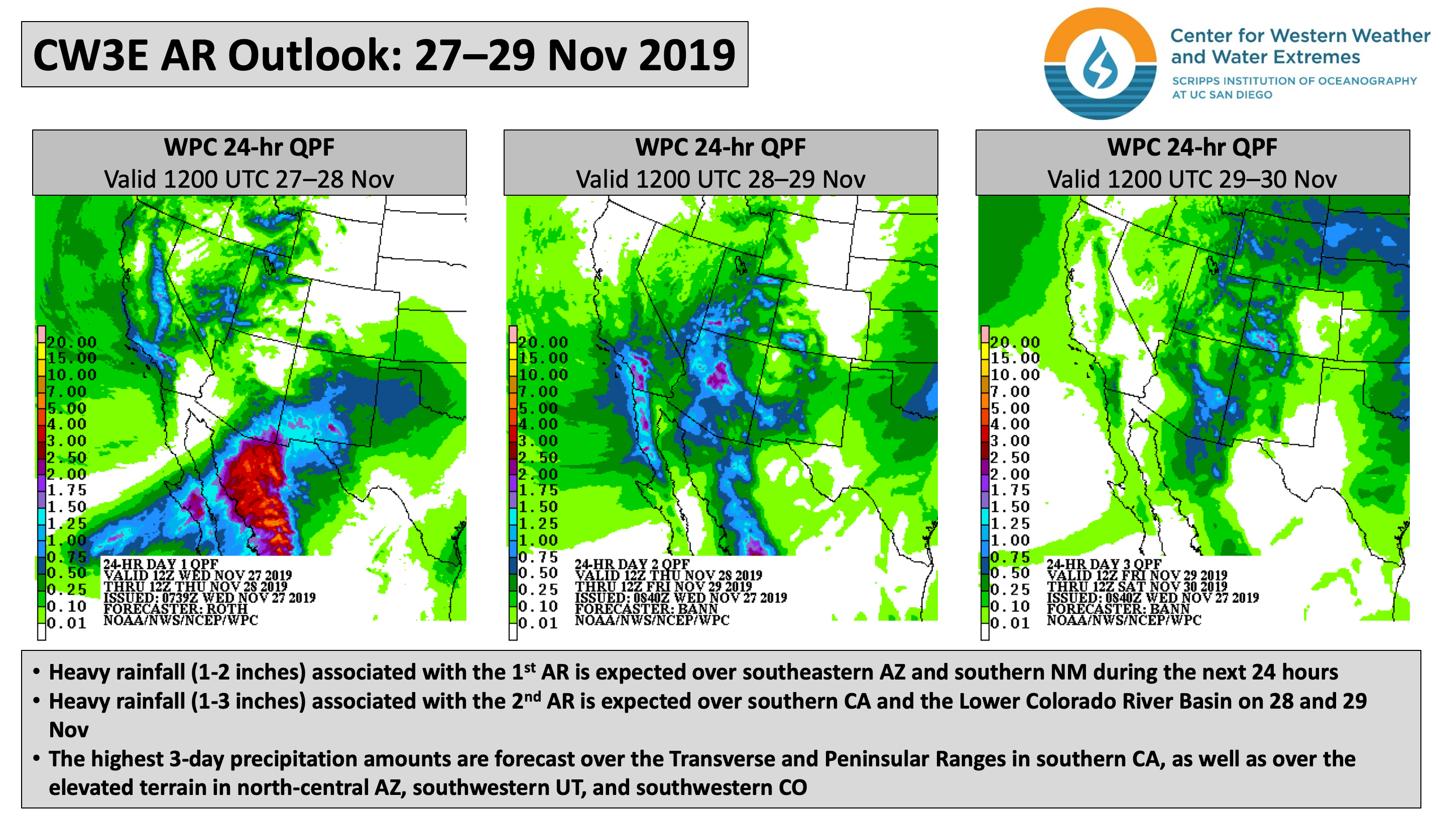
- Multiple landfalling ARs over western North America will impact the U.S. Southwest during the next 48 hours
- There is increasing forecast confidence in the likelihood of a long-duration AR event in California starting 30 Nov
- Total precipitation amounts over the next 7 days may exceed 5 inches in some locations
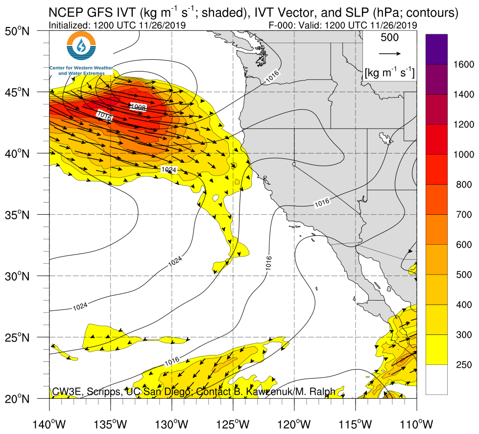
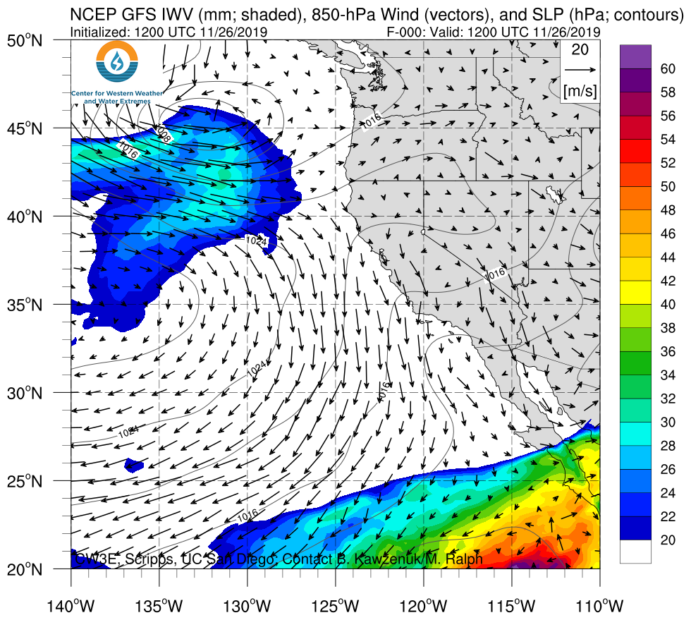
Click IVT or IWV image to see loop of GFS analyses/forecasts Valid 1200 UTC 26 November – 0000 UTC 4 December 2019 |
|
 |
 |
Summary provided by C. Castellano, C. Hecht, B.Kawzenuk, J. Kalansky, F. M. Ralph; 4 PM PT 27 November 2019


