CW3E AR Update: 28 March 2025 Outlook
March 28, 2025
Click here for a pdf of this information.
Forecast Update on Potential Atmospheric River Event Next Week
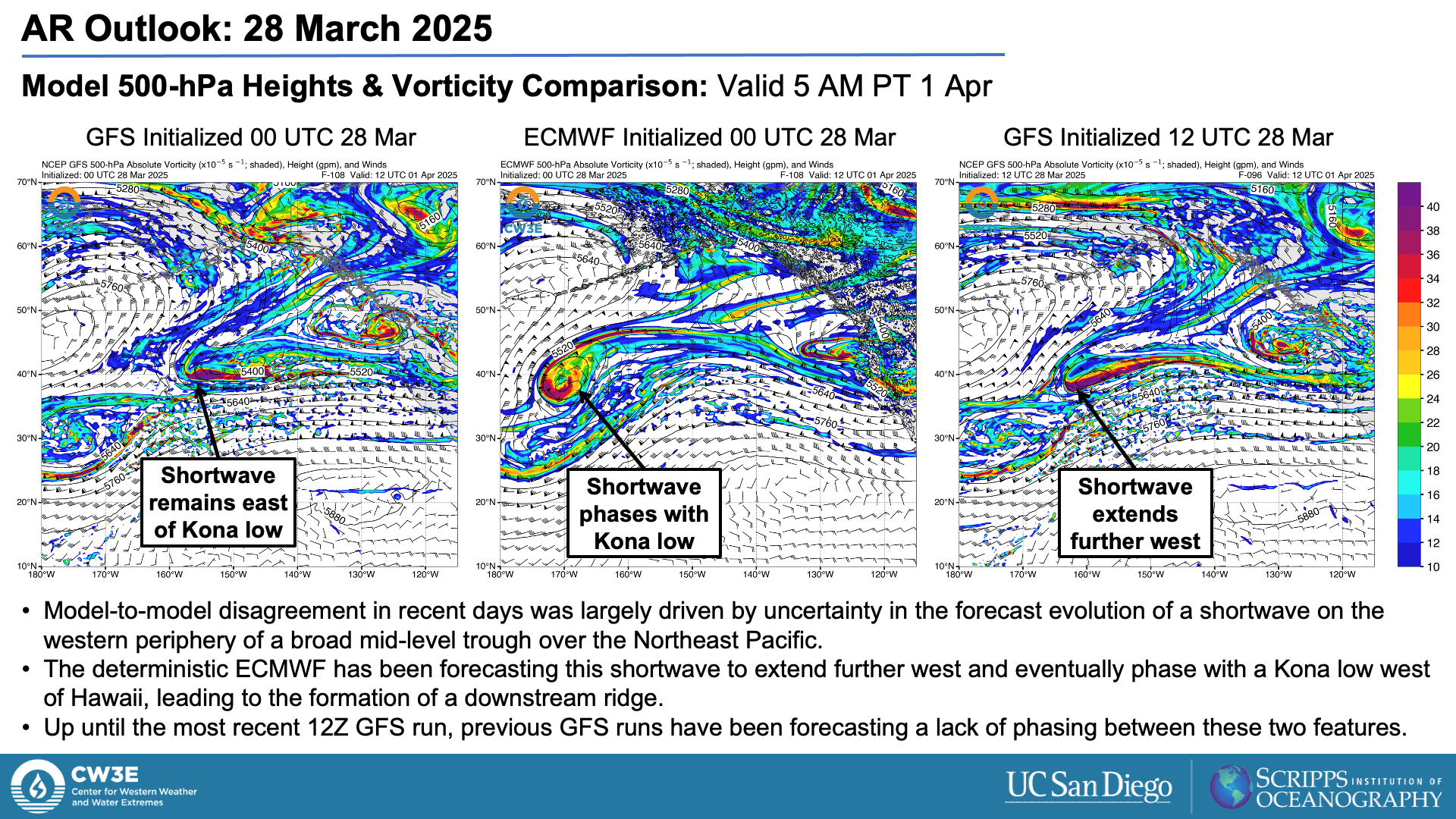
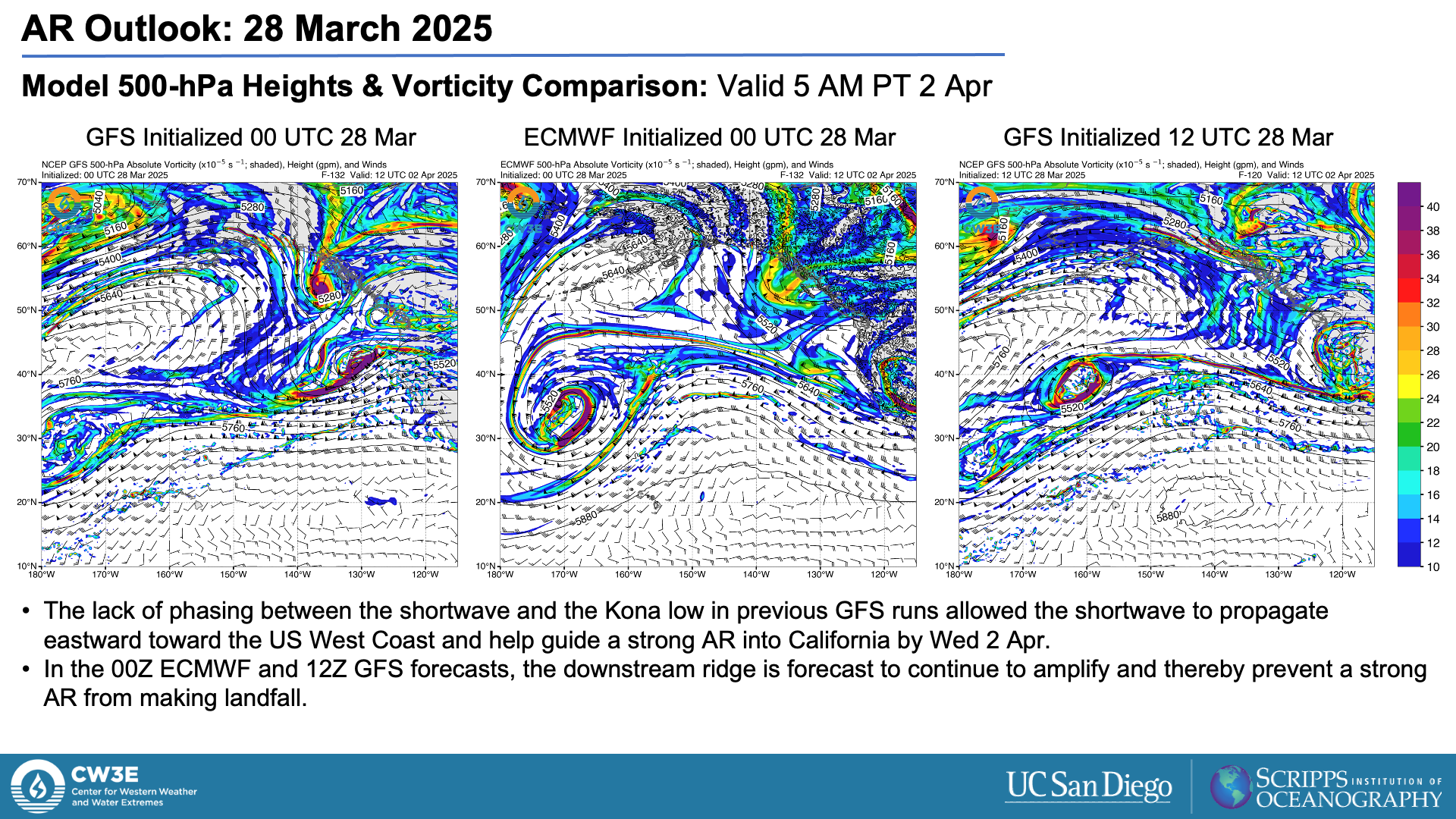
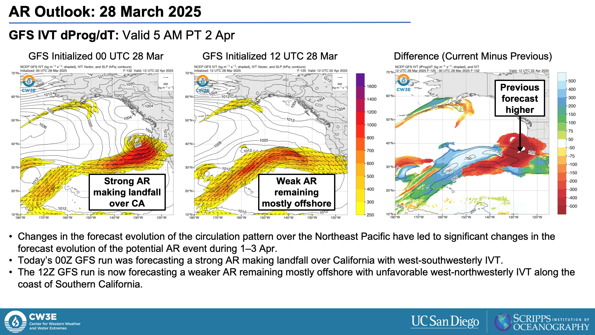
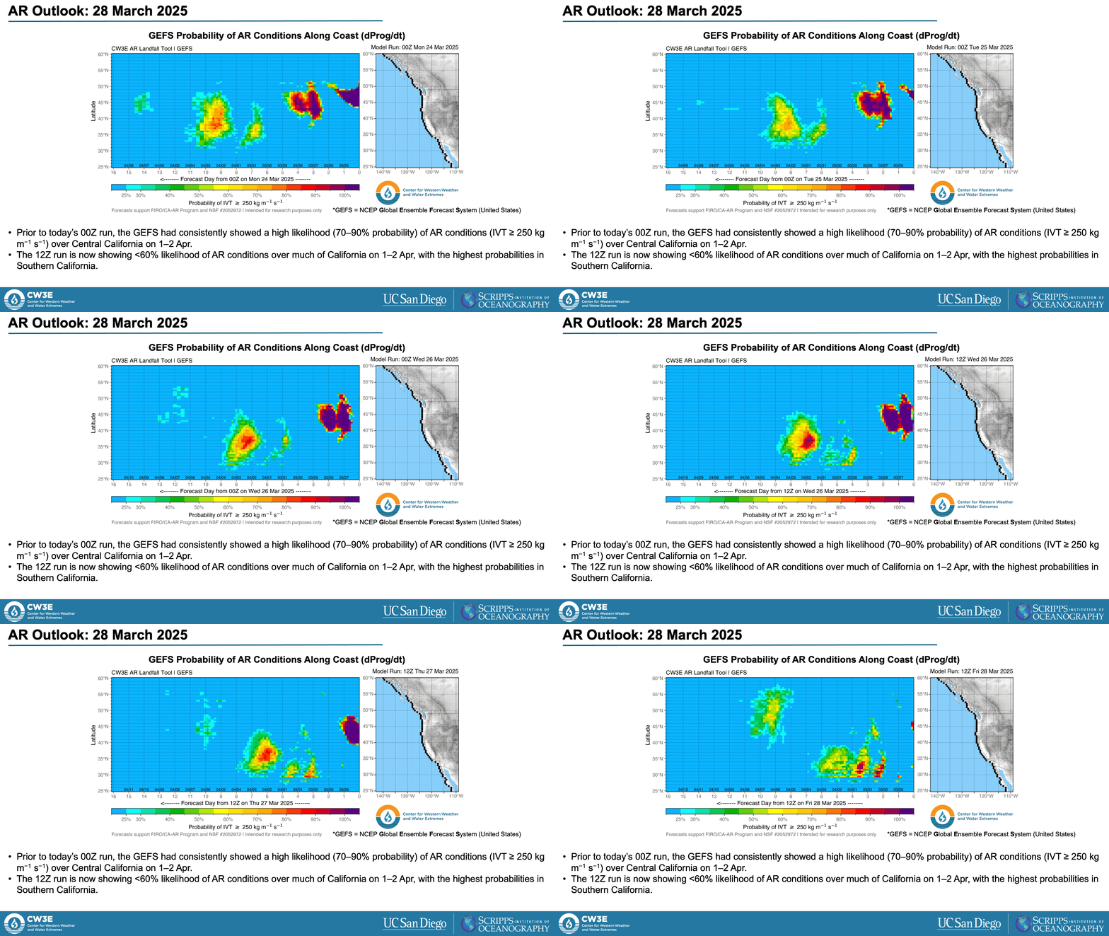
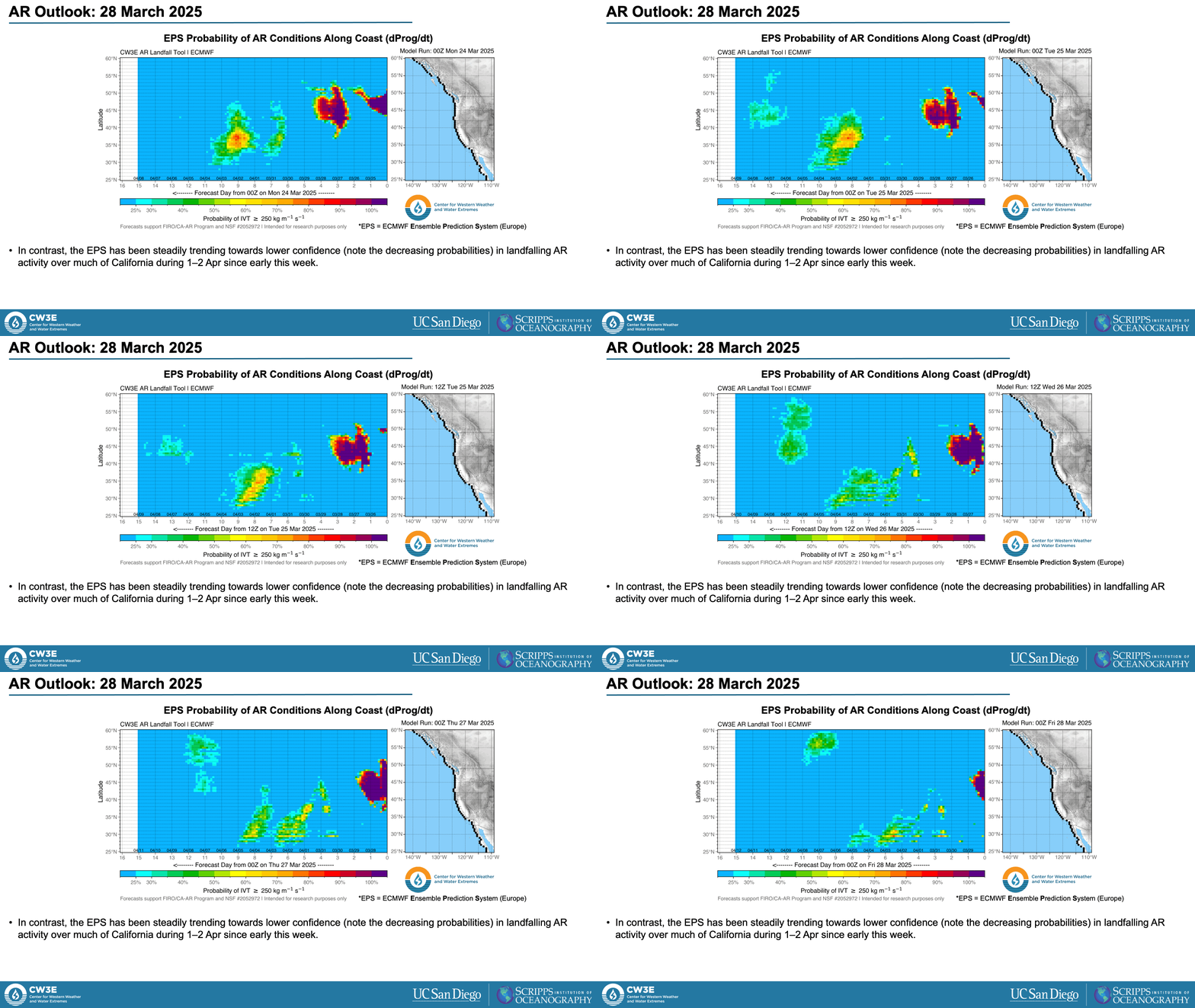
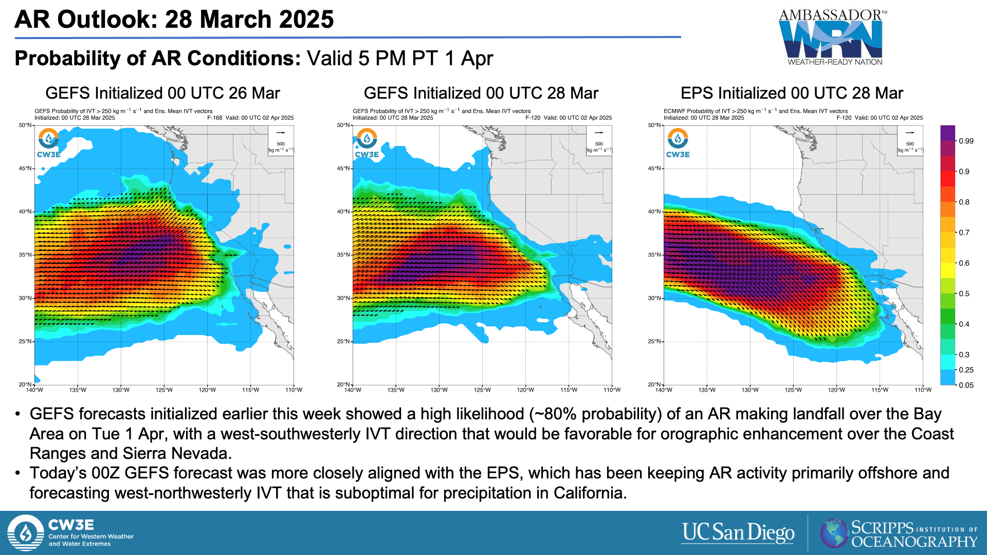
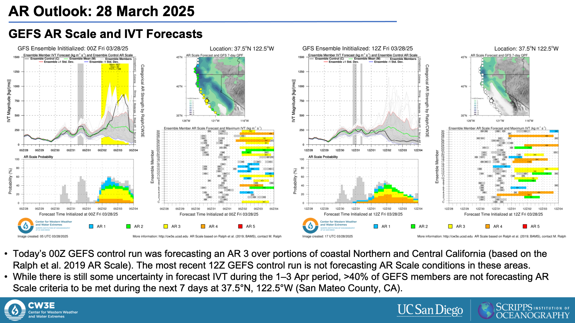
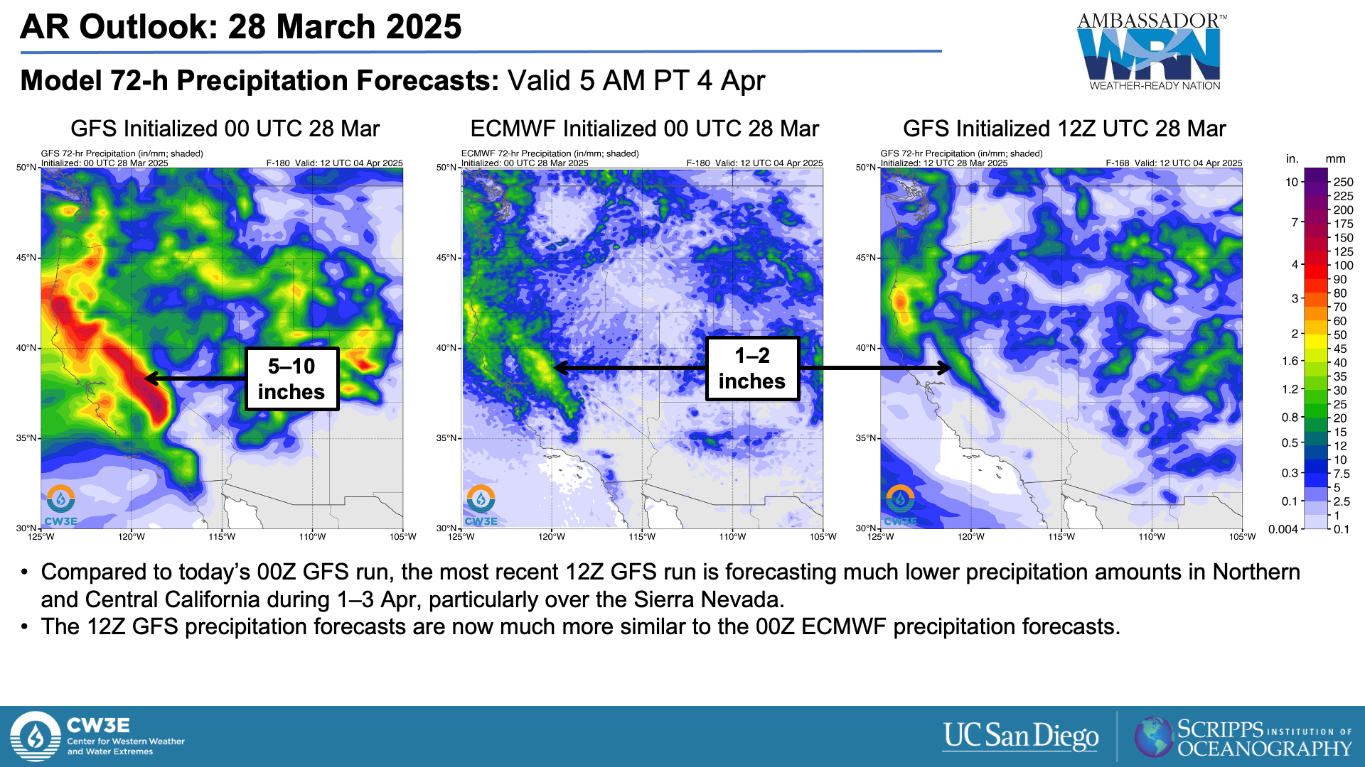
- CW3E’s previous outlook (posted on Wed 26 Mar) highlighted the strong signal for a high-impact atmospheric river (AR) in California next week in NCEP model guidance, as well as the substantial model-to-model differences between NCEP and ECMWF.
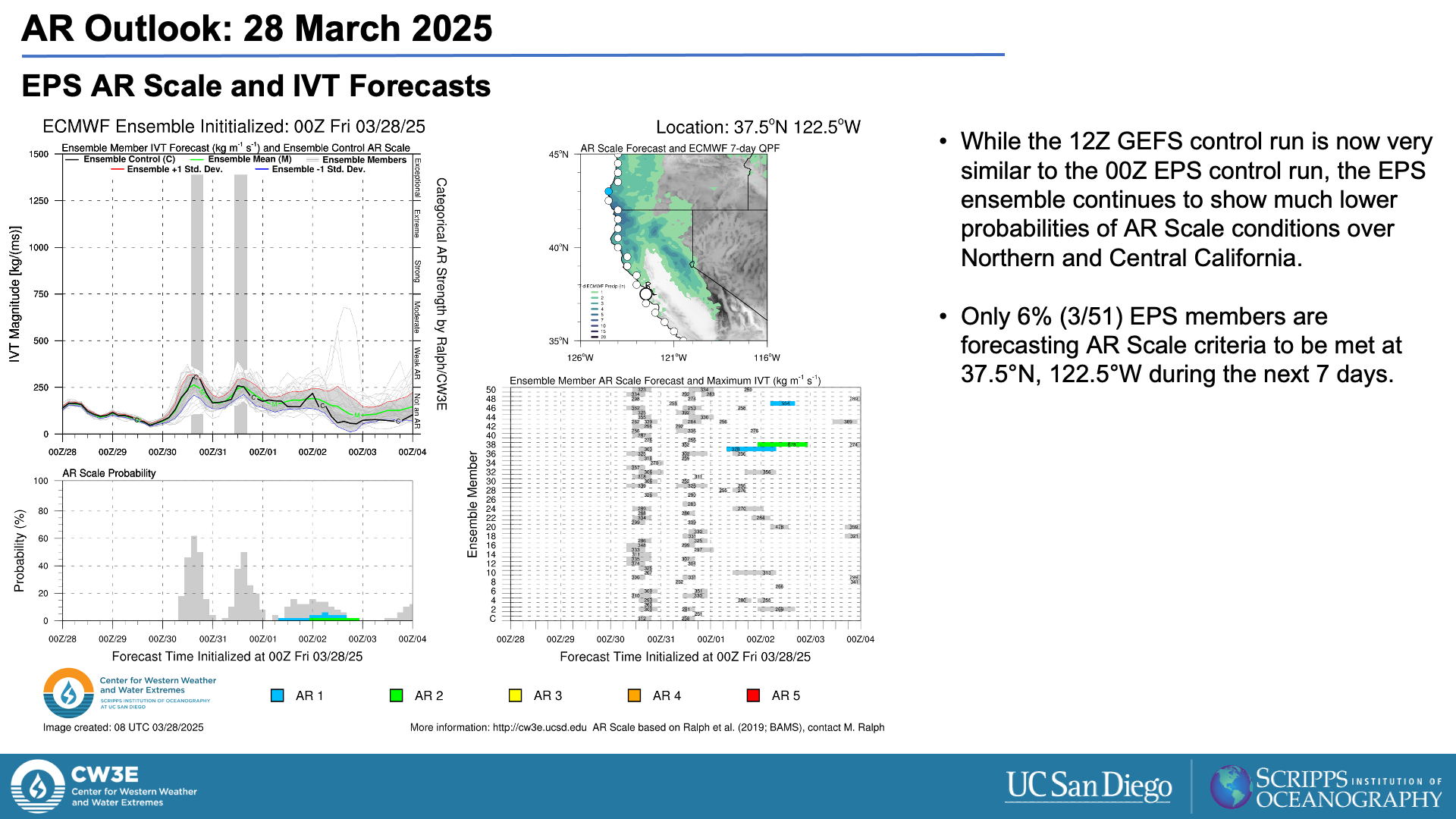
- While today’s 00Z model runs continued to show uncertainty in the forecast, the most recent 12Z NCEP guidance has shifted towards the ECMWF, which has been favoring a much weaker event for the past several days.
- Although a high-impact AR now appears unlikely, an unsettled weather pattern will bring precipitation to much of the western US through the middle of next week.
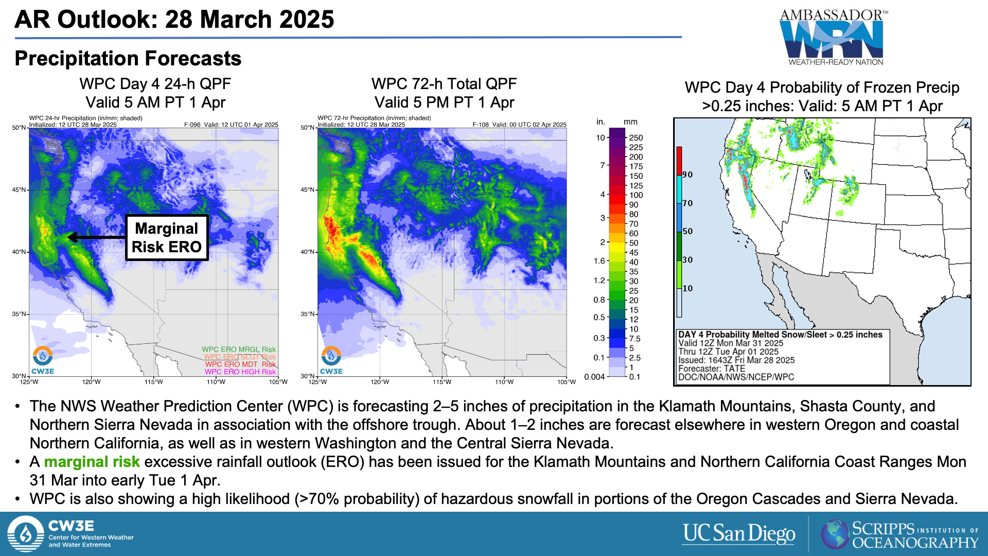
- A mid-level trough over the Northeast Pacific is forecast to produce 2–5 inches of precipitation in the Klamath Mountains, Shasta County, and Northern Sierra Nevada between Sun 30 Mar and Wed 2 Apr.
- The NWS Weather Prediction Center (WPC) has issued a marginal risk excessive rainfall outlook (ERO) for the Klamath Mountains and Northern California Coast Ranges Mon 31 Mar into early Tue 1 Apr.
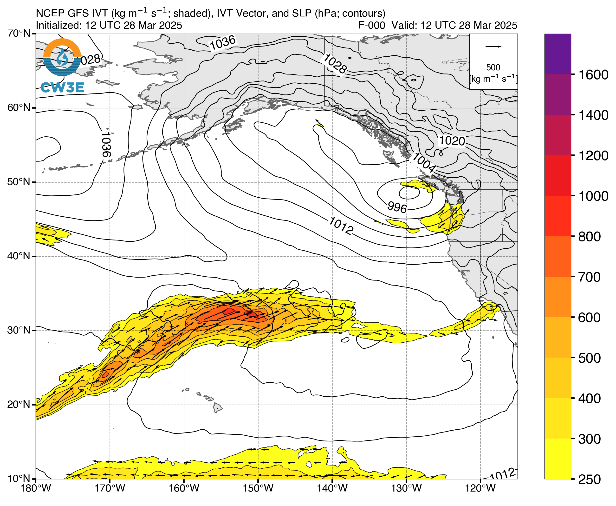
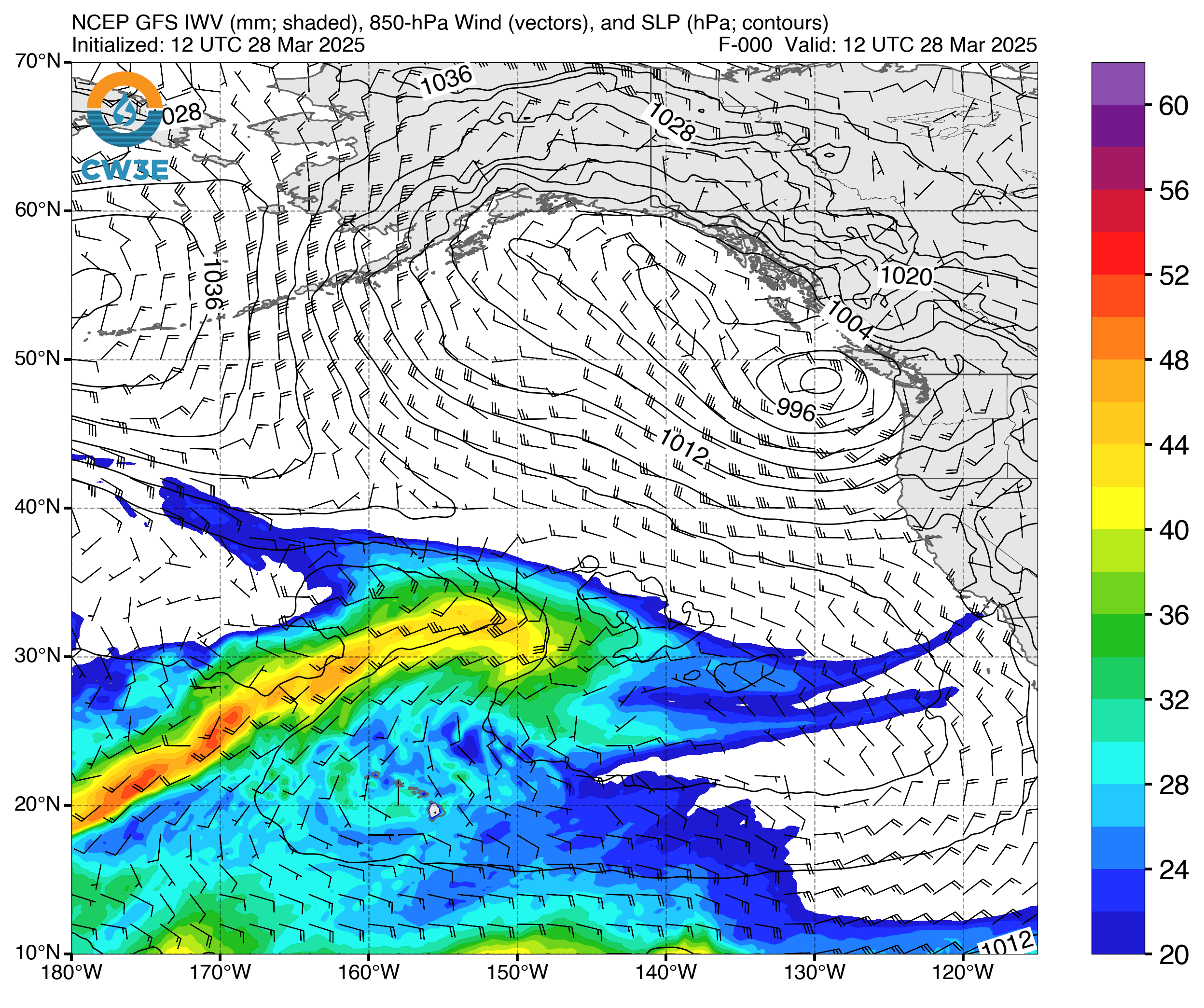
Click images to see loops of GFS IVT and IWV forecasts Valid 1200 UTC 28 March 2025 – 0000 UTC 5 April 2025 |
|
 |
 |
Summary provided by C. Castellano; 28 March 2025
To sign up for email alerts when CW3E post new AR updates click here.
*Outlook products are considered experimental
For any unfamiliar terms, please refer to the American Meteorological Society Glossary.

