
CW3E AR Update: 29 January 2024 Outlook
January 29, 2024
Click here for a pdf of this information.
Pair of Strong ARs Forecast to Bring Heavy Precipitation to USWC
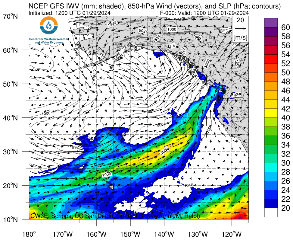
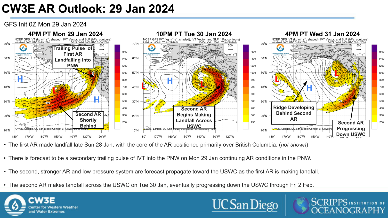
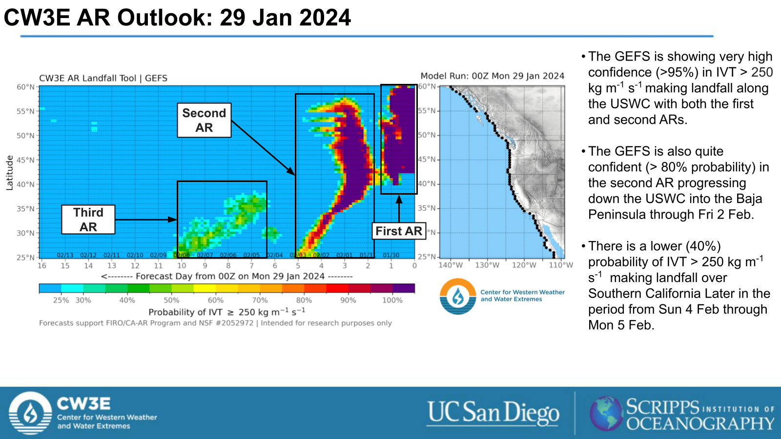
- An active weather pattern for the US West Coast is forecast to continue through Fri 2 Feb as two more strong ARs make landfall along the USWC.
- The first AR made landfall late 28 Sun Jan into British Columbia and the PNW. A second pulse of IVT associated with this system continues AR conditions in the PNW through Tue 30 Jan.
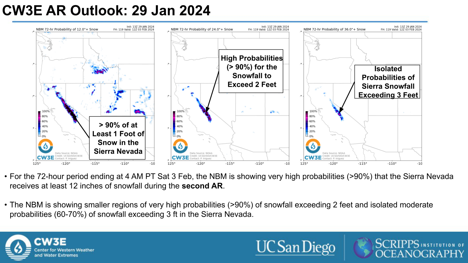
- The second AR is forecast to make landfall across the USWC later on Tue 30 Jan and progress down the USWC through Fri 2 Feb.
- There is likely development of a ridge over the Northeast Pacific following the second AR, leading to a break in AR conditions for the USWC.
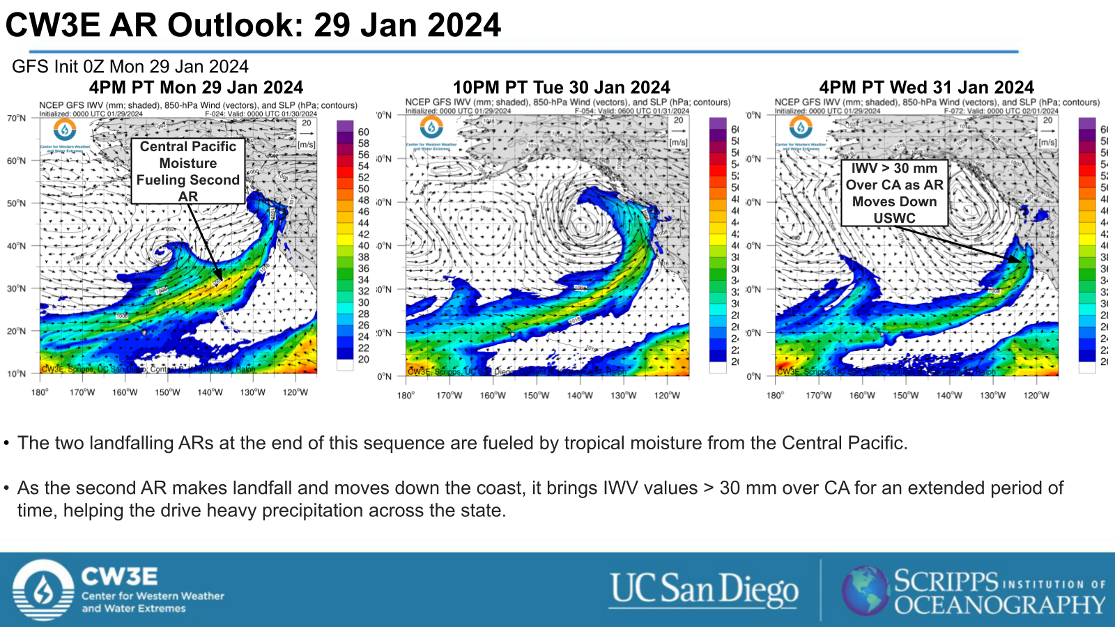
- Both ARs are forecast to bring precipitation to the USWC, with the heaviest rainfall expected from the second AR over Northern CA and heavy snowfall over the Sierra Nevada.
- The WPC Excessive Rainfall Outlook indicates a Slight Risk (level 2 of 4, or at least 15% chance) for flash flooding in Northern CA for the 24-hour period ending 4 AM PT Thu 1 Feb and in Southern CA for the 24-hour period ending 4 AM PT Fri 2 Feb with the second AR.
- Although there is potential for flooding in areas discussed in this outlook, the forecasts are not predicting anything in the magnitude of the ARkStorm scenarios developed by Porter et al., 2011 or Huang et. al., 2022
Click images to see loops of GFS IVT and IWV forecasts Valid 1200 UTC 29 January 2024 – 1200 UTC 2 February 2024 |
|
 |
 |


Summary provided by M. Steen, S. Bartlett and J. Kalansky; 29 January 2024
To sign up for email alerts when CW3E post new AR updates click here.
*Outlook products are considered experimental