CW3E AR Update: 3 January 2024 East Coast Outlook
January 3, 2024
Click here for a pdf of this information.
Pair of Atmospheric Rivers Forecast to Bring Precipitation to East Coast
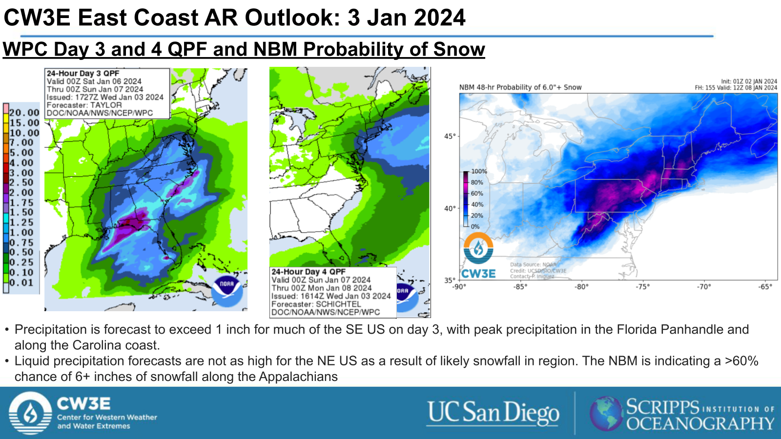
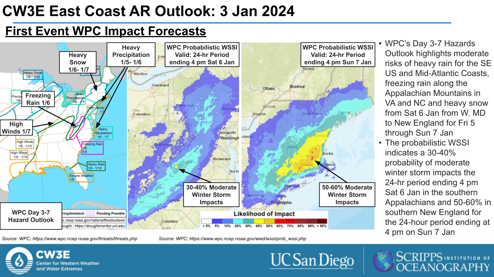
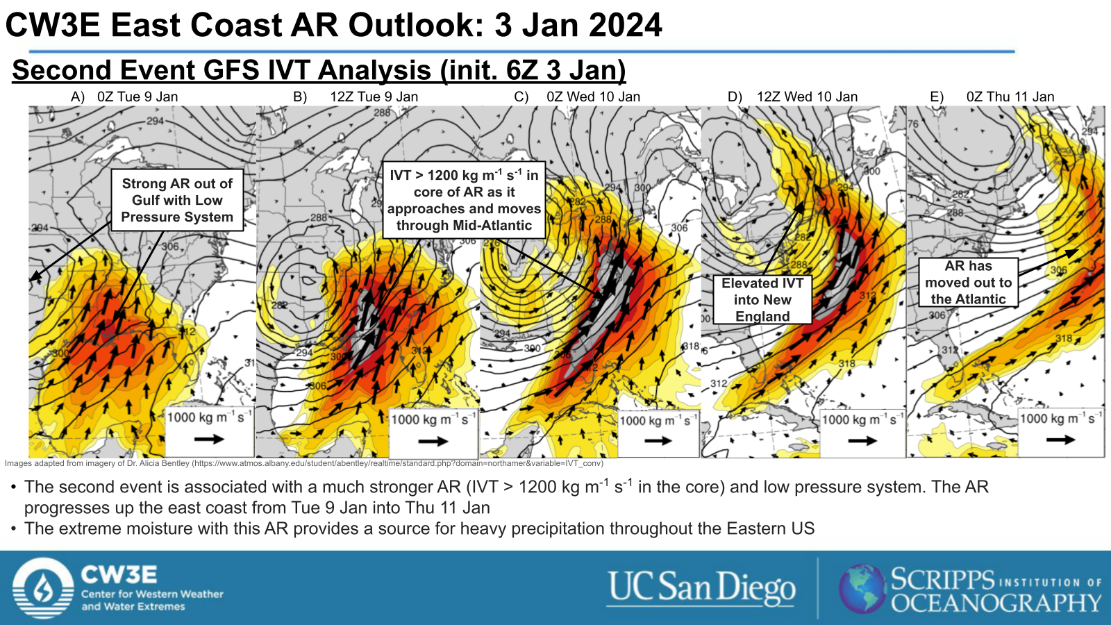
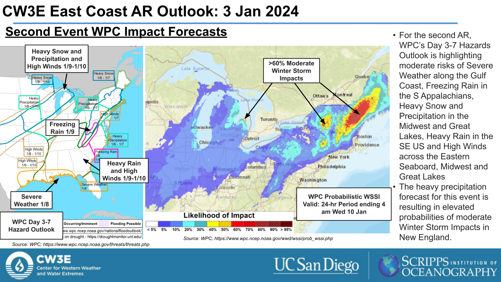
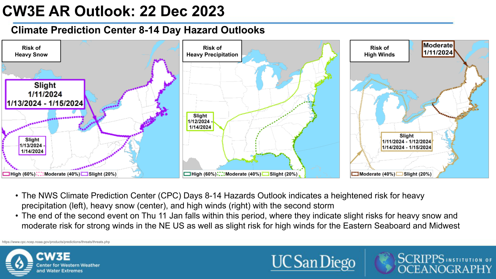
- A pair of atmospheric rivers (AR) are forecast to develop over of the Gulf of Mexico, bringing heavy precipitation to much of the Eastern US.
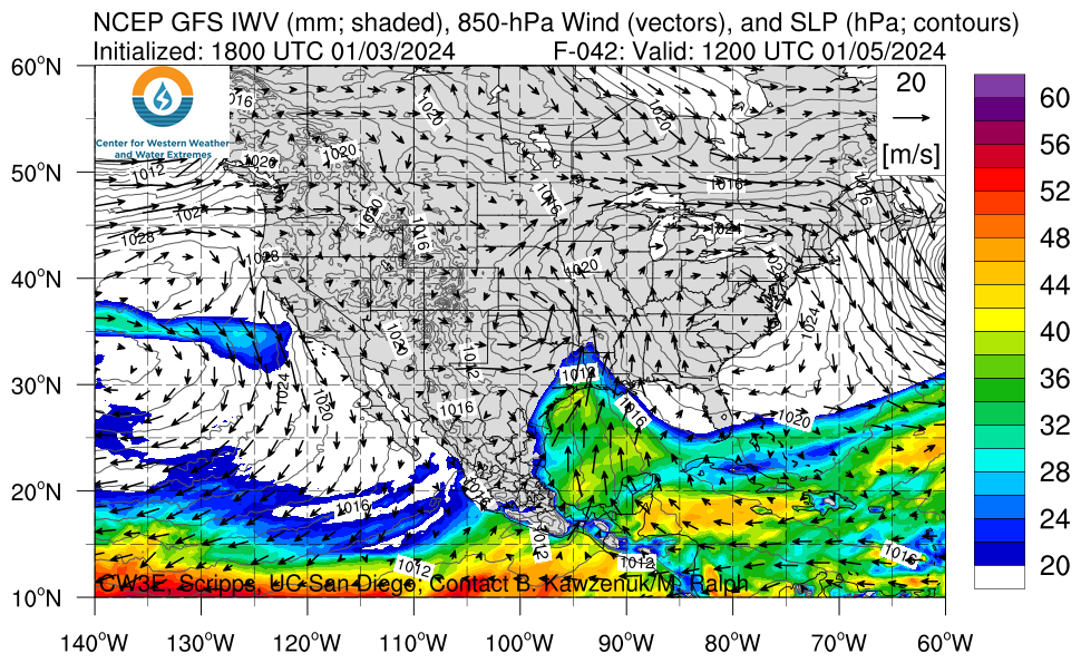
- The first AR is forecast to form early Fri 5 Jan, progressing up the US East Coast through Sun 7 Jan before moving out to the Atlantic.
- The first system is forecast to bring heavy precipitation, a mix of rain and snow, to the Eastern US. The SE US and Mid-Atlantic are expected to receive rain and New England, NY and PA are expected to receive more mixed precipitation and snow.
- The second, much stronger AR (IVT > 1200 kg m-1 s-1 in the core) forms in the Gulf last Mon 8 Jan into Tue 9 Jan, propagating through the region by Thu 11 Jan.
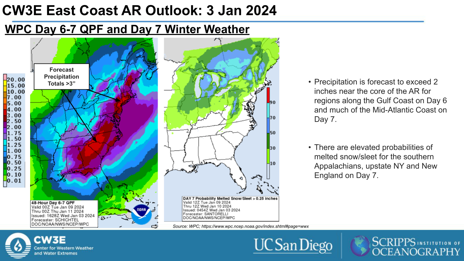
- The NWS Weather Prediction Center is forecasting > 2 inches of rainfall near the core of the AR on Days 6 and 7 as it progresses up the coast.
Click images to see loops of GFS IVT and IWV forecasts Valid 1200 UTC 5 January 2024 – 0000 UTC 11 January 2024 |
|
 |
 |
Summary provided by M. Steen, S.Bartlett, P. Iniguez and C.Castellano; 03 January 2024
To sign up for email alerts when CW3E post new AR updates click here.
*Outlook products are considered experimental


