CW3E AR Update: 5 April 2023 Outlook
April 5, 2023
Click here for a pdf of this information.
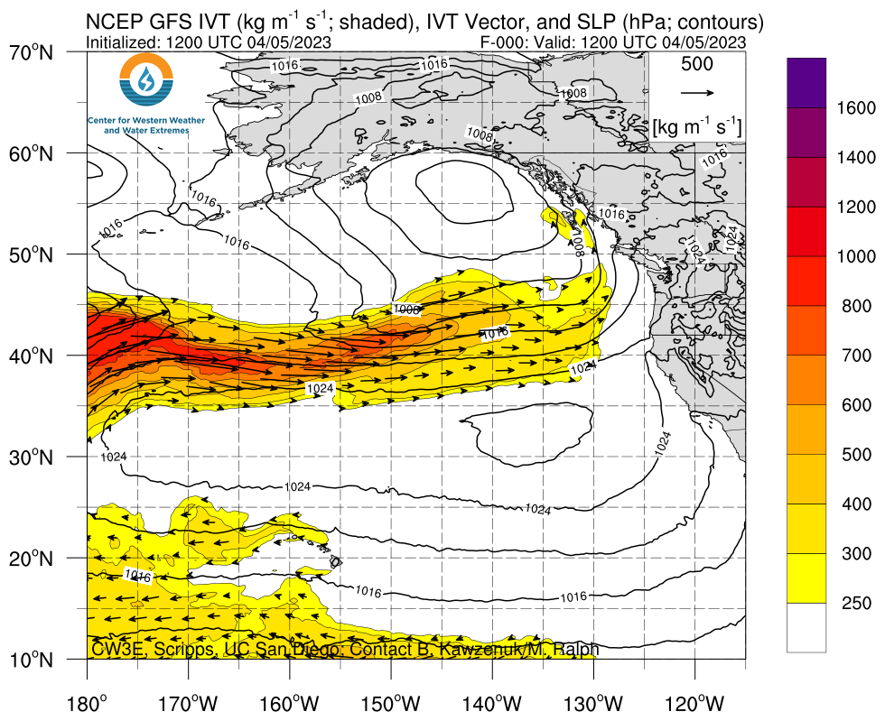
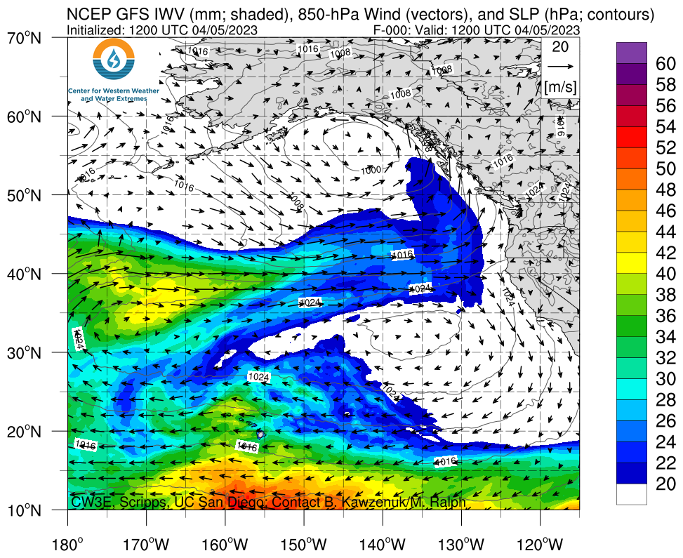
Multiple Atmospheric Rivers Forecast to Impact Pacific Northwest Though the Weekend
- A series of atmospheric rivers (ARs) are forecast to develop over the North Pacific Ocean and make landfall over the Pacific Northwest during the next several days
- The first AR is forecast to make landfall tonight and bring AR2 conditions (based on the Ralph et al. 2019 AR Scale) to coastal Washington and Oregon
- Another AR is forecast to make landfall this weekend, bringing AR2 conditions to coastal Washington and Oregon and AR1 conditions to coastal Northern California
- There is still considerable uncertainty in the timing, duration, and intensity of the second landfalling AR
- The NWS Weather Prediction Center (WPC) is forecasting at least 3–7 inches of precipitation in the Cascades and Coast Ranges in Washington and Oregon during the next 7 days, with more than 10 inches possible in the Olympic Mountains
- The NWS WPC has issued a marginal risk of rainfall exceeding flash flood guidance along the coast from Northern California to the Olympic Peninsula tomorrow into Friday morning
- Several rivers in Washington and Oregon are forecast to rise above monitor stage during the next 7 days
- A majority of the precipitation is forecast to fall as rain in most watersheds due to higher freezing levels during these AR events
Click images to see loops of GFS IVT and IWV forecasts Valid 1200 UTC 5 April – 1200 UTC 10 April 2023 |
|
 |
 |
Summary provided by C. Castellano, S. Bartlett, and S. Roj; 5 April 2023
To sign up for email alerts when CW3E post new AR updates click here.
*Outlook products are considered experimental


