CW3E AR Update: 5 October 2020 Outlook
October 5, 2020
Click here for a pdf of this information.
Update on Atmospheric Rivers Forecast to Bring Precipitation to the US West Coast
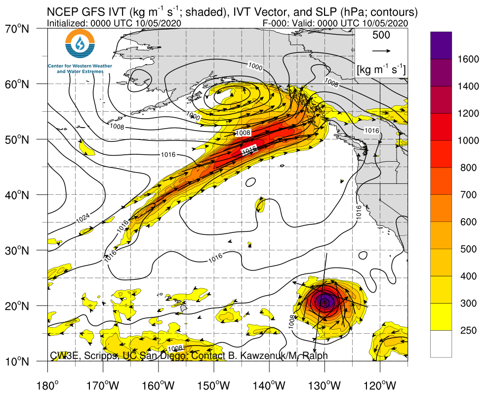
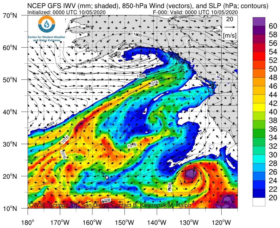
- A unique large-scale flow regime is forecast to result in the landfall of two separate but concurrent ARs over the USWC
- Current forecasts suggest that IVT magnitudes over southern Oregon may reach 500 kg m–1 s–1 while AR conditions are forecast to last ~27 hours, resulting in AR 2 conditions
- There is currently a large amount of uncertainty in the forecast, which is resulting in a large spread of potential outcomes
- The GFS, ECMWF, and NBM are forecasting different precipitation accumulations from Washington to Northern CA
- Due to the numerous fires currently burning across California, this precipitation in the forecast may bring much needed relief to extremely dry conditions
Click images to see loops of GFS IVT/IWV analyses and forecasts Valid 0000 UTC 5 October – 1800 UTC 14 October 2020 |
|
 |
 |
Summary provided by C. Hecht, C. Castellano, J. Kalansky, and F. M. Ralph; 5 October 2020
*Outlook products are considered experimental


