CW3E AR Update: 6 March 2020 Outlook
March 6, 2020
Click here for a pdf of this information.
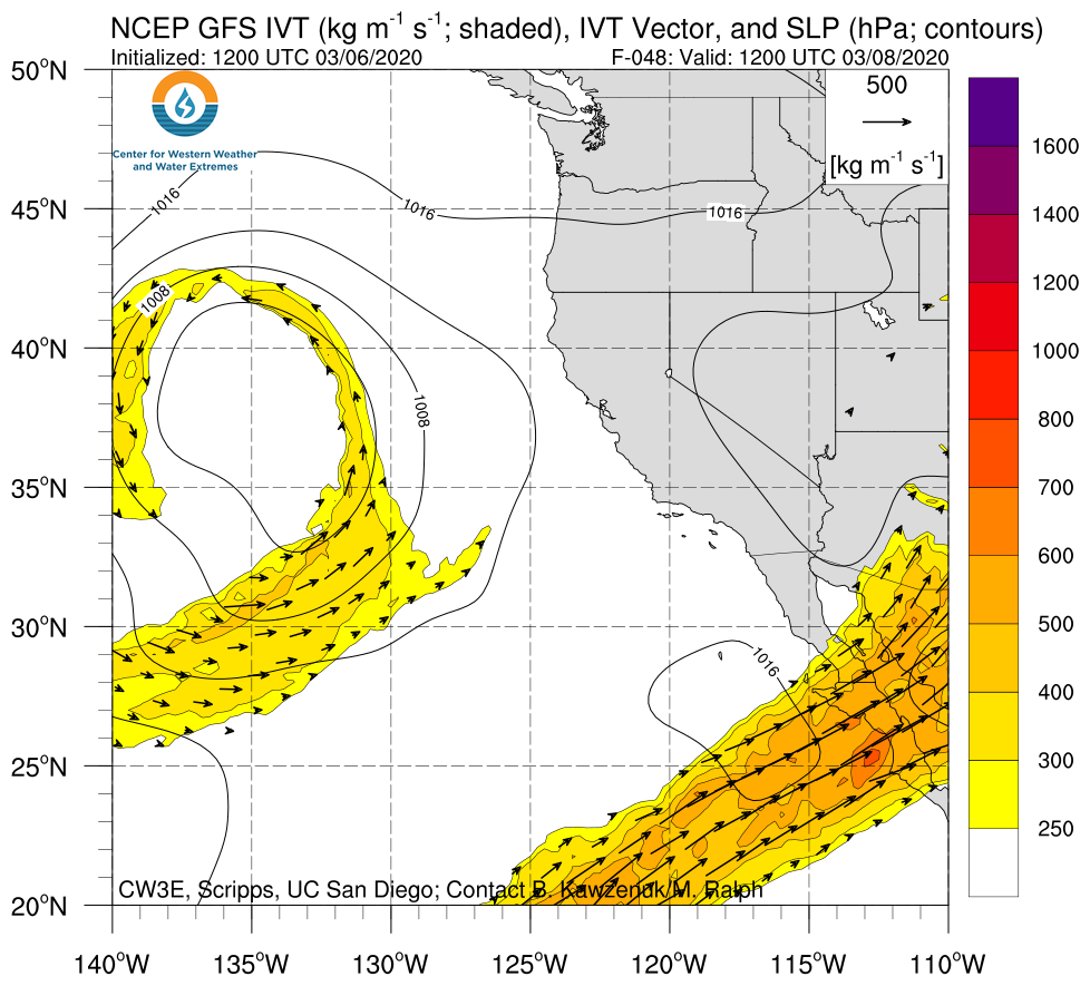
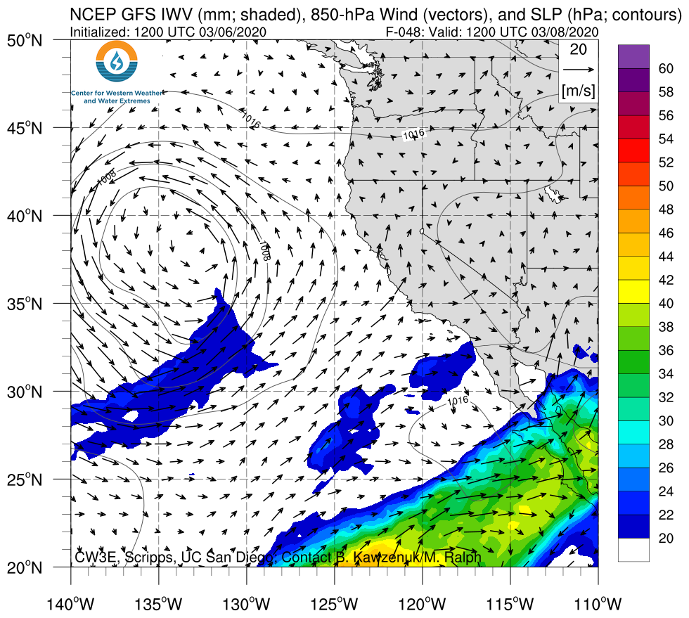
A cutoff low and landfalling AR is forecast to bring moderate-to-heavy rainfall to portions of the southwestern U.S.
- The interaction between a cutoff low off the California coast and tropical moisture over the Eastern Pacific is expected to result in a landfalling atmospheric river (AR) over Southern California and Arizona early next week
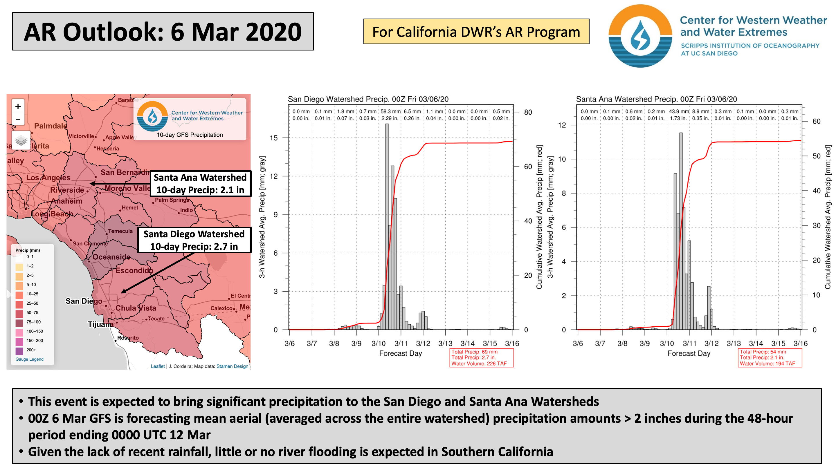
- Some areas in coastal Southern California may experience at least AR2 conditions
- The highest precipitation amounts are expected in Southern California, with 1–2 inches forecast over coastal and inland valley areas, and more than 2.5 inches possible over the Transverse and Peninsular Ranges
Click IVT or IWV image to see loop of GFS analyses/forecasts Valid 1200 UTC 8 March – 0000 UTC 12 March 2020 |
|
 |
 |
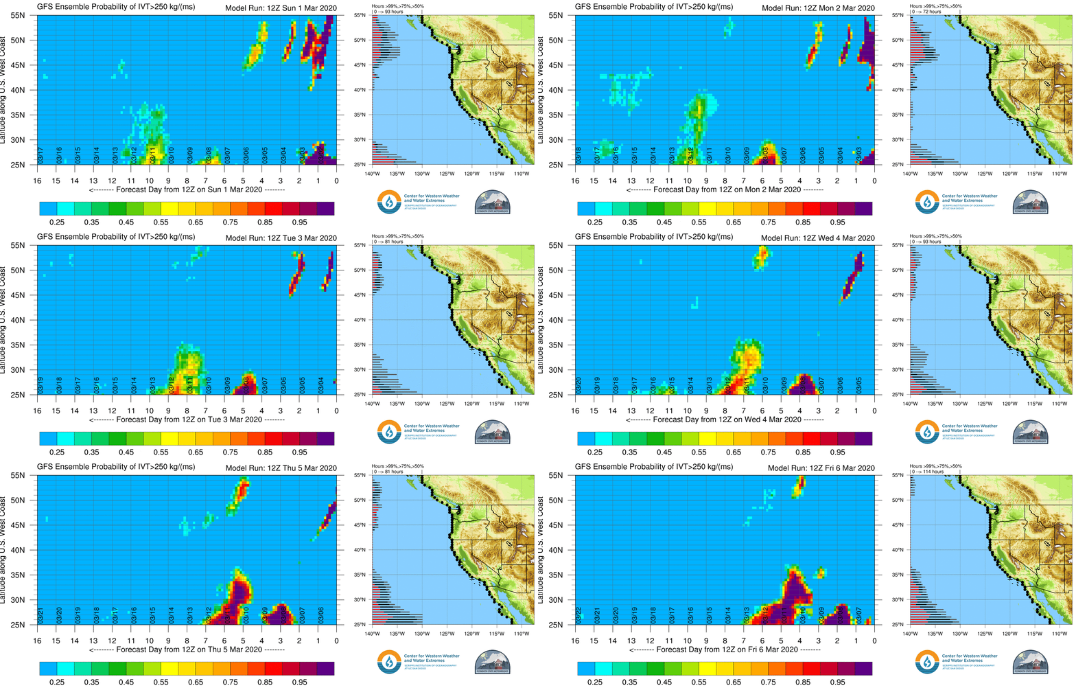
GEFS AR Landfall Probabilities: dProg/dt
Initialization Period: 1200 UTC 1 March – 1200 UTC 6 March 2020
- Confidence in the probability of AR conditions along the Southern California coast has increased substantially over the past 5 days
- As the loop demonstrates, run-to-run differences in forecast AR landfall probability were quite large until ~ 12Z 5 Mar
- High uncertainty in AR conditions was driven primarily by uncertainty in the evolution of a cutoff low that will form over the Northeast Pacific Ocean during the next 48 hours
Summary provided by C. Castellano, L. Delle Monache, B. Kawzenuk, and F. M. Ralph; 6 March 2020
*Outlook products are considered experimental


