CW3E AR Update: 9 December 2024 Outlook
December 9, 2024
Click here for a pdf of this information.
Unsettled Weather Pattern Likely to Return to US West Coast This Week
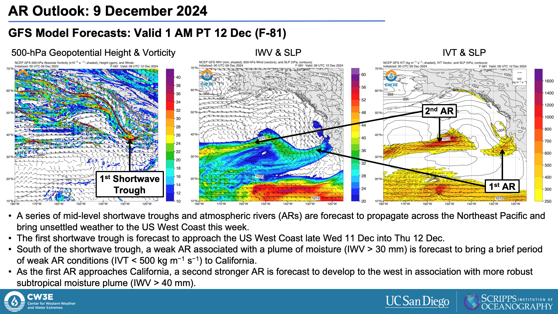
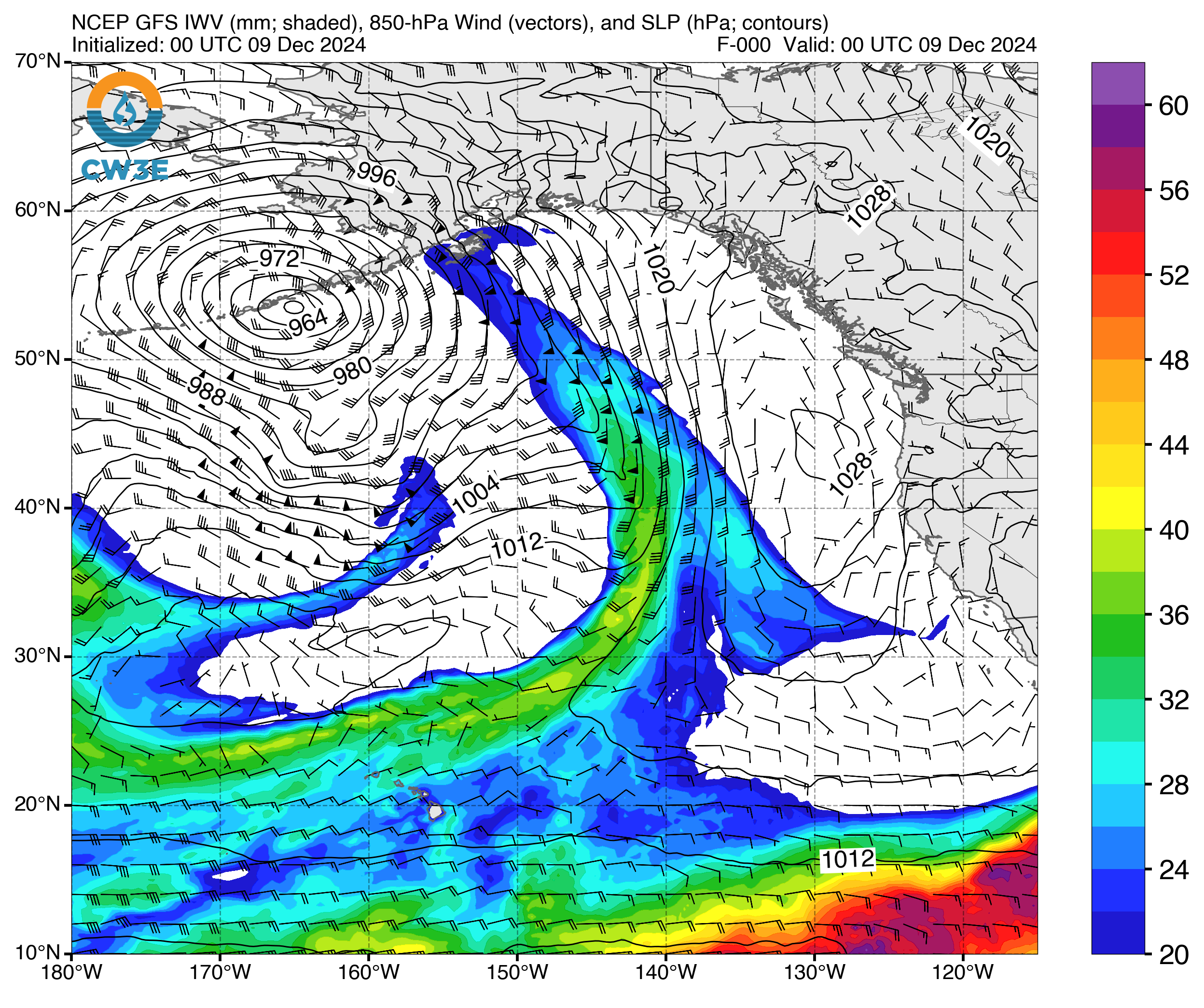
- A series of mid-level shortwave troughs and atmospheric rivers (ARs) are forecast to impact the US West Coast starting around mid-week and potentially continuing into next week.
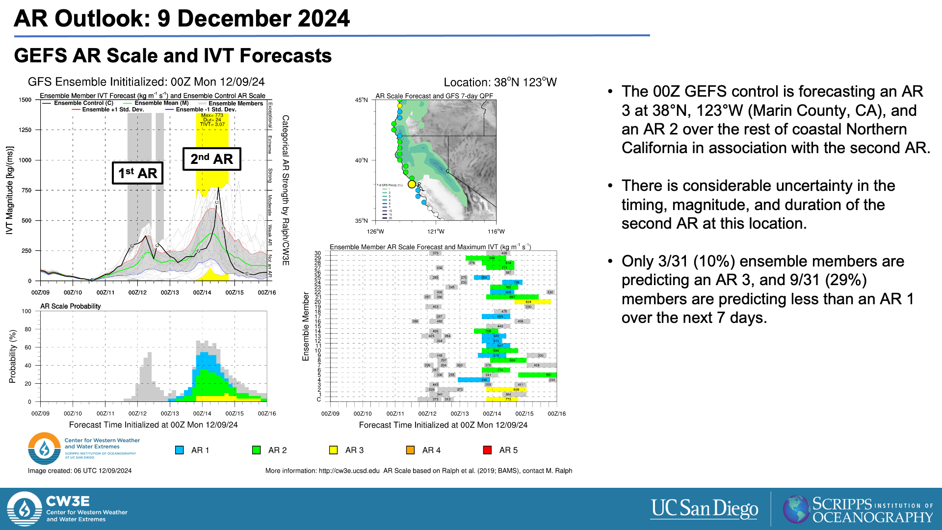
- The first AR is forecast to bring a brief period of weak AR conditions (IVT < 500 kg m−1 s−1) to California late Wed 11 Dec into Thu 12 Dec.
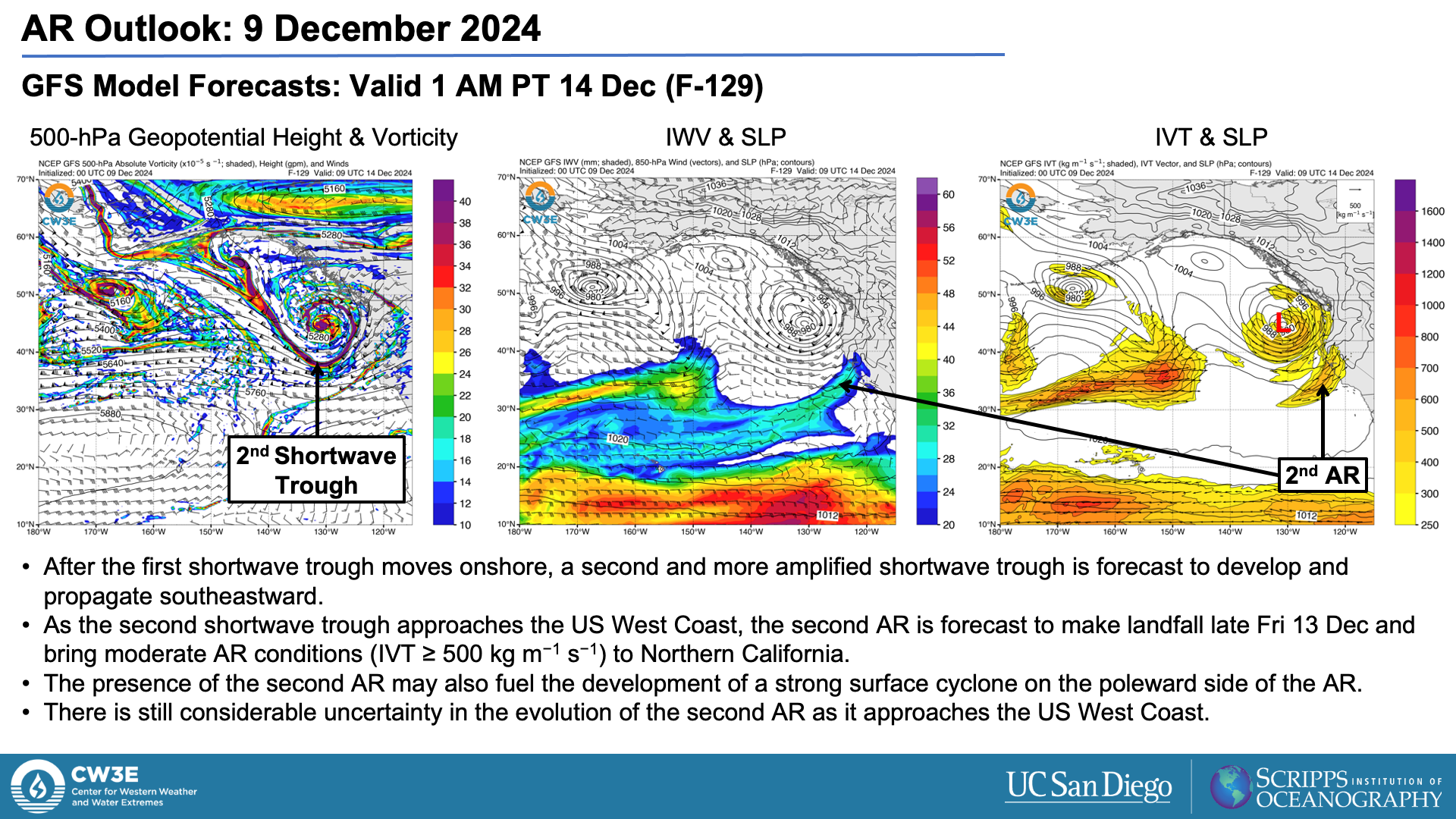
- A second and stronger AR is forecast to make landfall over Northern California Fri 13 Dec into Sat 14 Dec, but there is still some uncertainty regarding the timing, location, and magnitude of AR conditions.
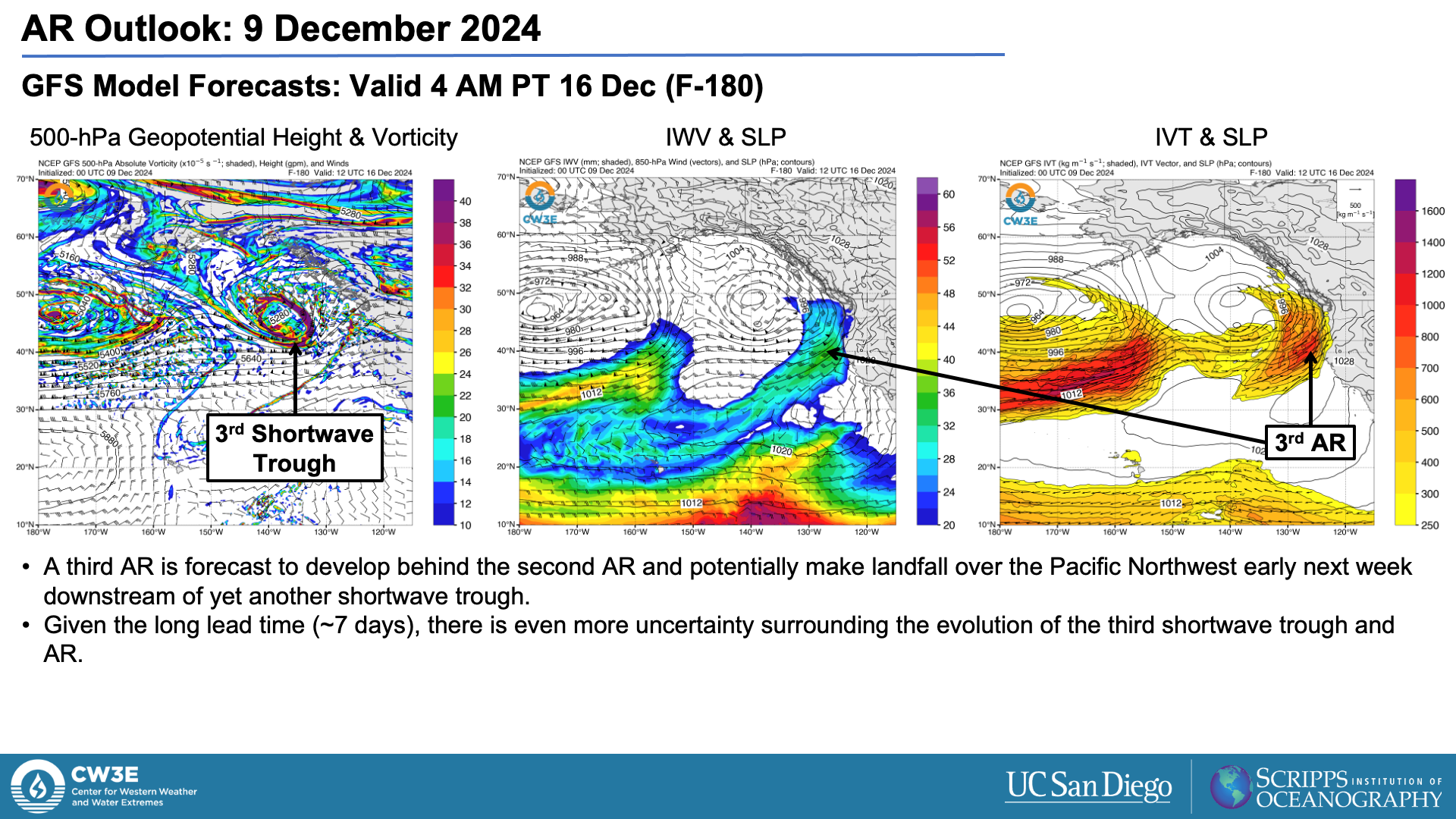
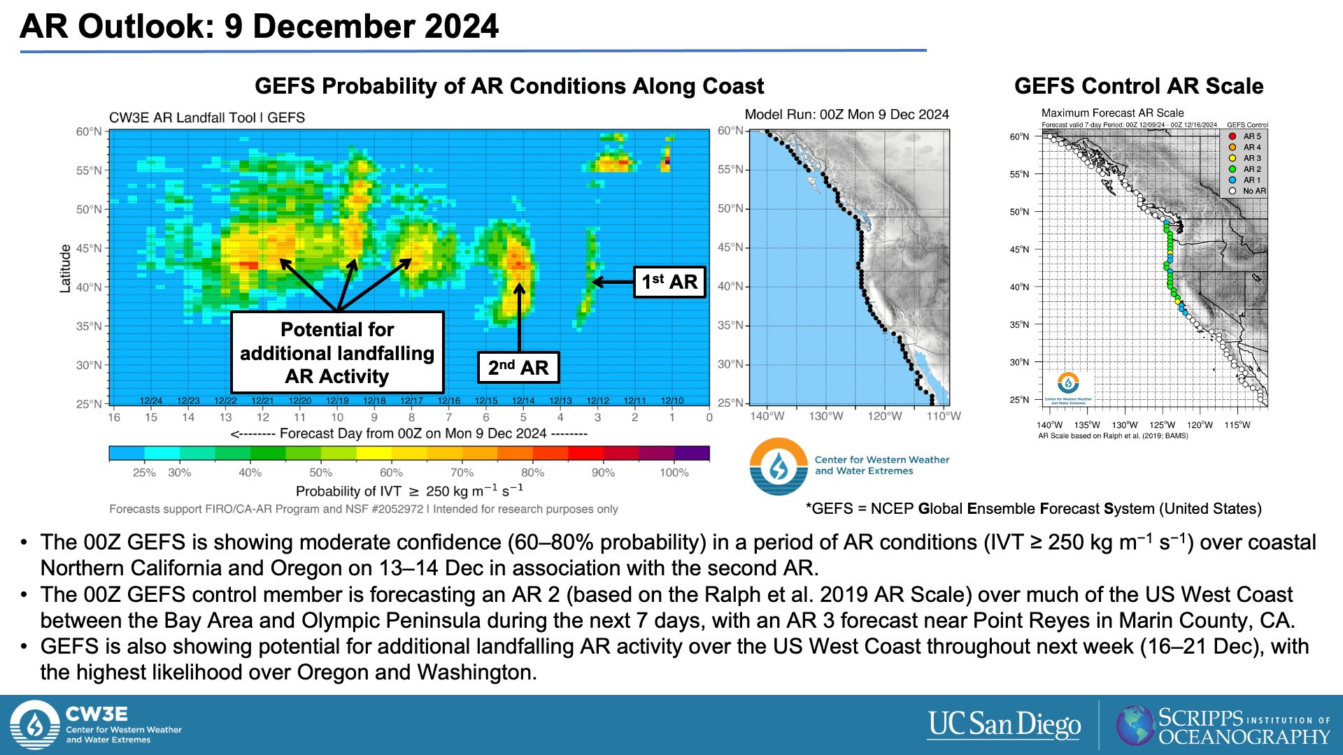
- Looking further ahead, deterministic and ensemble models are showing potential for additional landfalling AR activity next week.
- The 00Z GEFS and EPS control members are forecasting an AR 2 (based on the Ralph et al. 2019 AR Scale) over most of coastal Northern California in association with the second AR.
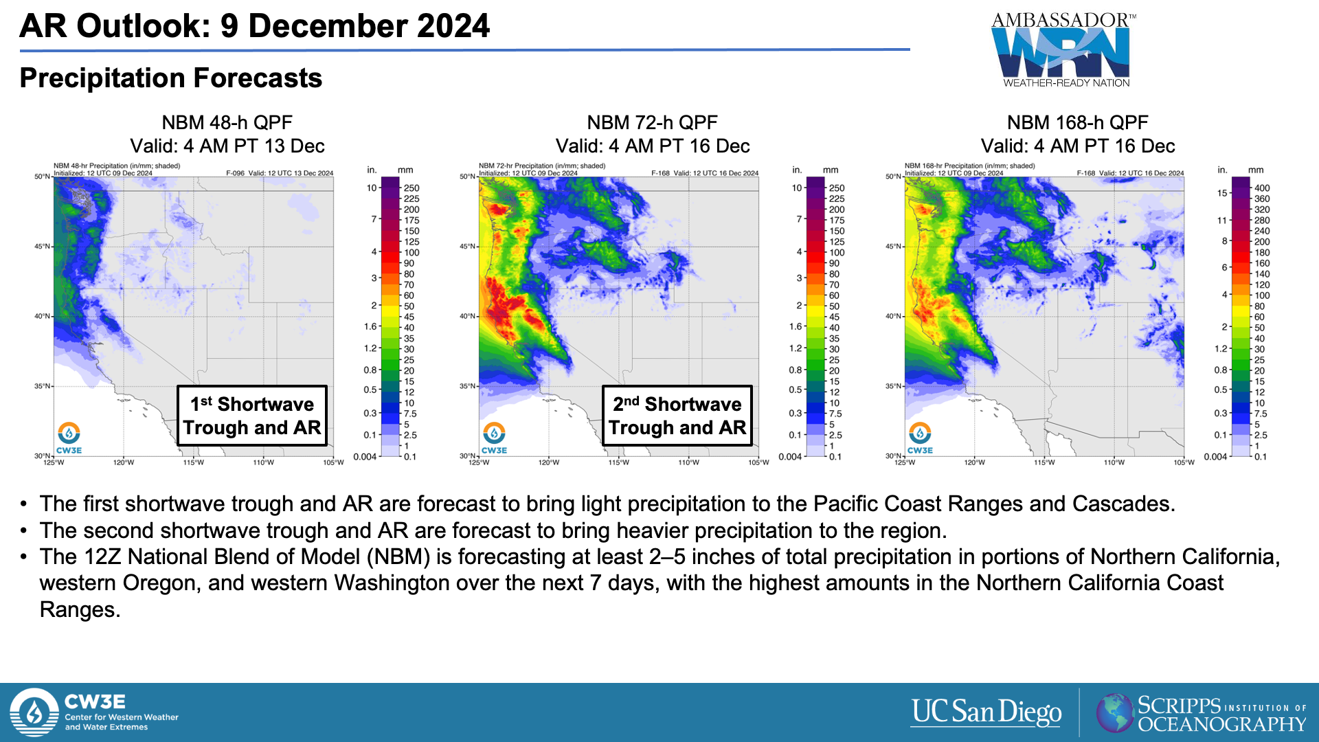
- The 12Z National Blend of Models (NBM) is forecasting at least 2–5 inches of total precipitation in portions of Northern California, western Oregon, and western Washington during the next 7 days.
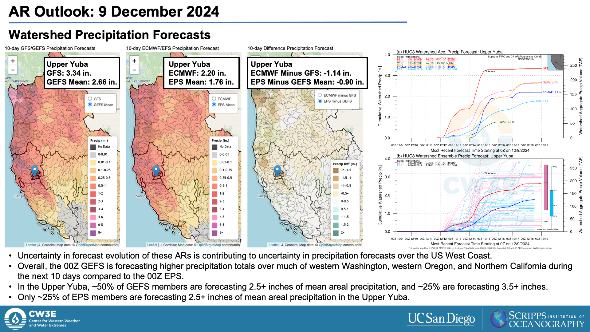
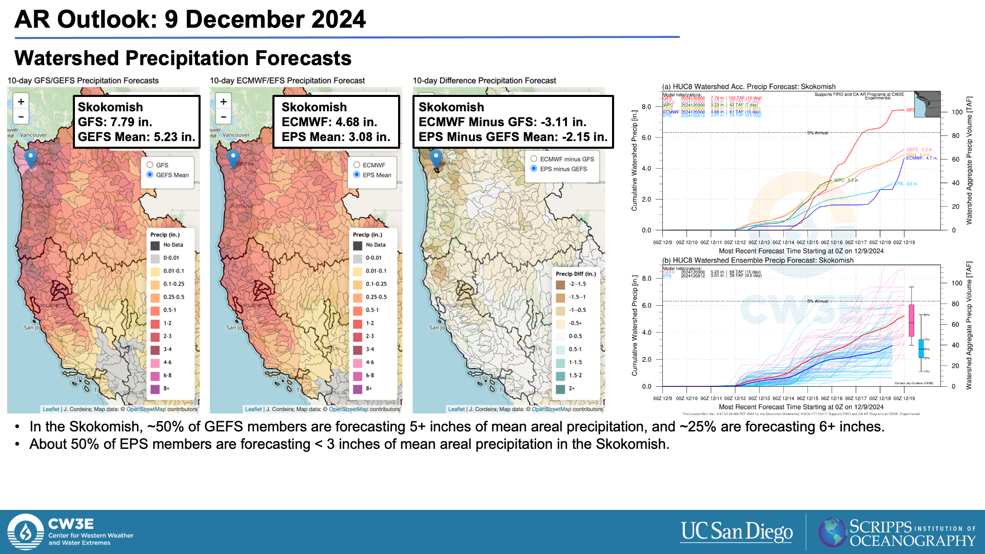
- Uncertainty in the forecast evolution of these ARs and shortwave troughs is driving uncertainty in forecast precipitation. In general, GEFS is forecasting higher precipitation totals across Northern California, western Oregon, and western Washington during the next 10 days compared to EPS.
Click images to see loops of GFS IVT and IWV forecasts Valid 0000 UTC 9 December 2024 – 1200 UTC 16 December 2024 |
|
 |
 |
Summary provided by C. Castellano, J. Kalansky, and S. Roj; 9 December 2024
To sign up for email alerts when CW3E post new AR updates click here.
*Outlook products are considered experimental
For any unfamiliar terms, please refer to the American Meteorological Society Glossary.

