
CW3E AR Update: 5-6 March 2016 Post-Event Summary
March 10, 2016
CW3E gives a post-event storm summary about a moderate strength Atmospheric River that made landfall over Northern California on 5 March 2016. The AR was an R-Cat 1 event and produced over 10 inches of 72-hour precipitation.
Click here for a pdf file of this information.


Northern Sierra Precipitaiton: 8-Station Index
 |
~7.5 inches of precipitation measured by the 8-Station Index Increased water-year-to-date accummulation from average to ~115% of average |
Lake Mendocino Storage
 |
Increase in storage of ~8000 af Storage remains above the Target Water Supply Storage Curve |
SSMI Integrated Water Vapor: 0000 UTC 3 March – 0000 UTC 7 March

- AR developed over the Central North Pacific and made landfall over Northern California
- AR entrained moisture from previous decaying AR off California coast prior to landfall
GFS IVT Analysis: 0000 UTC 3 March – 1200 UTC 7 March 2016

Cazadero, Ca Snow Level Radar
|
Heavy bright-band precipitation began ~0600 UTC 5 March Large drop in snow level post-frontal |

|
Bodega Bay 0200 UTC Sounding

|
|
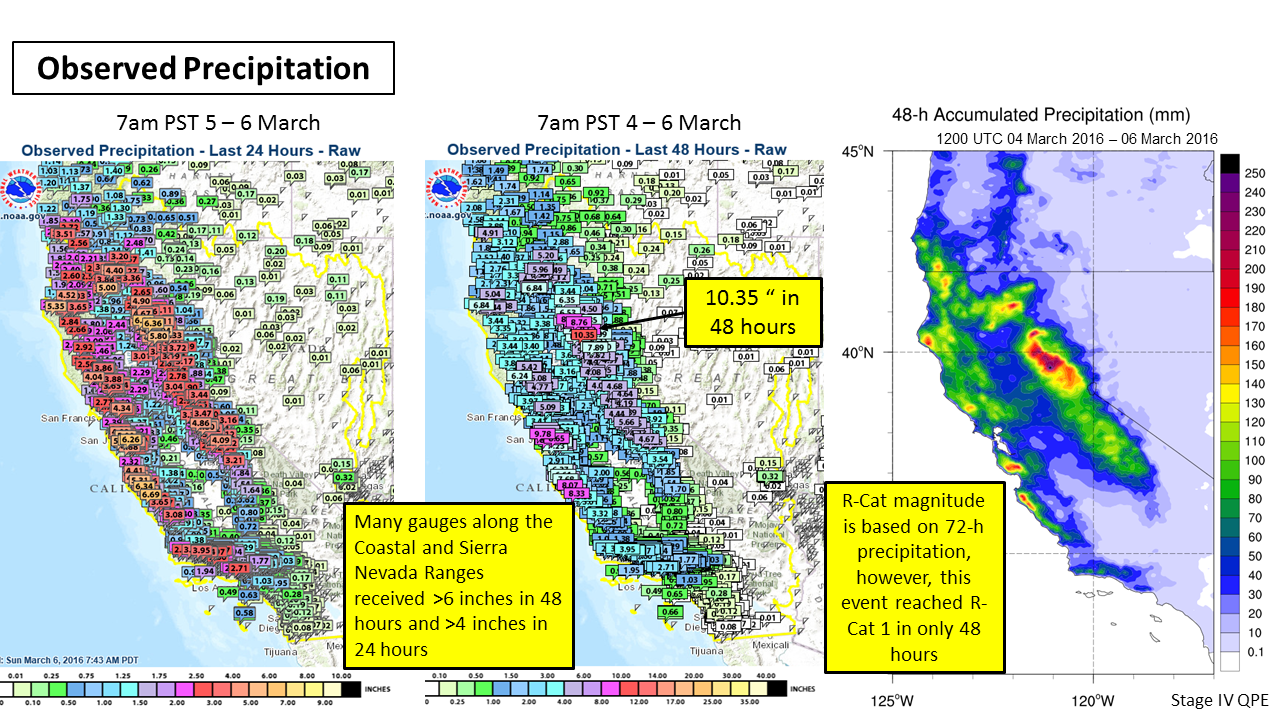
Event Summary
- A moderate strength Atmospheric River made landfall over Northern California during 5-6 March 2016
- Maximum 48-h precipitation of >10 inches occurred over the Sierra Nevada
- Widespread precipitation >6 inches occurred over the Coastaland Sierra Nevada Ranges
- Several rivers reached above flood stage in Northern California