
CW3E AR Update: 28 November 2023 Outlook
November 28, 2023
Click here for a pdf of this information. Click here to provide feedback on these outlooks!
Multiple Atmospheric Rivers Forecast to Impact Pacific Northwest and Northern California
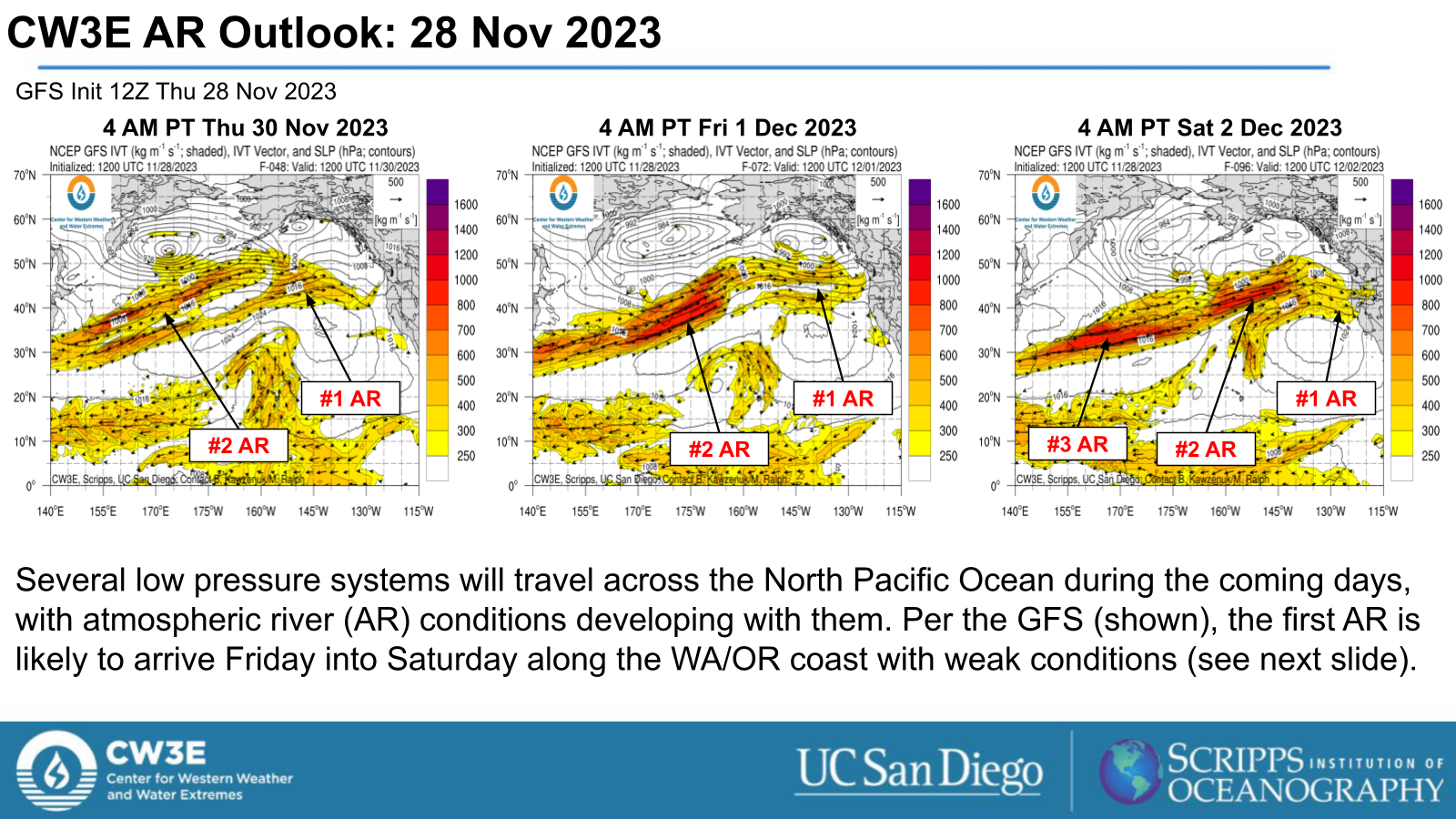
- Several low pressure systems will spin out of the Asian continent and into the Northeast Pacific Ocean heading into the weekend.
- As these systems approach the West Coast of North America, multiple atmospheric rivers (ARs) are forecast to develop and make landfall over the Pacific Northwest.
- The first AR is forecast to arrive by Sat Dec 2, with two stronger ARs to follow on Sun Dec 3 possibly through Wed Dec 6. IVT values may exceed 750 kg/(ms) with the third AR.
- While there is high confidence on the development of the ARs, large uncertainty in the timing, duration, and intensity remain.
- Moderate/heavy precipitation is very likely from far northwest CA into southern BC.
- Rises on area rivers could push them above action stage or even flood stage.
- Freezing levels may initially fall to ~2000’ in northern WA and to 5000’ in central CA during the first (weak) AR before rising with subsequent ARs.
- Significant mountain snow is possible.
Click images to see loops of GFS IVT and IWV forecasts Valid 1200 UTC 28 November 2023 – 0000 UTC 6 December 2023 |
|
 |
 |


Summary provided by P. Iniguez, C. Castellano, and S. Bartlett; 28 November 2023
To sign up for email alerts when CW3E post new AR updates click here.
*Outlook products are considered experimental